Rides in Northern California
Northern California seems to be a good destination in the spring, as long as it does not rain. I checked out some trails out there in the springs of 2003 and 2004.
Sacramento/Folsom/Auburn area
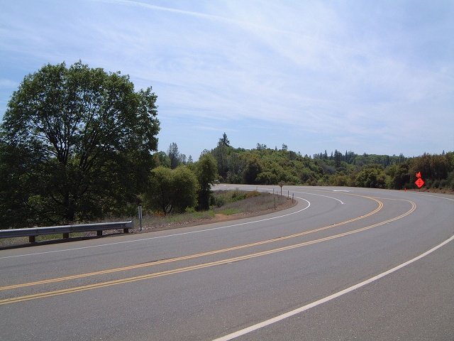
Auburn State Recreation Area
Olmsted Loop
Salmon Falls and Sweetwater Trails
Nevada City area
South Yuba Trail
Round Mountain Trails
Downieville area
Bullards Bar Trails
North Yuba Trail
First, Second and Third Divide Trails
North SF Bay
Rockville Hills park
Skyline Wilderness park
China Camp State Park
East SF Bay
Redwood and Joaquin Miller parks
South SF Bay
Stevens Canyon to Monte Bello
Kelly Lake Loop, H.W. Coe State Park
Auburn State Recreation Area
Here is the map of my tracks as taken by the GPS and plotted using the demo version of Topofusion (260 kB), and here is the elevation profile.
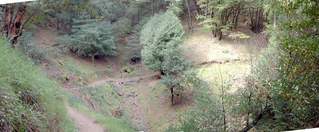
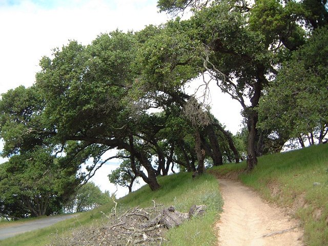
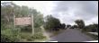
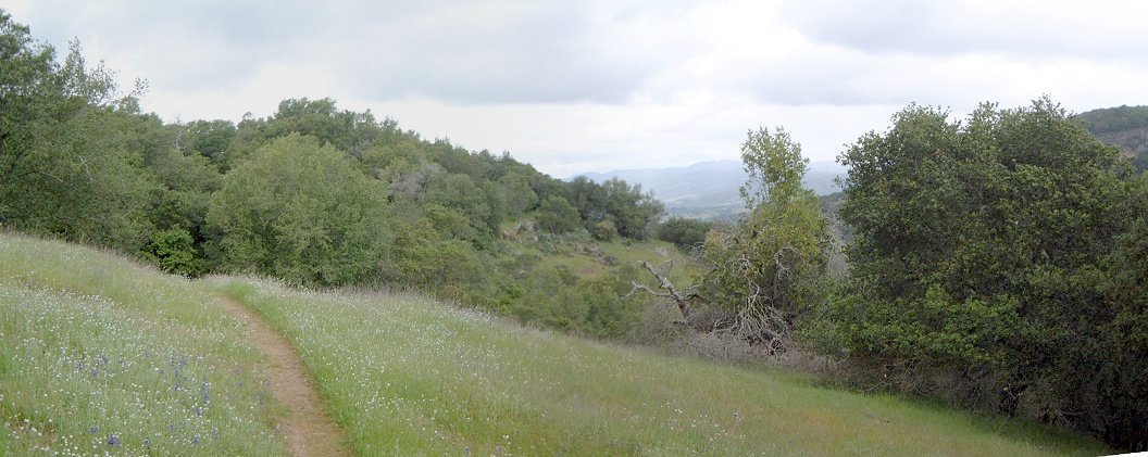
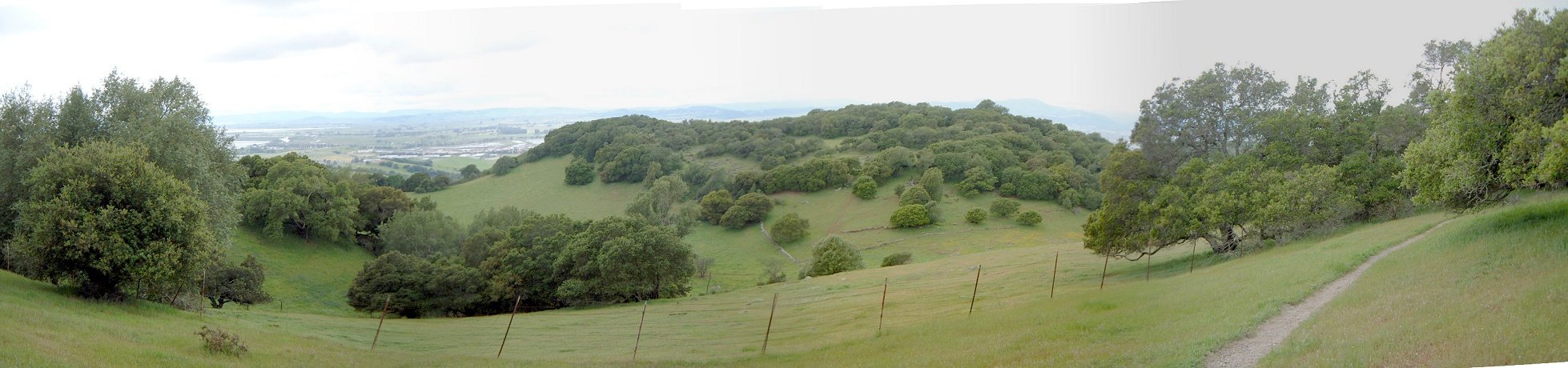
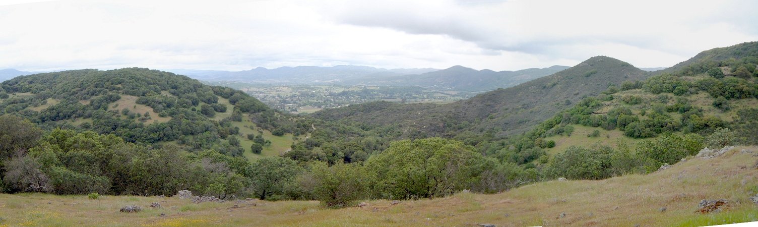
The area surrounding North and Middle forks of American River is called Auburn State Recreation Area, and includes numerous trails. Most of them are remnants of jeep roads, but, with help of several internet resources and common sense, I patched about 50 km ride with ca. 1400 m vertical change on 70-80% singletrack. Some of it was quite spectacular, as may be seen from pictures below. I started in the town, and rode down to the SRA ranger station, then found Manzanita trail, which is a nice singletrack on the canyon side, then up Stagecoach doubletrack, turning right onto Upper Stagecoach and Mossy Rock Trails (mix of st. and dt.), dropping to the river confluence. Then up Lake Clementine trail (starts as dt., turns into st.), onto Clementine Dam road, about 1.5 miles up on the road, and turning left onto a new st. right before the Dam road merges with Forestville road. This new st. is signed as banned to bikes, but it's too nice to skip, and connects to the Forestville Divide loop in about 2-3 miles. Then did the Divide loop (9 mi. of singletrack), rode back on the Forestville Road to Culvert Trail (although it would be possible to find some st./dt. to drop to Mammoth Bar and up to Culvert - I was getting too tired), then Confluence Trail dropping back to the river, and up Stagecoach to the car.
Auburn SRA contains numerous other trails, but from the map that I have seen at the spot, most of them are old jeep/forest roads, or singletracks closed to bikes. I believe that the loop that I did includes most of the singletrack in the area.

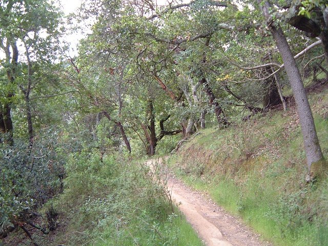
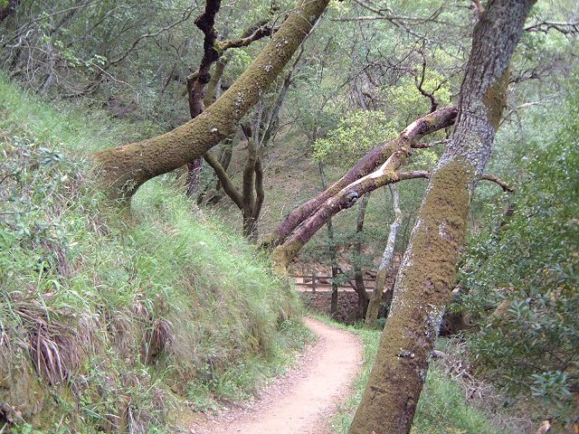
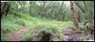
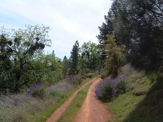
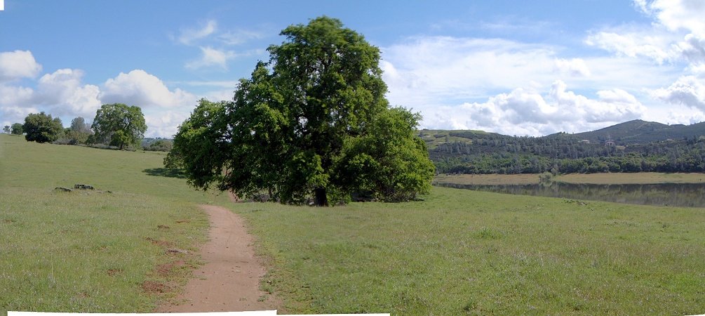
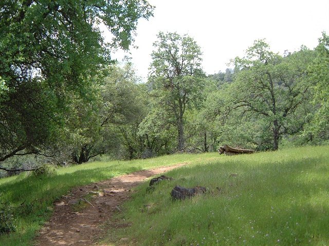
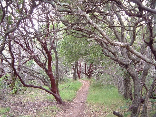
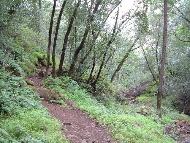
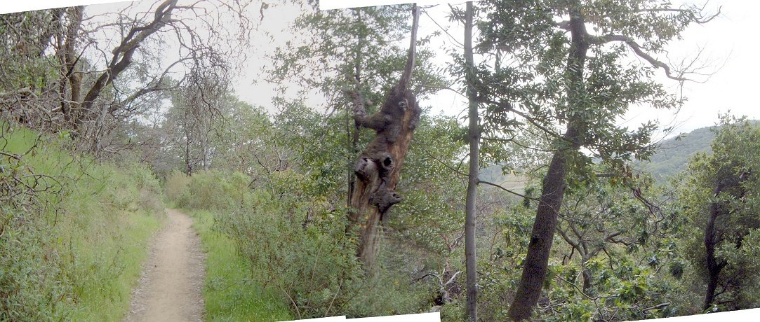
Manzanita singletrack.
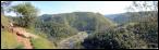

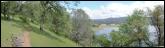
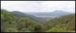
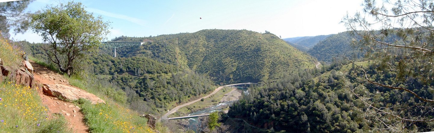
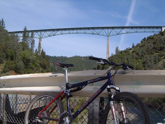
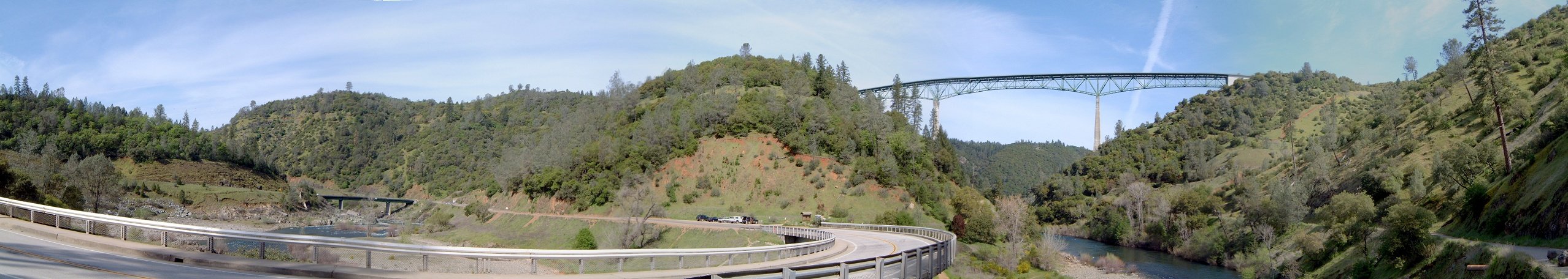
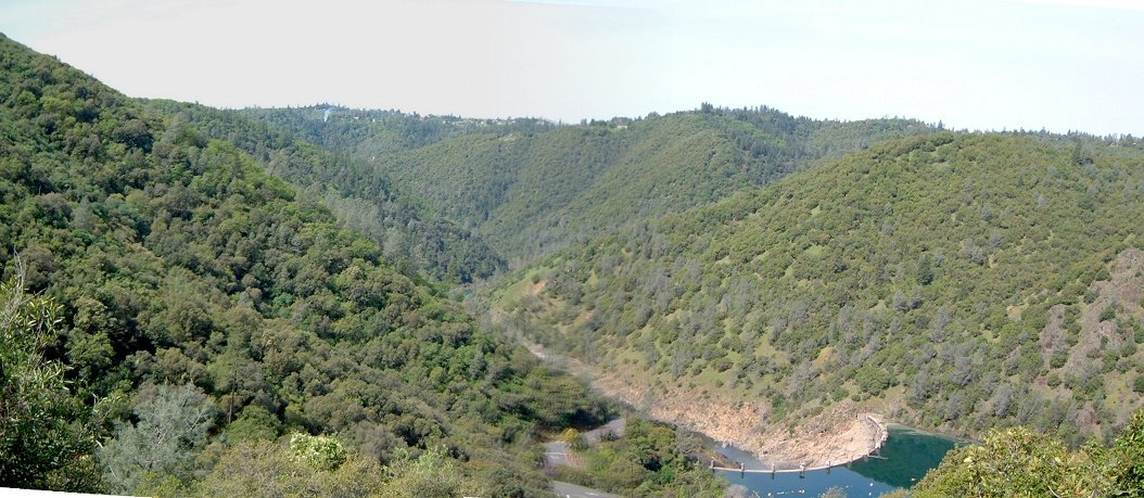
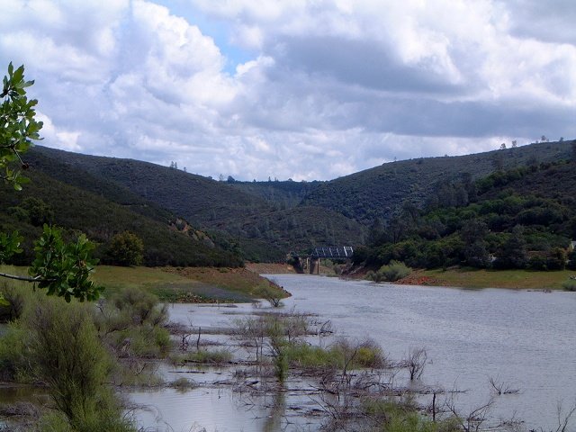
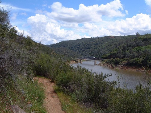
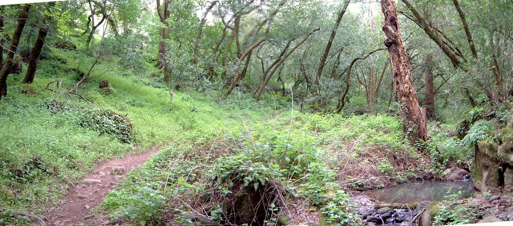
Panorama from Manzanita trail east to the confluence and Foreshill road bridge (known from several action flicks).

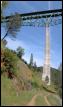
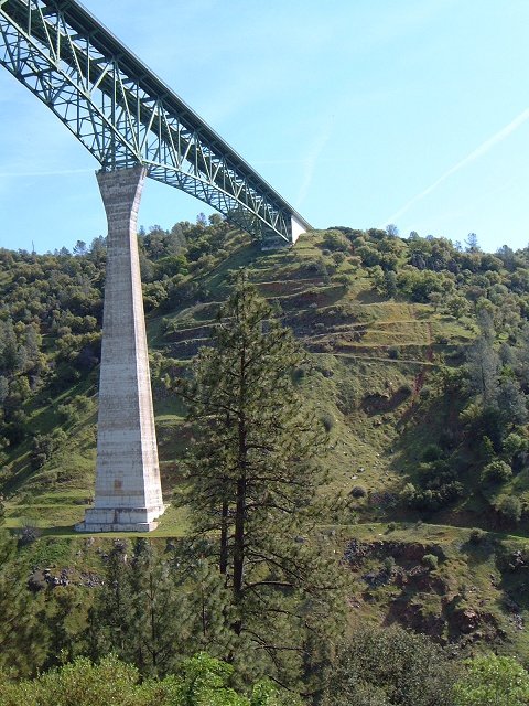
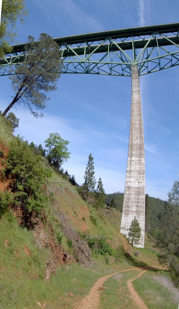
Details of the bridge from Moss Ledge trail.

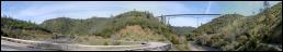
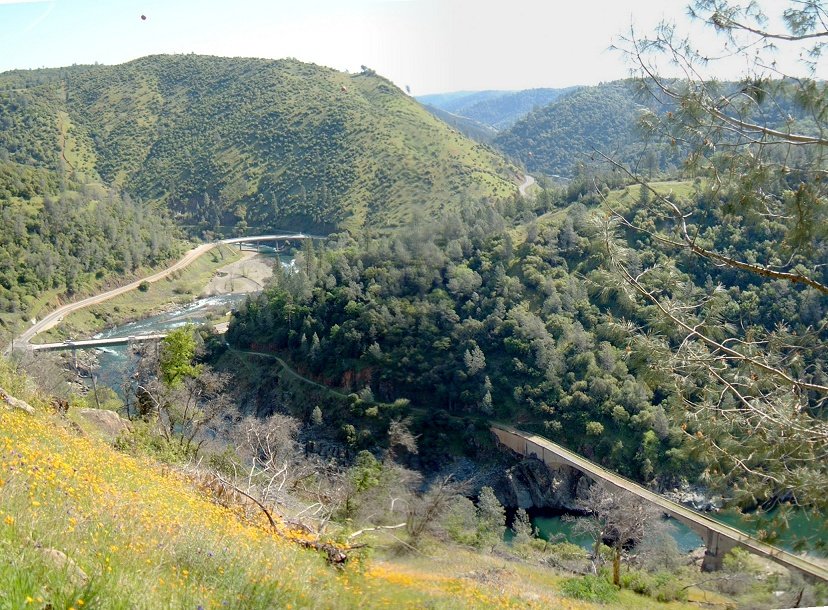
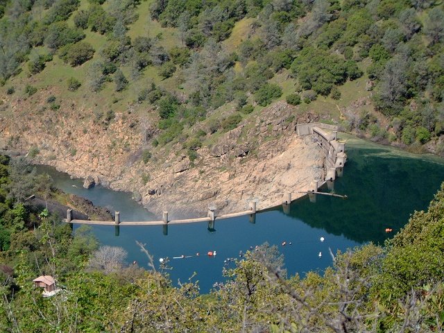
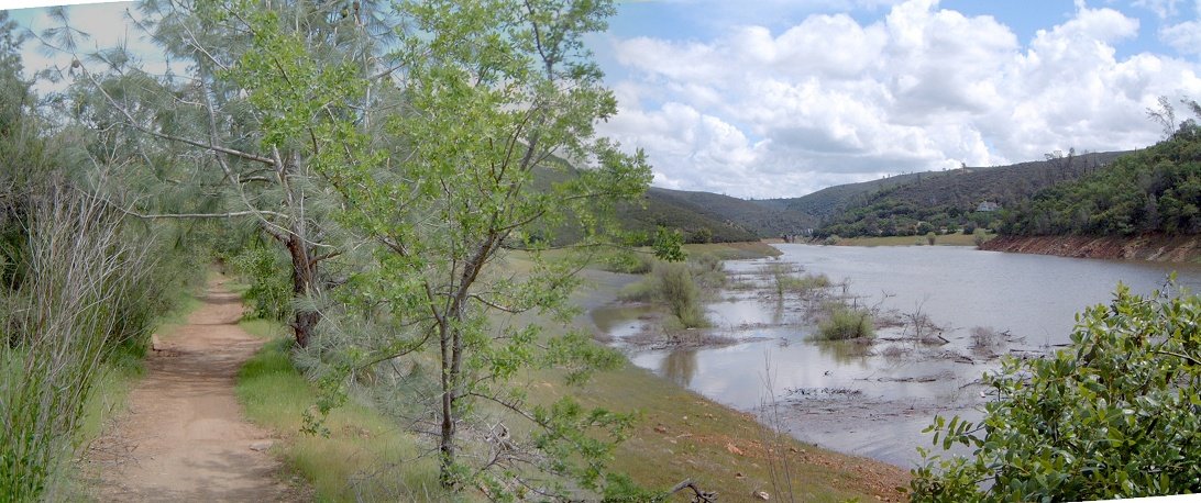
Fotos from the bridge before confluence, my bike, and panorama of the area, Clementine trail heads up the river on the right.


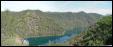

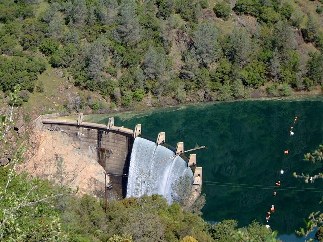
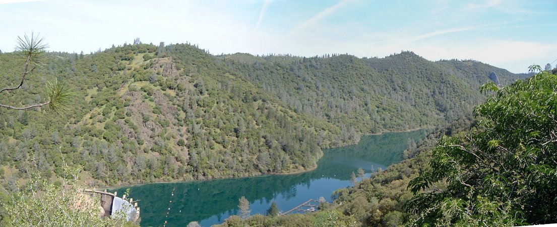
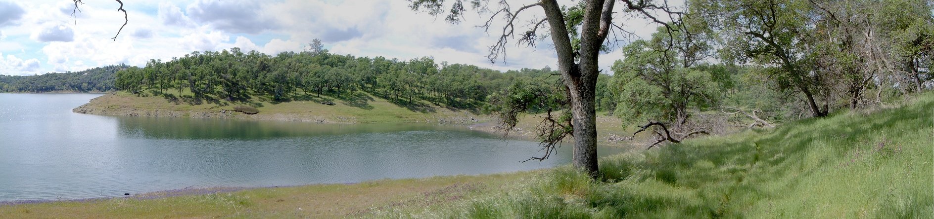
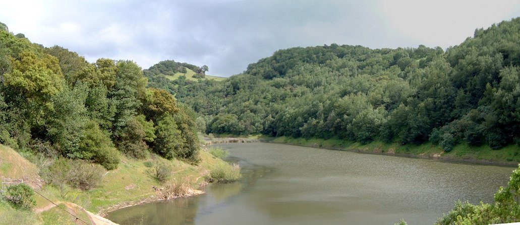
Views at the Lake Clementine dam from the dam road.
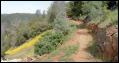
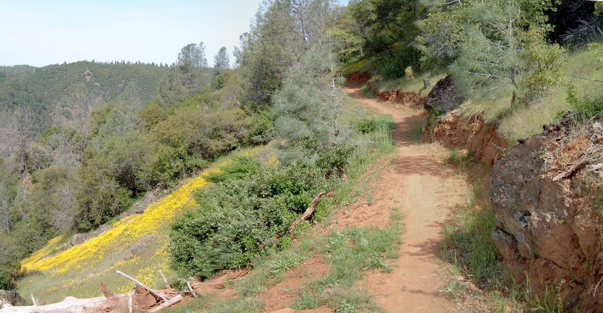
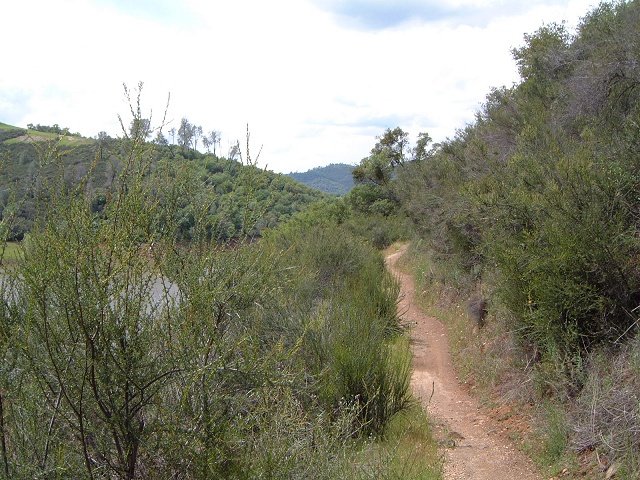
Singletrack connecting Clementine dam road with the Foresthill Divide loop trail.
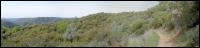
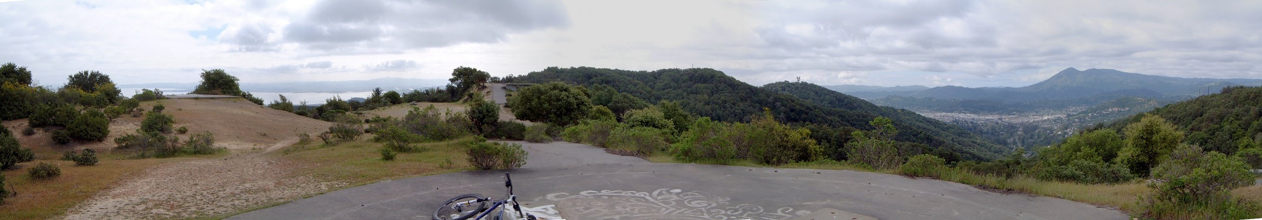
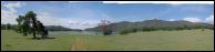
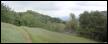
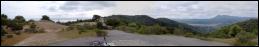
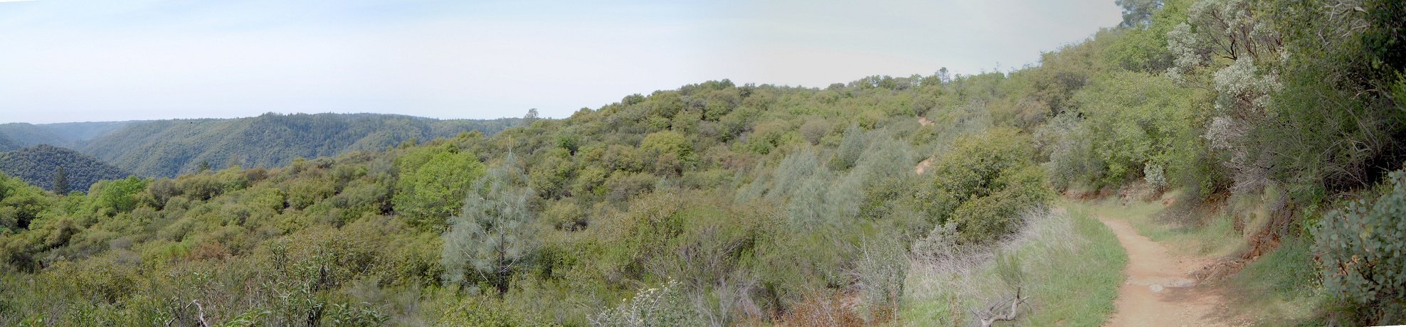
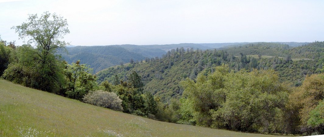
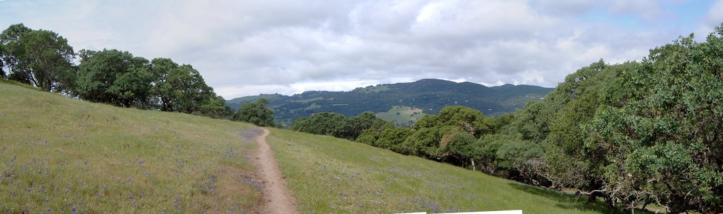
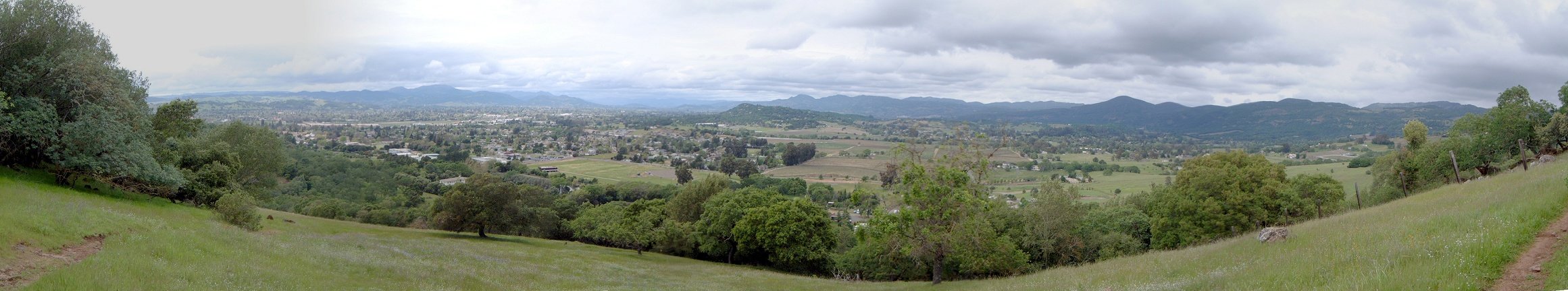
Panorama from the northern side of Foresthill Divide loop trail.

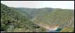
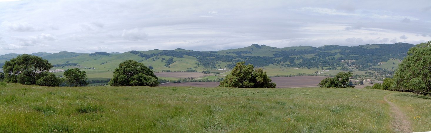
Eastern end of Foresthill Divide trail crossing the road, and panorama of the area.


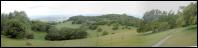
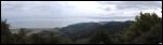
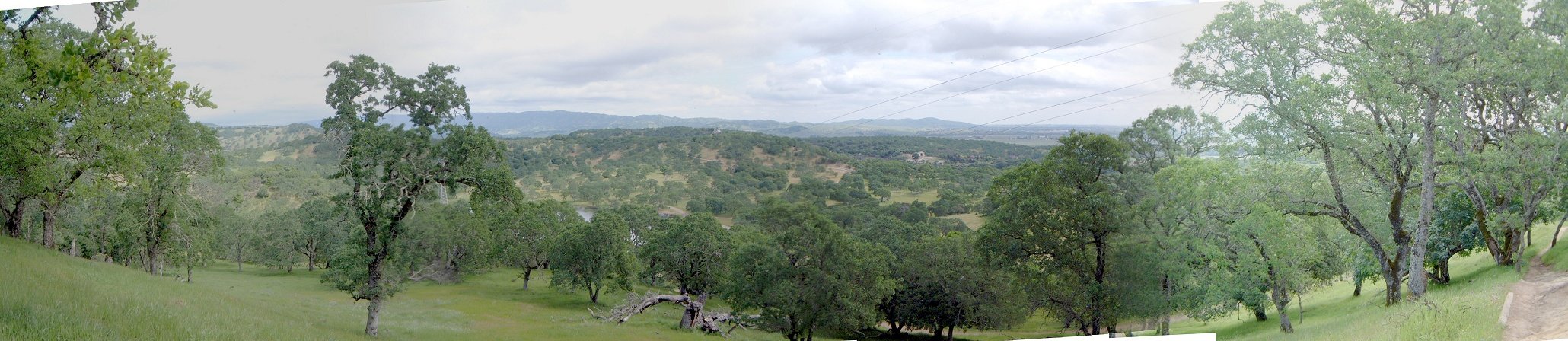
Several views from the southern part of the Foresthill Divide loop.
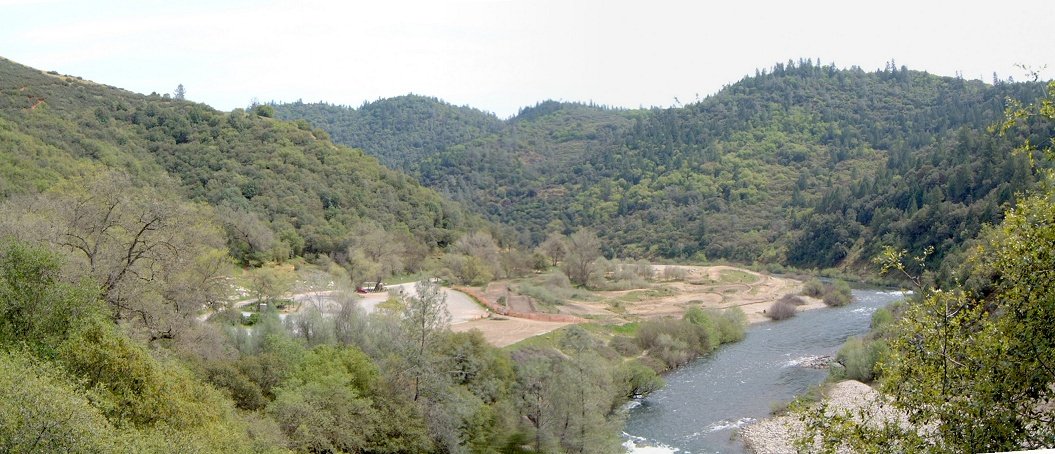
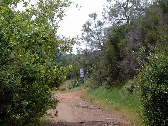
Mammoth Bar OHV area, where I inadverently descended after taking a wrong turn. Fortunately, it's not opened to OHVs on Wed.
Manzanita singletrack.
Olmsted loop
Olmsted loop is about 9 mile long trail starting in town Cool about 6 miles south of Auburn. Loop is not too great, and crowded with horseriders. Map and pictures are here
Salmon Falls and Sweetwater Trails
Here is the map of my tracks as taken by the GPS and plotted using the demo version of Topofusion (260 kB), and here is the elevation profile.
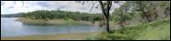
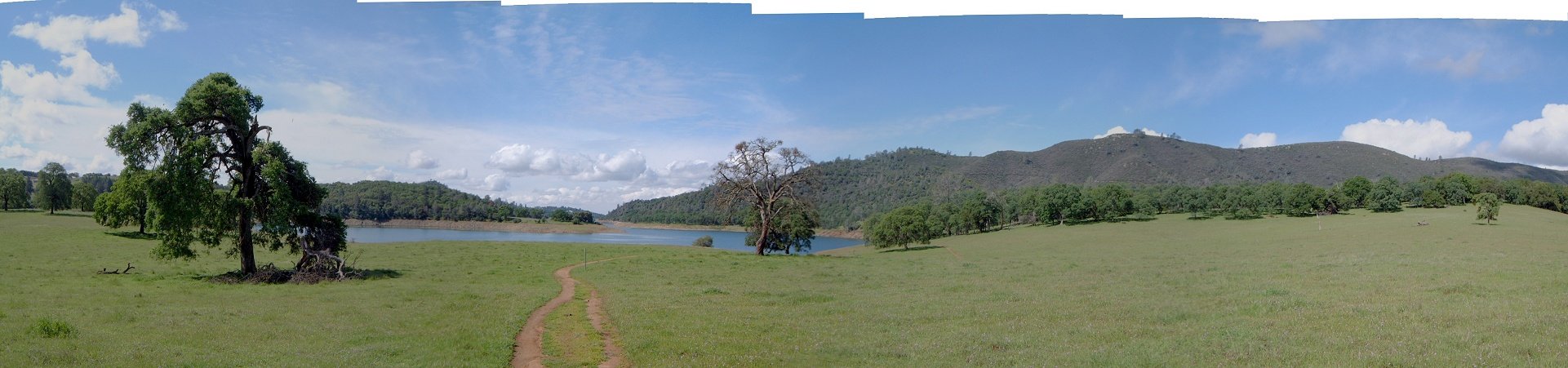
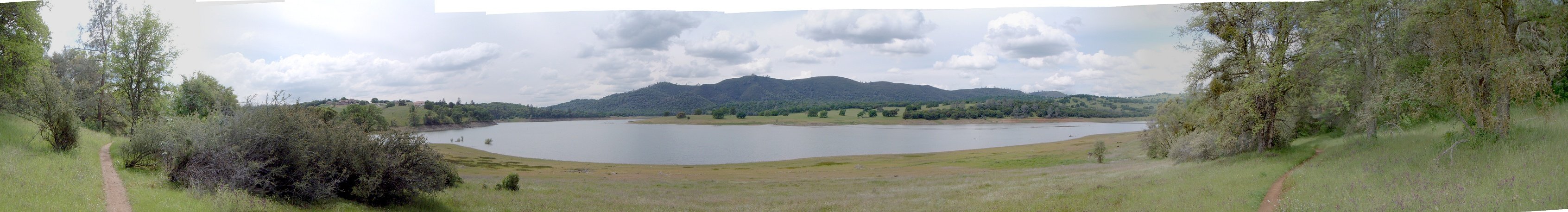
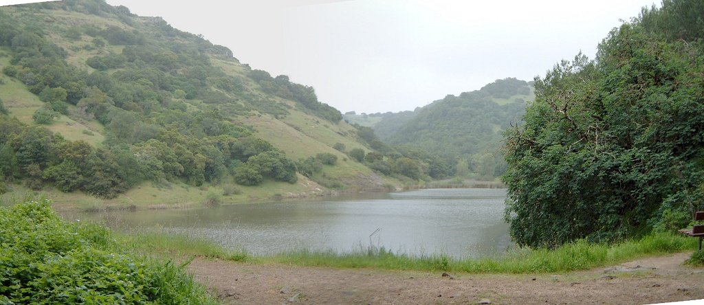
The trail starts off Salmon Falls Rd. near the bridge over South fork of American River, and follows the river's right side for about 7 miles to the Peninsula Campground. Since it rained all weekend, the trail was locally wet, but it was bearable as the soil is kinda sandy. There were just occasional puddles and numerous small creek crossings (with three bigger ones), not much mud. I rode to the campground (where I stayed on Wed) and back to the car, and then the Sweetwater trail on the southern side of the river. This trails goes only for about 2.5 miles one way. So, it was a bit over 30 kms with about 800 m. vertical, mostly on singletrack, with some enjoyable views of the lake and vegetation around. There was quite some poison oak alongside both trails, I got some on my right hand. For future reference, it would be the best to camp at the Peninsula campground, do the whole ride in a day along with a couple of other forest roads (see map) and camp another night.

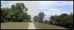
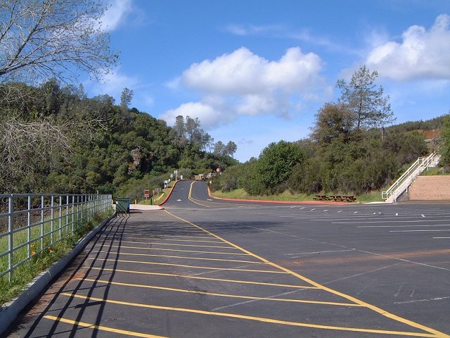
Parking lot at the trailhead.
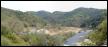
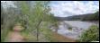
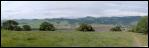
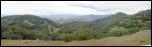
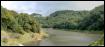
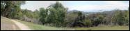
Panorama of the lake and surroundings about 5 km into the ride.
A small bay towards which leads a dead end trail/jeep road near the end of Salmon Falls trail.
Intersection that marks the end of the Salmon Trail st. about 1 km from the Peninsula Campground.
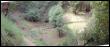
The deepest creek crossing that resulted in getting the feet wet.

A view up the river (east) on the way back about 1/2 way through and the trail behind.


Views from the trail about 2 km from the start (at the bridge).


Two views yet closer to the trailhead, the trail here goes through drier bushes.
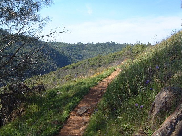
Nice singletrack section of Sweetwater trail near its end.
South Yuba Trail
South Yuba trail follows a deep river canyon for miles through a scenic wilderness. It is doable to ride the upper 11 or so miles of trail from the South Yuba campground up, and then ride up Missouri Bar trail to the state park that restores an gold mining town, and back to the campground. Map and pictures are here
Round Mountain Trails
These trails are located on the hills between Nevada City and South Yuba river, west of Bloomfield road. I rode several singletracks in the hills and then descended to the river and rode the 5 miles of trail between Edwards and Purdon crossing. Map and pictures are here
Bullards Bar Trails
Bullards Bar Reservoir is on North Yuba River about 30 miles east of Marysvale, Ca. On the southern shore is a network of trails, that can be ridden in a sort of a double loop. Map and fotos are here.
North Yuba Trail
This trail follows North Yuba river on its southern side for about 10 miles, I rode it a a loop from Ramshorn Campground, return of the loop is on the road that goes to Downieville. Map and fotos are here.
First, Second and Third Divide Trails
A nice loop from downtown Downieville climbing up alongside roaring Pauleys Creek and descending on the last stretch of famous Downieville downhill. Map and fotos are here.
Rockville Hills park
Here is the map of my tracks as taken by the GPS and plotted using the demo version of Topofusion (260 kB), and here is the elevation profile.
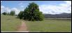
The trails are dense and often confusing, so, I would suggest just ride around first. The southern and eastern part of the park is a bit more tree covered and rocky, central and northern parts have sparse tree coverage and meadows.
Southern part of the park with view south.

A cool singletrack under subtropical shrubs.
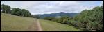
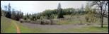
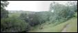
Several panoramas from the central and northern (higher) parts of the park.
Skyline Wilderness park
Here is the map of my tracks as taken by the GPS and plotted using the demo version of Topofusion (260 kB), and here is the elevation profile.
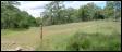
I rode a double loop through the park, which is relatively small. First up Lake Marie road, then down Skyline Trail (quite enjoyable), then half up Lake Marie rd. again, and onto Marie Creek trail, which follows up the creek in a bit tougher singletrack. Then loop over Lake Marie, and down again on Marie Creek and Manzanita Trails. One may climb up Skyline and Buckeye trails once instead of riding the Lake Marie road, but, the weather did not look too good, so, I decided to skip this option.
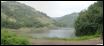
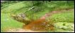
Lake Marie in a drizzle during the first loop through the park.
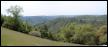
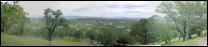
Panorama mostly to Napa valley and town of Napa while descending the Skyline singletrack.

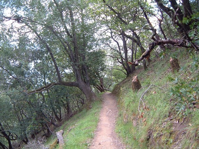
Marie Creek trail follows the creek.
Lake Marie on the second loop visit, the weather started to break up at this point.
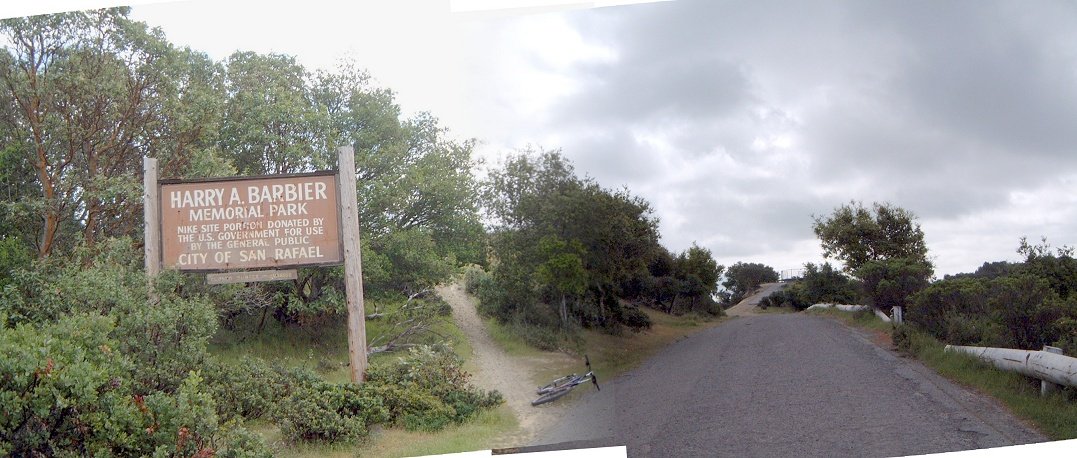
China Camp State Park
Here is the map of my tracks as taken by the GPS and plotted using the demo version of Topofusion (260 kB), and here is the elevation profile.
The suggested loop from a guide, about 10 miles, turned out too short, so, I made a modified double loop to a total of about 30 km and 800 m vertical. First gently climbing up Bay View singletrack, up to the Ridge trail via some kind of old missile site, down Ridge to Miwok FT, up Shoreline Tr. back to Bay View tr., taking it all the way to Oak Ridge tr. and then to Shoreline and back to the car (parked alongside the road near the campground). The whole ride took around 2 hours and was quite enjoyable, especially the slow downhill on the second half of Bay View and Oak Ridge trails.
 <
<

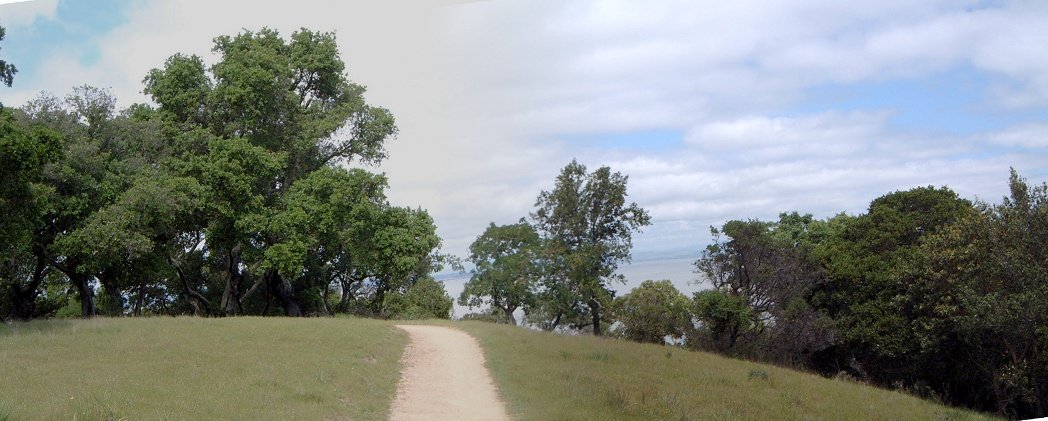
Bay View trail as it climbs up.
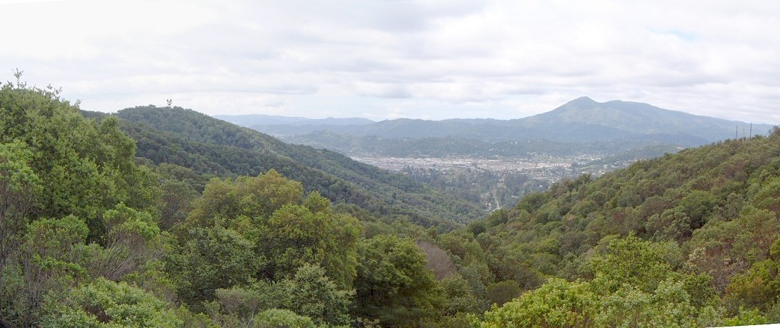
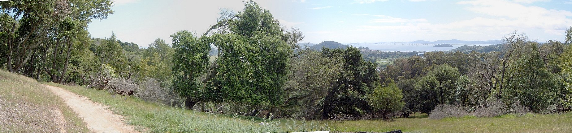
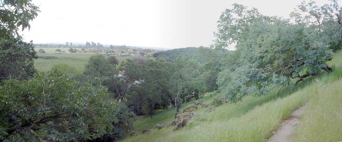
A few shots from the missile site, looking west to San Rafael, and east to the SF Bay.


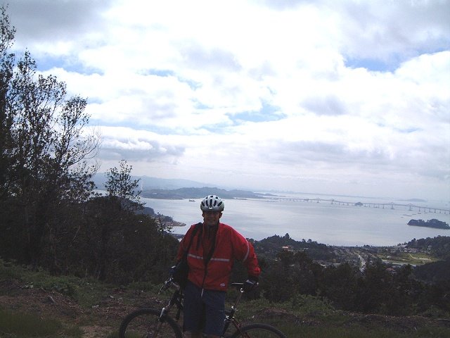
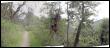
Me on the ridge trail with the bay in the background.


Bay View trail as it starts to descend.
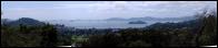
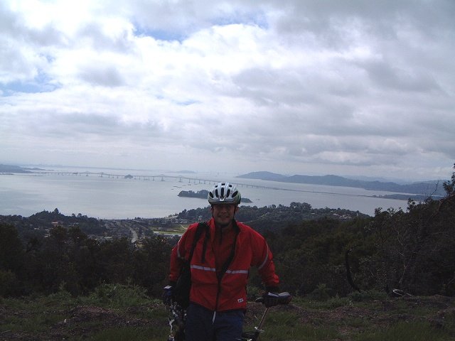
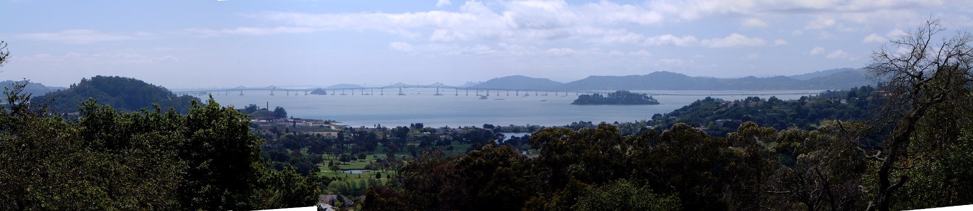
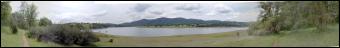
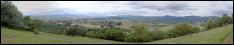
Panorama of the bay with San Rafael bridge in the foreground and Oakland bridge and San Francisco barely visible in the back.
Views from the southern parts of the Oak Ridge trail SE and NE.

Return on the Shoreline trail.
Redwood and Joaquin Miller parks
A foggy ride in the East Bay, on supposedly the best singletrack in the area. I went with a friend so don't know too much details. Map and pictures are here
Stevens Canyon to Monte Bello preserve
One of the nearest decent rides from downtown San Jose, climbs up Santa Cruz Mountains, around Stevens Creek Canyon. I did some exploration in the area, there's more singletrack west of Stevens Canyon. Map and pictures are here.
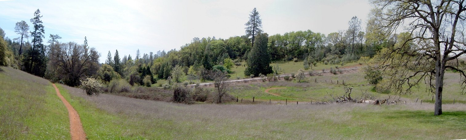
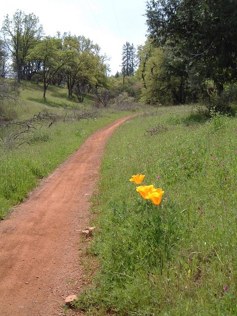
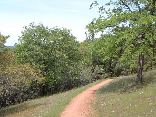
Kelly Lake Loop, H.W. Coe State Park
H. W. Coe State Park is located about an hour southeast of San Jose. The park is very beatiful, and I suppose spring is the time to come because everything is green and there are numerous flowers in the meadows. The park is rugged and remote and there is quite a lot of wildlife. I have heard wild turkeys, saw wild pigs and numerous water birds around Kelly Lake. From what I have seen so far, this is definitely the best place to ride in the Bay Area. The loop I took from Mountainbike Northern California book and modified it a bit to include more singletrack and climbing. Map and pictures are here.
U of U / CHPC / Cuma / Mountain Bike / Northern California
URL:
http://www.chpc.utah.edu/~mcuma/bike/ca_north.html


 <
<