| Name: | Sovereign Trail - Moab | 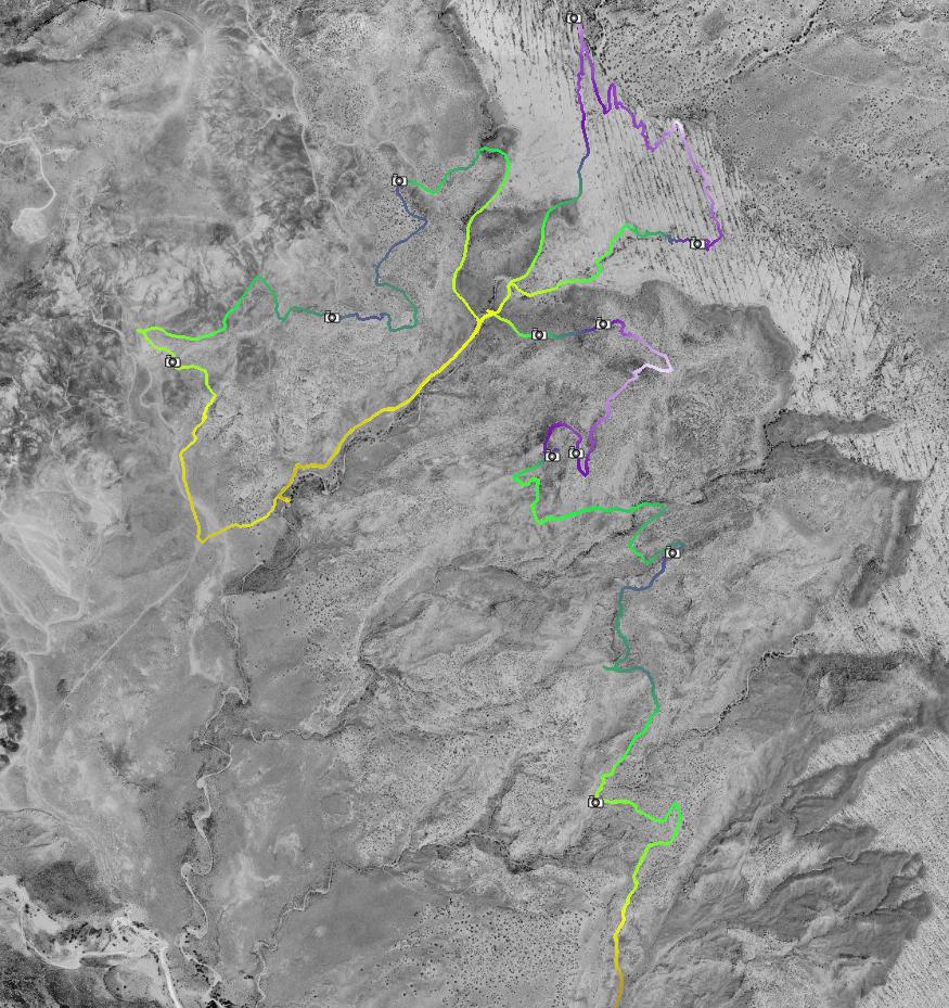
|
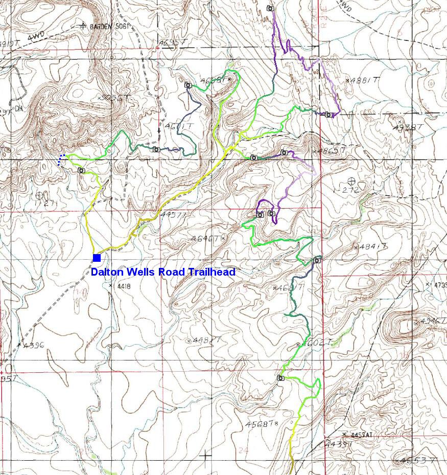
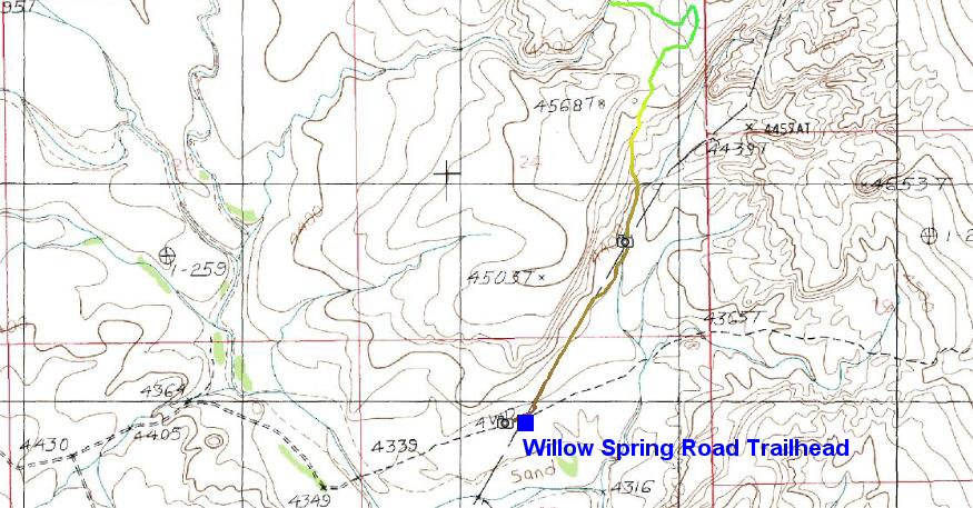
| Details: | A new trail near Moab as of 2003, north of town off Hwy 191, between Willow Springs Road and Klondike Bluffs. There is a whole network of trails, mostly old jeep roads, but also several singletracks. The best goes from Willows Springs Road to Dalton Wells Road, climbing through washes and sections of slicrock to a mesa above Dalton Wells road, and then descending. At intersection with Dalton Wells, the singletrack continues west in a small wash and then climbs on a plateau. From there, it's a dirt road back to Dalton Wells road. If one keeps going north on Dalton Wells road, there is a large area of slicrock that can be explored, although one has to be careful, because the area borders Arches NP. | |
| ||
| ||
| Trip Length: | 21.22 miles |
| Total Trip Time: | 6:40 |
| Total Climbing: | 3099 feet |
| Total Descending: | 3092 feet |
| Average Speed: | 4.46 mph |
Seznam fotek
![[sov01.jpg]](sov01.jpg) sov01.jpg 149966 bytes 800 x 600 |
![[sov02.jpg]](sov02.jpg) sov02.jpg 149154 bytes 800 x 600 |
![[sov03.jpg]](sov03.jpg) sov03.jpg 161984 bytes 800 x 600 |
![[sov04.jpg]](sov04.jpg) sov04.jpg 162751 bytes 800 x 600 |
![[sov01a.jpg]](sov01a.jpg) sov01a.jpg 320964 bytes 1866 x 566 |
![[sov02a.jpg]](sov02a.jpg) sov02a.jpg 242883 bytes 1327 x 532 |
![[sov03a.jpg]](sov03a.jpg) sov03a.jpg 288041 bytes 1670 x 540 |
![[sov04a.jpg]](sov04a.jpg) sov04a.jpg 285061 bytes 1872 x 559 |
![[sov05a.jpg]](sov05a.jpg) sov05a.jpg 225447 bytes 1338 x 575 |
![[sov06a.jpg]](sov06a.jpg) sov06a.jpg 326019 bytes 1809 x 521 |
![[sov07a.jpg]](sov07a.jpg) sov07a.jpg 391976 bytes 2351 x 547 |
![[sov08a.jpg]](sov08a.jpg) sov08a.jpg 449324 bytes 2900 x 552 |
![[sov09a.jpg]](sov09a.jpg) sov09a.jpg 311335 bytes 1891 x 566 |
![[sov10a.jpg]](sov10a.jpg) sov10a.jpg 543202 bytes 3747 x 540 |