| Name: | River Mountains Loop Trail | 
|
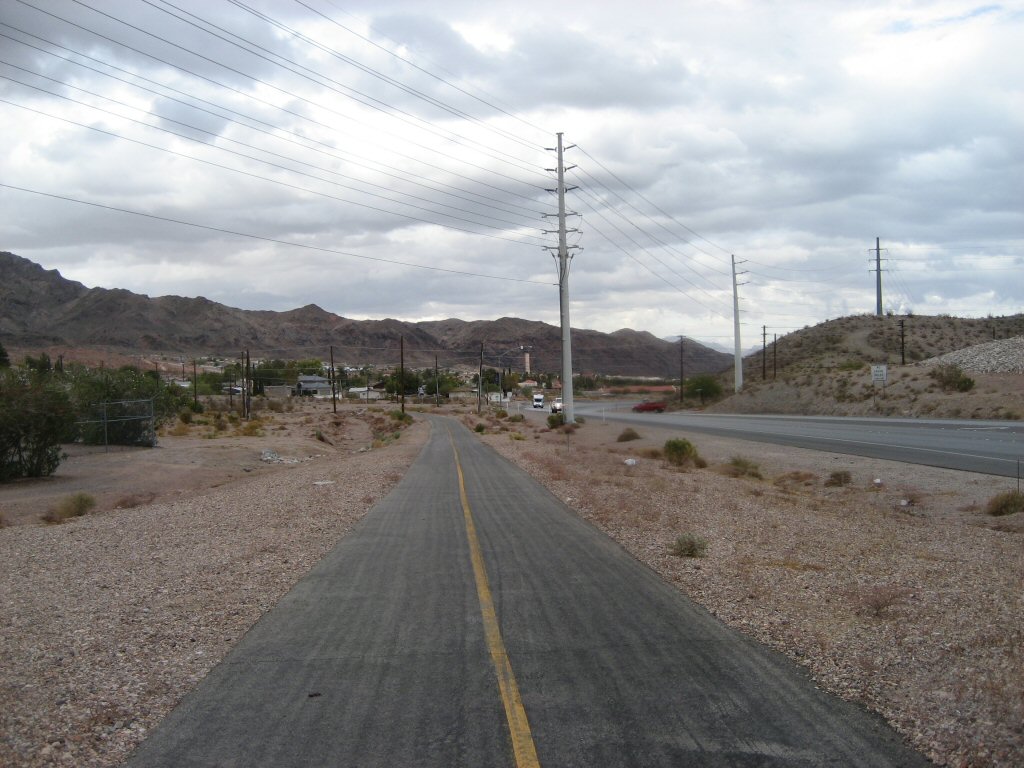
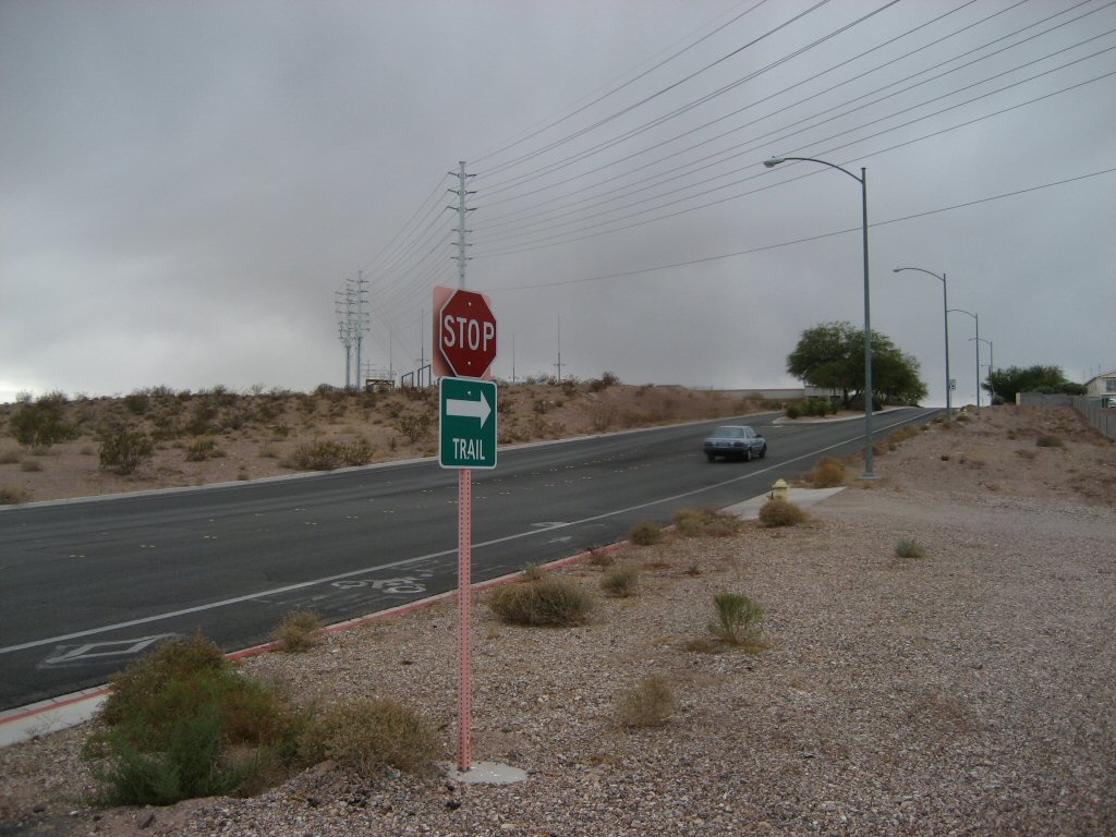
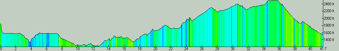
| Description: | The plan for Sunday was to ride loop around River Mountains, a range east of Las Vegas, between Vegas and Lake Mead. There as been an effort to create a loop path around the mountains, which is probably about 90% complete now. The morning did not look good, there were strong south winds, some sun in the east but black clouds in the west. A storm was coming. By the time I pack the camp, it started drizzling. I had a breakfast in the car and then, in the rain, drove to Boulder City to the Lake Mead visitors center. Here I hanged out for a couple of hours, waiting out the rain. Around 10am, the cloud broke and sun came in, and I decided to ride the 3.6 mile Rail Trail from the visitors center to the Hoover dam - which is on a bed from railroad that served the dam construction. It was interesting to ride through the 6 tunnels and then descend through the transformer stations, etc, to the parking lot at the dam's visitors center. By the time I came back to the car, the roads dried and sun shined, so, I decided to go for the loop around the mountains. I decided to go counter-clockwise so that I can take advantage of the southerly wind first - since I did not know when the storm is going to pass and winds shift to the north. It was a fairly smooth sailing along Lake Mead, the trail first descended a bit and then went up and down, but, no steep hills. The trail ends on the highway between Las Vegas and Las Vegas Bay, there is about 5 miles to go on the road. It was not too bad, though, since there was an ironman race there so I just joined in with other racers. The roads shoulder was not great, but not too bad either. Then as entering the Las Vegas valley, the trail appears again. There is three short steep climbs followed by the same descents, and then the trail slowly climbs along the western flanks of the River Mountains, all the way to the Railroad Pass. Here the trail ends again, and one has to ride on a busy Hwy 95 to Boulder City. The road is not bad, it has a wide shoulder, but, there were two tricky spots, one at the Hwy93 exit and one turning left onto Veterans road at the first Boulder City light. Also by now, the real storm rolled in, the winds shifted and it got cold. I put on my jacket and hat and started descending back towards the visitors center. First part of the descent is a trail that goes in a water culvert, and the last 4 miles or so is on the former railroad bed. I got to the car and promptly put pants and fleece on, loaded in the bike, and, just as I pulled out of the lot, it started drizzling again. So, overall, a good experience with great weather-wise timing. We have to come back with the tandem, and probably do it clock-wise, since it seemed like the climb up in Boulder City would be easier than the gradual climbs in the counter-clockwise route. Also, it may be a good idea to wait till next year when they hopefully finish the section between Railroad Pass and Boulder City. | |
| URL: | TopoFusion Home Page | |

| ||
| ||
| Total Distance: | 41.66 miles (67.04 km) |
| Total Trip Time: | 3:44:46 (3:12:51 moving time) |
| Total Climbing: | 3690 feet (1125 m) |
| Total Descending: | 3996 feet (1218 m) |
| Average Speed: | 12.96 mph (20.86 kph) |