A month went by and it was high time to get down to the canyons again. A good reason for this was a trip which my friend Šárka from California made to the northern Arizona. We agreed to meet on Friday night at a campground and spend a weekend hiking. The original plan was to hike the Buckskin Gulch on Saturday, as we had two cars, and hang around on Sunday.
The plans are made to be changed, though. I arrived to the campground along Paria river south of Hwy. 89 at 9.30 PM on Friday to be met by Šárka without car, because it broke down and was stuck in Page till Monday. We decided to postpone the plan making till the morning, and set to sleep under the open sky. We were awakened by rain at ca. 6am, and were forced to move to the car. This gave us enough oportunity to think about what to do.
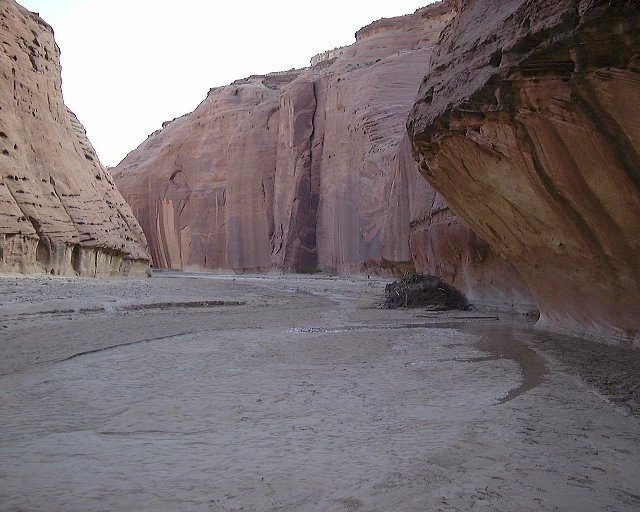
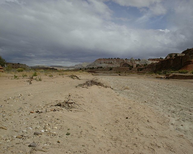
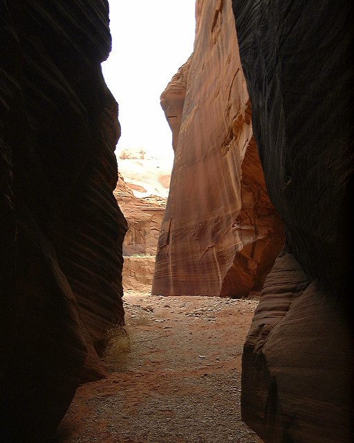
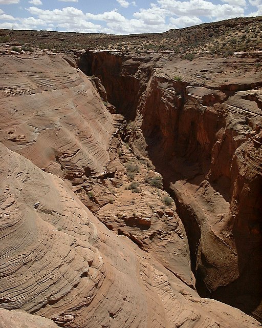
After we unfroze and ate something, we decided to go for a short walk down the Paria river drainage, the way we would be coming back from the Buckskin hike. The river was about 2 m wide, and had to be crossed many times, but there was always a way to cross it with dry feet. After a mile or two, the water ![]() disappeared. We turned around shortly after this. On the way back, we checked out a short slot canyon on the right side, about 1 km downriver from the campground.
disappeared. We turned around shortly after this. On the way back, we checked out a short slot canyon on the right side, about 1 km downriver from the campground. ![]() Here is a sample foto, and
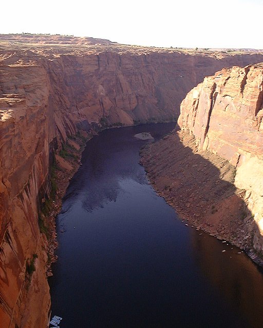
Here is a sample foto, and ![]() here is view against the Paria flow near the campground.
here is view against the Paria flow near the campground.
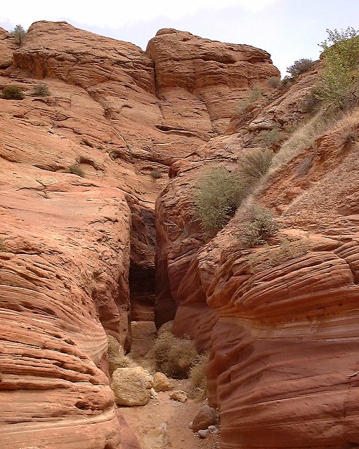
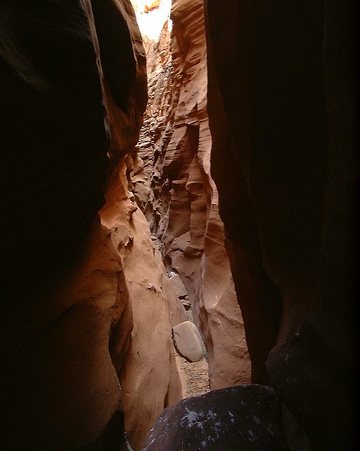
Around 11 am, we drove to the BLM ranger station to get some information, did not learn more, that I already knew, but they had some useful free brochures. Then we drove to the Wire Pass Trailhead, where start the hikes to the Buckskin Gulch and Coyote Buttes, a bone rattling 8 mile dirt road ride. The Buckskin hike starts going down the Wire Pass, first through ![]() a wash, but soon
a wash, but soon ![]() the narrows start. There were interesting
the narrows start. There were interesting ![]() logs stuck in the narrows. The canyon widened a bit near the
logs stuck in the narrows. The canyon widened a bit near the ![]() confluence with Buckskin Gulch. We went upstream a bit, but the narrows
confluence with Buckskin Gulch. We went upstream a bit, but the narrows ![]() were not too exciting. The wet section of Buckskin started about 100 m down from the confluence, so we turned around, went back through the first Wire Pass narrows section and
were not too exciting. The wet section of Buckskin started about 100 m down from the confluence, so we turned around, went back through the first Wire Pass narrows section and ![]() hiked south out of the canyon, towards the Coyote Buttes. The plan was to hike to the Teepee section of the Buttes, few miles south, which are out of the special management area. This area was created by BLM to limit amount of people in the area, since they are is pretty and popular among photographers. I share idea expressed by a writer of my guidebook Michael Kelsey, who suspects that the so called environmentalist restricting access to this are probably have been there already many times before the closure and thus do not have need to go through the bureaucracy of obtaining the permit. Currently the limit is 10 people/day, and the reservations are gone months in advance, so there is no chance one would get a permit at the arrival. Anyway, as you will read on later, we ended up getting into the special management area on the way back (needless to say, there was no sign of a boundary), and did not meet a soul during the whole hike. Rules are made to be broken, especially by curious Czechs ;-) ... We took a break on the top of the canyon, I made a few pictures.
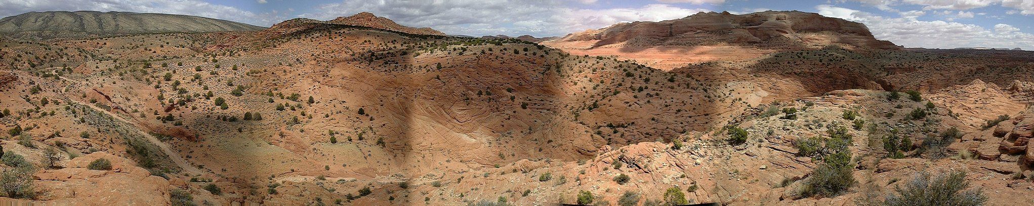
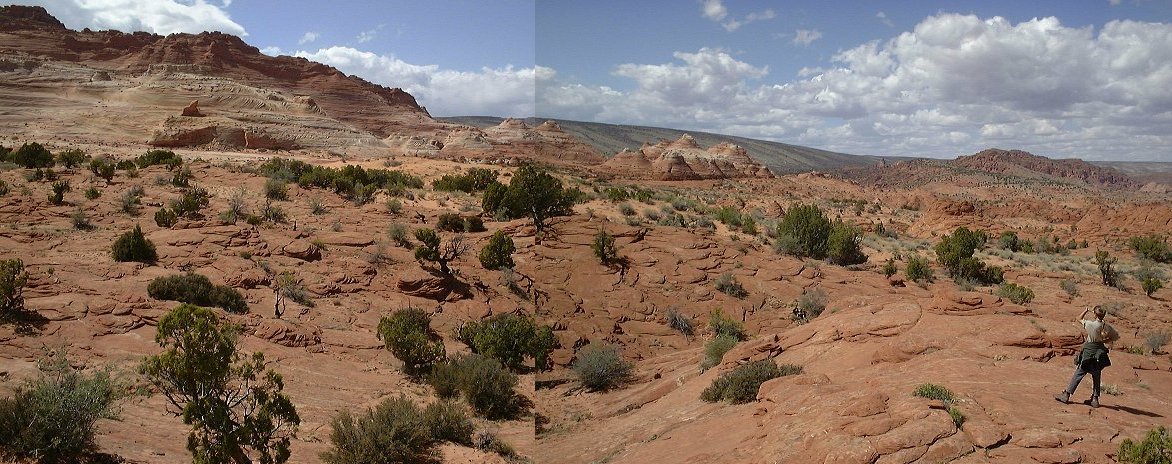
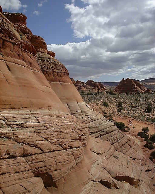
hiked south out of the canyon, towards the Coyote Buttes. The plan was to hike to the Teepee section of the Buttes, few miles south, which are out of the special management area. This area was created by BLM to limit amount of people in the area, since they are is pretty and popular among photographers. I share idea expressed by a writer of my guidebook Michael Kelsey, who suspects that the so called environmentalist restricting access to this are probably have been there already many times before the closure and thus do not have need to go through the bureaucracy of obtaining the permit. Currently the limit is 10 people/day, and the reservations are gone months in advance, so there is no chance one would get a permit at the arrival. Anyway, as you will read on later, we ended up getting into the special management area on the way back (needless to say, there was no sign of a boundary), and did not meet a soul during the whole hike. Rules are made to be broken, especially by curious Czechs ;-) ... We took a break on the top of the canyon, I made a few pictures. ![]() Here's view to the north (combo 350 kB), with the Wire Pass below us, and
Here's view to the north (combo 350 kB), with the Wire Pass below us, and ![]() here to the south (combo 350 kB).
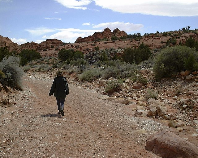
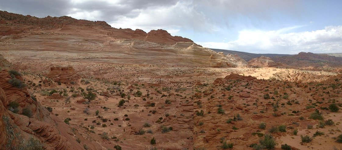
Then we hiked through what looked like a plain to the Teepees. Actually, it was pretty rolling terrain, going both through the sand and
here to the south (combo 350 kB).
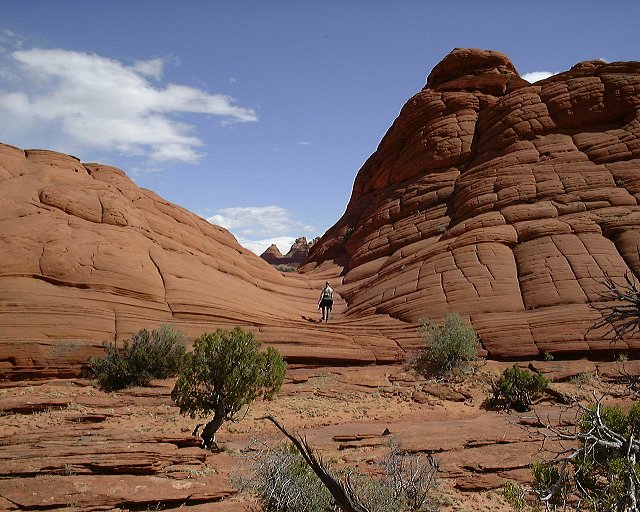
Then we hiked through what looked like a plain to the Teepees. Actually, it was pretty rolling terrain, going both through the sand and ![]() slickrock benches. We also encountered
slickrock benches. We also encountered ![]() a weird triangulation point. From about 1/3 way there, we had
a weird triangulation point. From about 1/3 way there, we had ![]() this view to the northern Coyote Buttes.
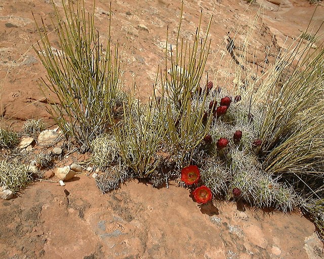
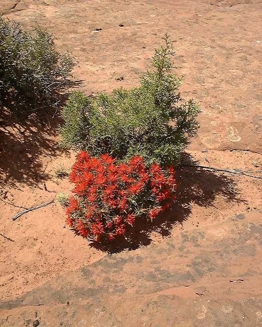
As the spring was in full gear, we saw some flowers too.
this view to the northern Coyote Buttes.
As the spring was in full gear, we saw some flowers too. ![]() Here is a cactus among the mormon tea bushes,
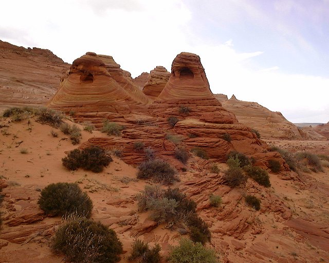
Here is a cactus among the mormon tea bushes, ![]() here indian paintbrush in front of a small juniper. After ca. 1.5 hrs, we got to the Northern Teepees. We
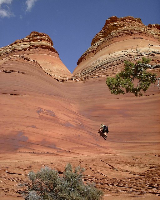
here indian paintbrush in front of a small juniper. After ca. 1.5 hrs, we got to the Northern Teepees. We ![]() climbed up a bit, here's view to the
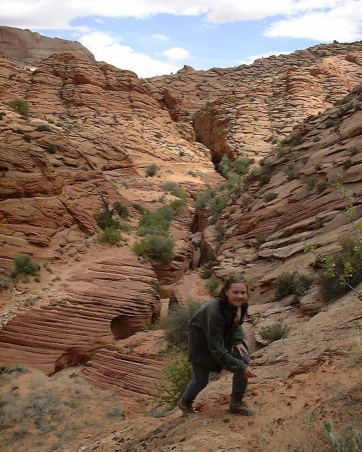
climbed up a bit, here's view to the ![]() Southern Teepes from a bit high up,
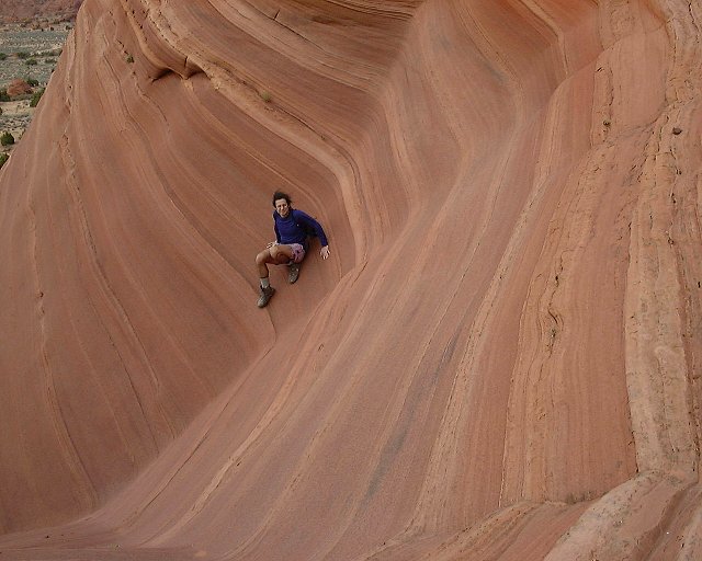
Southern Teepes from a bit high up, ![]() here is me going down. On the way back we decided to avoid the sand on the plateau and hiked directly west to the bench back on
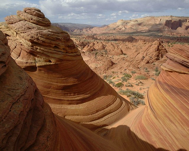
here is me going down. On the way back we decided to avoid the sand on the plateau and hiked directly west to the bench back on ![]() this image and to the north (right) to the best part of the northen Coyote Buttes (the forbidden zone). Notice the four beehives on the center left of this picture, we headed there first,
this image and to the north (right) to the best part of the northen Coyote Buttes (the forbidden zone). Notice the four beehives on the center left of this picture, we headed there first, ![]() here they are in detail,
here they are in detail, ![]() this is a view back to the Teepees and
this is a view back to the Teepees and ![]() first and
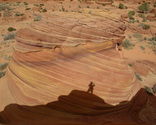
first and ![]() second pictures from the beehives themselves. Then we walked on the bench and got to the Wave, the most fotogenic part of the northern C.B. At the entrance was
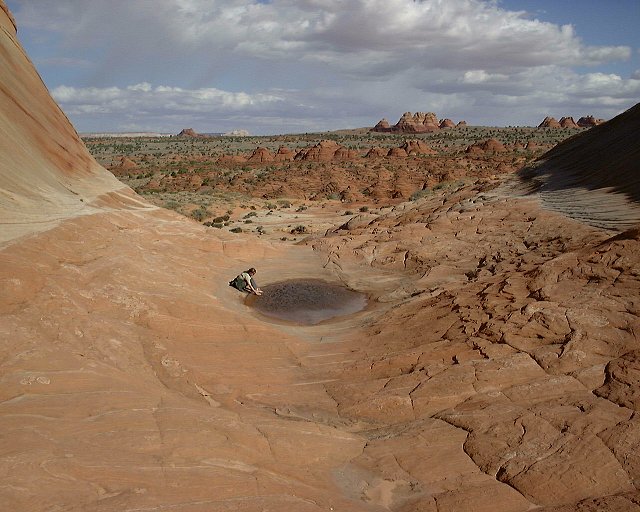
second pictures from the beehives themselves. Then we walked on the bench and got to the Wave, the most fotogenic part of the northern C.B. At the entrance was ![]() a small water pool. Then came a larger valley,
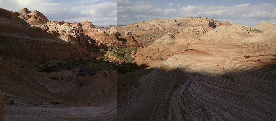
a small water pool. Then came a larger valley, ![]() here's view up and
here's view up and ![]() here view down, north. The lighting was not that great anymore though, since in was around 4.30 PM. We hiked back (whole loop took about 5 hours), drove to Page to get something to eat, make few phone calls and stock up on booze. After dark we found a deserted side road from the Hwy 89 and crashed there.
here view down, north. The lighting was not that great anymore though, since in was around 4.30 PM. We hiked back (whole loop took about 5 hours), drove to Page to get something to eat, make few phone calls and stock up on booze. After dark we found a deserted side road from the Hwy 89 and crashed there.
On Sun. morning we woke up early, and by 8am were at the Glen Canyon Dam to check out the visitor's center. Incidentally, we met a group of Czech tourists there, but did not attempt to make a contact. Here are two pictures of the dam, ![]() 1 and
1 and ![]() 2, and here is
2, and here is ![]() the Colorado downstream. Then we drove to check out the Water Holes Canyon narrows, few miles south of Page. We first went to the upper part, accessible from Coppermine Road, about 5 miles from Page. It lies on the Navajo Reservation, and the guide said to get $5 permit from the Navajo Parks office in the nearby village. We did not find the office, it was probably closed anyway, so we went for the hike without it. Needless to say, we were the only people there that day.
the Colorado downstream. Then we drove to check out the Water Holes Canyon narrows, few miles south of Page. We first went to the upper part, accessible from Coppermine Road, about 5 miles from Page. It lies on the Navajo Reservation, and the guide said to get $5 permit from the Navajo Parks office in the nearby village. We did not find the office, it was probably closed anyway, so we went for the hike without it. Needless to say, we were the only people there that day. ![]() Here (combo 400kB) is how the canyon looked like from the hike starting point. We went up into the central canyon and looped back on the mesa down the canyon on the left. In the central canyon, the narrows
Here (combo 400kB) is how the canyon looked like from the hike starting point. We went up into the central canyon and looped back on the mesa down the canyon on the left. In the central canyon, the narrows ![]() start like this,
start like this, ![]() this is the first corkscrew and
this is the first corkscrew and ![]() Šárka getting up.
Šárka getting up. ![]() Here is the dryfall, obviously not climable without gear, we got out on the right, on an exposed scramble, probably the worst I have done so far, since the sandstone was very soft and falling off, offerring little support. I would scramble up a bit and then secure Šárka with a rope on her way up. Here is
Here is the dryfall, obviously not climable without gear, we got out on the right, on an exposed scramble, probably the worst I have done so far, since the sandstone was very soft and falling off, offerring little support. I would scramble up a bit and then secure Šárka with a rope on her way up. Here is ![]() the slot and
the slot and ![]() the dryfall from the top. After ca. 30 min. hike on the mesa, we got to the
the dryfall from the top. After ca. 30 min. hike on the mesa, we got to the ![]() eastern canyon rim end, which was too steep to climb down. We backtracked about 800 m on the rim got down and went into the slot. Here is
eastern canyon rim end, which was too steep to climb down. We backtracked about 800 m on the rim got down and went into the slot. Here is ![]() the best section. After this, we walked down the wash for a bit, and got back through a short slot on the southern side of the canyon. Whole loop took about 5 hours. We planned then to hike to a lookout over the Colorado. This required to get back on Hwy 89. However, we missed the turnoff and ended up at the
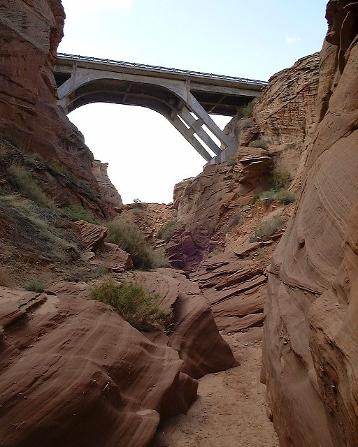
the best section. After this, we walked down the wash for a bit, and got back through a short slot on the southern side of the canyon. Whole loop took about 5 hours. We planned then to hike to a lookout over the Colorado. This required to get back on Hwy 89. However, we missed the turnoff and ended up at the ![]() bridge over the lower Water Holes Canyon. Supposedly, this one is on a private land and accessible only with a guide which charges $$ (at least that's what the signs alongside the road say). There were no signs of a guide, so we went down on our own (we were not too unhappy about that). There are not any special narrows upstream, we walked up ca. 800 m. to check it out. On the way down, the guides installed
bridge over the lower Water Holes Canyon. Supposedly, this one is on a private land and accessible only with a guide which charges $$ (at least that's what the signs alongside the road say). There were no signs of a guide, so we went down on our own (we were not too unhappy about that). There are not any special narrows upstream, we walked up ca. 800 m. to check it out. On the way down, the guides installed ![]() a ladder in a ca. 4 m dropof about 150 m. down from the road, after that, there are very good narrows for at least 1.5 km till a big (15 m) dryfall, which marks the begining of the technical section. We turned around here. Here are three best picts from the narrows,
a ladder in a ca. 4 m dropof about 150 m. down from the road, after that, there are very good narrows for at least 1.5 km till a big (15 m) dryfall, which marks the begining of the technical section. We turned around here. Here are three best picts from the narrows, ![]() 1,
1, ![]() 2 and
2 and ![]() 3. We got out at about 4.30PM, ate and then drove to the Lake Powell for a swim. After a while, we found
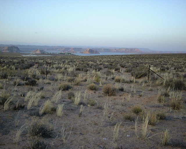
3. We got out at about 4.30PM, ate and then drove to the Lake Powell for a swim. After a while, we found
![]() this secluded bay, the water was cold but refreshing. Then we drove to Page to drop off Šárka and with the sunset I set out for the way home,
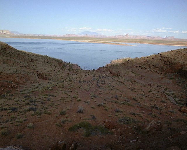
this secluded bay, the water was cold but refreshing. Then we drove to Page to drop off Šárka and with the sunset I set out for the way home, ![]() Lake Powell saying goodbye.
Lake Powell saying goodbye.
U of U / Chemistry / HEC / Voth Group / Cuma / Travel / English / Hiking around Page
URL: http://voth.chem.utah.edu/~mcuma/page0e.html
Last updated: 25-Apr-00 / mc