San Rafael Swell
San Rafael Swell je oblast cca. 100x100km ve středním Utahu, která se vyvrásnila o něco nahoru nad okolní poušť. Tím pádem jsou tu místy efektní pískovcové skály protkané štěrbinovými kaňony. Protože je to dost opuštěná oblast bez zájmu klasických turistů, je tu taky klid, jiní lidé se potkají jen zřídka.
Část 1. 3/11 - 3/13 2000
Zatím jen v anglické verzi.
A long planned trip to the southeastern part of San Rafael Swell, namely San Rafael Reef (which borderlines the Swell from the east) south of its highest peak, Temple Mountain, finally took place in the mid March.
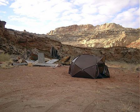
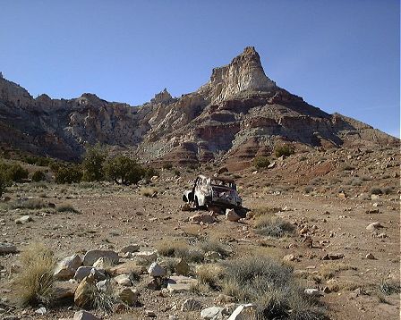
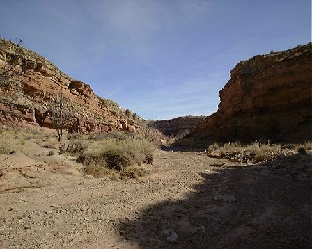
On Friday night, we drove from SLC to the Reef, about 3.5 hrs including about 30 min. jam in SLC (intersection of I15 and I215 - very hard to avoid). The road towards Temple Mountain, which branches left of Ut. Hwy. 24 about 20 miles south of I70, is paved till it enters the South Temple Wash, about 1 mile west of the turnoff to Goblin Valley SP. About another mile west, behind the reef, there is a junction with the Behind the Reef Road, another graded dirt road that goes south for ca. 9 miles. The road quality was good, and I don't think there are many times this road would be impassable to the passenger cars, as there are anly few washes it crosses and all of them are pretty wide. Anyway, we drove all the way to the end of the road at the mouth of Chute Canyon, and camped there for the first two nights ( here's how it looked like).
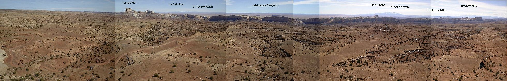
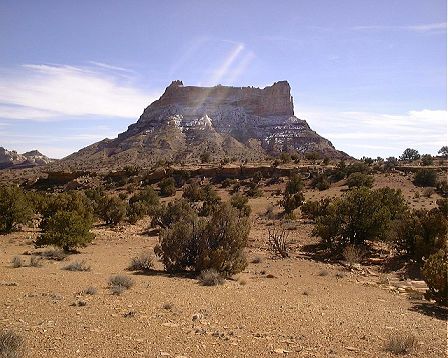
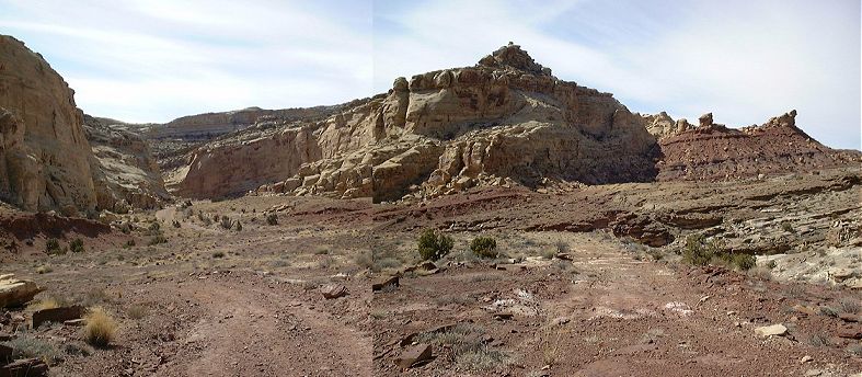
On Saturday morning we found, that the location was not the greatest, the sun reached our tent at about 11 pm. We got our bikes ready and biked north on the Behind the Reef Road. The only companion that day was a lone motorcyclist. I soon turned west and on a jeep road reached the Flat Top Mountain, about 8 miles west of Temple Mountain, about the same height, but as the name suggests, pretty flat. There is an old mining road that goes all the way to the top, the last piece is cut through the slope, and there, plus on most western slopes, were remnants of the Thursday's snow storm. In fact, it was still pretty chilly that day. I had a lunch on the top, and took bunch of pictures. Here are two sets which I collected into a panoramatic view: view to the west-south (150 kB) with the higher parts of the Swell, and view to the south-east-north (200 kB) with the overall Reef view. Then I continued north-west and up on the dirt road that leads to I70. Near the summit, I off turned east on another jeep road, towards the Temple Mountain. At the beginning, the road looked something like this, more-less packed dirt, but there were two wet sections from the melting snow, which made the dirt into a 5 cm thick glue-like stuff. The bike was covered in a few meters to an extent that the wheels would not move anymore. I had to carry it through these sections. A word of advise, if you go to bike in this area, make sure the roads are not wet. Once I got to lower elevations, the snow disappeared and the ride was a pleasant gradual downhill with few rougher spots. With the north side of Temple Mountain in view, I stopped for a while to clean the mud that did not fall off during the shaky ride. Another few miles down, in the cirque behind Temple Mountain (which displays remnants of the minig activities), I unsuccessfully tried to cross the mountain ridge, although there were roads marked on the map. One of the roads that I took up a bit seemed to be covered by a scree avalanche, so this might have been the one shown on the map. So, I had to go more east, cross the reef in the North Temple Wash, and on the road thru South Temple Wash and Behind the Reef got back to the campsite, by end of which I was pretty tired. Still, this was an enjoyable ca. 5 hr. 55 km ride. For those interested, though, I would suggest to take the jeep trail west of Temple Mountain to the main road, one does not miss much of the cool stuff and shortens the ride by good 10-15 km.
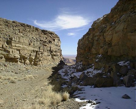
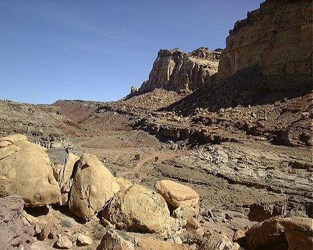
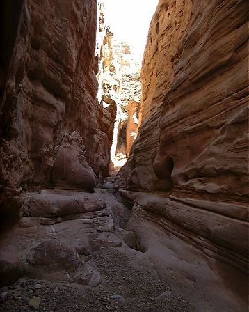
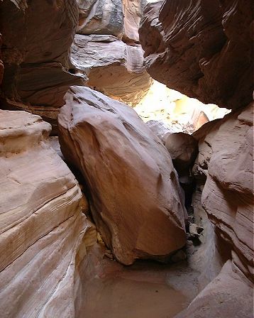
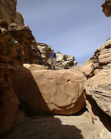
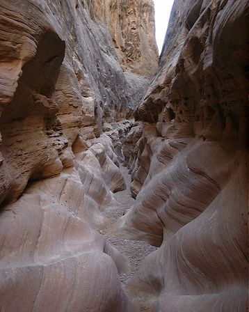
For Sunday, we originally planned a loop hike in the two nearby slot canyons, Bell's and Little Wild Horse (LWH). However, we did not manage to find the road that would cross a ridge between the Chute Canyon where we stayed and adjacent LWH. We just got up towards the ridge and realized this is not the way. At least, we took a picture of the campsite where we stayed with the reef behind. As it was already noon, we opted for an alternative program, walk down and up Crack Canyon, one up north from the Chute. This turned out to be a good choice. We parked off the road near where it crossed the wash going into the canyon. After about 15 min walk from here the wash enters the reef, the walls look like this. Right ahead was a first narrow section, looking like a tunnel. Fun thing was, that one could walk on a top of this from the other side. After about one more km, there was another section of the narrows, looking like this or this. This boulder was probably one of the toughest dryfalls in the canyon. In few hundred meters, the canyon widened a bit again and then started the third section of the narrows. Another km out the canyon slowly exited the reef, here's the look down the wash. We turned around about here, the way back involved several more climbs like this. The whole hike took us 4 hrs of leisure walk, no particularly tough spots or pools. We still managed to drive towards the Goblin Valley SP and camped near the Little Wild Horse Cyn. (LWHC) trailhead, on the east side of the reef.
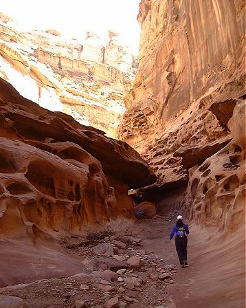
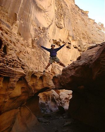
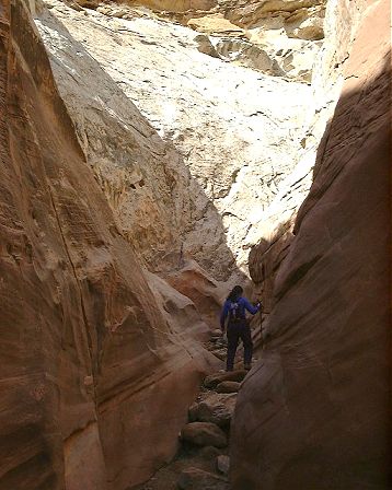
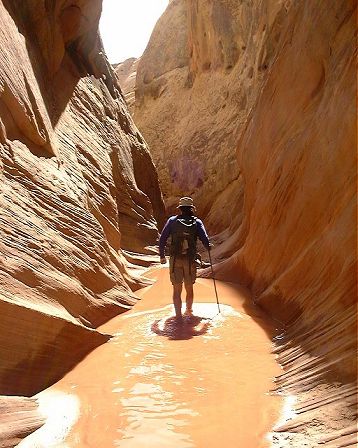
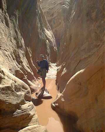
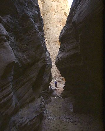
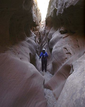
On Monday we set out a bit earlier, as our spot was sunny. To our surprise, there were already at least 5 cars at the trailhead. We had to get used to the crowds after a weekend of solitude behind the reef. BLM took some care of the trailhead, which looks like this. The hike is actually a loop, we went up Bell's Canyon and down LWHC, about 13 kms all the way. The Bell's canyon started to be interesting right after entering the canyon. Although the side walls were small, the canyon was narrow and there were two pools ca. 3 m long and up to knee deep which we had to wade. This was not particularly pleasant, as the water temperature must have been close to the freezing point (it was freezing in the morning). After few kms, the canyon got wider and almost at the end was a large boulder which we climbed up on the left. After exiting the Bell's Canyon, the trail follows an old mining road north to the mouth of LWH. Here's how the Bell's canyon entrance looks like, the actual canyon is on the left. On a similar picture is the LWH mouth, entrance on the right. The toughest part of LWH was in the upper section, but there were also some fun parts, such as a little tunnel formed by fallen rocks. A bit more down were 5 pools on a stretch ca. 300 m, which we walked barefoot. Here is one and another shot from the middle, deepest pool. Then we dried warmed up on one sunny spot and continued down. The coolest narrows were good 2 kms long, higher up it looked like this or this. Then the canyon widened a bit, and narrowed again. Here's the beginnig of the narrow part and here'sa crooked narrow that followed. However, this was almost the end, soon we exited the narrows, here's how it lookes like there, don't ask me what was the fishing net doing there.
After ca. 20 min. we were back at the trailhead. Overall, the hike took is 5 hours, but again, we were not rushing it.
Zpátky Otázky, poznámky
U of U / Chemistry / HEC / Voth Group / Cuma / Travel / Czech / San Rafael Swell
URL: http://voth.chem.utah.edu/~mcuma/s_raf00.html
Last updated: 23-Mar-00 / mc