Big Cottonwood Canyon
Broads Fork
Canyon leading to the Broads Fork Twin Peaks, day before Christmas Eve 1999 we snowshoed up to the upper basin for about 2 hours and then rushed back.
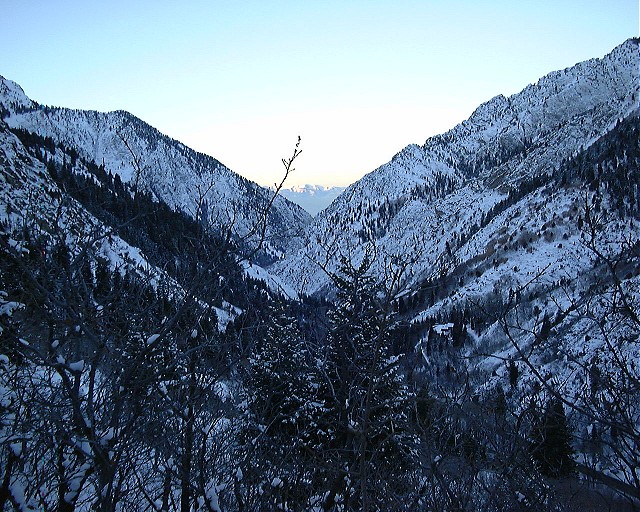
![]() Lower Big Cottonwood from first lookout, just before dawn.
Lower Big Cottonwood from first lookout, just before dawn.
![]() Mt. Olympus when we got out of the forest.
Mt. Olympus when we got out of the forest.
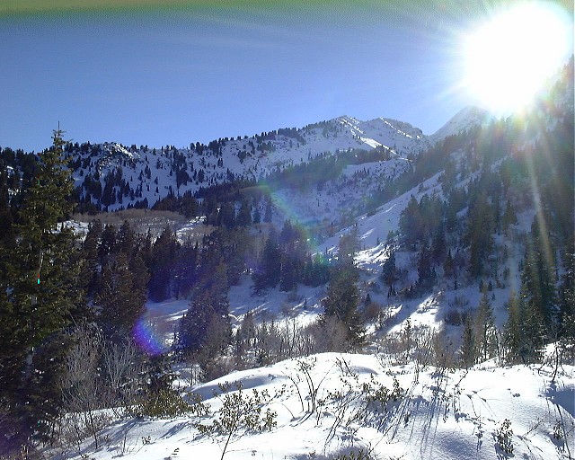
![]() Dromedary Peak from the same spot.
Dromedary Peak from the same spot.
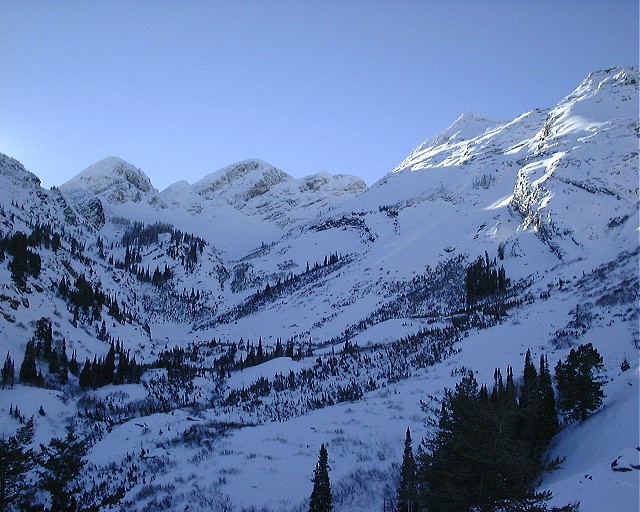
![]() Upper Broads Fork basin from the lake, from the left, Dromedary P., Sunrise P., Twin Peaks.
Upper Broads Fork basin from the lake, from the left, Dromedary P., Sunrise P., Twin Peaks.
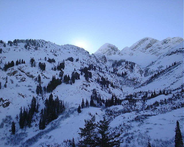
![]() Upper Broads Fork basin from the lake again, but look more to the east, the sun is peaking out.
Upper Broads Fork basin from the lake again, but look more to the east, the sun is peaking out.
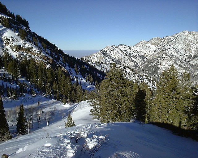
![]() View down the Broads Fork notice the "haze" = smog over the SL valley. We could not see anything
in the distance, not even the Oquirhs 20 miles away. It makes
you feel good to be above that crap.
View down the Broads Fork notice the "haze" = smog over the SL valley. We could not see anything
in the distance, not even the Oquirhs 20 miles away. It makes
you feel good to be above that crap.
![]() My friend Gabi getting ready to go down.
My friend Gabi getting ready to go down.
![]() And me with a nervous pose, it's getting late, let's go down.
And me with a nervous pose, it's getting late, let's go down.
![]() Last view towards the Dromedary P., the sun is firing up.
Last view towards the Dromedary P., the sun is firing up.
Side canyon leading to the north, pretty narrow at times. Leads towards a ridge between Big C. and the Canyons skiing resort. Nice half day workout hike. Beartrap Fork
![]() Canyon about 2/3 way up.
Canyon about 2/3 way up.
![]() Top of the ski lift on the ridge
Top of the ski lift on the ridge
A snowshoenig - snowcamping trip me and my firend Dina did last week on January 2000. Accompanied by my two regular hiking companions, Gabi and Ivan, we hiked from ca. 1900 m. at the Broads Fork trailhead to Lake Blanche (2716 m.). On snowshoes with packs on, it took us good 3 hours instead of typical 1+ hr. hiking in the summer. Just before the Lake, Gabi and Ivan turned back, and we set a camp on the southern shore of frozen Lake Blanche, just before dawn. The night was clear and pretty cold, probably slightly below -10 C. I bet we were the only ones there that night, although this is quite popular spot.Mill B Fork (Lake Blanche) snowcamping
We slept pretty late that morning, waiting for the sun to come, then had some breakfast and snowshoed a bit up towards the saddle between Sundial Peak and the main ridge. Then it was a fun run down towards the camp, pack the tent and go down back to the civilization.
Pictures:
![]() Dina about 2/3 way up the Mill B Fork, smile on her face as Ivan is carrying her pack ;-)
Dina about 2/3 way up the Mill B Fork, smile on her face as Ivan is carrying her pack ;-)
![]() Gabi and Ivan on the trail at the same spot.
Gabi and Ivan on the trail at the same spot.
![]() Dromedary Peak from about the same place.
Dromedary Peak from about the same place.
![]() Ivan and Gabi little higher up, having a snack.
Ivan and Gabi little higher up, having a snack.
![]() Dina in the fire hole. There was about 1.5 m snow at the campsite, about 25 cm fresh.
Dina in the fire hole. There was about 1.5 m snow at the campsite, about 25 cm fresh.
![]() Me in the same place. I had 3 layers on my legs and 4 layers on my top, was feeling just right next to the fire.
Me in the same place. I had 3 layers on my legs and 4 layers on my top, was feeling just right next to the fire.
![]() My tent Gemma in the evening, experimental photo turning out alright.
My tent Gemma in the evening, experimental photo turning out alright.
![]() Frozen Lake Blanche from our campsite, view directly north.
Frozen Lake Blanche from our campsite, view directly north.
![]() Side ridge east of the valley we camped. Notice the small avalanche paths.
Side ridge east of the valley we camped. Notice the small avalanche paths.
![]() Dina getting out of the tent in the morning.
Dina getting out of the tent in the morning.
![]() The fire hole in the morning.
The fire hole in the morning.
![]() Dina cooking breakfast or something.
Dina cooking breakfast or something.
![]() Our campsite with the Sundial Peak in the background.
Our campsite with the Sundial Peak in the background.
![]() Hiking up above the Lake Blanche.
Hiking up above the Lake Blanche.
![]() Sundial Peak from the north-west.
Sundial Peak from the north-west.
![]() Dromedary Peak (left hidden behind the tree) and B. F. Twin Peaks (actually only one of them, the other is hidden behind) from hills above the lakes, view directly west.
Dromedary Peak (left hidden behind the tree) and B. F. Twin Peaks (actually only one of them, the other is hidden behind) from hills above the lakes, view directly west.
![]() Mt. Olympus with Salt Lake Valley in the distance from one of the snowed-on rock plateaus above the lakes.
Mt. Olympus with Salt Lake Valley in the distance from one of the snowed-on rock plateaus above the lakes.
![]() Sundial Peak from the west.
Sundial Peak from the west.
![]() View towards the south, left behind the slope is the ridge between Sundial Peak and the main ridge.
View towards the south, left behind the slope is the ridge between Sundial Peak and the main ridge.
![]() Dromedary Peak from where we turned around.
Dromedary Peak from where we turned around.
![]() Dina rushing up, the Millcreek-B. Cottonwood ridge in the distance, with most distinctive hill, Mt. Raymond in the middle.
Dina rushing up, the Millcreek-B. Cottonwood ridge in the distance, with most distinctive hill, Mt. Raymond in the middle.
![]() Running down the hill.
Running down the hill.
![]() Sundial Peak from a forest somewhere above our camp.
Sundial Peak from a forest somewhere above our camp.
![]() Sundial Peak from the Lake Blanche wall (i.e. its north-eastern end.
Sundial Peak from the Lake Blanche wall (i.e. its north-eastern end.
![]() Dina warming up her fingers, Mt. Superior in the distance.
Dina warming up her fingers, Mt. Superior in the distance.
![]() View down the Mill B fork from the lake.
View down the Mill B fork from the lake.
U of U / Chemistry / HEC / Voth Group / Cuma / Travel / English / Snowshoeing Little Cottonwood Canyon
Maybird Gulch snowcamping
Two days venture, one day hike up to a ridge between Red Pine and Maybird gulch, camp there and hike back the next day. The hike up took a little longer, due to heavy packs, but we were rewarded by a night in solitude.
Cardiff Pass
V plánovacím stadiu.
URL:
http://voth.chem.utah.edu/~mcuma/sshoe_en.html
Last updated: 25-Jan-00 / mc