Cross country skiing in the Beaver Creek area
Beaver Creek valley is located east of Kamas, the start point of the Mirror Lake Highway, that cuts through the western Uinta Mountains. The cross country skiing area starts right at the pay station ($3/day) and runs for about 5 miles along the road and in the surrounding hills. Further up the road is a snowmobile land. Fortunately, the skiing area is closed to these stinking noisy machines, which makes it one of the favorite winter destinations.
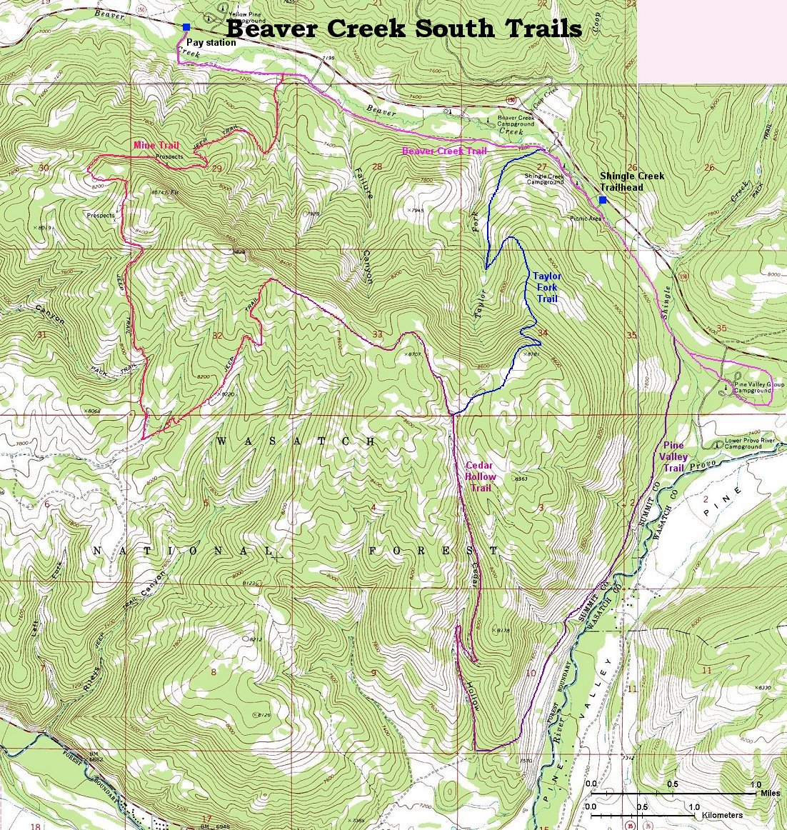
Here is map (610 kB) of the area south of the highway, which I explored so far, few comments on the trails are below. There are another 3-4 options north of the highway, map of the eastern part is here (600 kB).
Beaver Creek Trail
Flat trail that runs on a forest road parallel with the highway, on the other side of the creek. There are several access points along the highway, the first is right at the pay station. Park on the northern side of the road, at the Yellow Pine trailhead. The trail is about 5 miles long (one way) and makes a small loop around the Pine Valley campground, where are some nice views on the valley. Apart from this, there is not much scenery. Since it is fairly popular, the trail is usually in a reasonable shape, with two tracks in parallel. The rating is easy, it's a good place for the beginners or for those looking for a workout.
Pine Valley Trail
This trail starts west of the Pine Valley campground and heads south on the western foothills of the Pine Valley. First mile or so it's flat and then it climbs moderately to a ridge on the between Pine Valley and Provo River Valley. The trail is not visited very often, so expect that you may have to break your own path. Also, the area seems to be heavily populated by deer and moose, since the trail was full of their tracks which made the skiing a little difficult. Because of this and few short steep sections, I give this trail moderate rating. A more advanced skier can return via Cedar Hollow Trail and Taylor Fork trail.
Fotos
Click on the picture to display the original size.
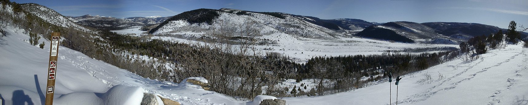
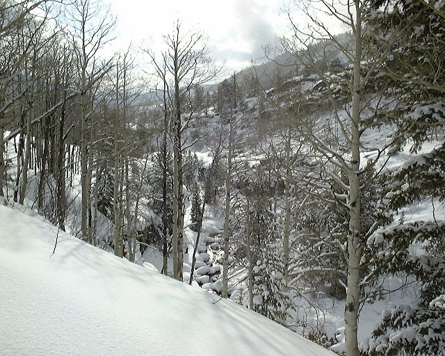
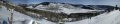 Panorama of Pine Valley from the south end of the Pine Valley Trail (210 kB).
Cedar Hollow Trail
Goes up on a road in Cedar Hollow from the Hwy. 35 east of Francis. In about 2.5 miles, it reaches the ridge above Beaver Creek Valley and offers spectacular views of the valley and western Uintas. This area is seldomly travelled, even by snowmobiles. Every time I was there, I skied in a snowmobile track. However, the snowmobile density there is very low and thus they are not annoying. This trail provides a good connection between Pine Valley Trail and the trails that go up the hills south of Beaver Creek. Rating is moderate, due to the climb up Cedar Hollow and several short steeper hills.
Fotos
Click on the picture to display the original size.
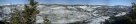
 Panorama west towards the Wasatch Mountains from about where the Cedar Hollow Trail ends.
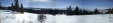
 Panorama north, down below is the Beaver Creek, in the distance western Uintas (200 kB).
 The same panorama from the highest point on the ridge, 8820 ft. (300 kB).
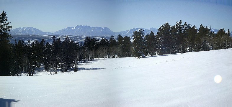
 Panorama south towards the Provo river valley (150 kB).
Taylor Fork Trail
This trail climbs up the hill starting at the west side of the Shingle Creek campground. In about one mile, there is a junction, with few signs and a fence on the western side. The trail going straight (south) is a dead end, turn east uphill and follow what is an ATV trail in the summer. It is moderately steep until the last stretch where are a couple of switchbacks. The last half mile or so until the Cedar Hollow Trail is nearly flat on a high plateau. This trails seems to be quite popular, I have seen there several ski tracks and a group of snowshoers (if you have snowshoes, this is probably the shortest way to reach the hills south of Beaver Creek). I would rate this trail as difficult, mainly because of the steep ascent/descent in the final stage of the climb.
Fotos
Click on the picture to display the original size.
 ATV gate on Taylor Fork trail at the high plateau ca. 0.5 km south from the ridge.
 A lone tree at the same spot.
 View down south from the same spot. The sun was already setting down, this loop took longer than expected.
Mine Trail
This trail starts where a sagebrush slope meets the Beaver Creek trail, about a mile east from the paystation. First half mile, it moderately climbs south to an intersection. Turn right (west), the other trail leads to a destination unknown. The climb gets steeper for about another half mile, and then flattens up again as it reaches the western flank of the mountain. The trail then goes down a bit to the west, I have opted for climbing a hill towards the east, and joined a snowmobile trail, which seemed to be a part of the summer ATV loop. This trail heads south for about 1.5 miles. Keep straight on a first intersection (the other trail heads west, not a good idea) until you get to a large meadow with a corral. Turn left on a trail that is marked as Jeep Trail on the map. This trail climbs for about 1.5 miles until it reaches the ridge above Beaver Creek, where it joins Cedar Hollow trail. I would rank this trail highest in the difficulty, the initial climb up is fairly steep, then follows some routfinding in the deep snow until one hits the ATV trail again, and then there is the long climb up back to the ridge. I have made the loop Mine Trail - Cedar Hollow - Taylor Fork in about 5 hours non-stop.
Fotos
 Panorama at the bottom of Mine trail, on the sagebrush clearing (140 kB).
 View up Mine trail from the sagebrush slope.
 Panorama of the Wasatch from the western flank of the Beaver Creek ridge, on the westernmost reach of Mine Trail (140 kB).

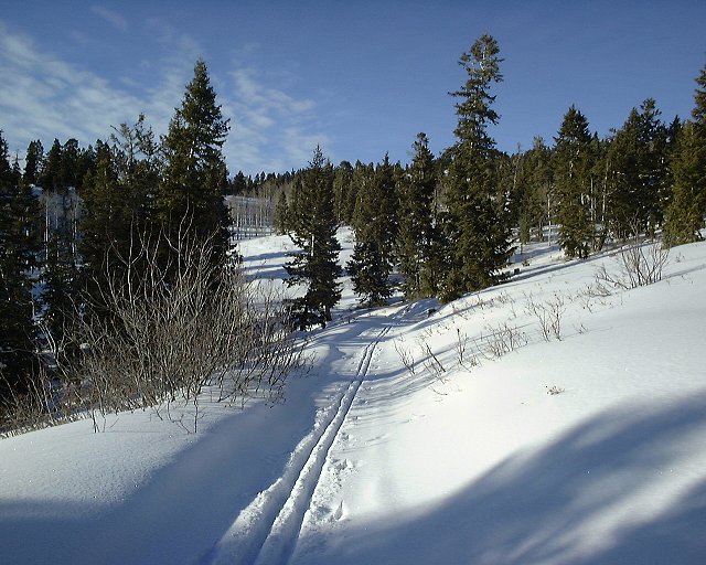
 Two shots from the climb back to the Beaver Creek ridge from the south.
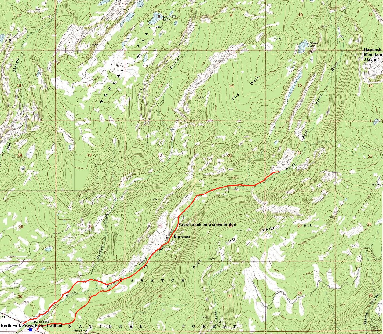
North Fork Provo River Trail
This is apparently the eastermost trail in the area where one is not threatened by the snowmobiles. There is two large parking lots on the right side of the road, the closer to the road for the skiers and snowshoers, the one further off for the snowmobilers. Very good idea. This trailhead serves two trails, the eastern end of Beaver Creek - Pine Valley trails, and North Fork Trail. Here, one have two options, either go up on the right or on the left side of the river. It's about 1.5 miles on both trails to reach a sign post on the right side of the river. Further up, it's better to go up on the right side, since the left side gets rocky in the narrows area. The narrows are another mile up, there are few hills to get around, but nothing serious. The trail up to the narrows is frequently travelled, so it's usually well broken, although large size dogs which seem to accompany altmost every skier here can make quite a mess out of the track. Continuing past the narrows is a more adventurous task, prepare for some serious trailbreaking and routefinding. The rule is to stay on the left side of the creek. The valley goes up only moderately, it's possible to locate the trail once in a while. Turn around when the trailbreaking gets too tiring. I have been there right after a storm that dumped 20-30 cm of heavy new snow, and followed a faint track under the new snowcover to the point where the valley turns back north and view to the Haystack Mountain appears. The skier before me, looked like, turned at the same place. As for difficulty rating, the loop starting at one side of the river and coming back on the other is easy and good for the beginners. Further up it's itermediate, be aware of few possible avalanche paths on the steep hills above the valley.
Fotos
 View down south towards Pine Valley from where the North Fork narrows start.
 View north to the upper North Fork from the same spot.


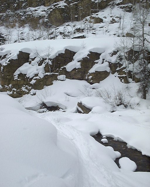
 Some shots of the narrows.
 View down the valley from above the narrows towards the narrows.
 View up the valley about 2 miles from the narrows.
 View down the valley from the same spot.
 View up the valley from where I turned around, Haystack mountain is between the two trees on the left.
 Zoomed up view to Haystack Mountain.
Back Comments, questions
U of U / CHPC / Cuma / Travel / English / Beaver Creek X-country
URL: http://voth.chem.utah.edu/~mcuma/b_crk01e.html
 Panorama west towards the Wasatch Mountains from about where the Cedar Hollow Trail ends.
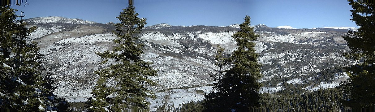 Panorama north, down below is the Beaver Creek, in the distance western Uintas (200 kB).
 The same panorama from the highest point on the ridge, 8820 ft. (300 kB).
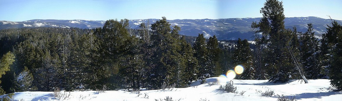 Panorama south towards the Provo river valley (150 kB).
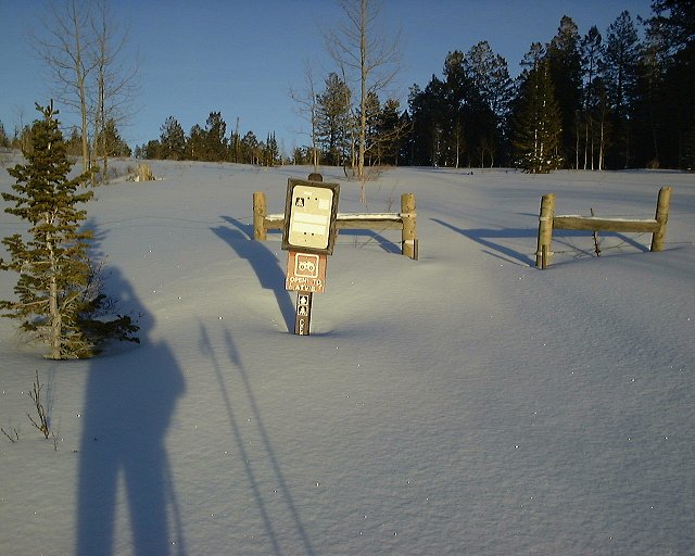 ATV gate on Taylor Fork trail at the high plateau ca. 0.5 km south from the ridge.
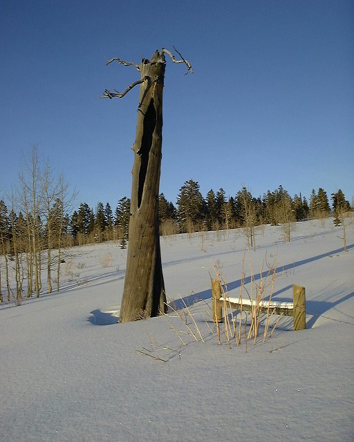 A lone tree at the same spot.
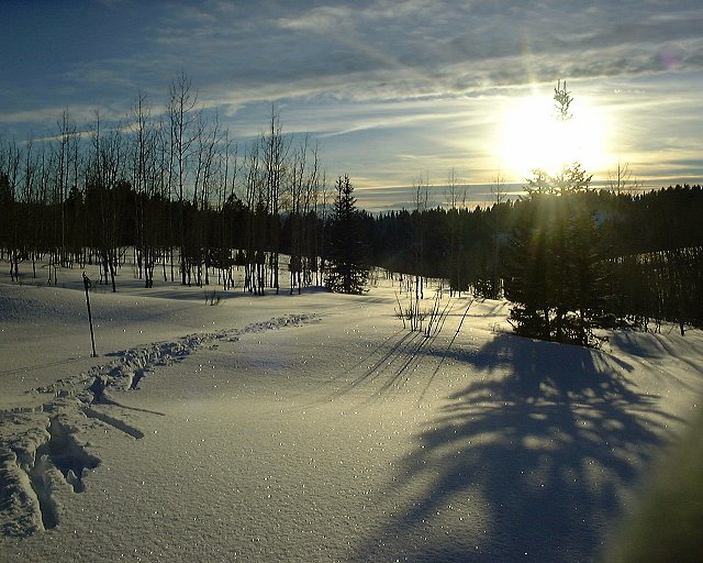 View down south from the same spot. The sun was already setting down, this loop took longer than expected.
 Panorama at the bottom of Mine trail, on the sagebrush clearing (140 kB).
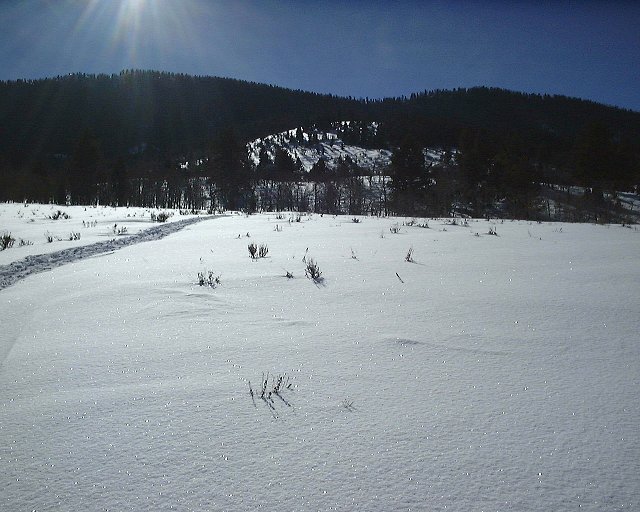 View up Mine trail from the sagebrush slope.
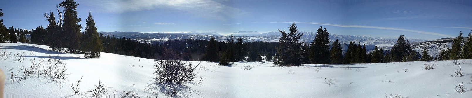 Panorama of the Wasatch from the western flank of the Beaver Creek ridge, on the westernmost reach of Mine Trail (140 kB).
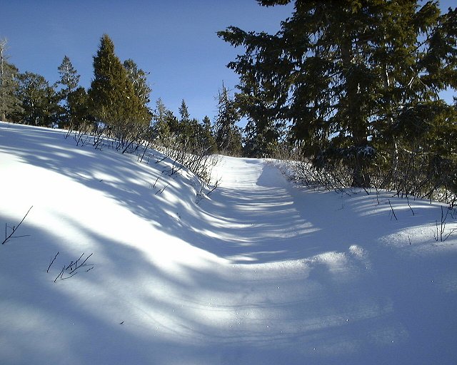
 Two shots from the climb back to the Beaver Creek ridge from the south.
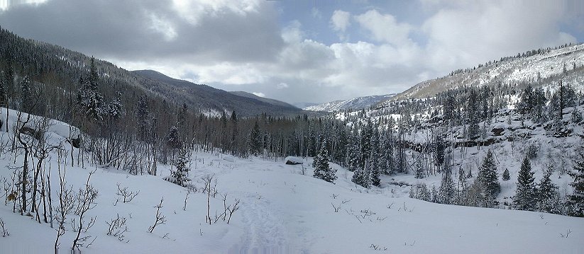 View down south towards Pine Valley from where the North Fork narrows start.
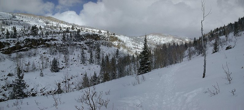 View north to the upper North Fork from the same spot.
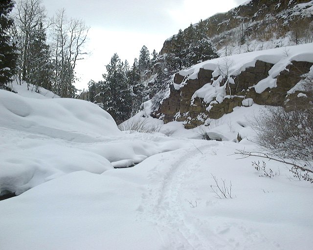
 Some shots of the narrows.
 View down the valley from above the narrows towards the narrows.
 View up the valley about 2 miles from the narrows.
 View down the valley from the same spot.
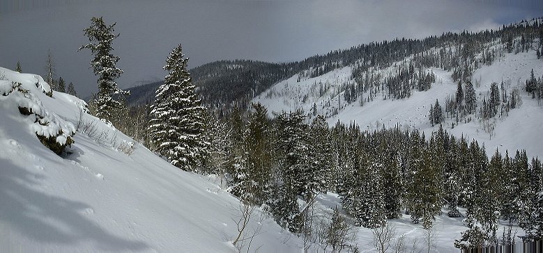 View up the valley from where I turned around, Haystack mountain is between the two trees on the left.
 Zoomed up view to Haystack Mountain.