Research Projects
1. Satellite data validation using field campaign observations
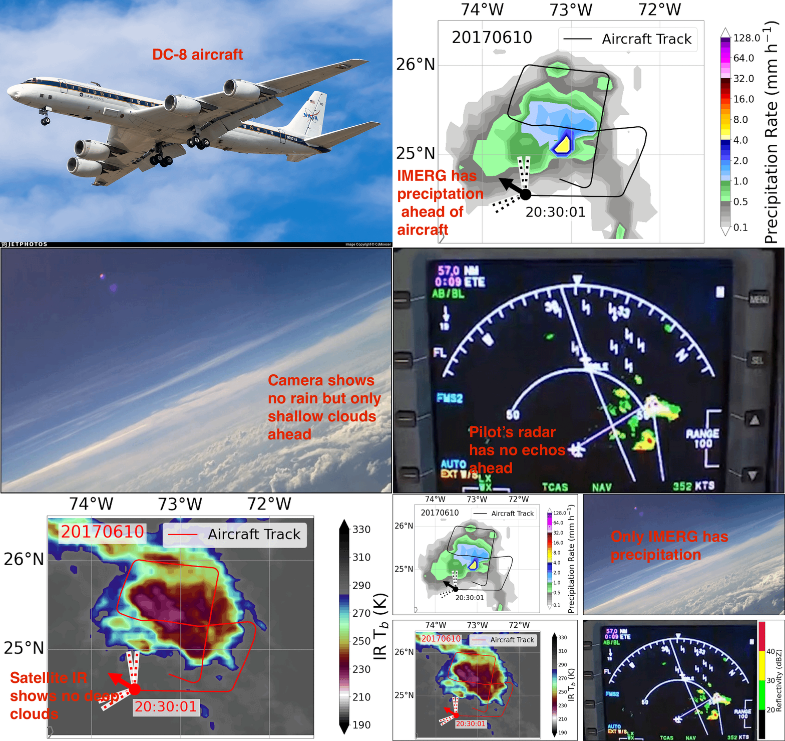
In this project, NASA's CPEX aircraft observations were used to validate NASA's satellite precipitation product (IMERG version 6). Images here show that the IMERG product has a large area with light precipitation (~ 1 mm/hr), but aircraft camera and radar show only scattered clouds in that location. Rajagopal et al. (2021) also found that this spurious precipitation is more common and identified the source to be the time interpolation of PMW observations. This led to improvement of the IMERG algorithm that removed the spurious precipitation in version 7 ( Tan et al. 2021 ).
2. Tracking mesoscale storms in satellite data
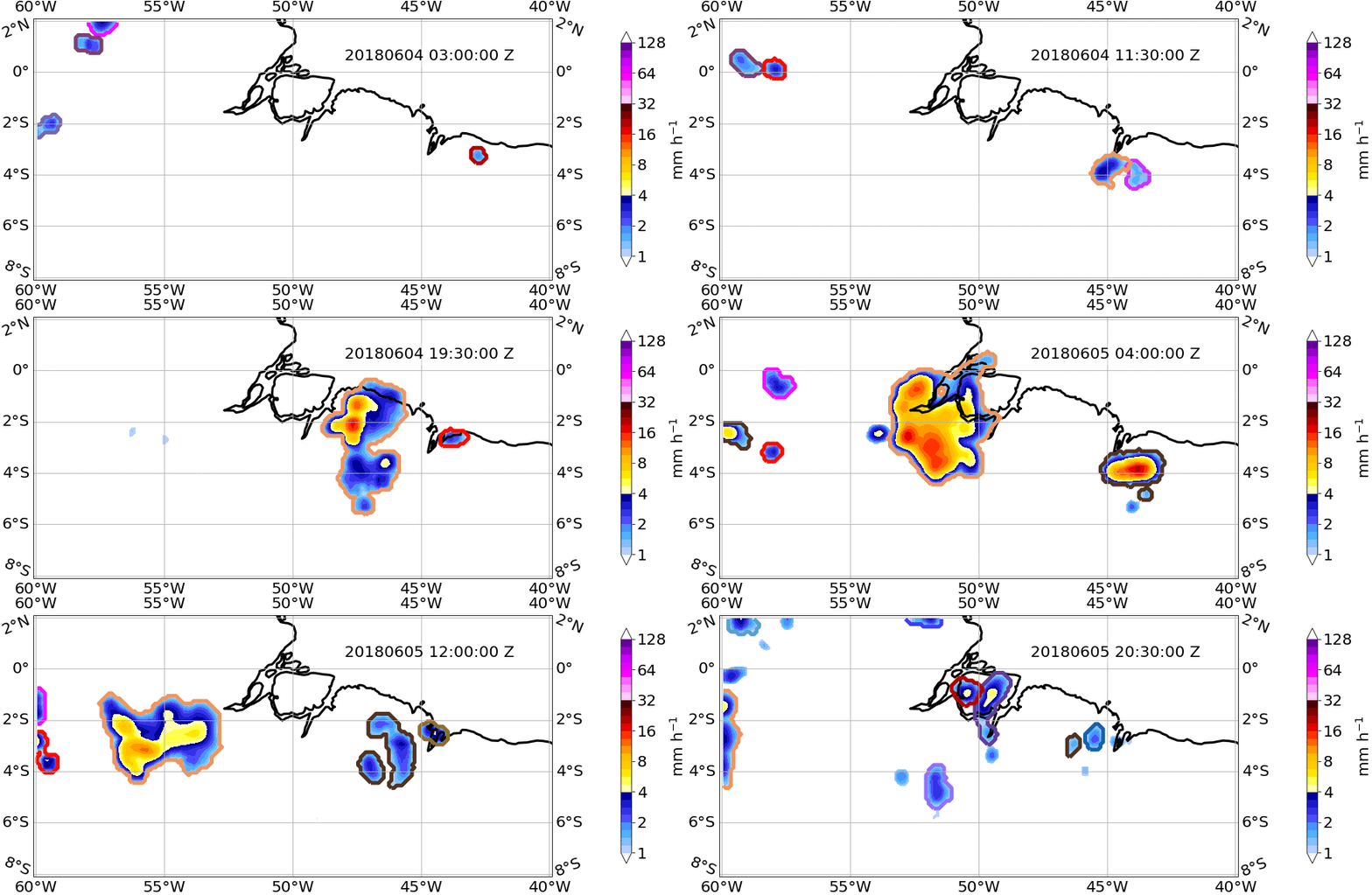
Tropical countries and oceans lack continuous radar observations in space and time to study storms. Hence, we use satellite data to track mesoscale storms in the tropics to study their properties such as frequency, size, duration, rain volume, and velocity (Rajagopal et al., 2023). The animation here shows storm tracking in NASA's IMERG precipitation field. The outermost color contour represents a mesoscale storm with the same tracking ID. If the same colored contour persists for many time steps, it implies that the FiT tracking program identifies those precipitation areas as belonging to the same storm.
3. Tracking mesoscale storms in high resolution computer models
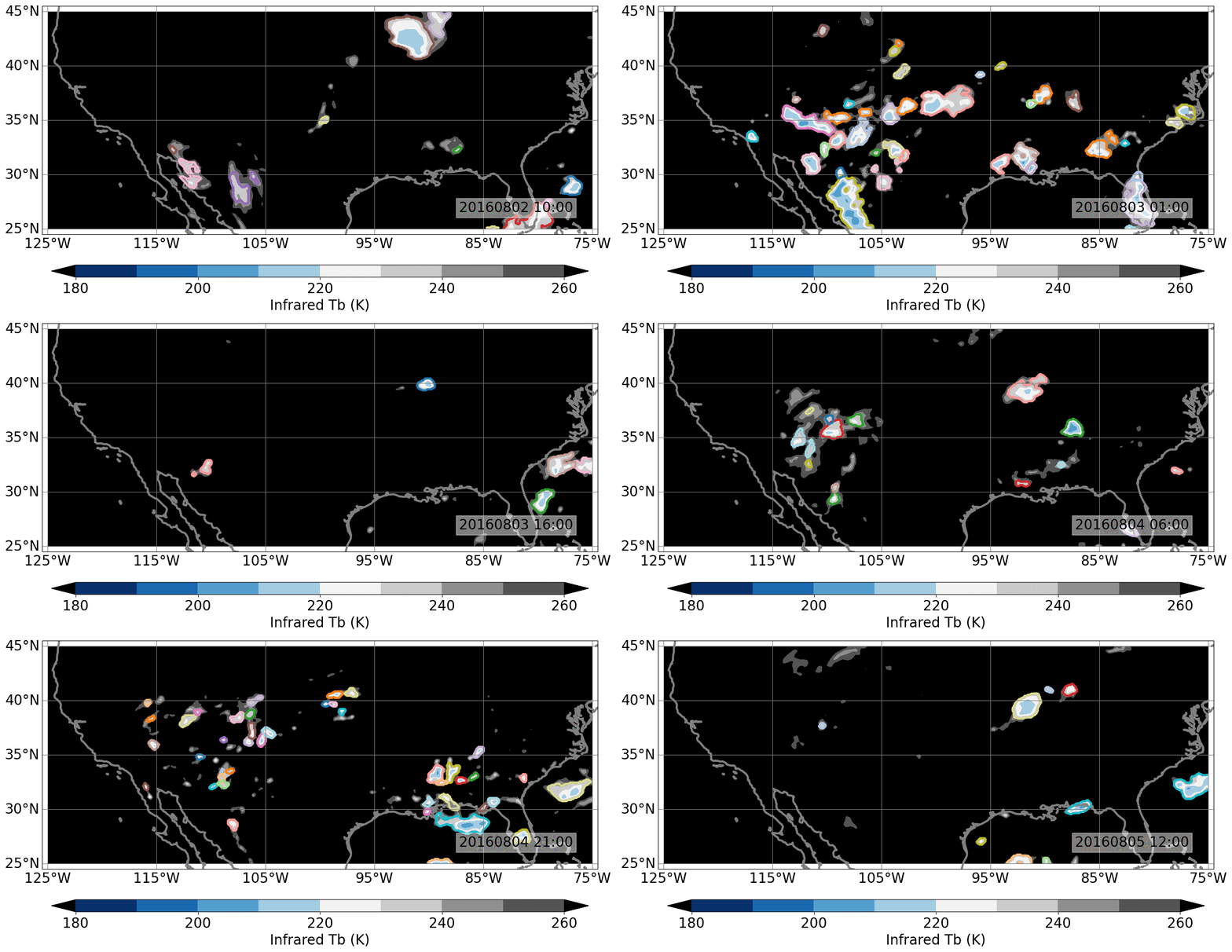
Can high-resolution numerical computer models produce deep convection and storms like the real atmosphere? Traditionally, the models were evaluated at each grid point for daily, monthly, and annual precipitation or cloudiness. Though helpful, the point-by-point validation doesn't provide process-level bias information on storm simulations. Tracking storms in the numerical model's output and comparing them to satellite observations through storm properties (frequency, size, duration, and velocity) help understand the model's shortcomings in representing storm processes. The animation shows storm tracking in NOAA's FV3 model's infrared output over the USA.
4. Evaluation of storm representation in low resolution models
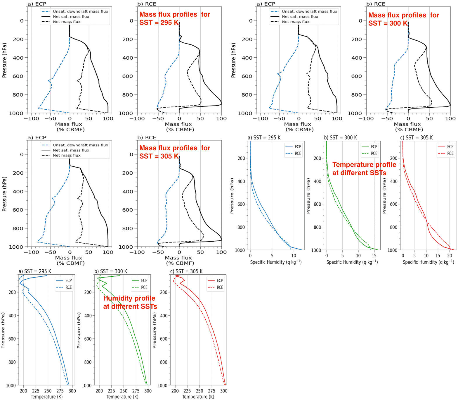
Low-resolution (grid cell ~ 100 km) models don't produce storms but represent their effects through cumulus parameterization. In this project, Prof. Kerry Emanuel's cumulus parameterization (ECP) for low-resolution models is compared with high-resolution (grid cell ~100 m) storm simulation (Radiative Convective Equilibrium, RCE) for the same environmental conditions, including sea surface temperature(SST). The parameterization scheme and high-resolution simulations have similar profiles for mass flux, temperature, and humidity.
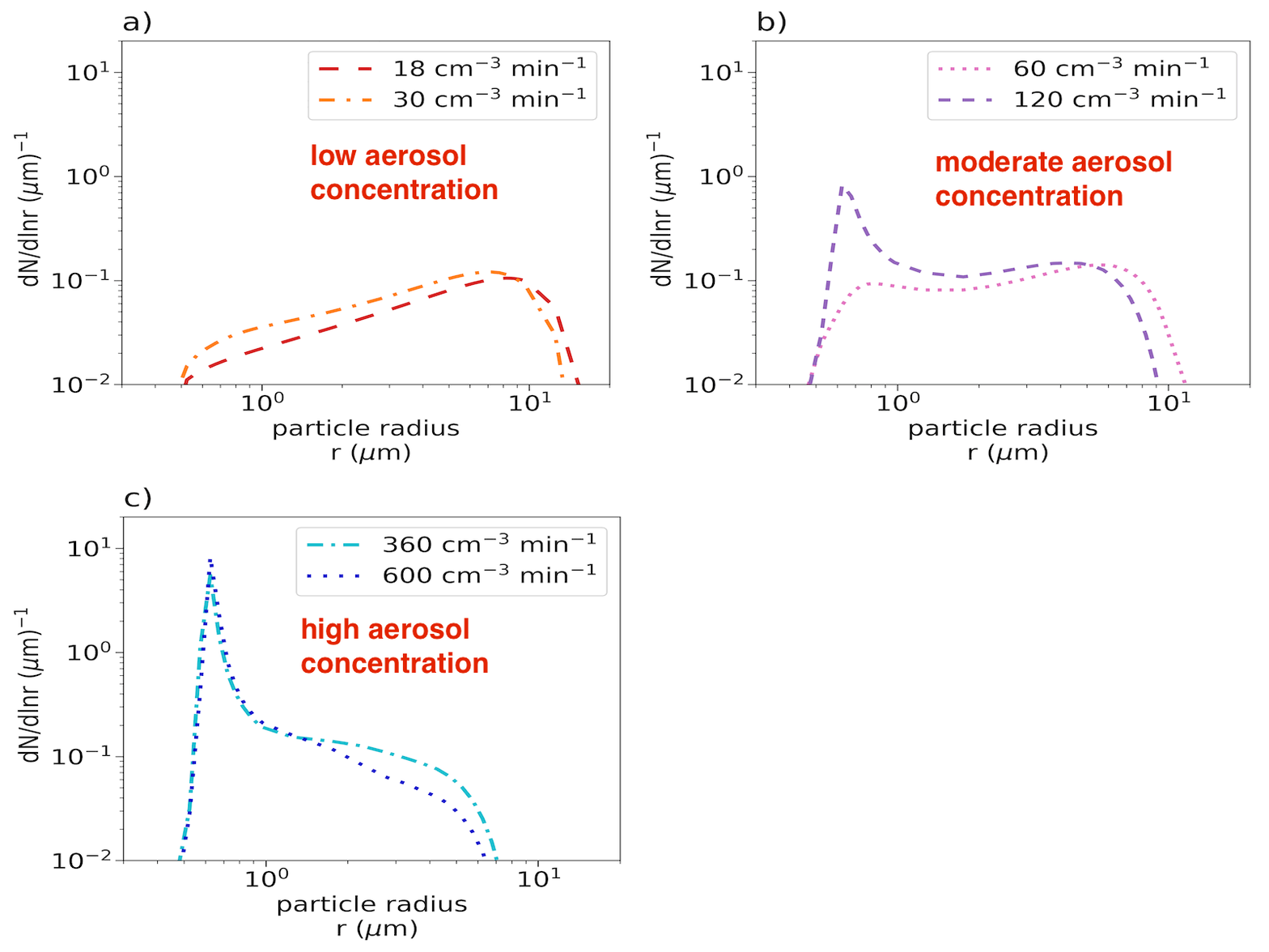
5. Turbulence effect on cloud droplet growth
Turbulence, inside a cloud, produces pockets of high and low supersaturation (relative humidity > 100%). This results in the broadening of droplet sizes present inside the clouds. In this project, I implemented cloud droplet microphysics in a one-dimensional turbulence model (ODT) to study the effect of aerosol concentration on droplet sizes. Consistent with past studies, low aerosol concentration produces many large droplets with broad size distribution , whereas high aerosol concentrations produce many small droplets with narrow size distribution.