| Name: | White House Ruin Trail - Canyon de Chelly NM | 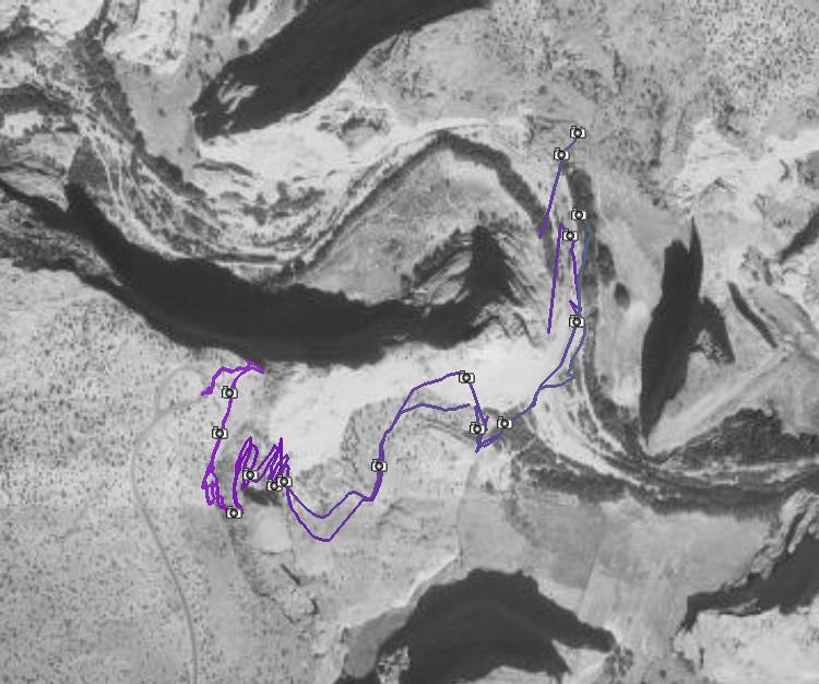
|
| Details: | Out and back hike from the south canyon rim to the canyon bottom (ca. 300 m descent) and back, towards a pueblo ruin under a cliff. The only hike in the Canyon de Chelly that can be done without a guide. The trail descends at moderate grade, partially cut in the sandstone cliffs. At the canyon bottom are some fields, ..., and at the ruin itself, numerous indian art vendors. Take the wallet if you want to buy something. | |

| ||
| Trip Length: | 3.31 miles |
| Total Trip Time: | 1:38 |
| Total Climbing: | 1164 feet |
| Total Descending: | 1180 feet |
| Average Speed: | 2.16 mph |
List of images
Including those taken alongside the south Canyon de Chelly rim.![[cdch01.j
pg]](cdch01.jpg) cdch01.jpg 110601 bytes 600 x 800 |
![[cdch02.j
pg]](cdch02.jpg) cdch02.jpg 152188 bytes 800 x 600 |
![[cdch03.j
pg]](cdch03.jpg) cdch03.jpg 143769 bytes 800 x 600 |
![[cdch04.j
pg]](cdch04.jpg) cdch04.jpg 145553 bytes 600 x 800 |
![[cdch05.j
pg]](cdch05.jpg) cdch05.jpg 152533 bytes 800 x 600 |
![[cdch06.j
pg]](cdch06.jpg) cdch06.jpg 142023 bytes 600 x 800 |
![[cdch07.j
pg]](cdch07.jpg) cdch07.jpg 149977 bytes 800 x 600 |
![[cdch08.j
pg]](cdch08.jpg) cdch08.jpg 154269 bytes 800 x 600 |
![[cdch09.j
pg]](cdch09.jpg) cdch09.jpg 216953 bytes 800 x 600 |
![[cdch10.j
pg]](cdch10.jpg) cdch10.jpg 203713 bytes 800 x 600 |
![[cdch11.j
pg]](cdch11.jpg) cdch11.jpg 166806 bytes 600 x 800 |
![[cdch12.j
pg]](cdch12.jpg) cdch12.jpg 139920 bytes 800 x 600 |
![[cdch01
a.jpg]](cdch01a.jpg) cdch01a.jpg 418561 bytes 2980 x 575 |
![[cdch02
a.jpg]](cdch02a.jpg) cdch02a.jpg 319497 bytes 2362 x 519 |
![[cdch03a.jpg]](cdch03a.jpg) cdch03a.jpg 149725 bytes 1254 x 532 |
![[cdch04a.jpg]](cdch04a.jpg) cdch04a.jpg 204917 bytes 1284 x 664 |
![[cdch05a.jpg]](cdch05a.jpg) cdch05a.jpg 473379 bytes 2161 x 770 |
![[cdch06a.jpg]](cdch06a.jpg) cdch06a.jpg 325214 bytes 2311 x 574 |
![[cdch07a.jpg]](cdch07a.jpg) cdch07a.jpg 342792 bytes 2326 x 574 |
![[cdch08a.jpg]](cdch08a.jpg) cdch08a.jpg 358987 bytes 2816 x 505 |