| Details: |
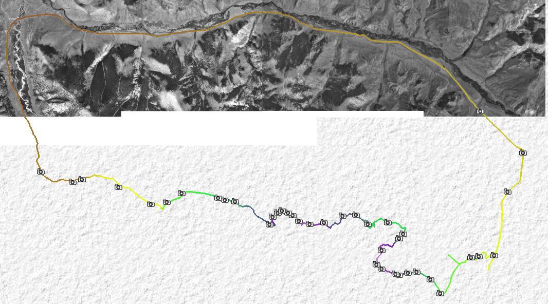
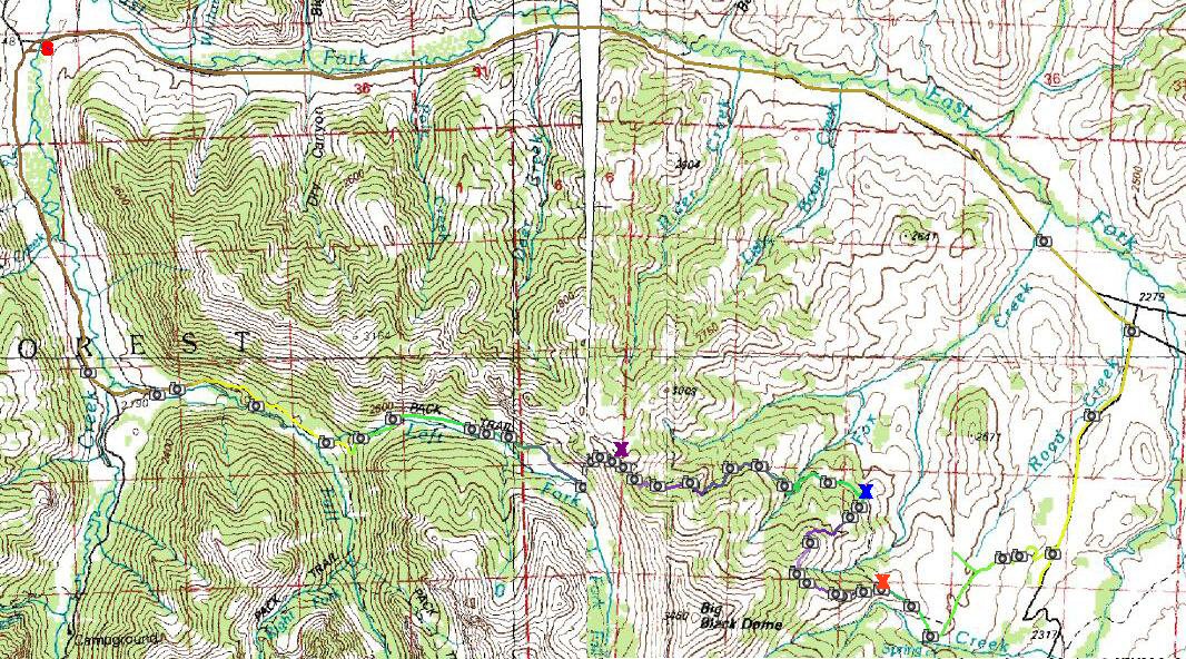
An attempt to make a reasonably large loop in the
border area of Copper Basin and Pioneer Mountains. First part on the
dirt road that follows East Fork to Copper Basin, starting at the
confluence of Wildhorse Creek and East Fork (red s). The chanllenge was
to locate the Highline Trail trailhead. I succeeded in that, but then
followed more pronounced ATV trail up to Big Black Dome, not noticing a
right turnoff after the first steep hill (red x). I assume that this
must have been somewhere near a fence crossing. In any case, I pushed
the bike up about 300 vertical meters after finally realizing that I am
off the right track. I went north a bit on a faint deer trail, and then
down another ridge line, part on foot and part on the bike. Then I hit
the right (= Highline) trail (blue x). The trail was pretty obvious in
the wooded areas, almost not visible in the sagebrush. I often curse at
horse poop on the trail, but here it was a blessing as it was the best
trail marker. Most of the singletrack to the high ridge was rideable,
but, I had to push the bike on many ocasions. On the descent to Fall
Creek, the trail totally disappeared. Looking back at the map and my
GPS track, I lost the trail on the ridge (amber x). I pushed the bike
down ca. 200 vertical meters to the valley bottom, where I located the
trail. Again, it was pretty faint, but rideable, and the descent down
Fall Creek was actually quite enjoyable. Needless to say, the ride was
a classical hike-a-bike, which is done once in a lifetime, but, I am
happy I did it since it enabled me to see a lot of the country side in
one day. |