| Name: | Durango - La Plata Canyon to Kennebec Pass to Colorado Trail | 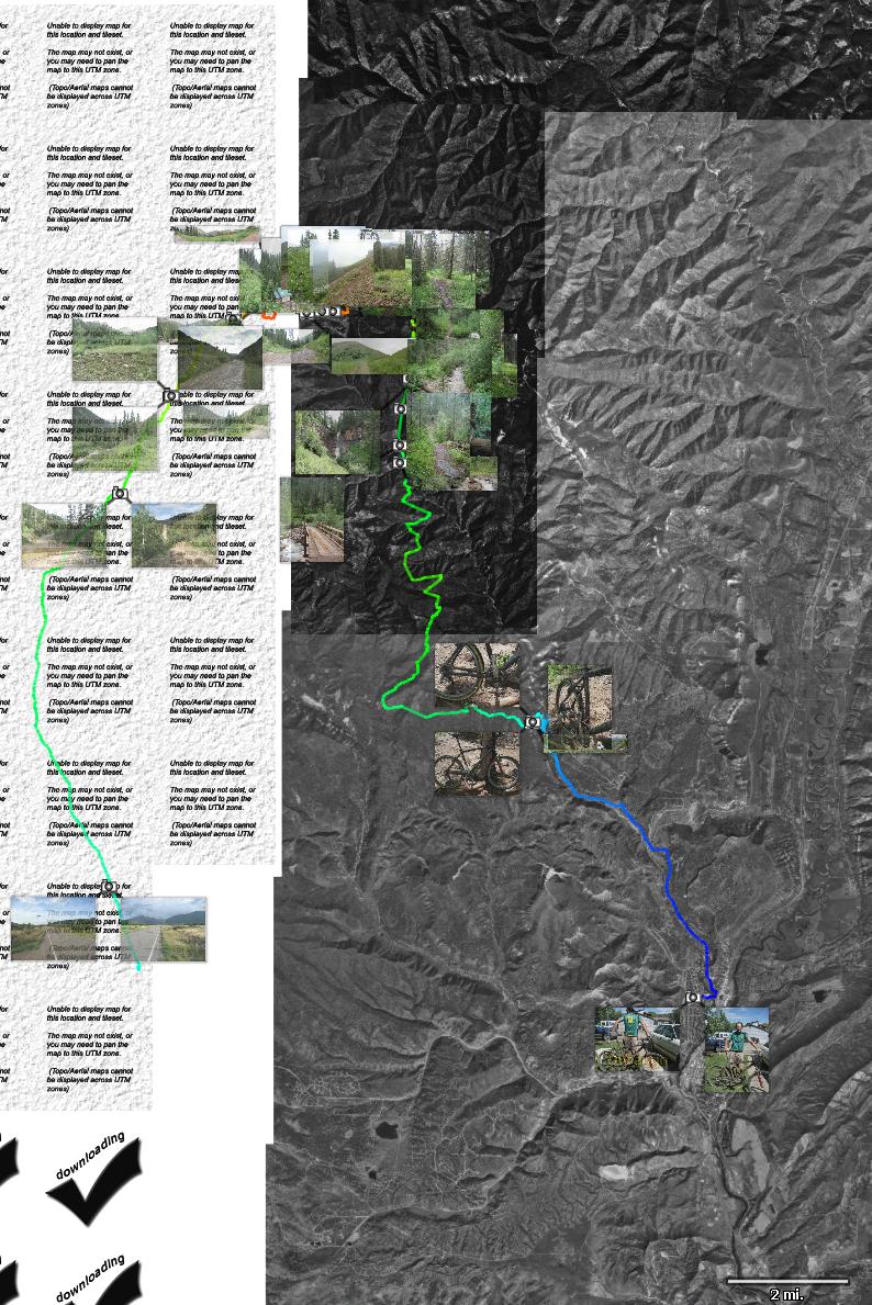
|
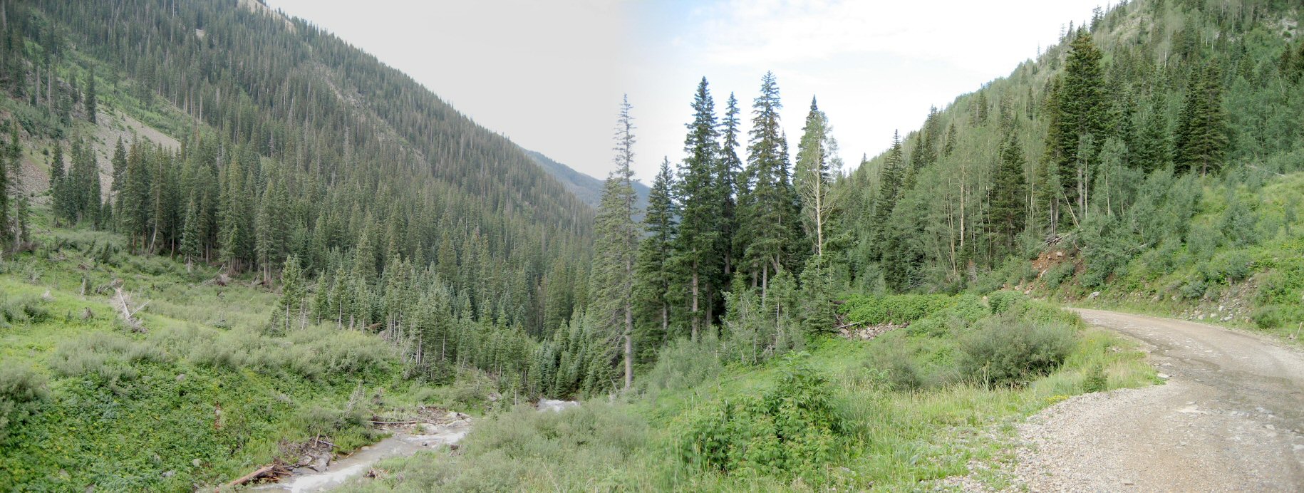
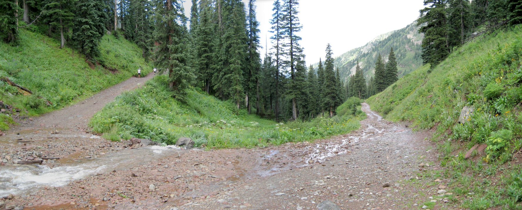
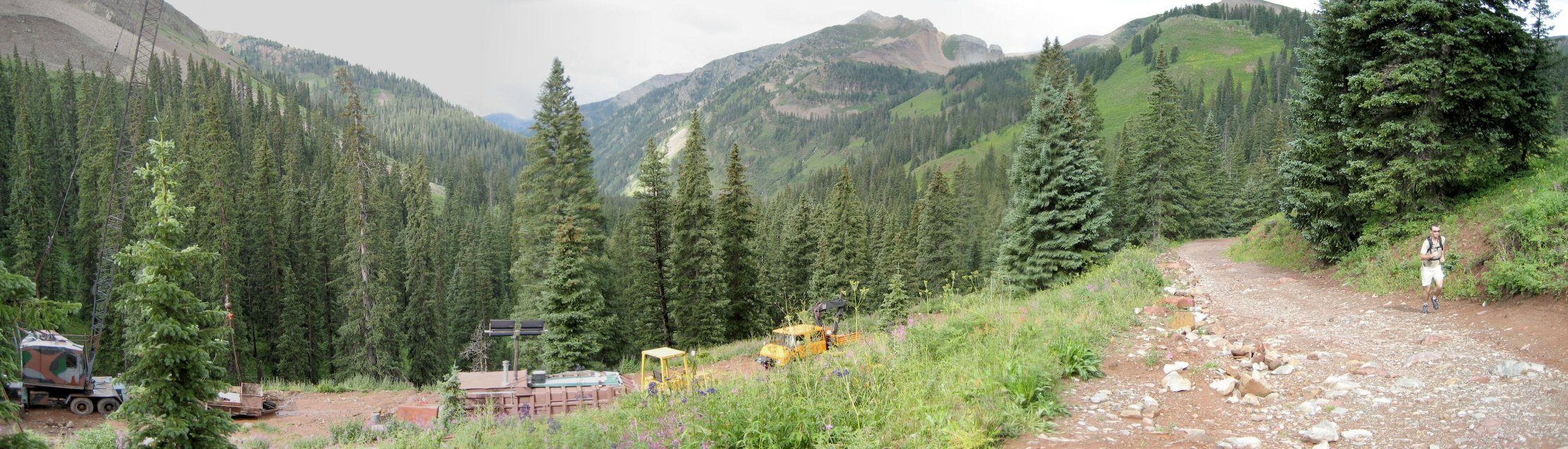
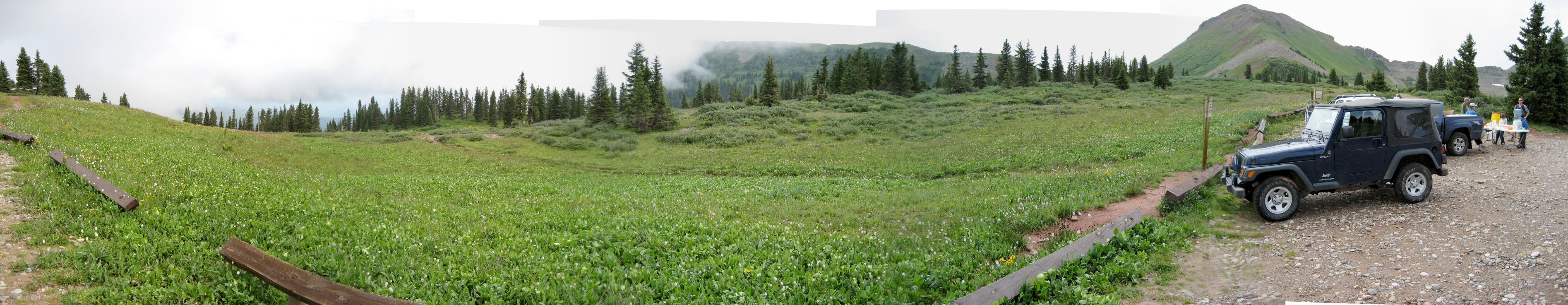
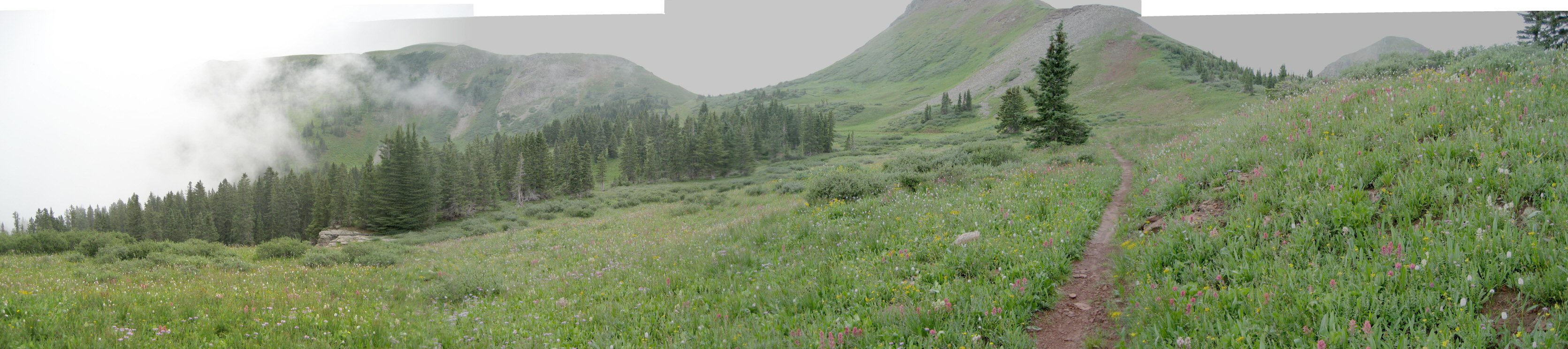
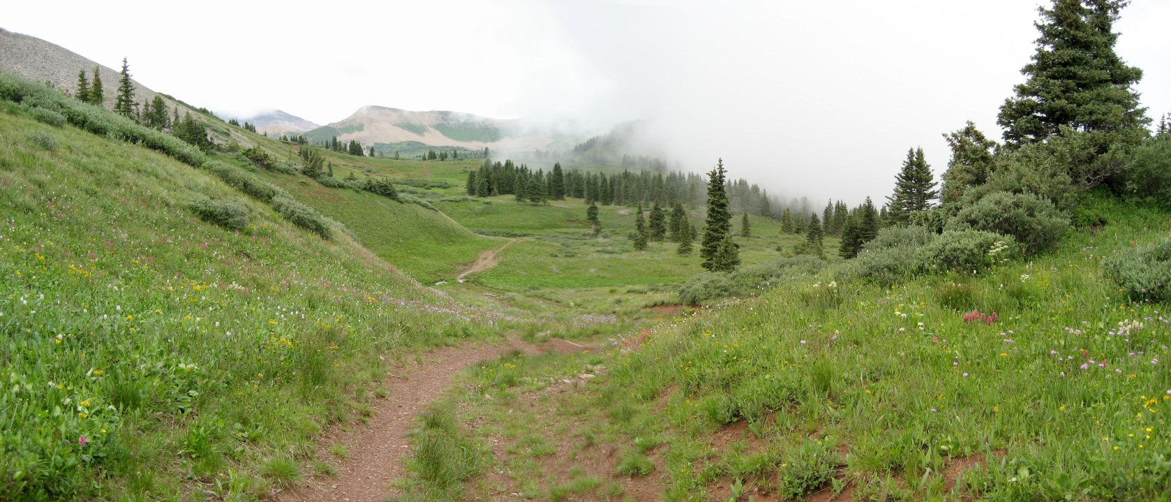
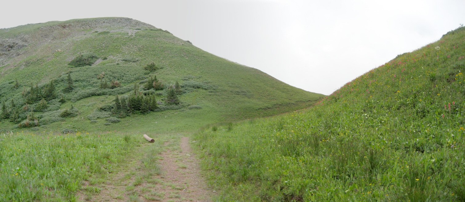
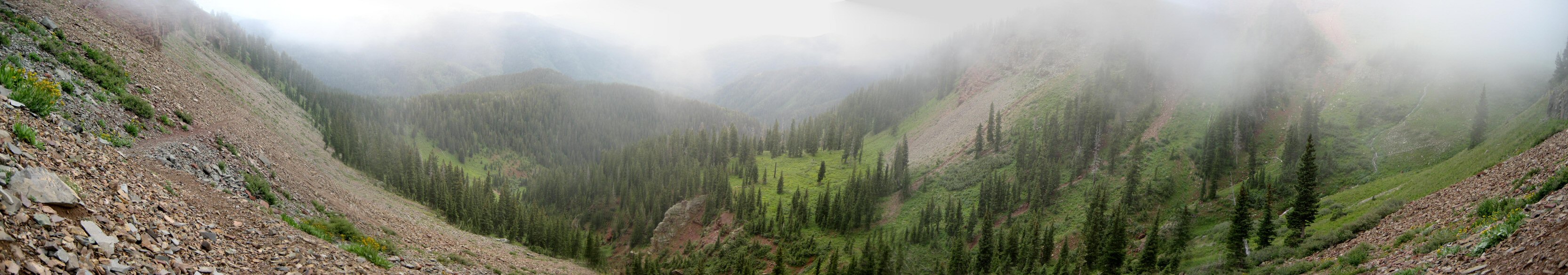
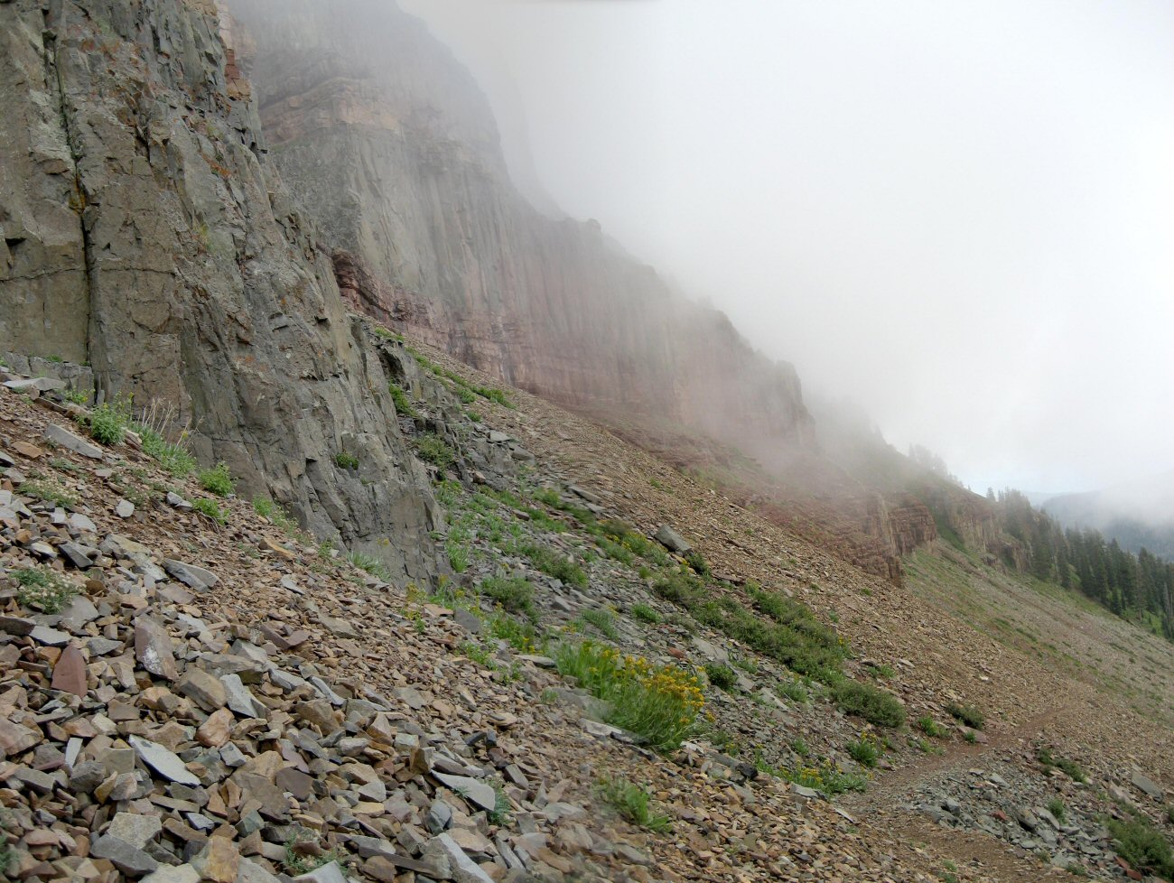
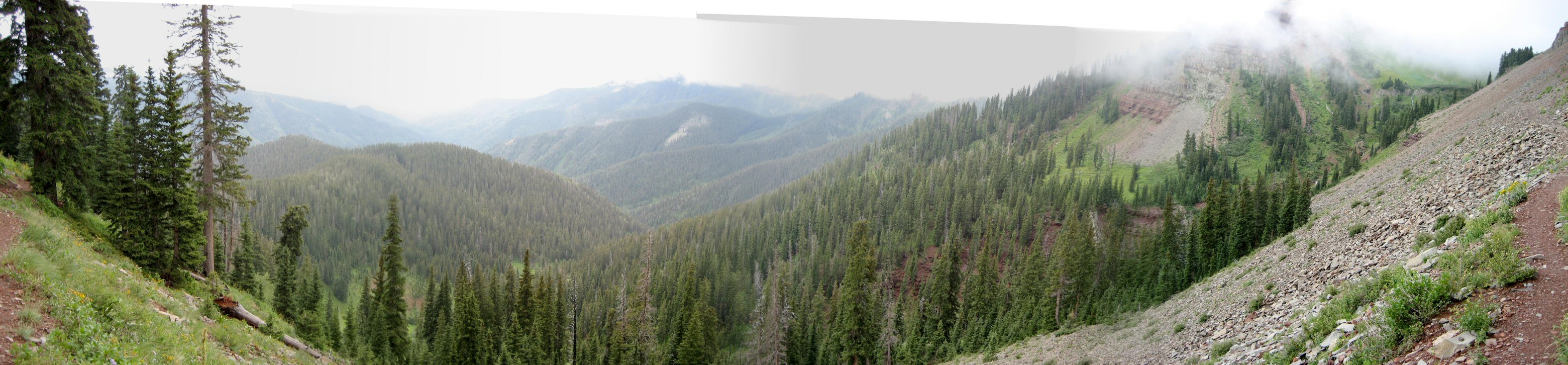
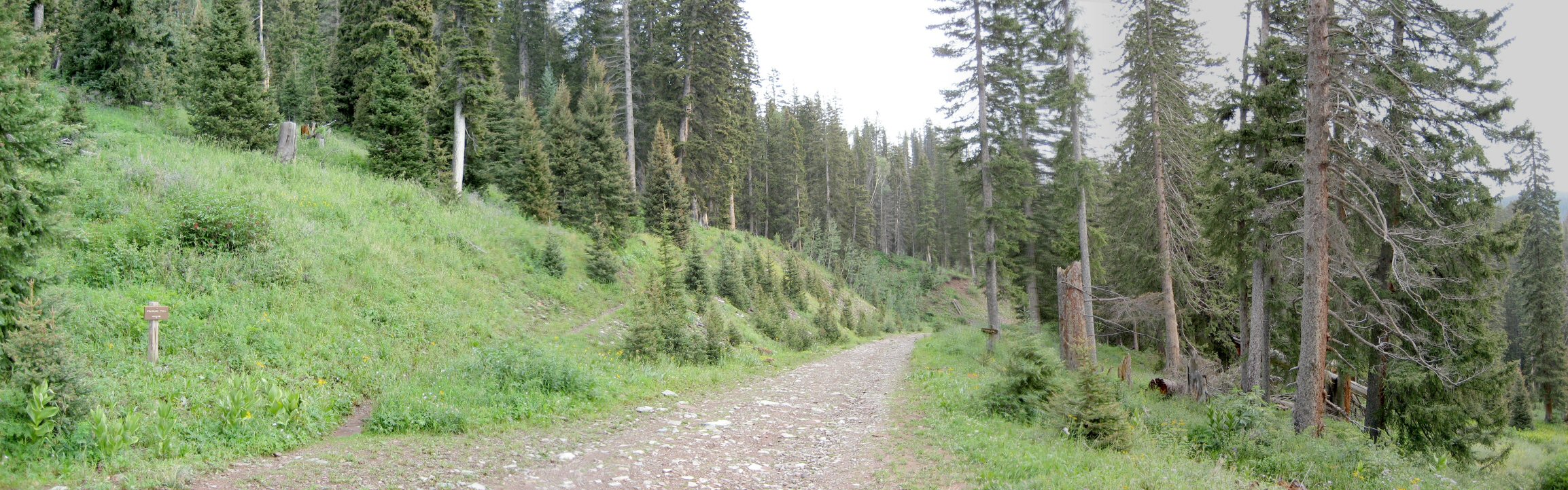
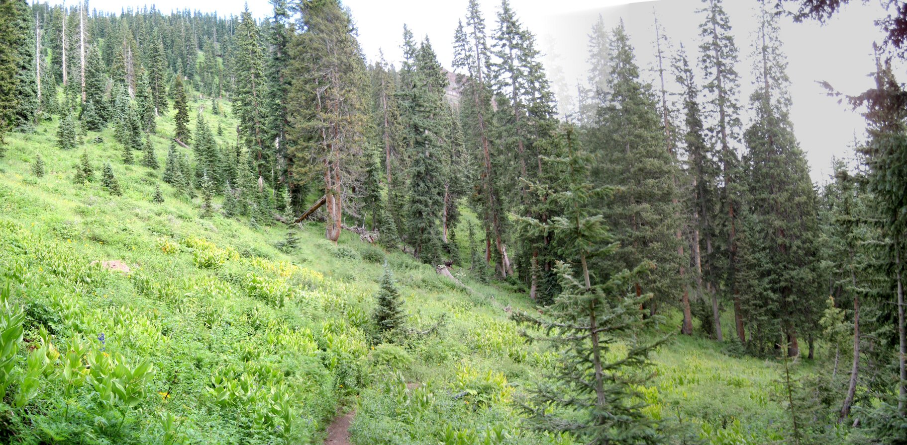
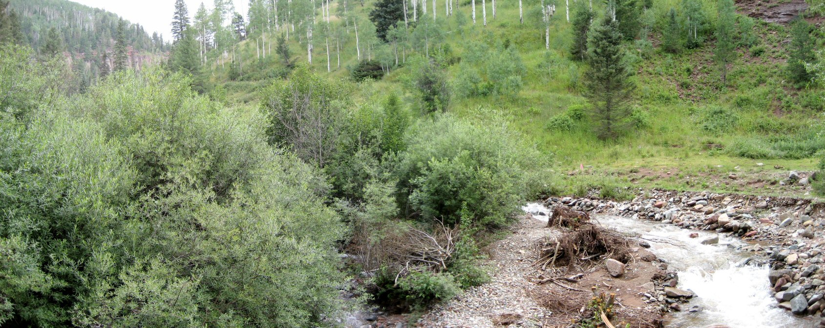
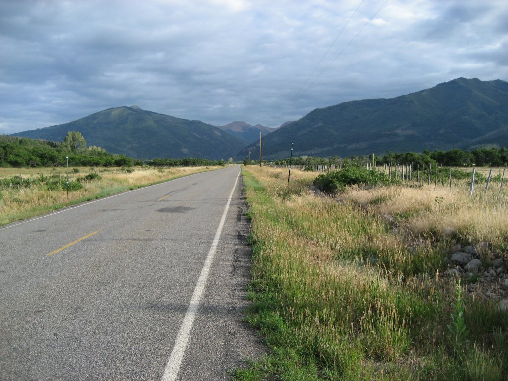
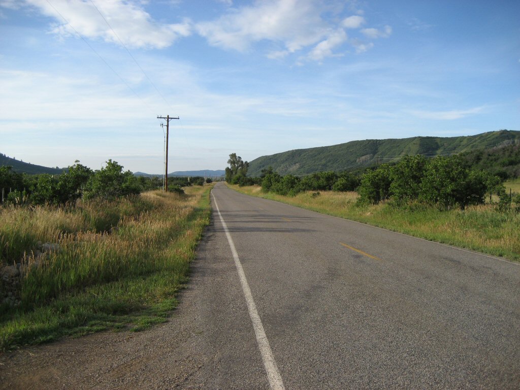
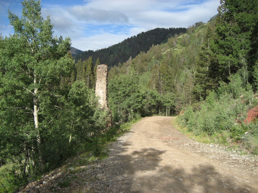
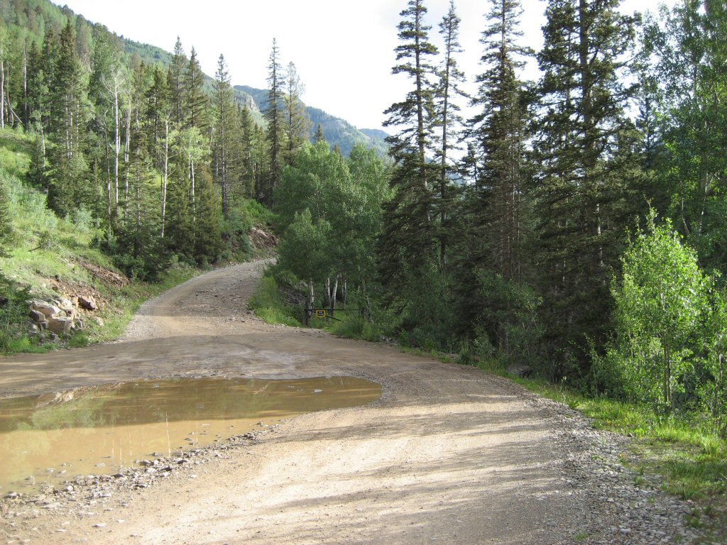
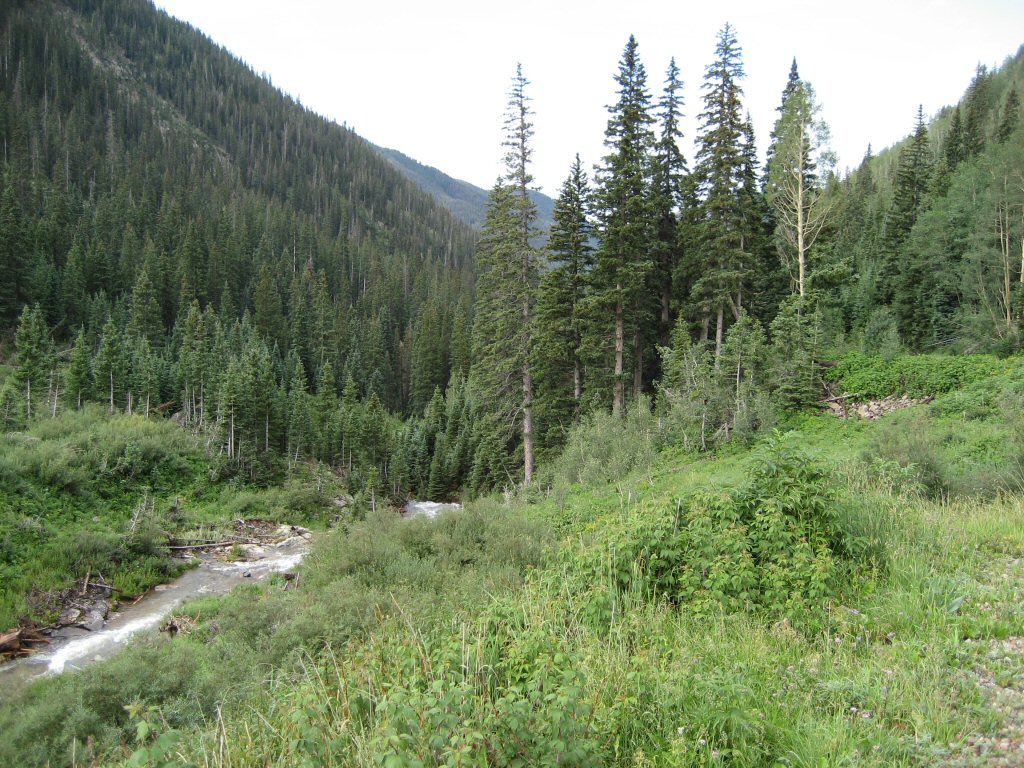
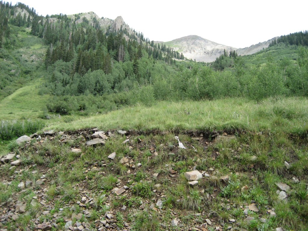
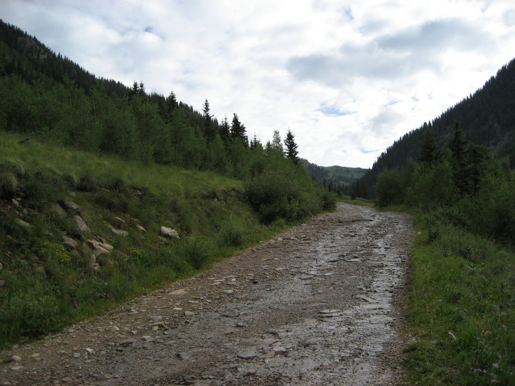
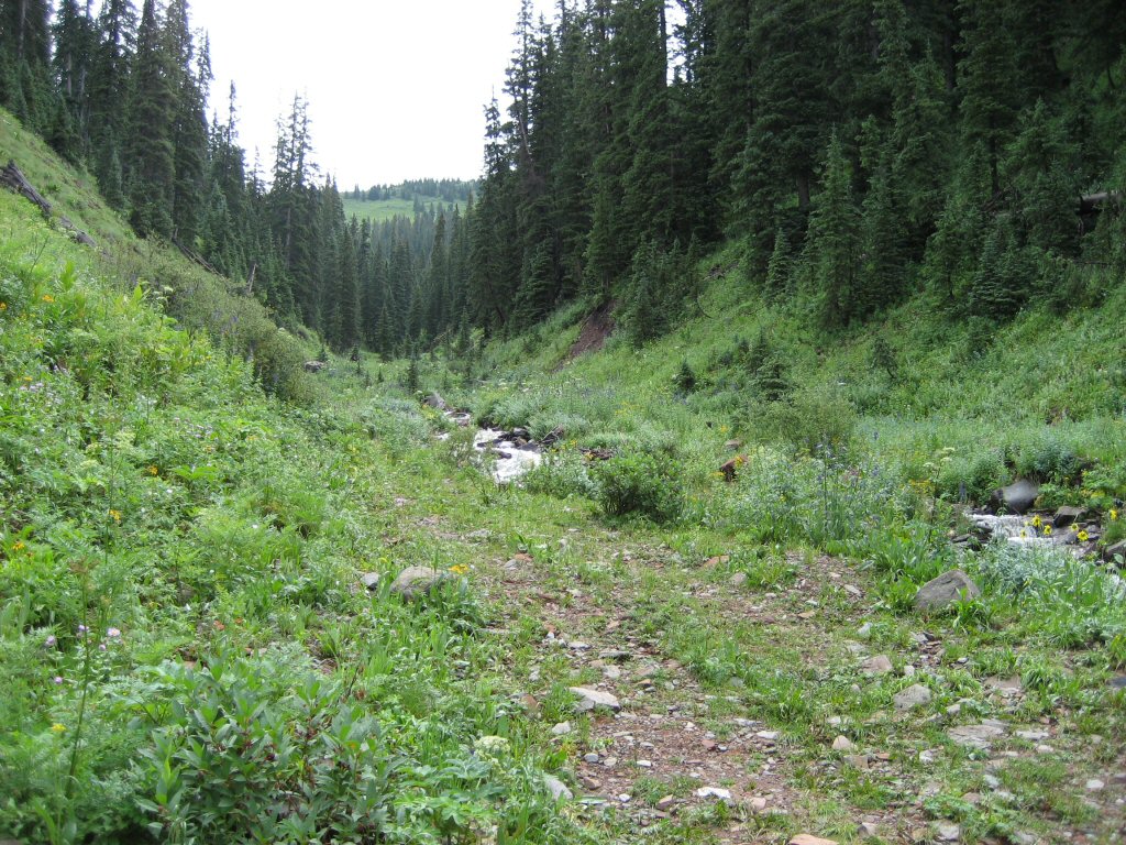
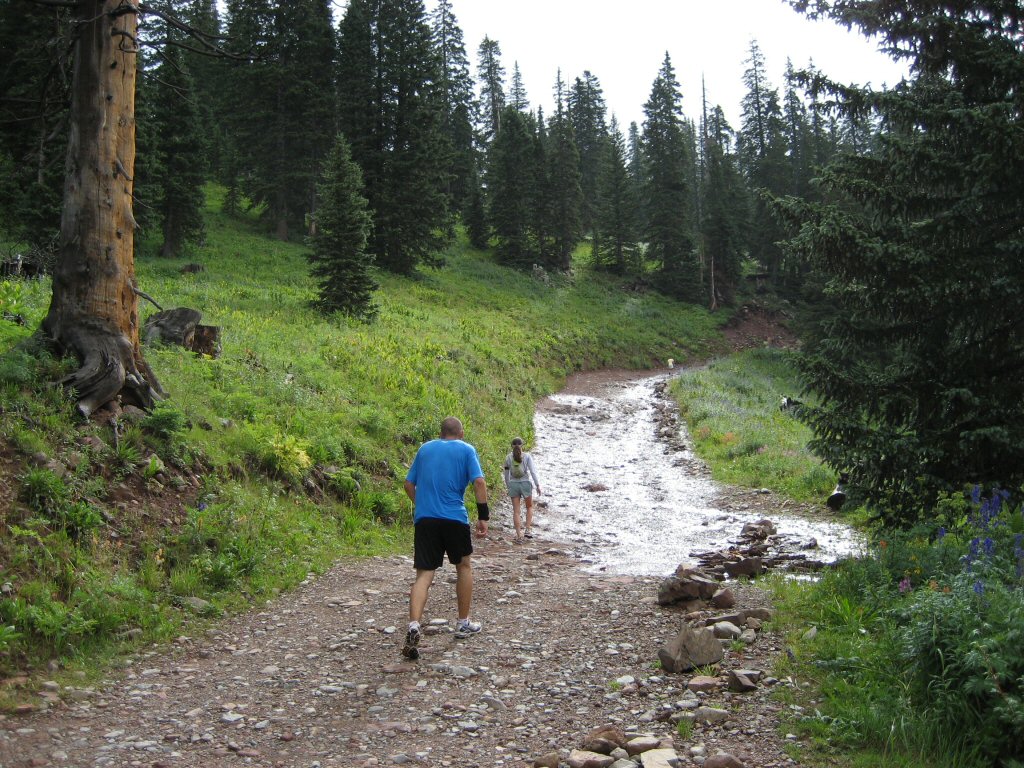
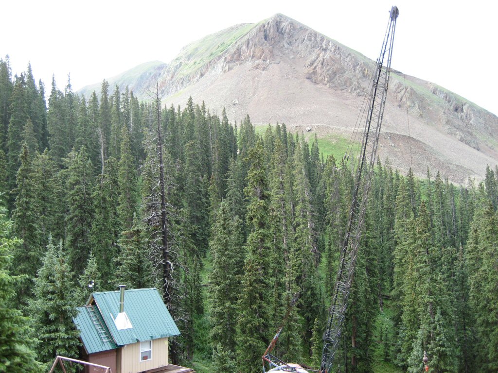
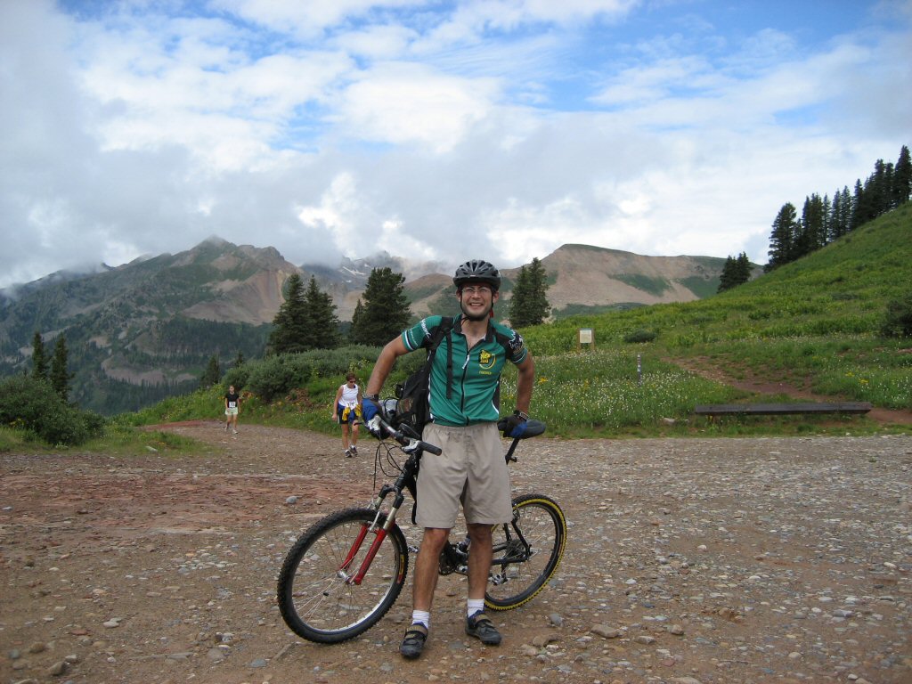
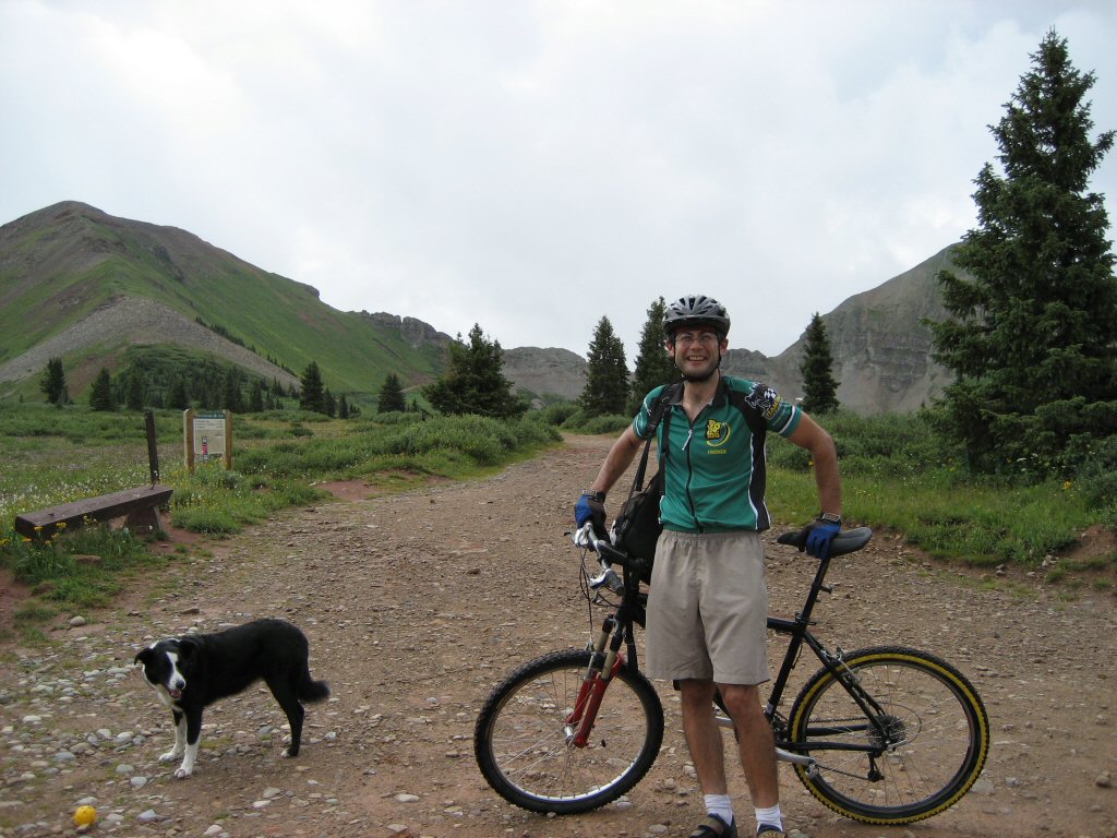
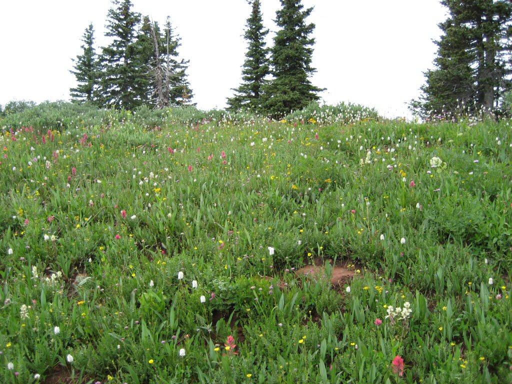
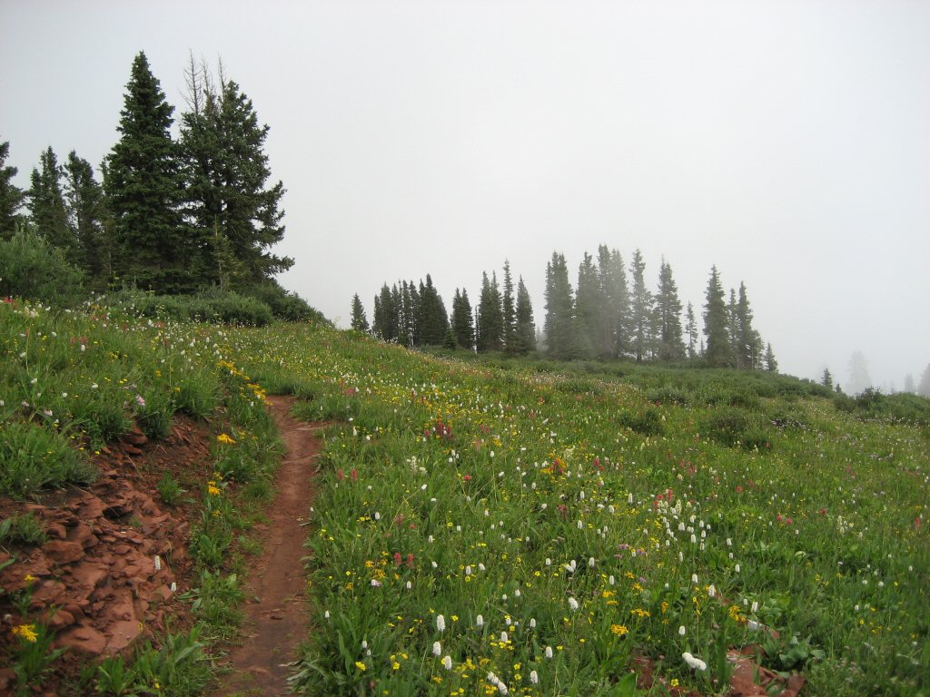
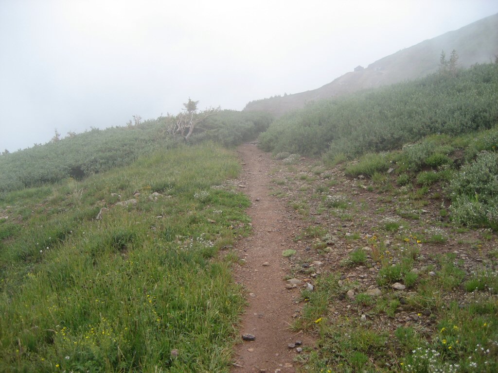
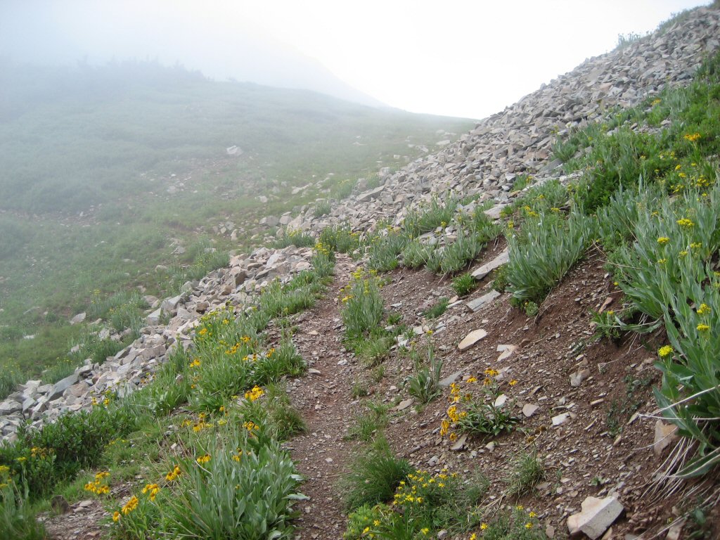
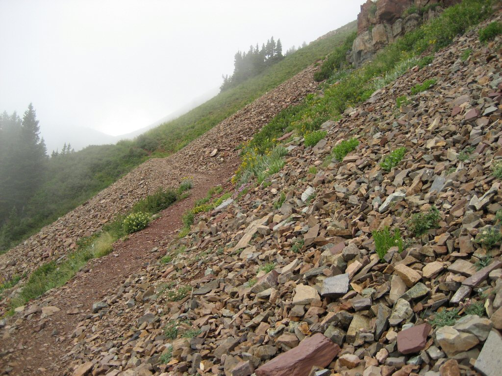
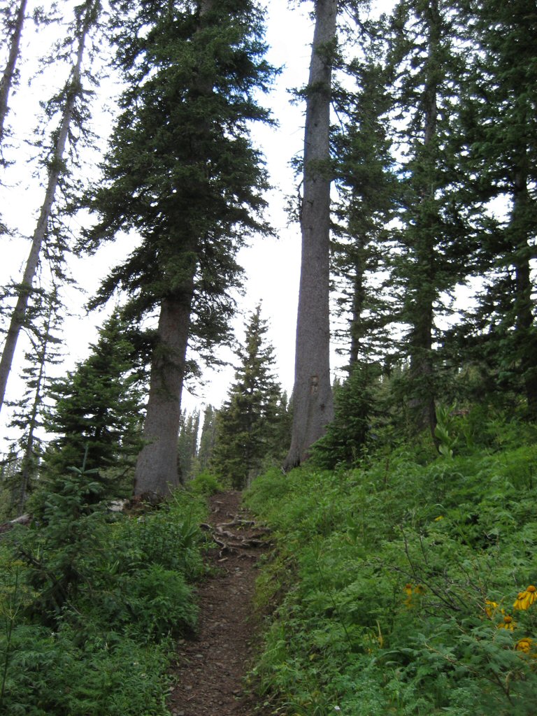
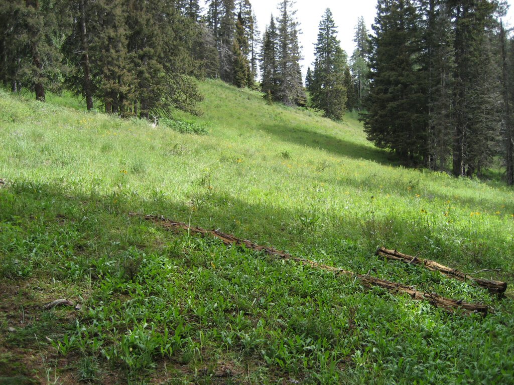
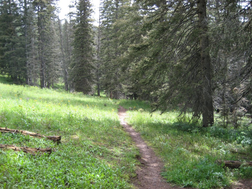
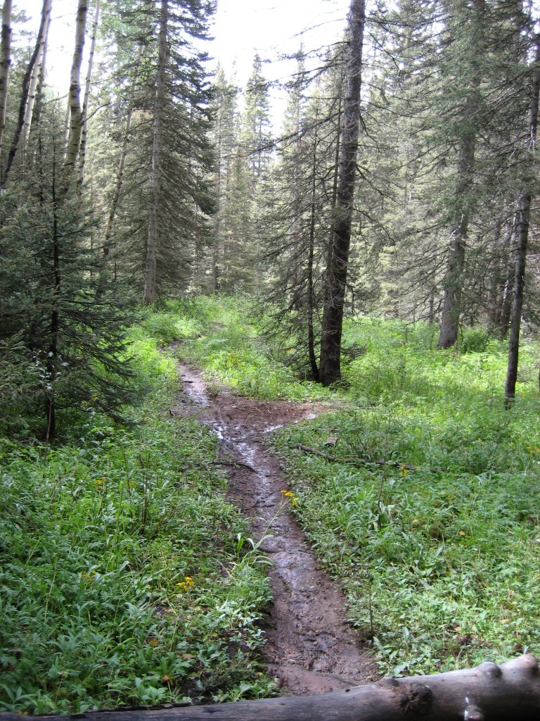
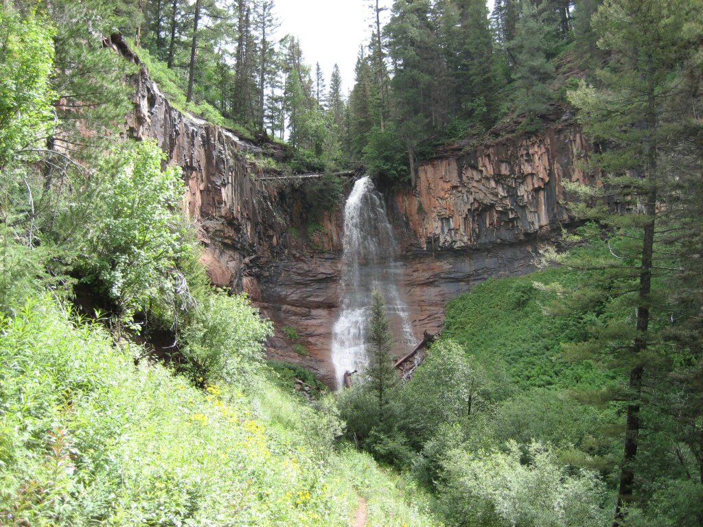
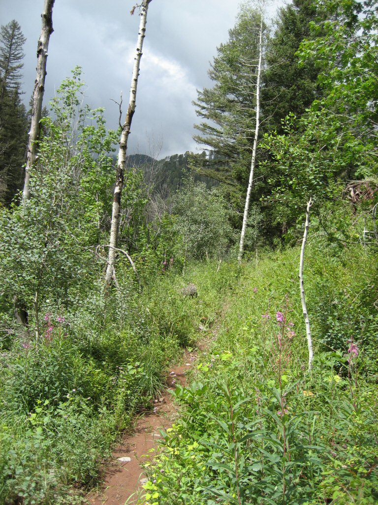
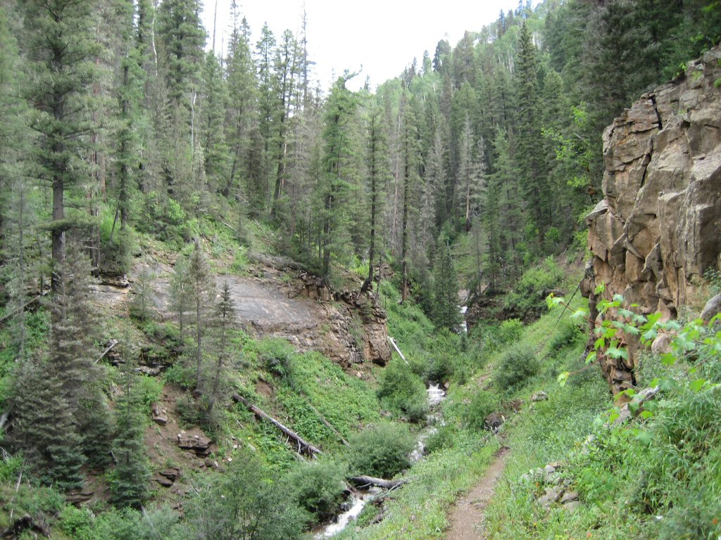
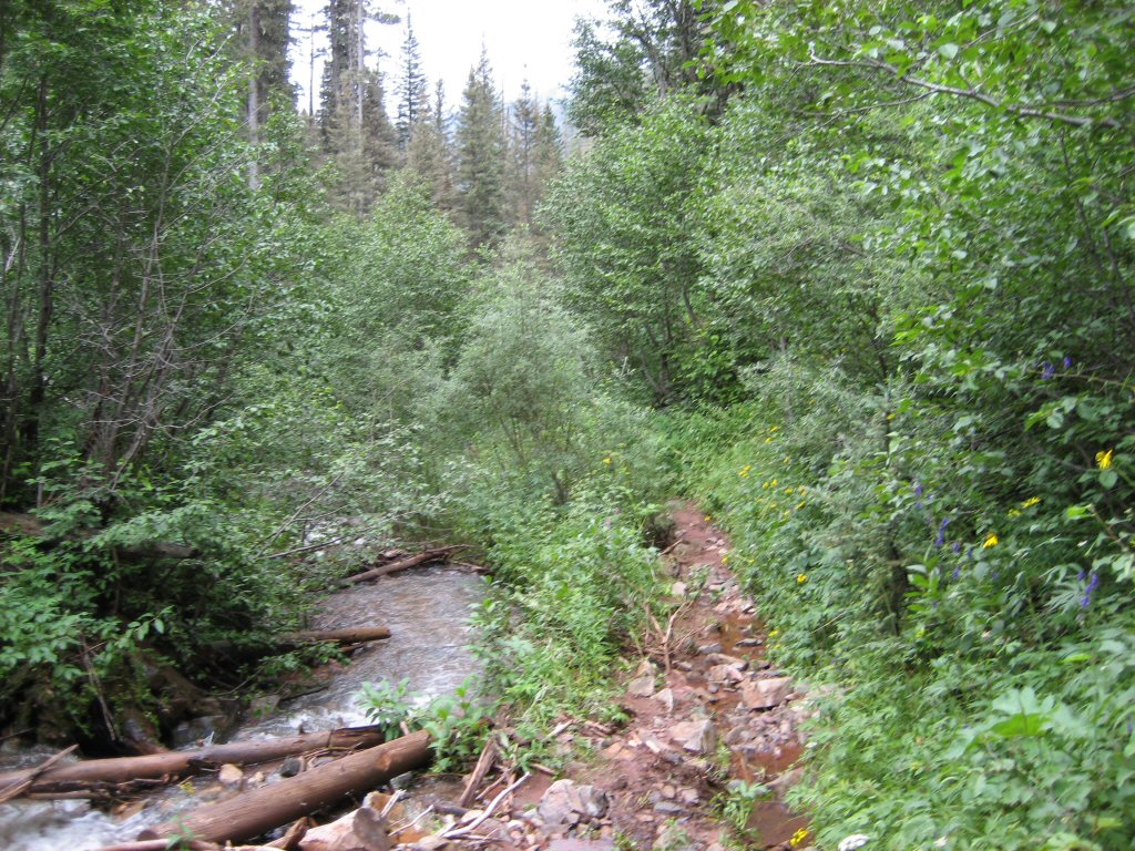
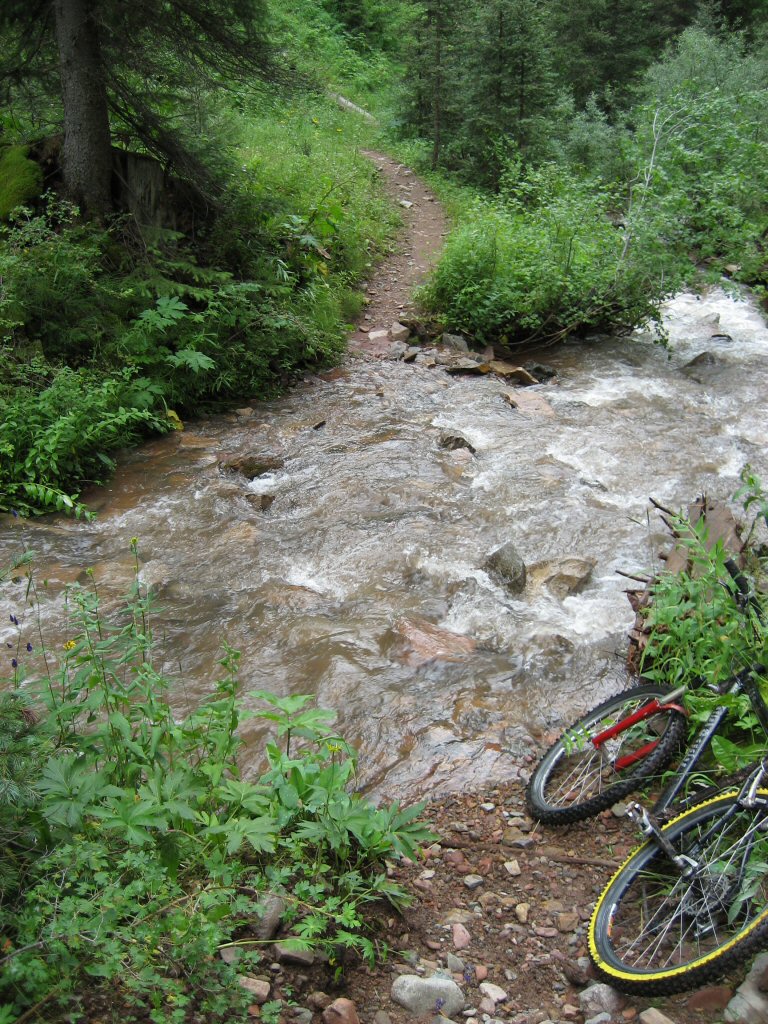
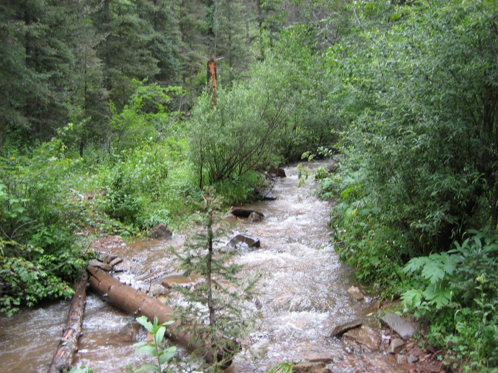
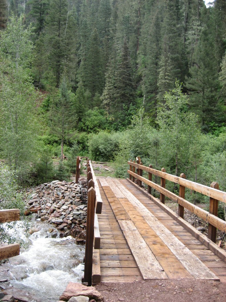
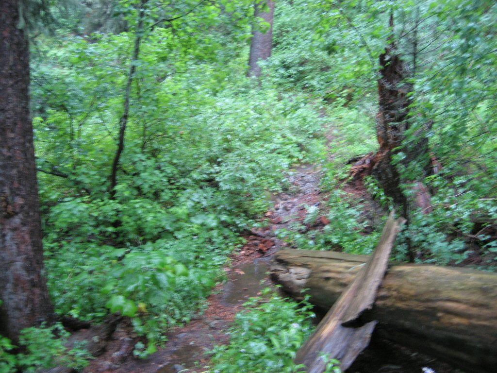
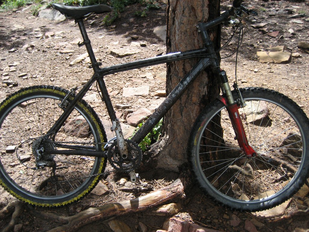
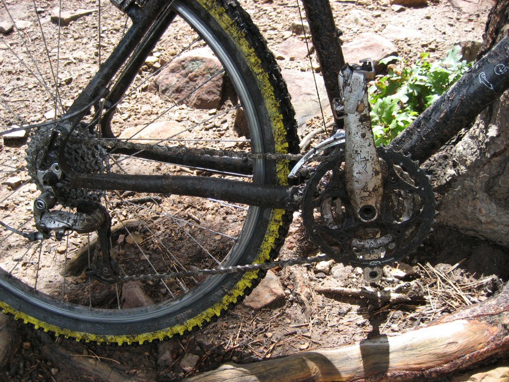
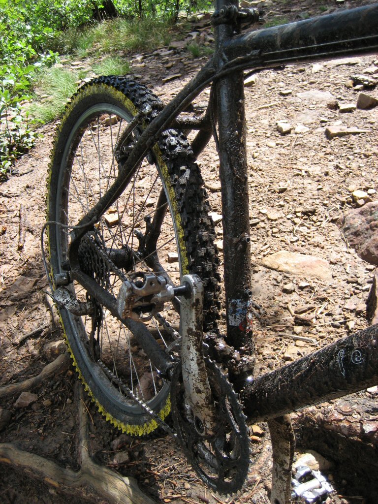
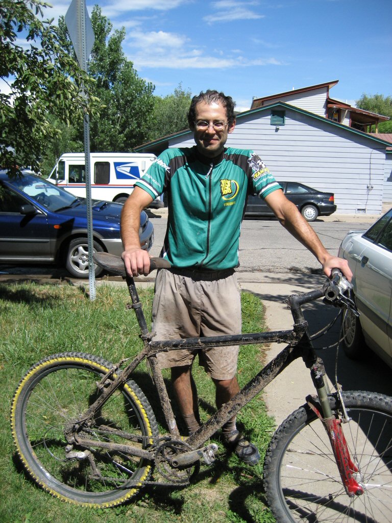
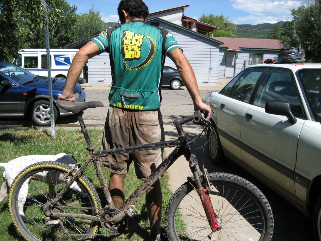
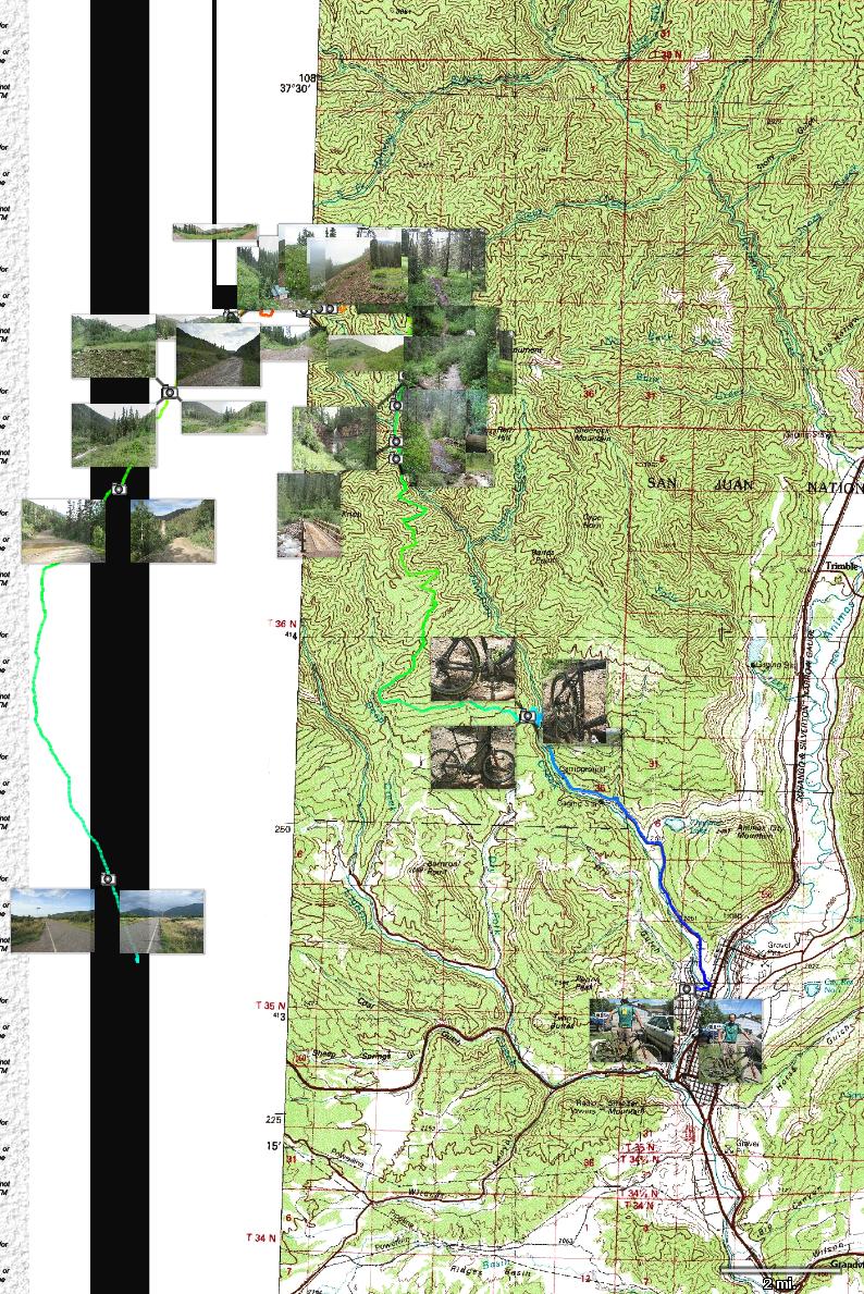
| Description: | During our stay in Durango, I wanted to ride a part of Colorado Trail, which extends all the way from Denver to Durango. After some map consulation, I came up with idea to connect to Colorado Trail at Kennebec Pass and take it to Durango. The Pass is accessible via La Plata Canyon, which is about 10 miles west of Durango. The whole loop from town would be about 50 miles, but, there was one problem, the monsoon season. It was pretty rainy lately and I did not want to be stuck in a storm high up. After a long contemplation if it's even worth it to do the ride in these conditions, I decided to go for it, with help of Shelly and Adam who drove me up Hwy 160 to the start of La Plata Canyon road, saving about 14 miles of road and 1500 ft of climbing.. I started riding up at 7.30am under partly cloudy skies, and things looked great. By 8am, I entered the canyon and slowly climbed up dirt road, that was in pretty good shape, probably thanks to banning ATV use on it. In the upper part of the canyon I ran into a running race, but, the people were pretty spread out so it was no hassle, except that the stronger runners would be faster than me, which was somewhat annoying. It was moist everywhere and there were small streams running on the road in the upper parts. Also, I got my feet wet during ford of upper La Plata river. I got to Kennebec pass (11680 ft) around 10am, took some pictures and observed clouds rolling in. Then hopped onto water puddled Colorado Trail. The trail was pretty wet around the pass and adjacent basin, but, there was not much mud. Then the trail starts descending first on talus slopes, then through spruce forest under the tree line. The talus part was gravely dirt that was just right moist, in the forest there were sections with streams running down the trail which made it wetter, and, occasionally, muddier. The trail keeps descending through upper tributaries of Junction Creek with a slight detour to a nice waterfall in Gaines Gulch. Then follows four crossings on Junction Creek, which were about knee deep due to runoff from the rains. The last crossing of the creek is a bridge, after which the trail slowly climbs out of the creek valley. Here is where things turned from bad (mud, creek crossings) to worse. At about 11.15am, it started raining. I have put on rain gear and decided to wait out the rain under some trees. Half an our later came the thunder, and, kept going strong for a good hour. By 1pm, the rain got thinner, and, I was wet enough that it did not matter if I am under the tree or on a bike. There was still some thunder in the distance, but, I figured as long as I climb in the trees, I'll be OK. So, I climbed up the trail which was often water covered, but, not muddy (thanks to rockier soil). I pushed up some steeper or rockier sections, but, it would be a nice climb if dry. By the end of the climb, it was just drizzling so the only concern was the brake situation on the 3000 ft descent towards Durango. My rim brakes were fairly worn at the start and wet and sandy trail was wearing them fast. So, I was not particularly bombing down the hill. Also, I was glad I brought the chain lube with me, I had to apply it good 5 times since it was washing off quite quickly. I decided not to bail out onto Dry Creek trail, since I figured that it'd be a longer haul to town. Colorado trail climbs up a bit and then flattens all the way to Gudy's Rest, on top of switchbacks above Junction Creek. The sun showed up here, so, I took off rain gear and then went down. Then followed a short ride a bit above the creek to the trail head, and first on dirt and then on pavement back to Durango. Just as I entered Durango, I met concerned Shelly and Adam, who were driving up to check where I am. It was good to see them and to be over with this ordeal. To conclude, the ride is great but not under conditions that I had. There is no wonder that I only saw a couple of recent tire tracks on the trail. I am still glad that I did it and saw the spectacular scenery, but, next time under weather like this, I'll stay closer to town. B�hem na�� n�v�t�vy Duranga m� l�kalo projet ��st stezky Colorado Trail, kter� vede z Denveru do Duranga po h�ebenech Skalist�ch hor. Z mapy vyplynulo, �e je mo�n� napojit se na Colorado Trail v pr�smyku Kennebec a pak po n� jet asi 20 mil do Duranga. Pr�smyk je dostupn� p�es La Plata Canyon, kter� za��n� asi 10 mil z�padn� od Duranga. Cel� okruh je asi 50 mil, co� by nebyl probl�m kdyby nebyla monzunov� sez�na. Odpoledn� bou�ky jsou prakticky jist�, a b�t p�i n�jak� vysoko v hor�ch nen� ��douc�. Po dlouh�ch rozvah�ch a studiu po�as� jsem se dal do akce s t�m, �e m� Shelly a Adam zavezli po silnici 160 na za��tek silnice do La Plata Canyonu, ��m� m� u�et�ili asi 14 mil a 450 m stoup�n�. Vyjel jsem v 7.30 pod polojasnou oblohou, a v�e vypadalo dob�e. P�ed osmou jsem vjel do ka�onu a pomalu stoupal po cest�, kter� byla p�kn� udusan�, nejsp� d�ky z�kazu vjezdu pro ter�nn� �ty�kolky. V horn� ��sti ka�onu jsem narazil na b�eck� z�vod, ale lidi byli dost rozprost�en� tak�e jsme se navz�jem nepletli. Jedin� otrava byla �e m� siln�j�� jedinci p�edb�hli. V�ude bylo hodn� vlhko a po silnici v��e v hor�ch tekly pot��ky vody. Nakonec jsem si i namo�il nohy p�i p�ejezdu horn� ��sti �eky La Plata. Do pr�smyku Kennebec (11680 ft) jsem se dostal asi v 10, ud�lal p�r fotek a zpozoroval mraky val�c� se ze severu. Pak jsem se vydal na Colorado Trail, kter� byla na luk�ch pod�l pr�smyku pln� kalu��. Na�t�st� p�da je zde kamen�t�, tak�e nebylo moc bl�ta. Po pr�smyku stezka kles� nejprve po �otolinov� str�ni a pak lesem do �dol� Junction Creek. Po �otolin� se jelo dob�e, ale v lese bylo ob�as bahnito. Stezka se m�rn� zata�� do Gaines Gulch, kde je malebn� vodop�d. Pak n�sleduje n�kolik brod� p�es Junction Creek, kter� byl po de�t�ch pln� vody, tak po kolena. Posledn� p�echod potoka je po most�, pak n�sleduje del�� stoup�n� na h�eben nad Durangem. Most jsem p�ejel asi v 11.15, a kr�tce pot� za�alo pr�et. Na za��tek jenom d隝, ale po p�l hodin� se p�idaly i hromy a blesky. Bou�ka se kolem honila asi dv� hodiny, kolem jedn� to trochu zesl�blo, tak jsem zase vyrazil. U� jsem i tak byl dost mokr� a za��nala m� b�t zima. Stoup�n� nebylo tak zl�, ale i tak jsem musel ob�as tla�it proto�e po stezce tekla voda a prud�� �seky klouzaly. Ke konci stoup�n� u� jen mrholilo, ale uk�zal se dal�� probl�m - na mokr�ch r�fc�ch nefungovaly dob�e brzdy. Tak�e jsem se p�i sjezdu do Duranga sna�il nejet moc rychle. Ne� jsem dojel ke konci stezky, tak dokonce vysvitlo i slun��ko, tak jsem kone�n� sundal mokrou bundu. Pr�v� p�i p��jezdu do Duranga jsem potkal Shelly a Adama, kte�� m� jeli naproti, proto�e se b�li, co se mnou je. Po tomto dobrodru�stv� jsem byl r�d, �e je vid�m. Co na z�v�r? Dobr� stezka, n�dhern� p��roda ale ne v podm�nk�ch, kter� jsem m�l j�. P��t� budu v tomto po�as� d�lat n�co bl�e m�stu. | |
| URL: | TopoFusion Home Page | |
| ||
| ||
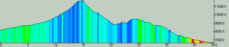
| Total Distance: | 38.56 miles (62.06 km) |
| Total Trip Time: | 7:58:38 (6:05:53 moving time) |
| Total Climbing: | 5694 feet (1736 m) |
| Total Descending: | 6874 feet (2095 m) |
| Average Speed: | 6.32 mph (10.18 kph) |