| Name: | Exploring Mormon Mesa - Pruzkum Mormon Mesa | 
|
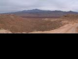
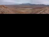
| Description: | Mormon Mesa is a flat mesa at about 1800 ft. between Mesquite and Overton, Nevada. This area is one of the closest places that stays warm through the winter. As a result, it was a focus of my trip planning after we got our tandem bike over the Christmas. Finally, mid February we had time and the weather was there to go and test the tandem in the real setting. The ride started off a campsite that we selected a bit off the main dirt road that crosses the mesa west-east from Overton. We got to here from I-15 exit 100, and about an hour drive on ATV tracks, since we missed the dirt road that we should have taken south. In any case, all these dirt roads are not in very good shape, and I'd recommend to go to Overton and get to the mesa from here. Riding the tandem on the south-western flank of the mesa, the road was pretty rocky, and the rocks were sharp. We had a flat in about a mile. That was not a good start, especially since I kept on the semi-worn tires that we used on the road - I was assuming smooth dirt roads. I pumped the tires pretty hard, and, we went on (I usually pack 2 spare tubes and glueless patch kit). The road was rocky all the way to the southern tip of the mesa, but going north, it got more smooth with only occasional rocky sections. From the southern end, there were good views of Virgitn River valley and Lake Mead to the south. Then we road back north on the eastern side of the mesa. At the junction with main dirt road, we rode down towards Virgin River, back up and then a bit more north and then west along a power line road. The tandem handled very well and after initial strugle, we learned how to work together riding over rocks, etc. We came back right on time to cook dinner, make tent, and eat the dinner with the standard background of gun shots heard in the distance. Overall, good exploration, but, there is nothing too attractive on the mesa so seeing it once was probably enough. Mormon Mesa je mezi Mesquite a Overton v jižní Nevadě, asi 100 km SV od Las Vegas. Protože je v nadmořské výšce cca. 600 m, je zde většinou i přes zimu teplo. Tudíž je tato oblast logickým cílem naší první cesty s novým tandemem. Poušť je tu sice málo atraktivní, jen keře tak co dva metry, ale teplota v zimě na kráse přidá. Přes mesu vede několik cest, ale jen pár jich je dobře sjízdných. My jsme zakempovali poblíž té hlavní. Bohužel, dostali jsme se sem po celkem nesjízdných cestách od severu, Subaru naštěstí výdrželo, ale místy jsem byl nervózni. I jízda s tandemem nezačala nejlíp, tak po kilometru jsme měli defekt. Cesta byla totiž plná ostrých kamenů. Napumpoval jsem víc kola, a naštěstí byl zbytek jízdy bez problému. Po kamenité cestě jsme dojeli na jižní cíp mesy, a odtud po východni straně po lepší cestě na sever. Sjeli jsme dolu k řece Virgin, zase zpátky, ještě kousek dál na sever, a pak zpět na kempovišti. Zde jsme akorát stihli uvažit, postavit stan a naveeeoet se v pozadí vzdálených výstoelu, což je kolorit pouštní divoeiny. Stšelci toho naštistí po soumraku nechali, takže poes noc jsme slyšeli jen obeasné vytí kojotu. | |
| URL: | TopoFusion Home Page | |

| ||

| ||
| Total Distance: | 27.30 miles (43.94 km) |
| Total Trip Time: | 3:59:33 (3:59:33 moving time) |
| Total Climbing: | 1180 feet (360 m) |
| Total Descending: | 1110 feet (338 m) |
| Average Speed: | 6.84 mph (11.01 kph) |
DSCF0004.JPG |
DSCF0005.JPG |
DSCF0015.JPG |
DSCF0016.JPG |
DSCF0017.JPG |
DSCF0018.JPG |
DSCF0021.JPG |
DSCF0022.JPG |
DSCF0023.JPG |
DSCF0027.JPG |
 mormon_mesa1s.jpg |
 mormon_mesa2s.jpg |
 mormon_mesa3s.jpg |
DSCF0031.JPG 115869 bytes 800 x 600 |
DSCF0032.JPG 87367 bytes 800 x 600 |
DSCF0038.JPG 65811 bytes 800 x 600 |
mormon_mesa4s.jpg 171822 bytes 1800 x 556 |