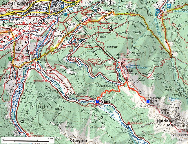
During my stay in central Europe, I wanted to do at least some hikes in the real mountains, so for the last three days of Dina's stay we drove to the northern Austrian Alps, in particular, to the surroundings of a town Schladming. This town is located in the upper Enns valley, enclosed from north by the Dachstein mountain group (which reaches 3000 m.) and from the south by Schladminger Tauren (which reach ca. 2700 m.). We left Brťov before 6 am on Monday morning and after 11 arrived to Schladming. The drive was surprisingly smooth, the only two lane highway being a stretch from north of Czech border to Vienna and last part from Liezen to Schladming, where the traffic was the busiest. We rested a bit, ate lunch and went for a hike. The plan was to start in valley Untertal, south of Schladming, at 1014 m. and hike on trail no 54 to the ridge north of the valley and then up to peak Krahbergzinken, 2134 m. The distance on the map does not look too bad, but the vertical distance has paid its toll and it took us over 3 hours to get to the peak, and another 2.5 hrs to get back to the car. Also, the trail that climbed out of the valley was not much travelled, so our legs got quite a beating. Here is a
map (180 kB) of the hike. We just managed to drive back to the campground and cook dinner before it got dark.
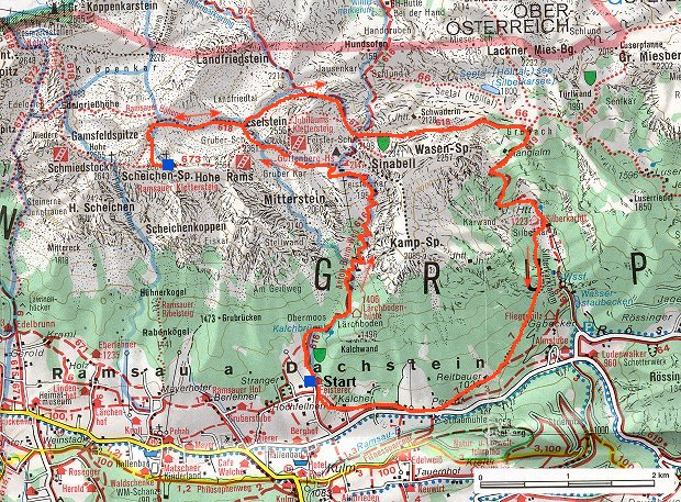
For Tuesday, I had planned a full day hike. It turned out that Dina was not so excited, after the experience from the previous day, so, we just drove to the trailhead and then split. We both started at Feisterer hut in Ramsau, a town north of Schladming. Starting at ca. 7.45, I hiked up the valley to Guttenberg Haus, supposedly the highest located hut in Styria at 2147 m. Then I went west to peak Scheichen-Spitze, 26xx m. where I got around 11.15. While the sky was almost cloudless when I started, by the time I got to the summit, its southern and western part was in the clouds, so I could not see the valley down south. I ate lunch at the summit and went down when I started getting cold. It was sprinkling a bit, once in a while. Instead of returning the same way, I decided to walk further east above valley Seetal and descend through the next valley, Silberkartal. It was cloudy to misty above about 2000m., but when I descended down to the valley, it was sunny and pretty hot there. I got back to Feisterer hut on a forest doubletrack and through several meadows with cows. I got there around 4pm and Dina was not there, so I sat at the hut and had a beer. A nice way to wait at the trailhead, unfortunately, not very common here in the US. In general, I liked the atmosphere in the mountains in Austria. Thanks to the huts, there are more families in the mountains, just hiking a mile or two to the hut, have a lunch there, and go down. There is a plenty of space on the trails above the huts where are no crowds, so, I would say that the huts are fitting well to the overall picture. Dina got back before I downed the beer, after which we drove down to Schladming and had an evening walk around the center. Here is a
map (170 kB) of the hike.
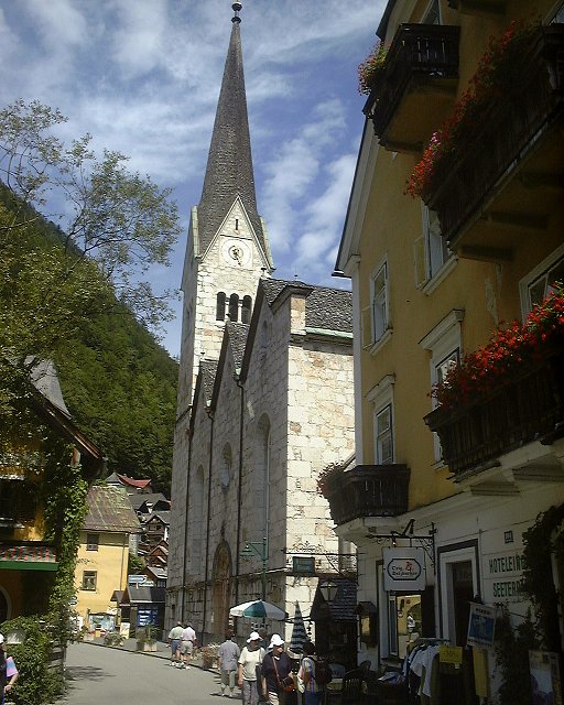
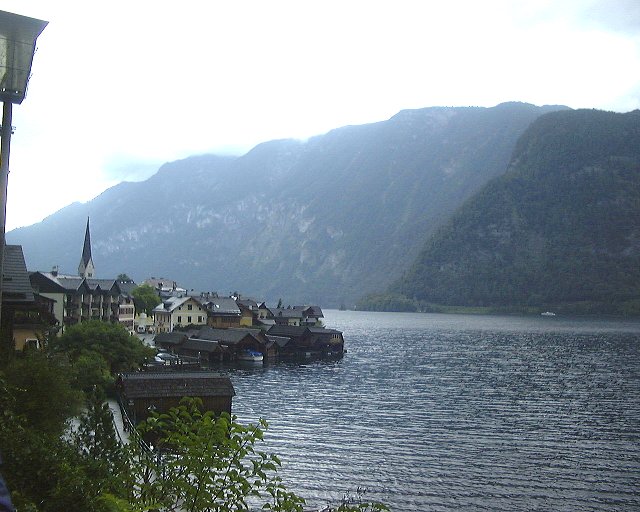
On Wednesday, we both had enough of hiking, so, we drove north across the moutains to the lake region of Salzkammergut, in particular to Halstatt Lake, which is located just north of Dachstein. There were major salt mines around Halstatt, so the area was populated for thousands of years, and bears good archeological deposits. We walked through the town, took a boat ride on the lake and visited two museums, one archeological and the other ethnographical. A cold front moved in during the afternoon, so it was the right time to take off and head to Vienna to drop Dina off at the airport.
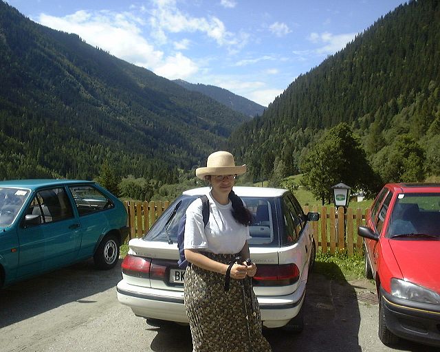
Dina and my dad's Corolla at the parking lot next to Wohnhaus Tetter, where we started the hike.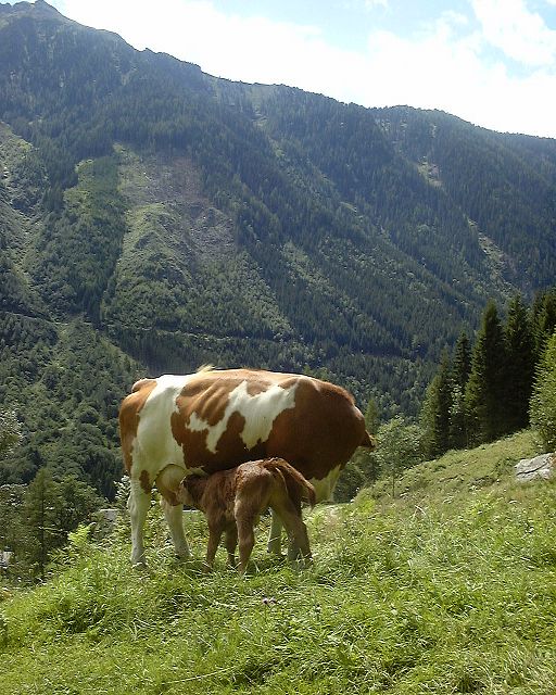 Cows at the meadows on which we started hiking up.
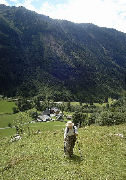 Dina hiking up the upper meadow, Wohnhaus Tetter where we started is below.
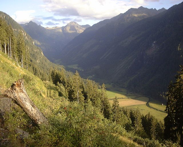
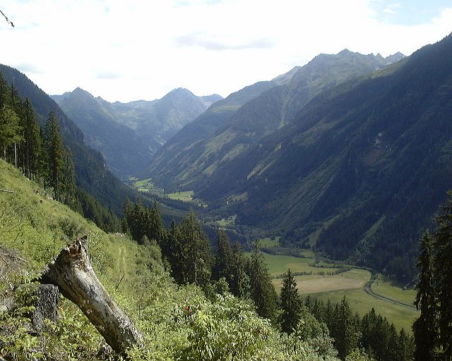 View south to upper Untertal from a first break in the forest.
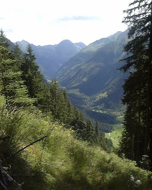 Another view a bit higher up.
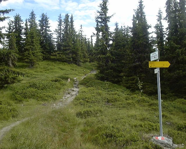 Trail marker on the ridge.
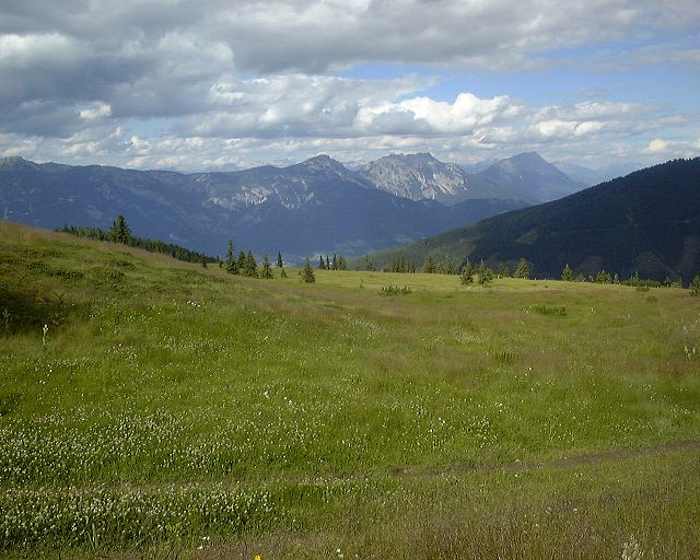 View north-east from the ridge.
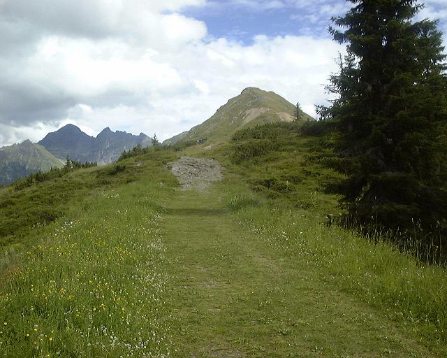 View south from the ridge, towards Krahbergzinken.
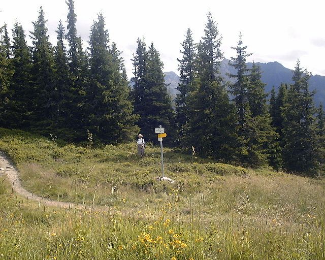 Dina in the bushes at the ridge.
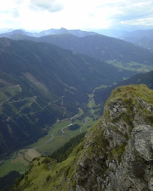 View north-west and direct down from Krahbg.zinken, the hut where we started is visible in the middle of the picture.
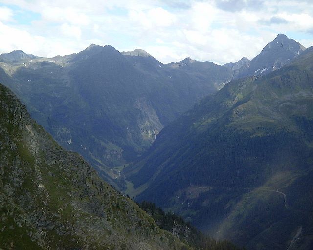 Look from the summit south to upper Untertal.
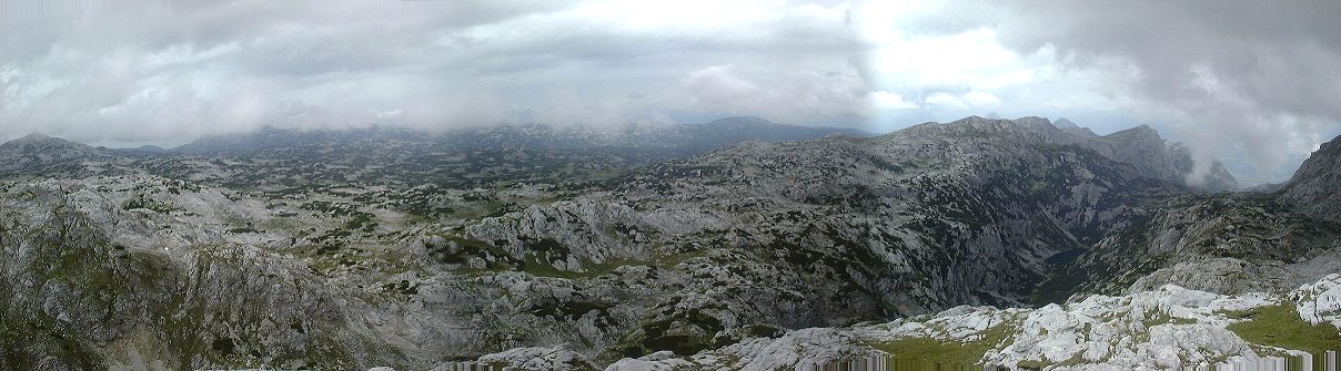
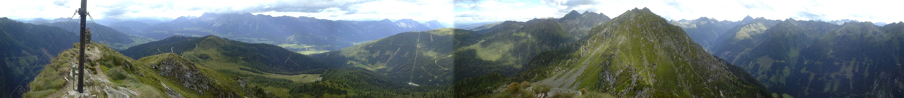 360 deg. panorama from Krahbergzinken.
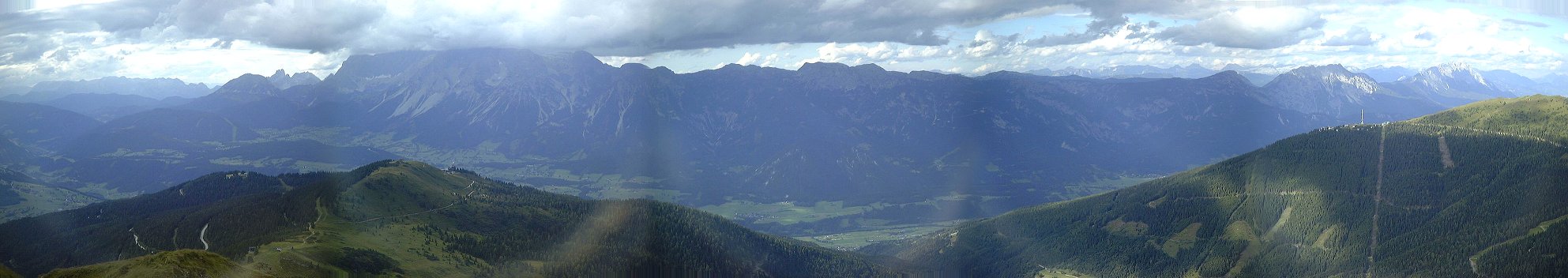 Zoomed-up view north, towards Dachstein, which is in the clouds.
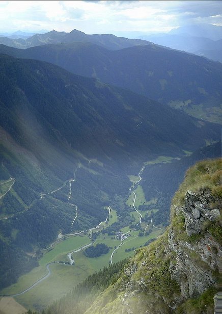 Zoomed-up view north-west into lower Untertal, with Whs. Tetter where we started.
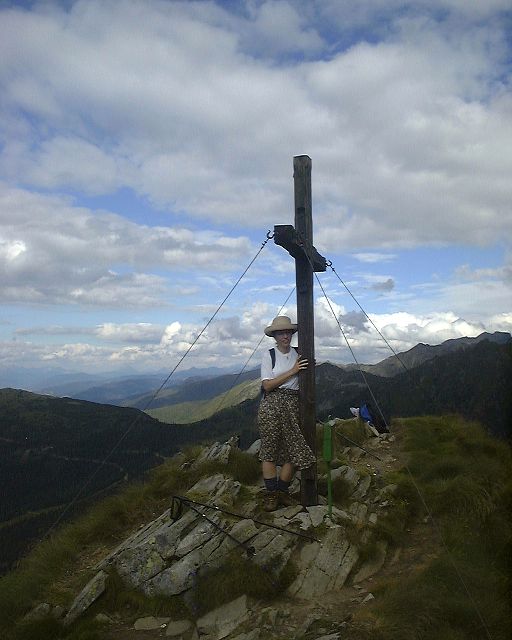 Dina hugging the summit cross at Krahbergzinken. Almost every mountain in Austria has a cross on the summit.
.
Dina hugging the summit cross at Krahbergzinken. Almost every mountain in Austria has a cross on the summit.
. Late afternoon look to upper Untertal from our descent.
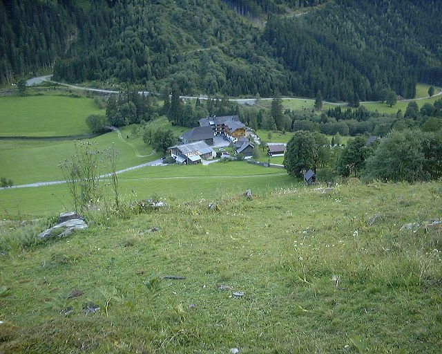 Whs. Tetter from the start of meadow during our descent.
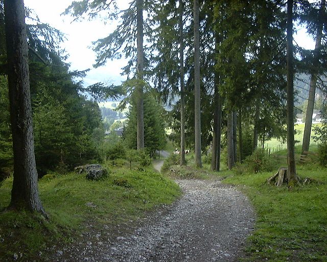 View down the trail towards Feisterer hut a bit above the traihead.
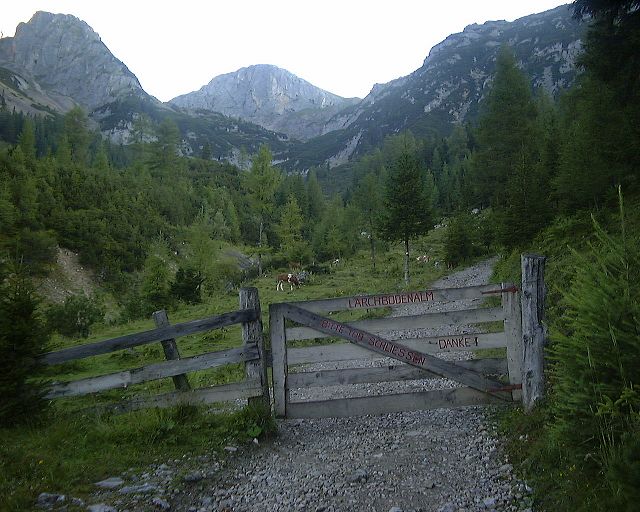 A gate to Larchbodenalm hut about 1.5 mile up the trail.
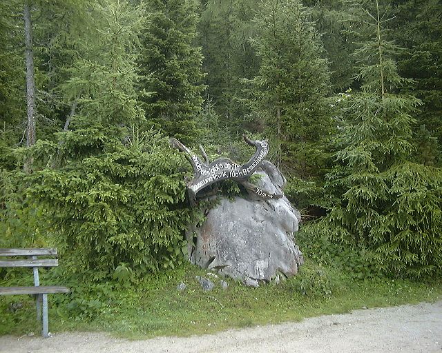 Turnoff to Larchbodenalm a bit higher up. As I got here somewhat after 8am, the hut was naturally still closed.
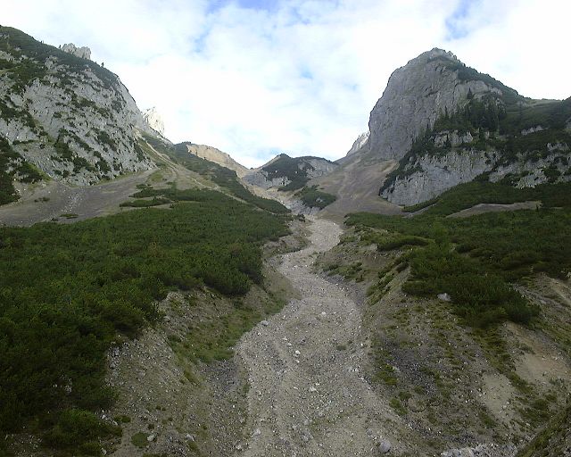 View up the valley towards Guttenberg Haus a little above Larchbodenalm.
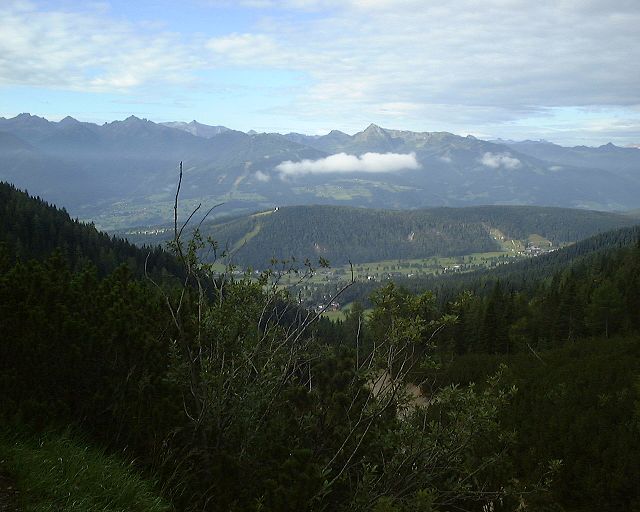 View down south to the valley from a spot nearby.
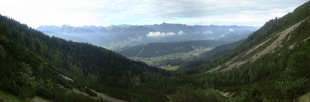 View down the valley (Ramsau in the foreground, Schladming in back) from under where the lift to Guttenberg Haus starts.
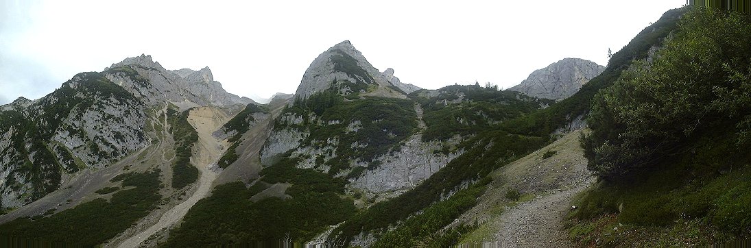 View up the valley from a spot nearby.
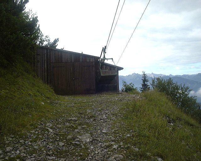 Lower end of a cable lift that is used to bring supplies to Guttenberg Haus.
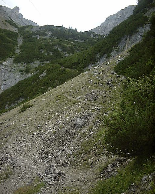 Switchbacks up the slope above the cable lift station.
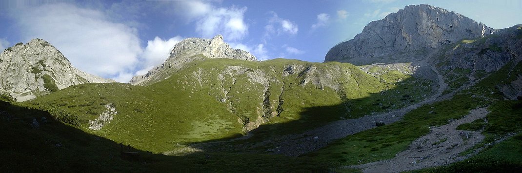 View up the meadow leading to Guttenberg Haus.
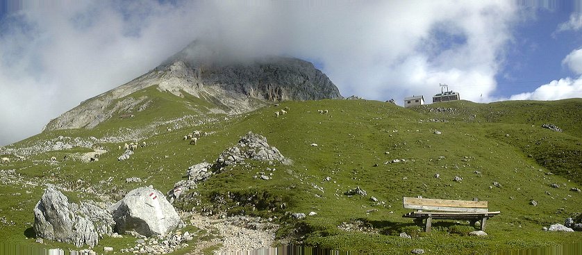 Guttenberg Haus from a bit closer.
 Guttenberg Haus at 9.15am, not much life there yet.
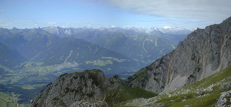 Zoomed-up view from Guttenberg Haus towards Hohe Tauren (in the left) and Schladming on the right.
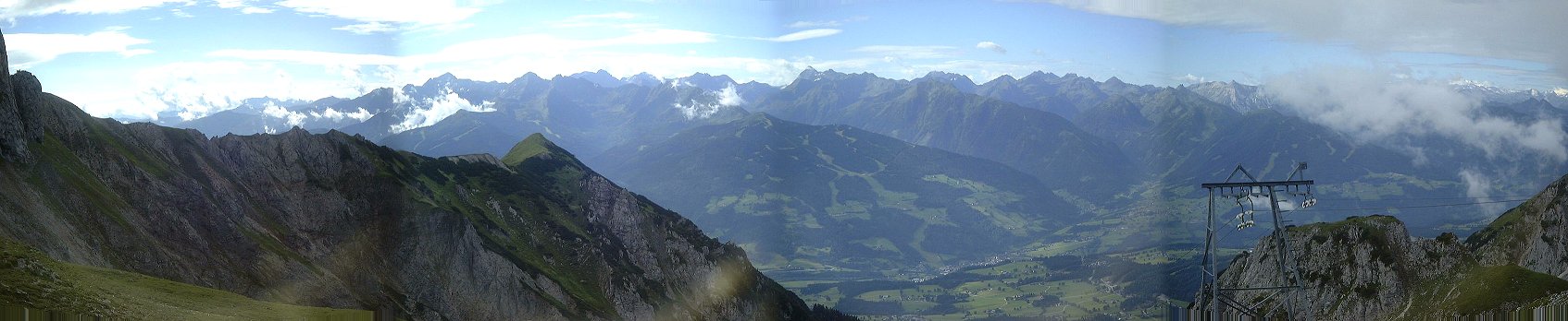 View from Guttenberg Haus south down the valley.
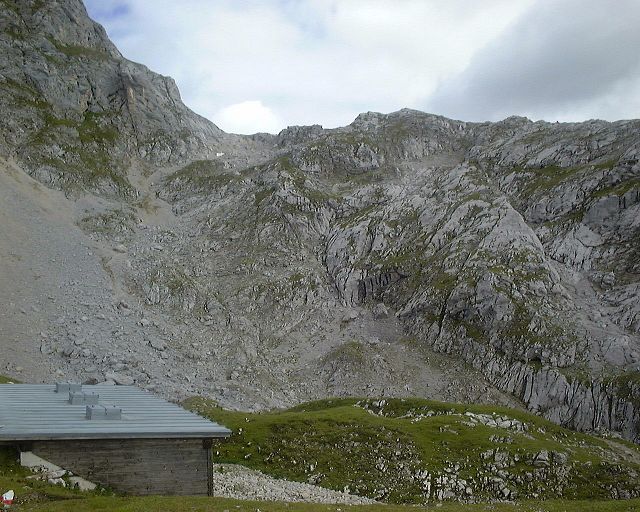 View from Guttenberg Haus to the saddle west of Sinabell.
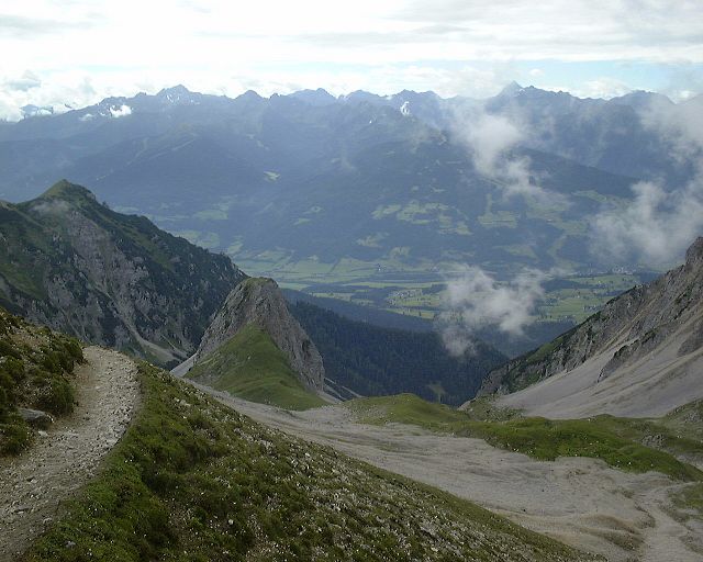 View from about middle way between Guttenberg Haus and saddle east of Hohe Rams into the valley.
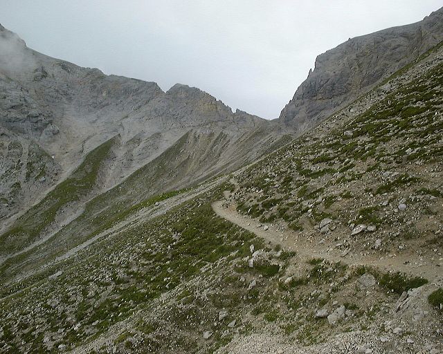 View up to the pass.
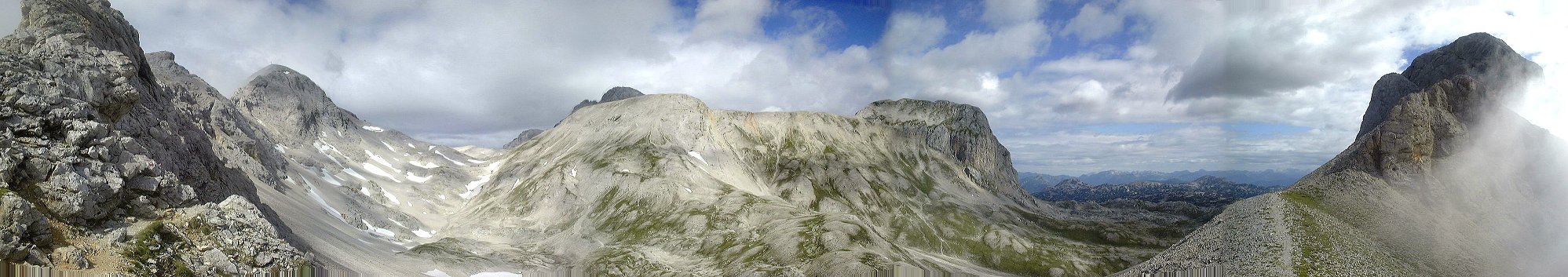 Panorama from the pass east of Hohe Rams east-north, Scheichenspitze on the left, valley Landfriedtal in the middle and plateau Am Stein in the back.
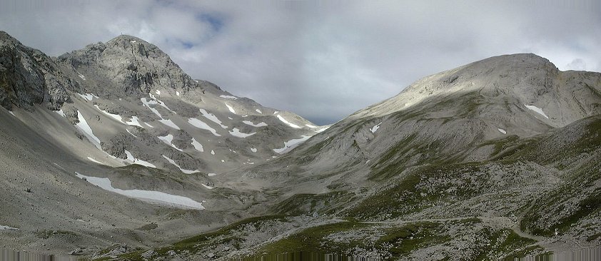 View from valley up to Scheichenspitze and the pass left of it which is used to get to the summit.
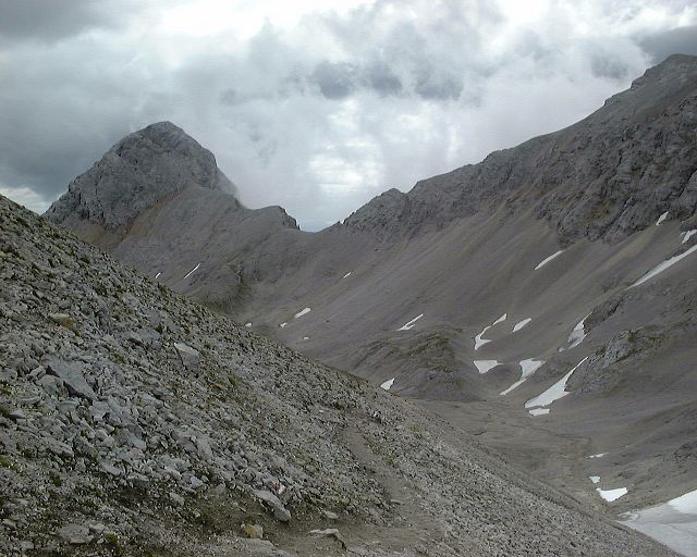 Look at the ridge between Hohe Rams and Scheichenspitze from below the pass north of Scheichensp.
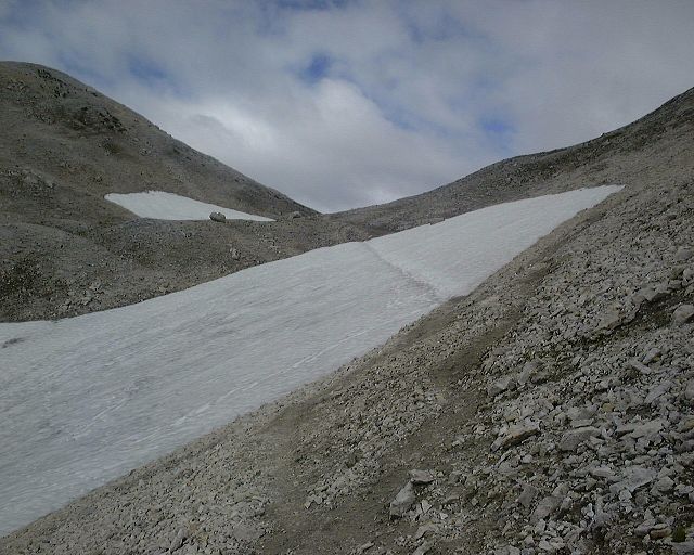 View up the pass (and the only snowfield to be crossed) from the same spot.
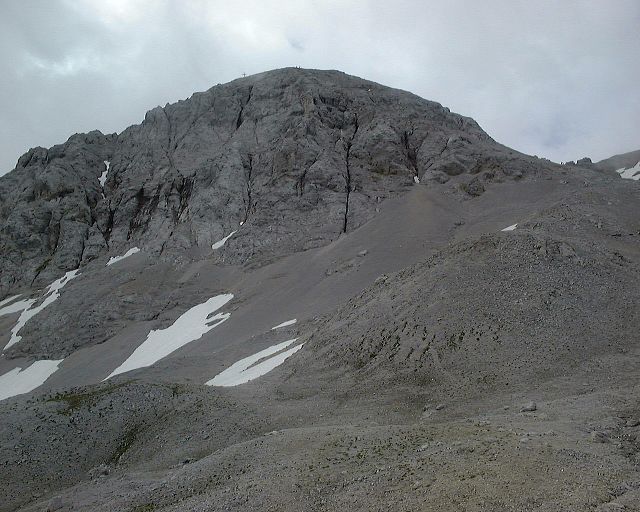 View at Scheichensp. from the saddle.
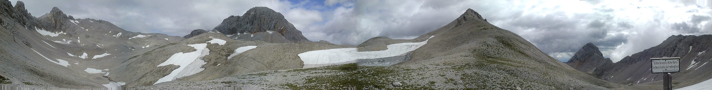 Panorama from the saddle west-north-east, Gr. Koppenkarstein in the middle right, Hohe Dachstein hidden behind.
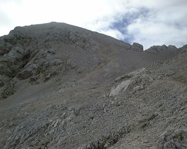 View at Scheichensp. from a small hill above the saddle.
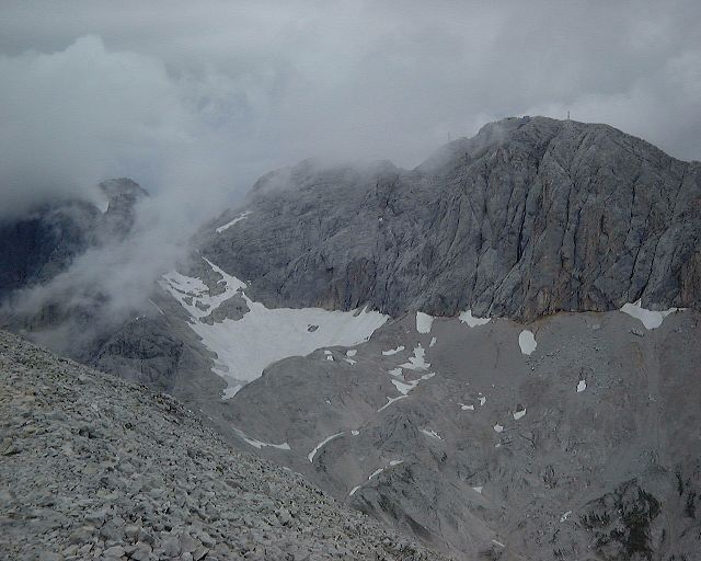 View at Gr. Kopperkarstein from the ridge west of Scheichensp.
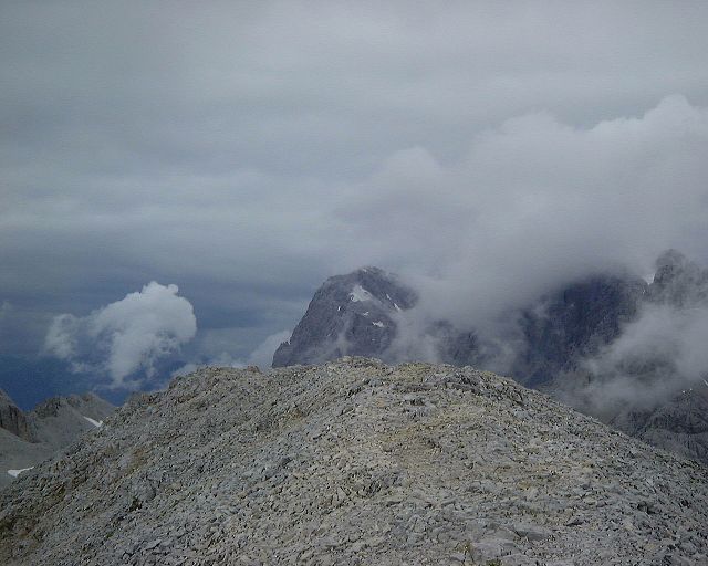 A rare look from Scheichensp. south-west, when the clouds broke for a little bit.
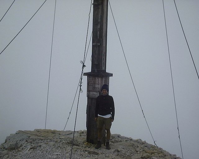 Me at Scheichensp. summit.
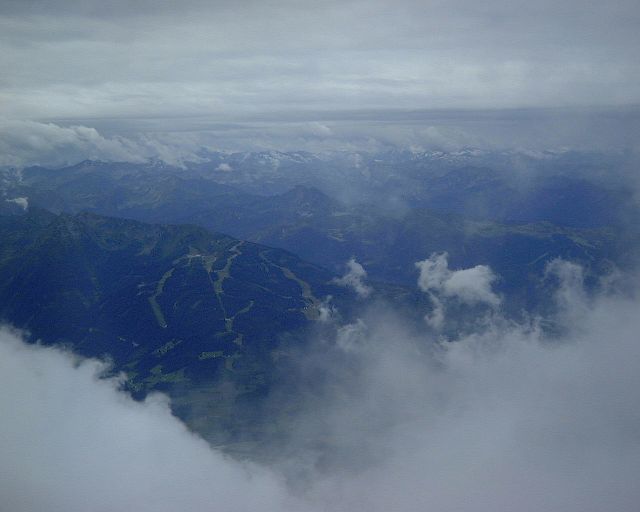 Another rare look from Scheichensp. south, Planai in the foreground, Niedere Tauren in the back.
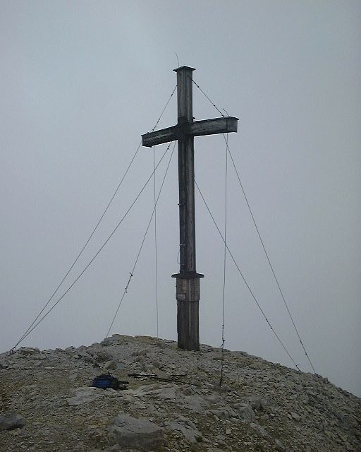 Scheichensp. summit cross in a full view.
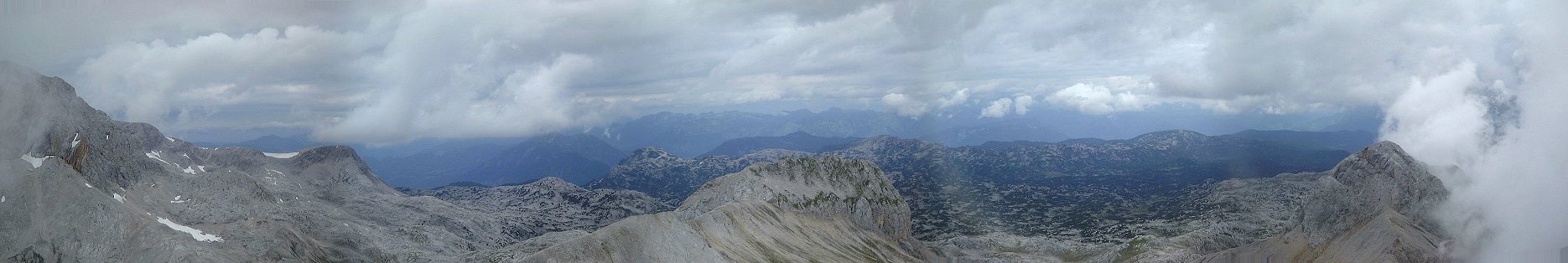 Panorama from Scheichenspitze north, towards Am Stein plateau, it was too cloudy towards the south.
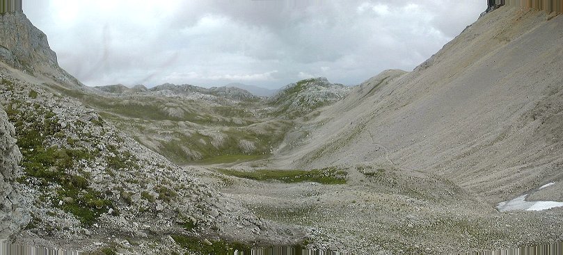 View down the lower Landfriedtal from a bit below the junction leading to pass east of Hohe Rams.
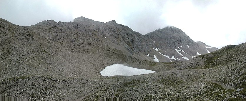 View north from the junction with trail 674. Landfriedstein is the mountain in middle right.
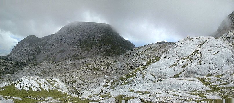 View from the same junction south-east, Sinabell is the flat mountain in the middle.
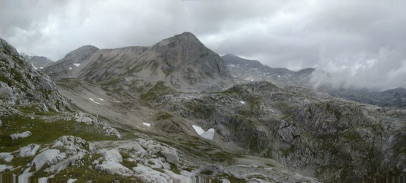
 Panoramas west and north from the trail crossing in the pass west of Sinabell.
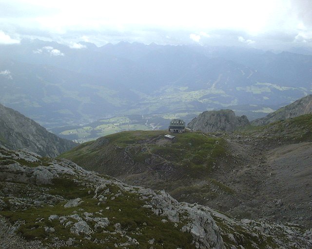 View from the pass south, at Guttenberg Haus and Ramsau valley.
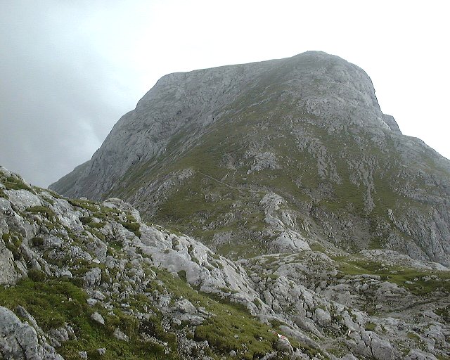 View from the pass east, at Sinabell.
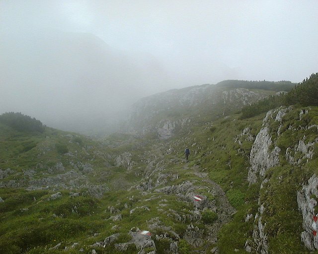 Walking down the trail north of Sinabell.
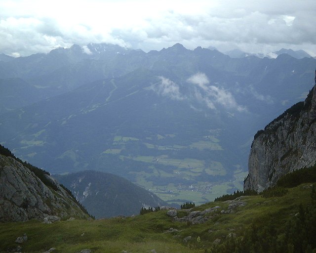 First view down south after having walked around Sinabell.
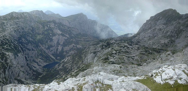 View east at Seetal and lake Seetalsee (or Silberkarsee).
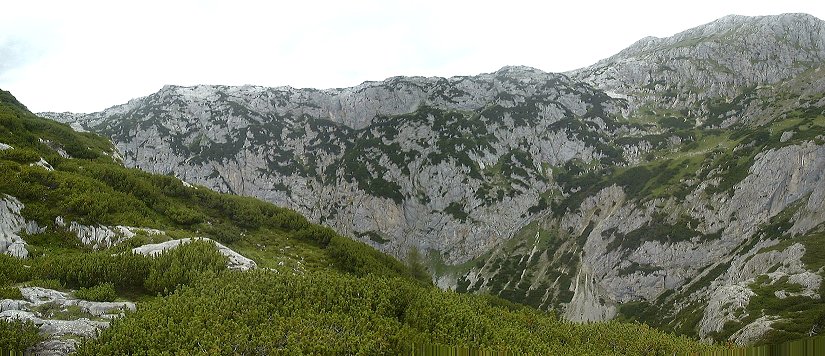 View into Seetal from the trail above, the lake is hidden in the valley in the right part of the picture.
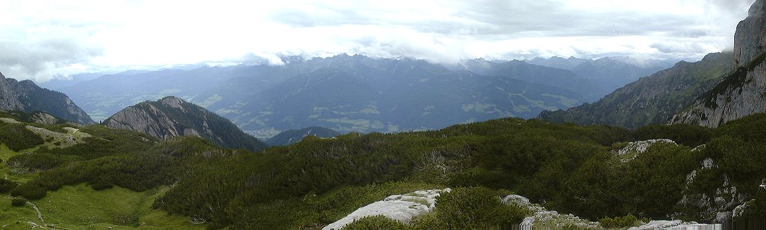 Panorama south from the same spot.
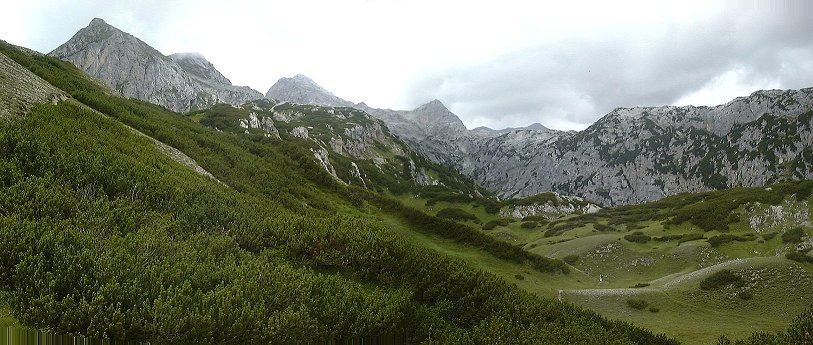 Panorama north towards upper Seetal from where the trail started to descend south into Ramsau valley.
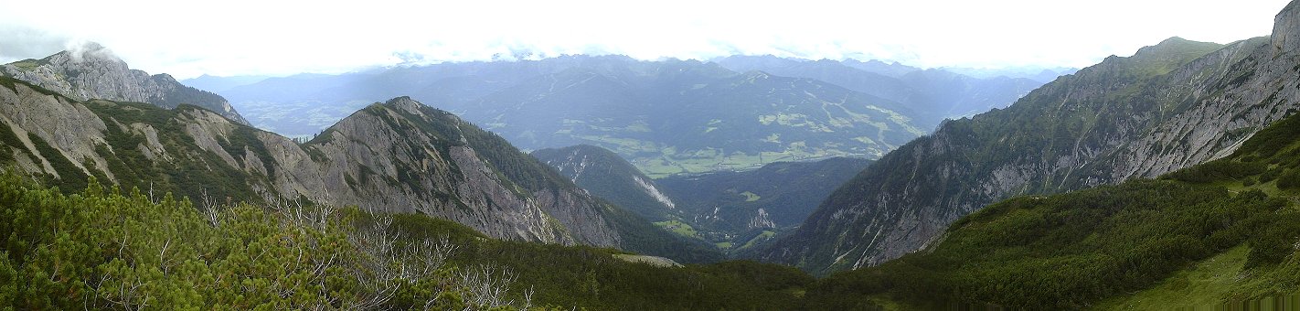 Panorama south from the same spot.
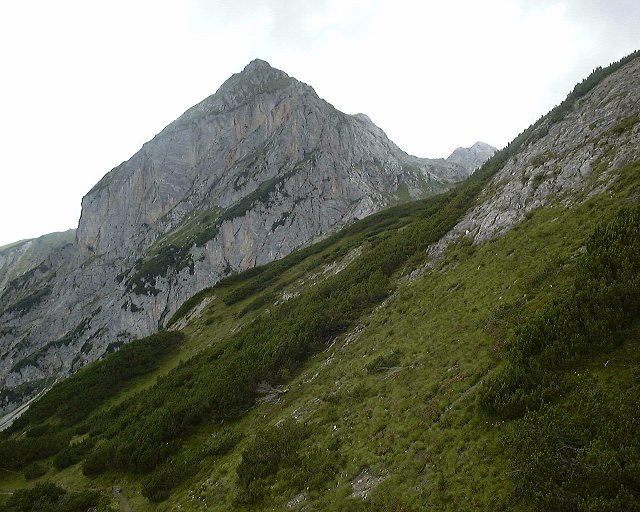 View west at Wassenspitze from a bit above cottage called Stanglalm.
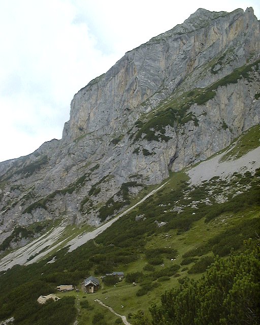 View at Stanglalm from the same spot.
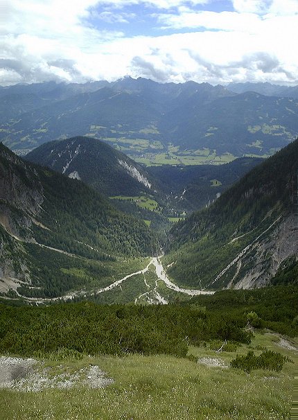 View down the valley through which I descended.
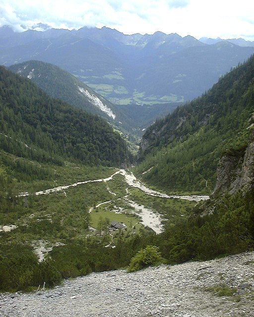 View at Silberkarhutte from about 2/3 way down.
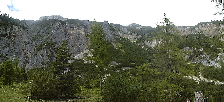 View up the valley from hut Silberkarhutte.
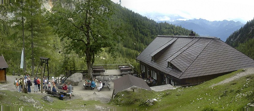 Silberkarhutte itself, full of life in the early afternoon.
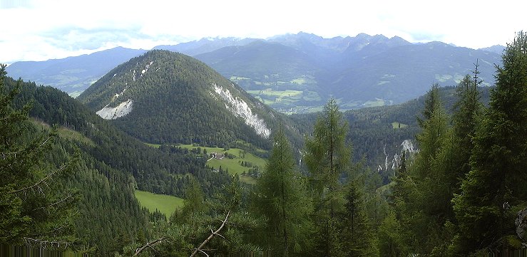 View down lower Silberkartal from bypass trail no. 7.
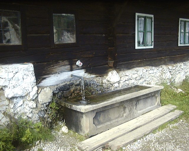 A water source next to a house called Reitbauer along trail no. 7.
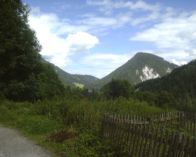 View south-east from this house.
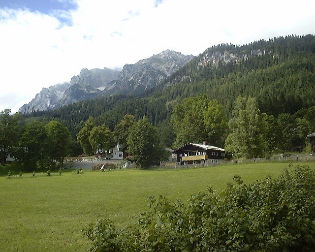 View north-west at the hills below Guttenberg Haus valley from the road.
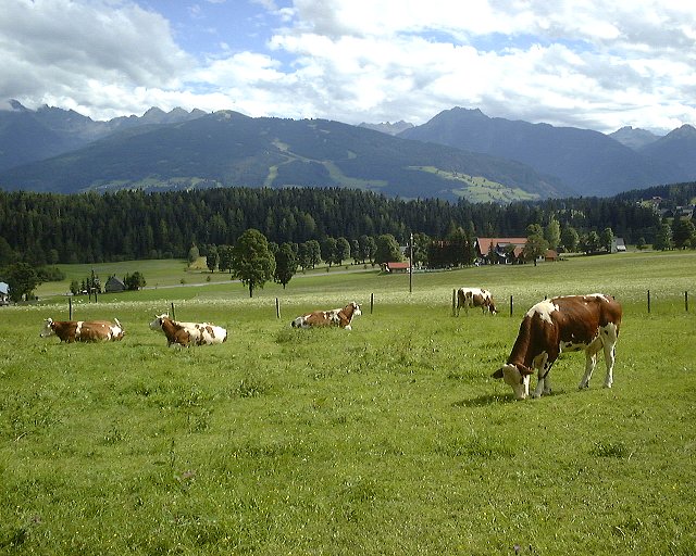 Look south while walking through a meadow towards Feisterer hut.
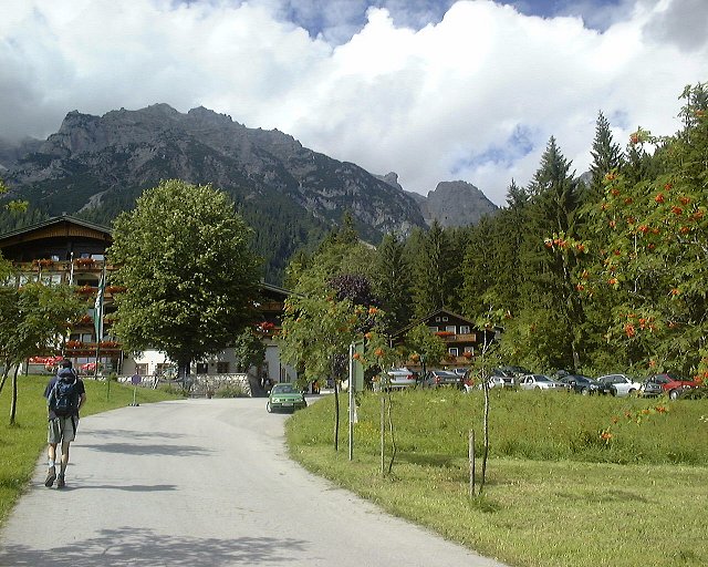 Feisterer hut itself.
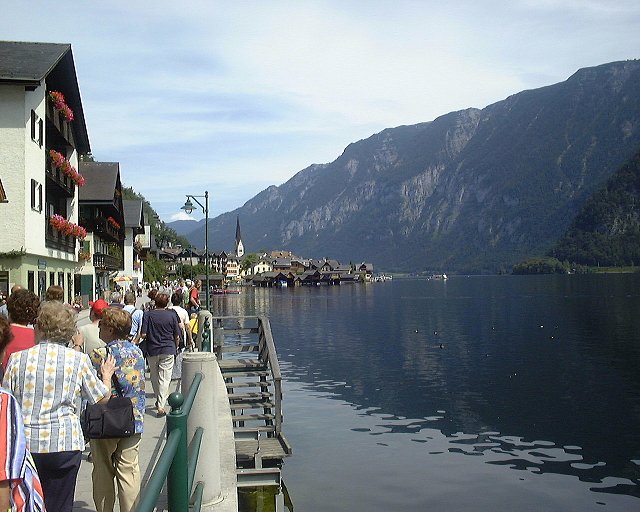

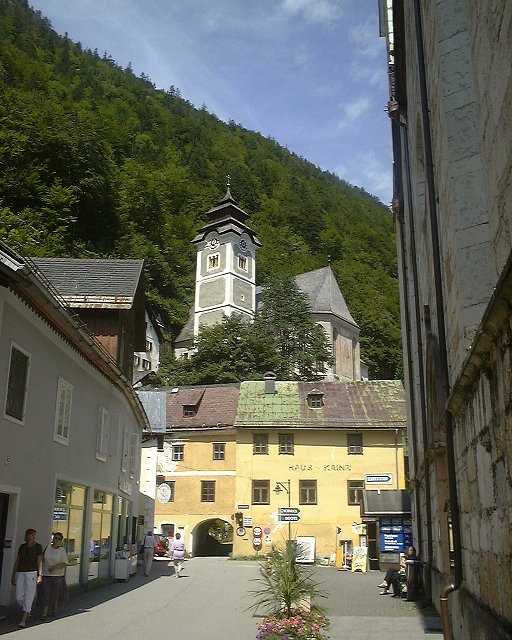
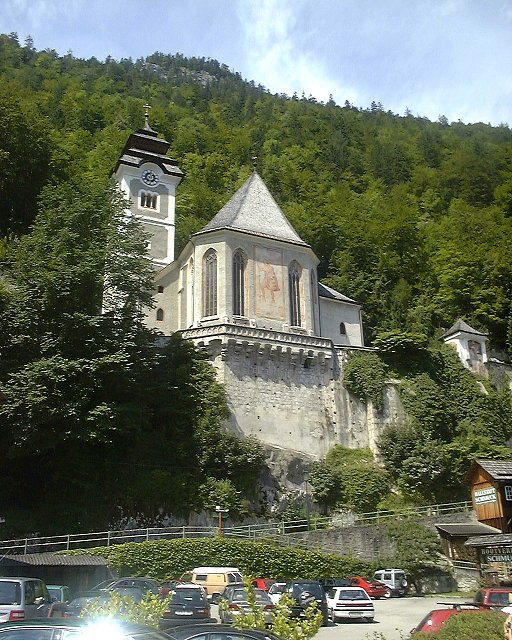
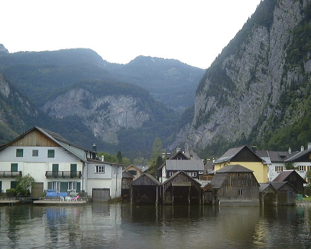
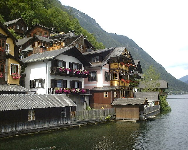
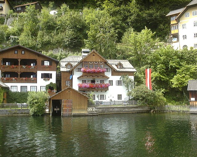
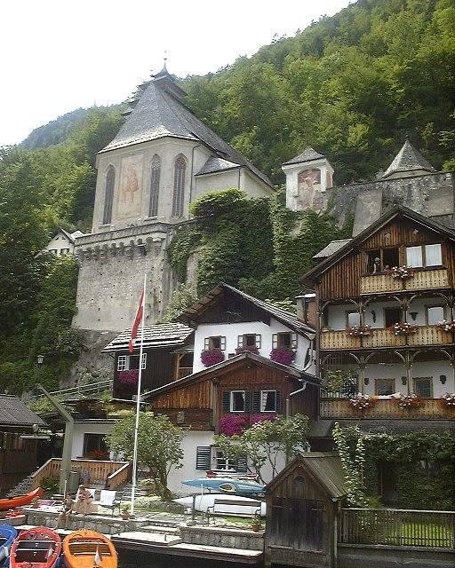
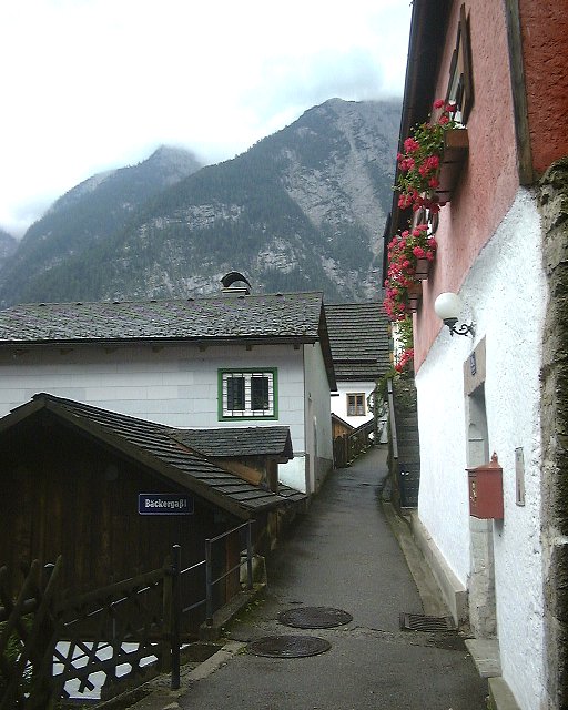
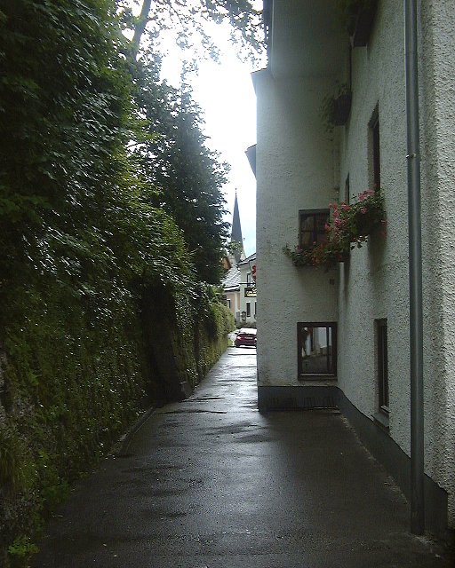
 Pictures from walking through Halstatt.
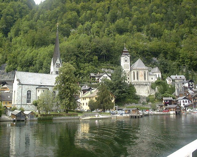
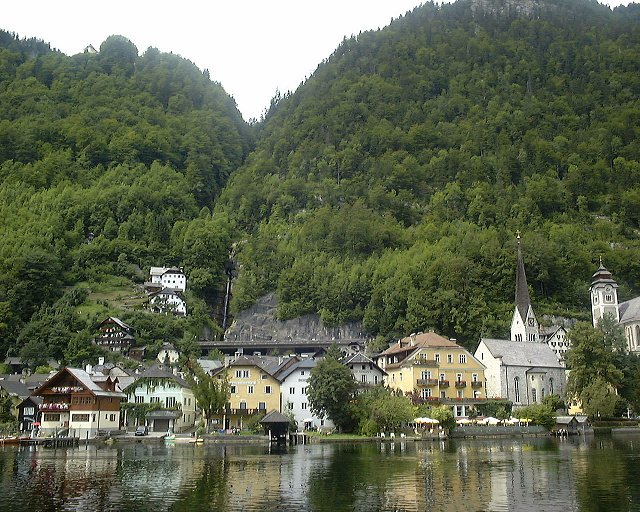
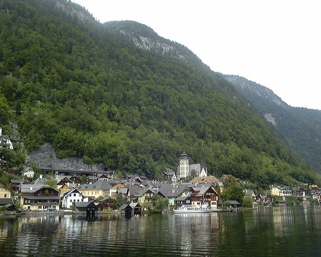
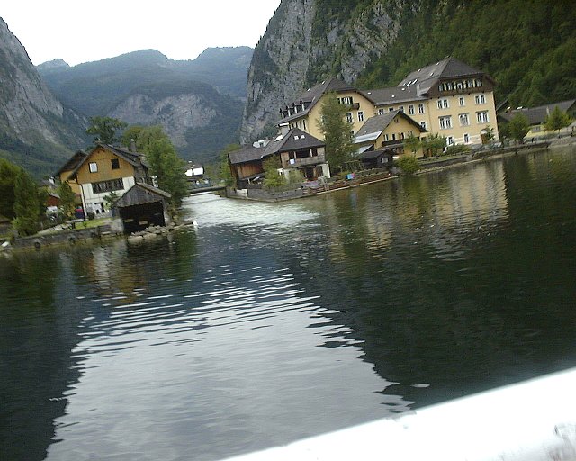
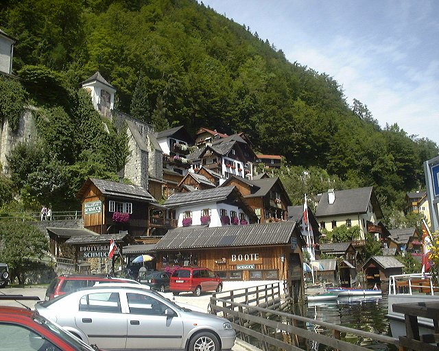
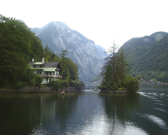
 Pictures from the boat ride on Halstatt Lake - views at Halstatt.
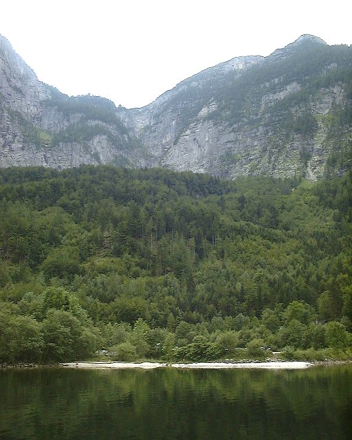
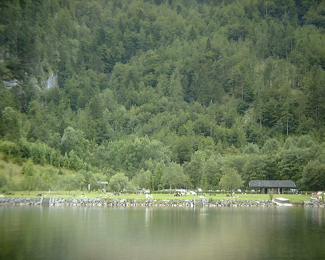
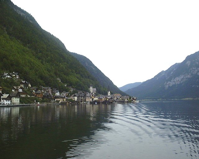
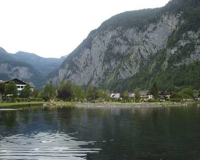
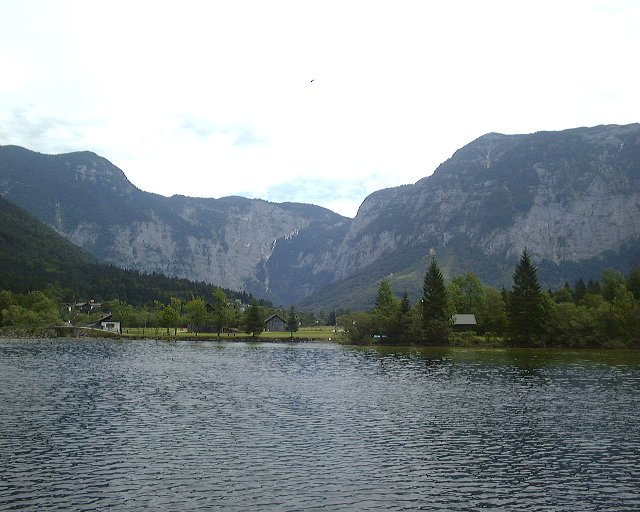
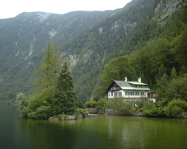
 Pictures from the boat ride on Halstatt Lake - south shore.
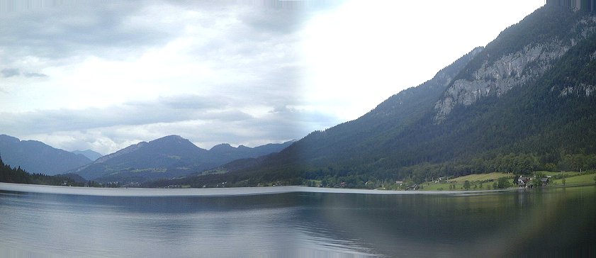 Panorama of Halstatt Lake east from the boat, Obertraun in the left.
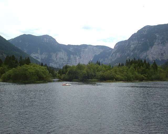
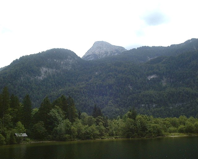
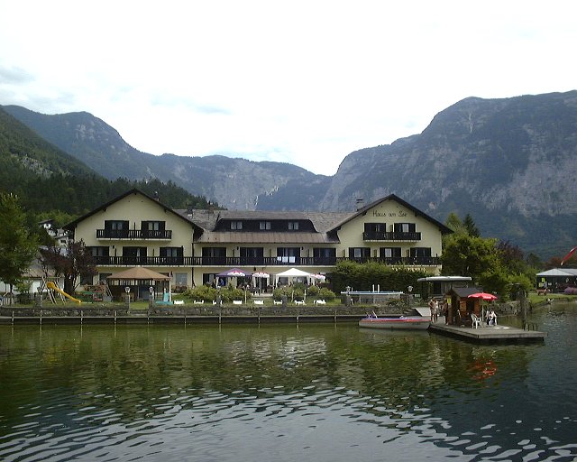 Pictures from the boat ride on Halstatt Lake - Obertraun.
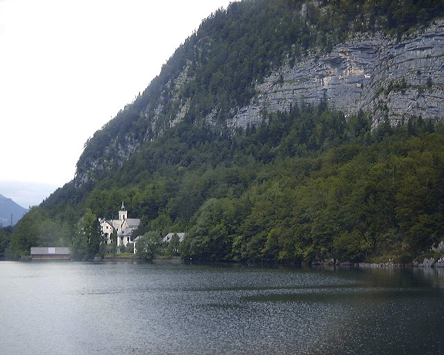
 Pictures from the boat ride on Halstatt Lake - northeastern shore.
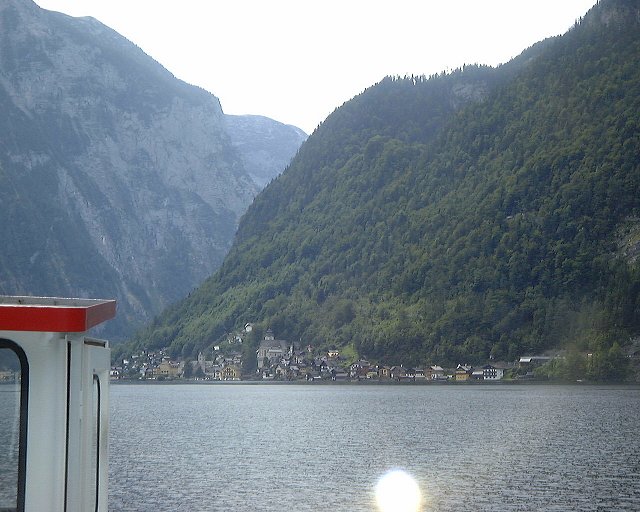
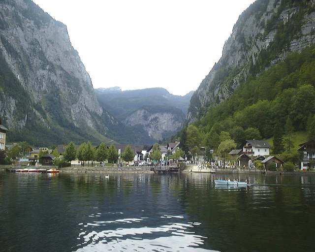
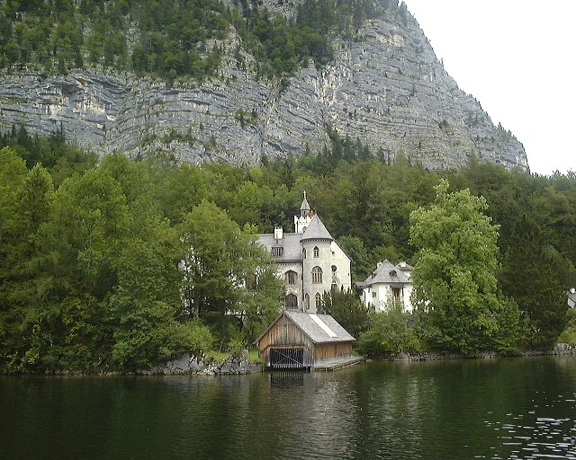
 Pictures from the boat ride on Halstatt Lake - return to Halstatt.
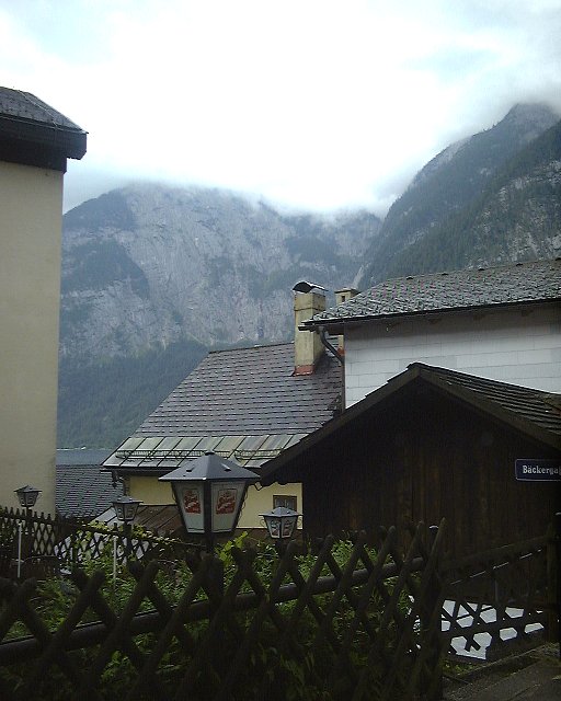
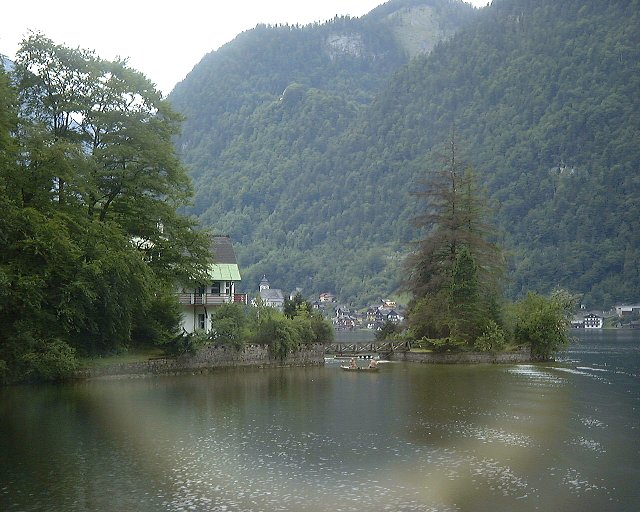
 Some more views from Halstatt after the boat ride.
 Panorama of Halstatt Lake from the shore in Halstatt, view south-east.
U of U / CHPC / Cuma / Travel / English / Alps 01
URL: http://www.chpc.utah.edu/~mcuma/alpy01e.html