Brťov is a small village in central Moravia, where I grew up. I've been road biking in the area quite a bit when I lived there, but only during my summer 2001 visit I repaired my old ATB bike that I bought in the early 90s and set out to ride on the forest roads and hiking trails around the village.
Summers in central Europe are much different from the western US. Although it can get warm with highs around 30C, more often the temperatures stay in the 20s, with periods of sunshine and rain. It was like this also the last week I stayed at Brťov. The bike was fixed and ready for a ride on Thursday, but it was raining almost whole Friday, so I went for a first longer ride on Saturday. The weather looked fine, but it was quite humid for what I was used to from the west.
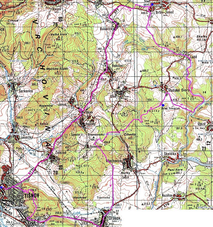
It was fairly sunny in the morning, but clouded up by the afternoon (a usual thing). I left the house at about 11am, and the grass and shaded areas on the forest roads were still wet with numerous puddles and mud spots. I was very happy that I left the old fenders on the bike, they are a must. I rode continuously for about 2.5 hrs, for a while on tracks that I knew before, for a while on marked hiking trails, occasionally not knowing exactly where I am, but relying on my orientation sense. I visited a ruin of a castle from 13th century, and then descended through the forest to a valley of creek Lubě, about 15 kms air distance from the point of origin. I continued on a road for a while towards town of Tišnov, but when I reached its outskirts, I turned off on another hiking trail that leads on a hill east of the town. The climb reminded me of Utah and the top offered a nice view. Then I rode to the town to get something to eat and drink, and since it was getting late and the legs were tired, I rode back to Brťov on the road. Here is map (340 kB) of the ride.
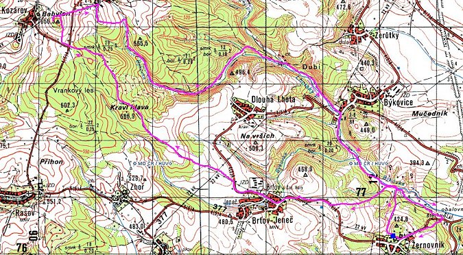
On Sunday we were invited to a village feast in neighboring village of Žernovník, where my cousin lives. The weather was still nice, so I decided to go for about 2 hr. ride through the places I knew pretty well. Up west towards village of Kozárov through a forest that borders my village (where I used to often go mushroom picking, or, in winter, cross-country skiing). There is a new cell-phone transmitter at the top of the hill east of Kozárov with a view tower, so I stopped there for a panoramic view, and then rode back to Žernovník through valley of creek Býkovka, a nice long descent. Here is map (160 kB) of the ride.
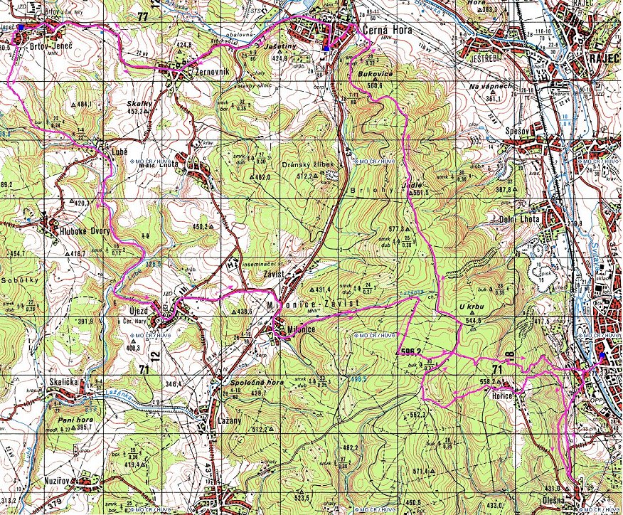
On Monday, I had some business to do in the district town of Blansko and haircut appointment in nearby Černá Hora. I combined both into about 55 km. loop. First descended from Brťov into valley of creek Lubě and then over a hill on a road into Milonice. East of here goes a ridge, that rises about 200 m. above the valley. East of this ridge is the valley of river Svitava, where lies Blansko. I took a marked hiking trail up the ridge, which climbed moderately, but the vegetation around the trail was getting thicker as I was getting higher, probably not too many hikers have used the trail recently. I eventually lost the trail and continued on a forest track to the ridge, where I crossed another marked hiking trail and on this one got back to the trail I wanted to be on. This was followed by a long downhill, nice and smooth in some parts, fairly steep and technical at others. Before I realized, I was in Blansko. I spent some time there, bought some water (since I forgot the bottle at home), and rode back. The plan was to take another hiking trail back to the ridge and then followed the ridge trail north to Černá Hora. However, it took me longer than I thought to find the trail up, there are numerous forest roads that criss-cross the slopes, so I was riding around a bit until I found the marks of the trail. Then followed a hairy climb up to small village of Hořice, probably the toughest I have done during my whole stay there. Since the time of my hair appointment was getting close, instead of riding the ridge trail (which looked like a nice singletrack), I hopped on a paved forest road, that also follows the ridge and in 15 min. were at the hairdresser. From there, I just took the road back to Brťov, because it was again getting late. Here is map (410 kB) of the ride.
Panorama from the fields east of Hluboké Dvory.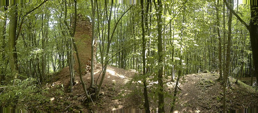 Last remnant of a castle ruin Trmačov, part of the castle tower. This castle was supposedly the smallest in Moravia and in ruin since mid 15th century.
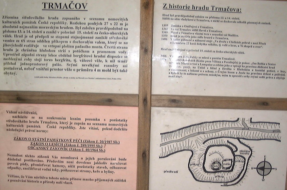 Board at the Trmačov site describing the castle history and its floor plan (in Czech).
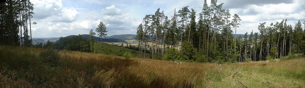 Panorama from a hill east of Tišnov towards north.
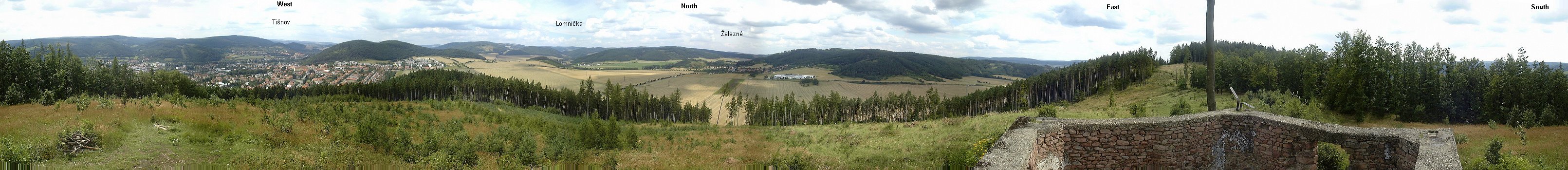 360 deg. panorama from a clearing slightly below the hill east of Tišnov.
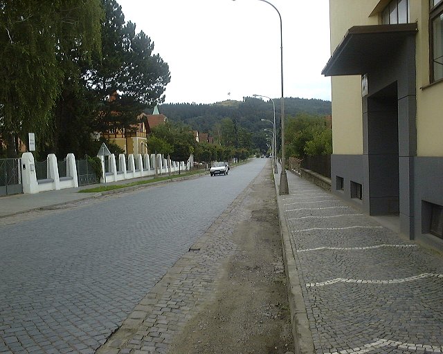 View from a street in Tišnov towards the hill where was taken the previous picture.
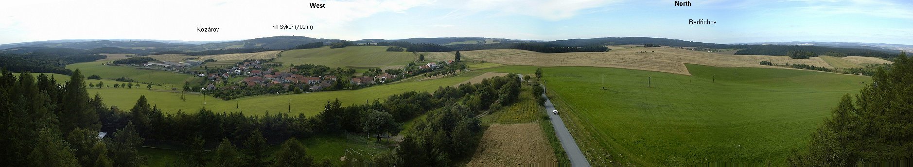 Panorama from the view tower near Kozárov.
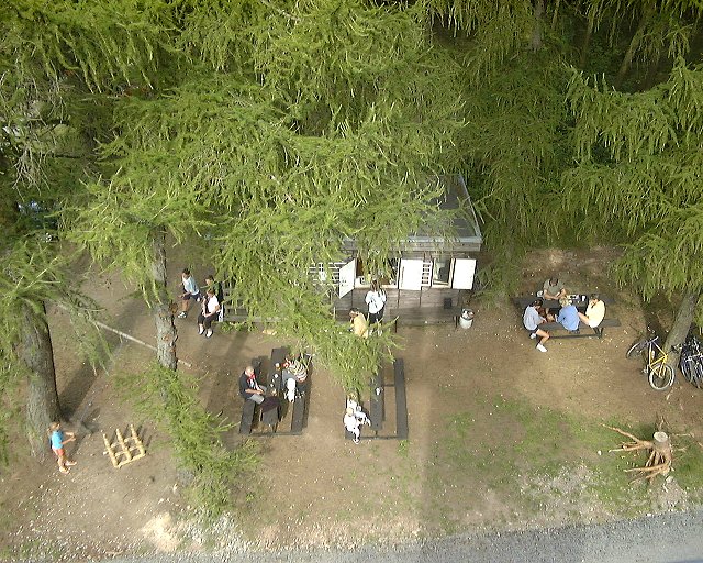 Look from the view tower down, below a refreshments kiosk and people downing some beer after the hard work of getting up the hill.
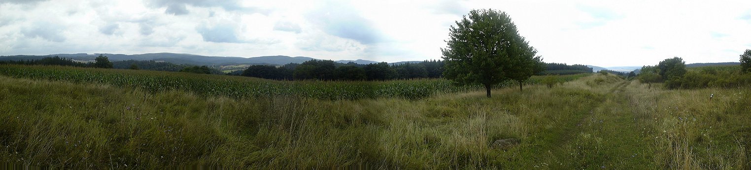
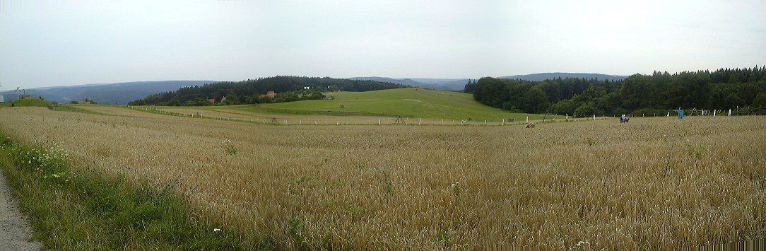 Panorama from the ridge above Hořice towards south.
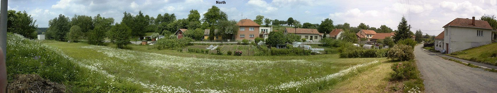 Panorama of the street in Brťov with my family house.
U of U / CHPC / Cuma / Travel / English / Brtov 01
URL: http://www.chpc.utah.edu/~mcuma/brtov01e.html