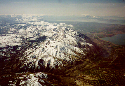
 Senior Project: Orographic Precipitation of the Wasatch Mountains
Due: 23 April
Project overview:
Precipitation prediction over the Wasatch Mountains provides a
unique challenge for several reasons. First, the organization of clouds
and precipitation associated with cyclones and fronts is greatly perturbed
by upstream mountain ranges, such as the Cascades and Sierra Nevada, as
well as the various ranges of the Great Basin. Second, cloud microphysical
processes occur in a continental airmass that is characterized by cold
cloud conditions, large cloud condensation nuclei (CCN) concentrations, and
large cloud droplet concentrations. These conditions frequently lead to
very low-density snowfall. Third, the Wasatch Mountains are narrow and
steeply sloped on both their windward and lee slopes and are not well
represented in current real-time forecast models. Due to insufficient
model resolution, errors in large-scale numerical forecasts arising from
initial condition uncertainty, and problems with model parameterizations,
including cloud microphysics, skill scores for models like the Eta are
lower over the Intermountain West than any other part of the United States.
This class project is motivated by the fact that advances in our
ability to predict precipitation over the Wasatch Mountains requires us
to fill many gaps in our understanding of orographic precipitation and
precipitation processes. The project will first focus on documenting the
distribution of precipitation across the Wasatch Mountains during an
orographic precipitation event. Several factors are believed to
influence this distribution including characteristics of the upstream
flow and stability, as well as microphysical processes such as snow crystal
growth, riming, and transport. We will measure snowfall across a section
of the Wasatch Mountains that is located due east of Ogden and includes
Snowbasin ski area. To the west,
this portion of the Wasatch rises almost 1500 m in 5 km, while to the east
the mountains rise around 1000 m in 10 km. Our manual observations will
be "quality controlled" and then compared to those taken by automated
ETI guages at snowbasin (3 total) and on the west bench of the Wasatch
(Weber State University). We will then examine the factors influencing
the precipitation distribution using a variety of meteorological data
sets. If time permits, we will verify a very high resolution simulation
by the MM5 (~1km).
Project objectives:
To describe the distribution of precipitation across the Wasatch
Mountains, a narrow and steeply sloped mountain range.
To examine the factors that affect this precipitation distribution
To validate automated precipitation guages and, time permiting,
high resolution model simulations.
Methodology/tasks:
1. Develop an accurate, cheap, manual way to measure 6-h snowfall
and SWE using snow boards and coaring tubes.
2. Plan and forecast for an orographic precipitation event.
3. Collect data during 1-3 IOPs.
4. Quality control and analyze your preipitation observations.
5. Determine the accuracy of the 4 automated ETI guages.
6. Examine the meteorological conditions influencing this precipitation
distribution using observed and model data available at the
University of Utah.
7. Verify a high resolution MM5 simulation (time permitting).
8. Write up your results.
Observing sites:
A. Weber State University (ETI guage, manual)
B. Top of Porcupine Chairlift (manual)
C. Top of John Paul Chairlift (tipping bucket, manual)
D. Bottom of Middlebowl Chair (ETI guage, manual)
E. Bottom of Strawberry Express (ETI guage, manual)
F. Base of John Paul DH (ETI guage, manual)
G. Snowbasin Access RD at Wheeler Creek (Manual, conventional rain guage)
H. Huntsville St. Park (manual, conventional rain guage)
I. Trappers Loop Highway (manual, conventional rain guage)
Observing site maps:
Snowbasin ski area
Topomap

