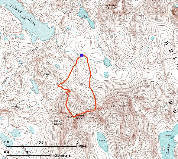
Výstup na Mt. Lester
Přeskoč mapu na popis obrázků
Nebo:
Kopíruj trasu myší.
Podrž myš nad mapou když se kurzor změní v ruku. Zobrazí se popis.
Kliknutím se zobrazí odpovídající obrázek.
 1. Pohled z místa pod nízkým SZ hřebenem Mt. Lester na sever a na východ.
 2. Pohled z místa o trochu výš na východ, na tři vrcholy Mt. Lester.

 Dvě horské květiny na svazích Mt. Lester.
 3. Pohled na prudký severní svah, kterým jsme lezli nahoru..
 4. Pohled na další dva vrcholy Mt. Lester ze severního svahu.
 5. Lezení po boku severního svahu, Island Lake a Titcomb Basin v pozadí.
 6. Pohled dolů z lezení po severním hřebenu Mt. Lester.
 7. Pohled od začátku horního, meně prudkého hřebenu, který vede k vrcholu.
 8. Pohled ze stejného místa nahoru.
 9. Výstup po méně prudké části severního hřebene, pohled na sever s Titcomb Basin v pozadí.
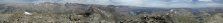 10. 360 st. panoráma z vrcholu Mt. Lester.
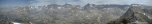 11. Přiblížená panoráma na sever a na východ, k hlavnímu hřebeni Wind River Mtns.

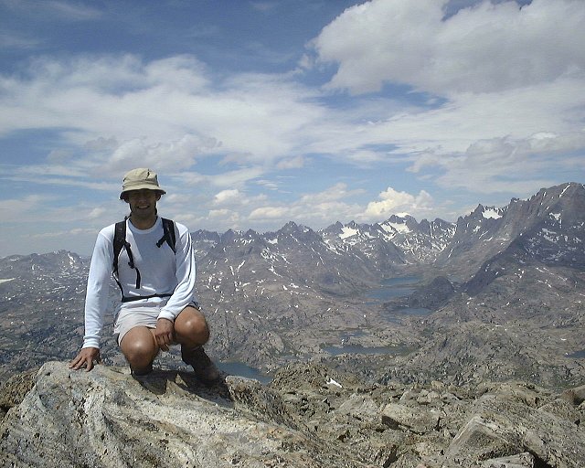
 Záběry nás dvou na vrcholu.
 12. Pohled dolů po východním hřebeni Mt. Lester, kudy jsme šli dolů.
 13. Pohled dolů údolím pokrytým štěrkem, kudy jsme sešli dolů z hřebene Mt. Lester ridge. Fremont a Jackson Peaks v pozadí.
 14. Pohled z asi 1/3 dolů údolím.
 15. Pohled ze spodní části údolí směrem dolů.
 16. Pohled na dva jižní vrcholy Mt. Lester z místa pod tím údolím.
 17. Sjezd po sněhu v dolní části sestupu.
 18. Chůze po méně prudkém sněhu.
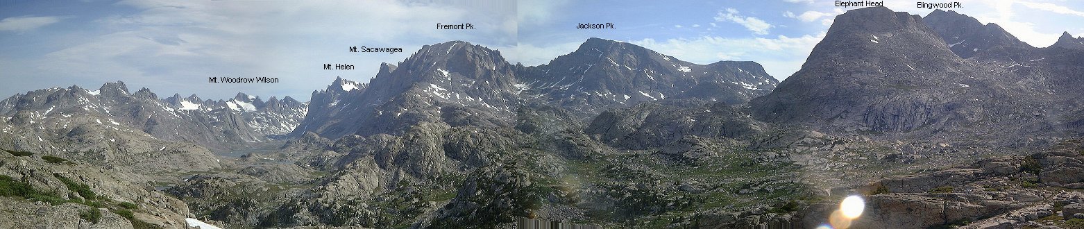
 19. Panoráma na západ ke všem třem vrcholům Mt. Lester z údolí poblíž našeho tábora.
 20. Pohled na sever kousek blíže k táboru Mt. Lester.
 21. Další pohled dolů údolím asi 100 m. od tábora, směrem k táboru.
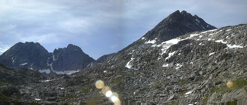 2. Pohled z místa o trochu výš na východ, na tři vrcholy Mt. Lester.
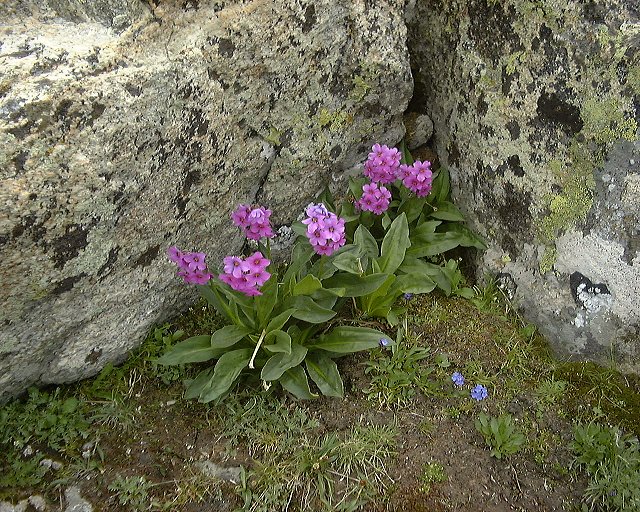
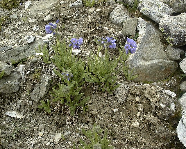 Dvě horské květiny na svazích Mt. Lester.
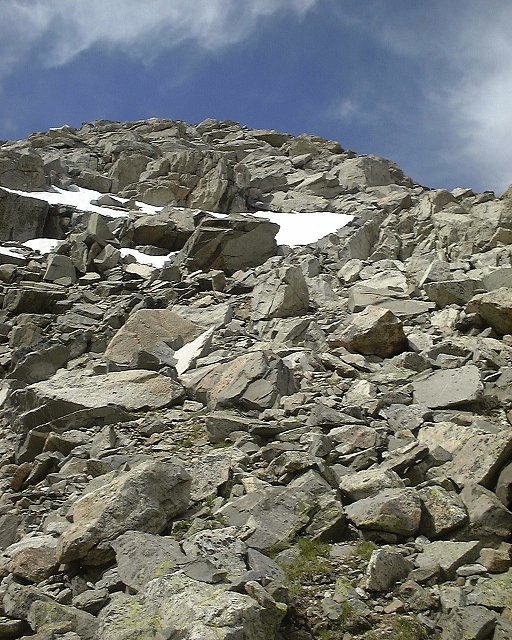 3. Pohled na prudký severní svah, kterým jsme lezli nahoru..
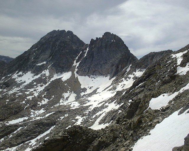 4. Pohled na další dva vrcholy Mt. Lester ze severního svahu.
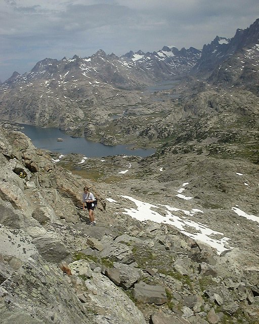 5. Lezení po boku severního svahu, Island Lake a Titcomb Basin v pozadí.
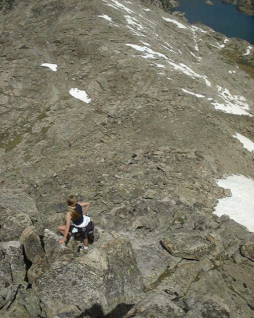 6. Pohled dolů z lezení po severním hřebenu Mt. Lester.
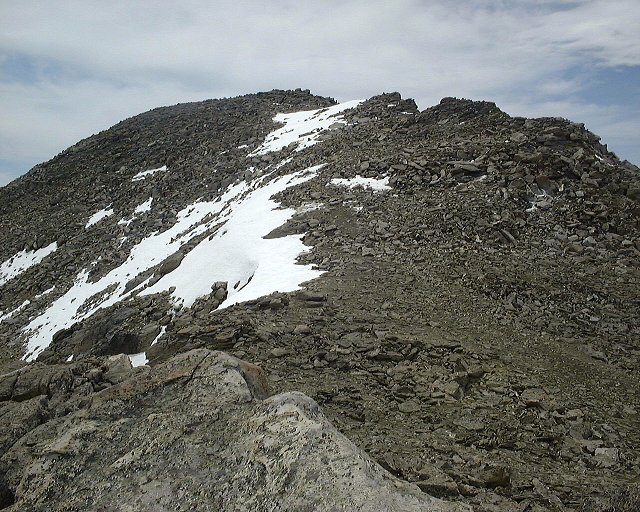 7. Pohled od začátku horního, meně prudkého hřebenu, který vede k vrcholu.
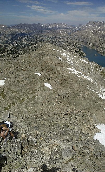 8. Pohled ze stejného místa nahoru.
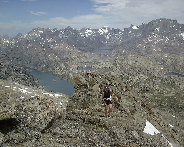 9. Výstup po méně prudké části severního hřebene, pohled na sever s Titcomb Basin v pozadí.
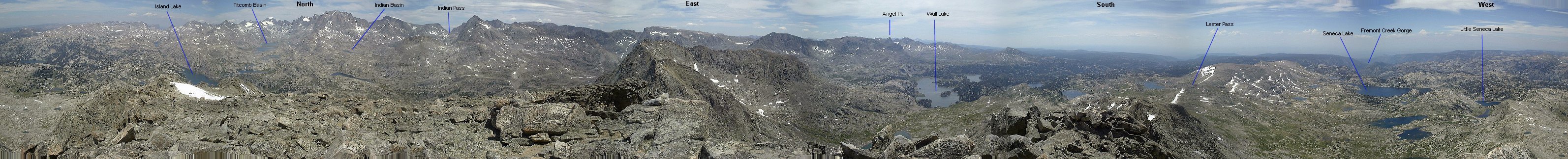 10. 360 st. panoráma z vrcholu Mt. Lester.
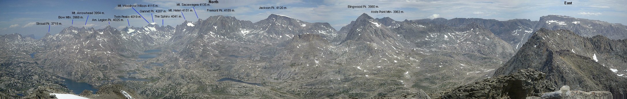 11. Přiblížená panoráma na sever a na východ, k hlavnímu hřebeni Wind River Mtns.
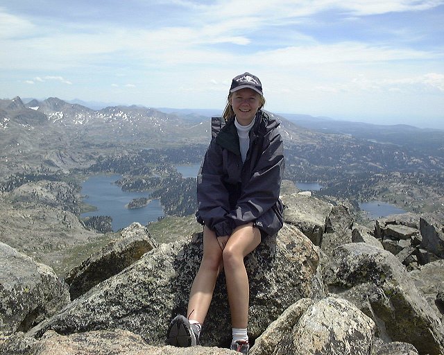
 Záběry nás dvou na vrcholu.
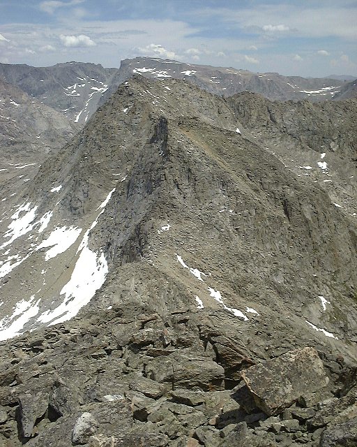 12. Pohled dolů po východním hřebeni Mt. Lester, kudy jsme šli dolů.
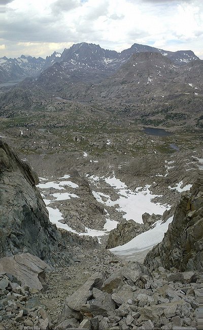 13. Pohled dolů údolím pokrytým štěrkem, kudy jsme sešli dolů z hřebene Mt. Lester ridge. Fremont a Jackson Peaks v pozadí.
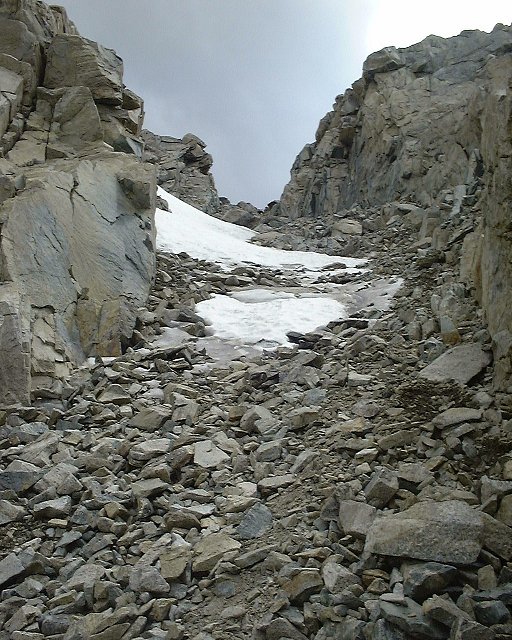 14. Pohled z asi 1/3 dolů údolím.
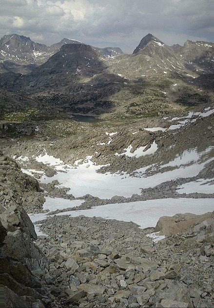 15. Pohled ze spodní části údolí směrem dolů.
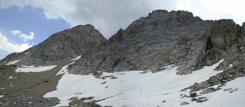 16. Pohled na dva jižní vrcholy Mt. Lester z místa pod tím údolím.
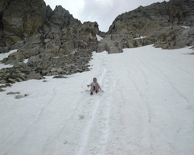 17. Sjezd po sněhu v dolní části sestupu.
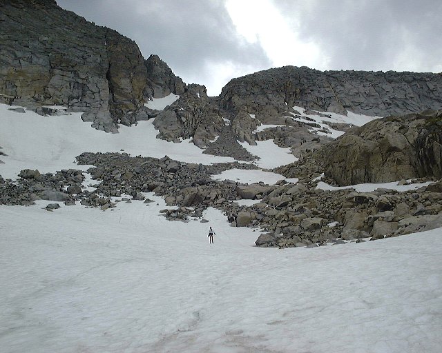 18. Chůze po méně prudkém sněhu.
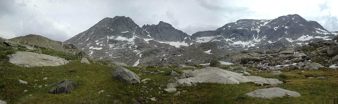 19. Panoráma na západ ke všem třem vrcholům Mt. Lester z údolí poblíž našeho tábora.
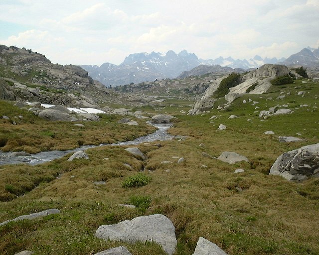 20. Pohled na sever kousek blíže k táboru Mt. Lester.
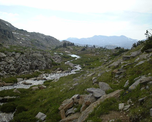 21. Další pohled dolů údolím asi 100 m. od tábora, směrem k táboru.