And
View at the
Camp below the
And
View from the
I took this trip in the first week of September 1998. My brother and his girlfriend came to visit, so I drove to pick them up in San Francisco and then we went to national parks in California and Arizona. Here is the trip plan (map):
Sat. 29.8.: From SLC, on I15 below Provo and then on US 6 to Great Basin National Park in east-central Nevada
Sun. 30.8.: Climb on the highest mountain in the park - Wheeler Peak, then visit of the nearby Lehman Cave and drive thru Nevada on US 50, camping in BLM camp Sand Mountain before Fallon, Ne.
Mon. 31.8.: On I80 thru Reno, Sierra Nevada and Sacramento to San Francisco, picking up the rest of the crew and night in Half Moon Bay State Beach.
Tue. 1.9.: San Francisco visit.
Wed. 2.9.: Drive to Yosemite Natl. Parku and hike above the Yosemite Falls.
Thu. 3.9.: Drive to the Glacier Point in the Yosemite, then to Sequoia NP and a short hike in its western part.
Fri. 4.9.: Second part of Sequoia, drive to Los Angeles a overnight stay there.
Sat. 5.9.: Drive to Grand Canyon.
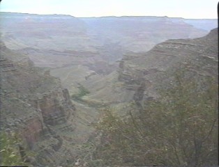
Sun. 6.9.: Hike down the Grand Canyonu, and quick drive on the top (in the bus).
Mon 7.9.: Wupatki a Sunset Crater Natl. Monument, Monument Valley and return to SLC.
Pictures
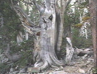
![]() Bristlecone Pine in the nature hike of the same name in Great Basin NP.
Bristlecone Pine in the nature hike of the same name in Great Basin NP.
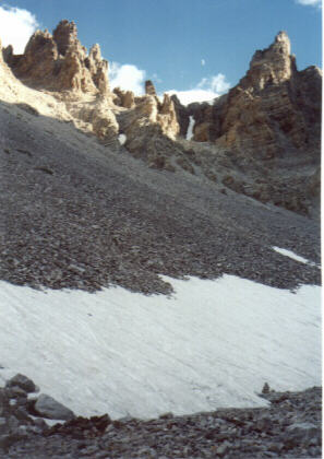
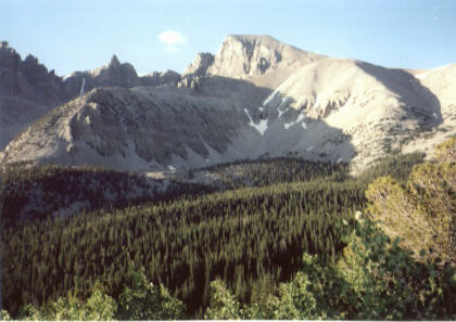
![]() Below the Wheeler Peak Glacier, the only glacier in Great Basin.
Below the Wheeler Peak Glacier, the only glacier in Great Basin.
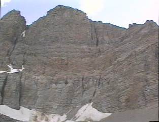
And ![]() yet another view below the peak, the highest in the park.
yet another view below the peak, the highest in the park.
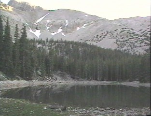
![]() Stella Lake, one of several mountain lakes under the Wheeler Peak.
Stella Lake, one of several mountain lakes under the Wheeler Peak.
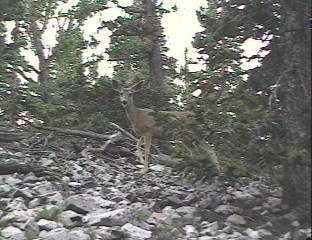
![]() Tame deer spotted not far from the lake.
Tame deer spotted not far from the lake.
View at the ![]() Wheeler Peak at the beginning of the trail to the top (4 miles long, 3000 ft. elevation gain, peak height around 13000 ft).
Wheeler Peak at the beginning of the trail to the top (4 miles long, 3000 ft. elevation gain, peak height around 13000 ft).
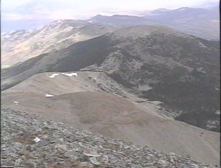
![]() Ridge leading to the summit.
Ridge leading to the summit.
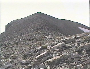
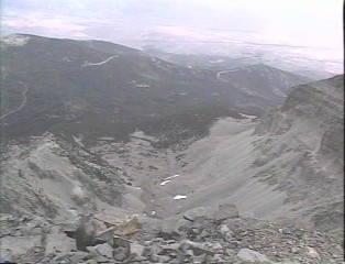
![]() View from the summit at the valley with the glacier and lakes.
View from the summit at the valley with the glacier and lakes.
![]() The ride, om which goes the trail.
The ride, om which goes the trail.
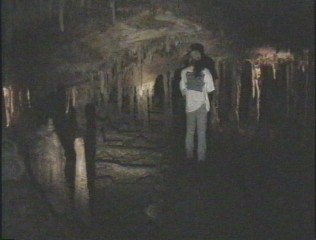
![]() Shield formations in the Lehman Cave.
Shield formations in the Lehman Cave.
![]() Another picture from the cave.
Another picture from the cave.
Camp below the ![]() Sand Mountain.
Sand Mountain.
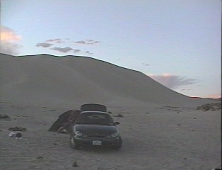
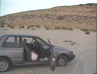
And ![]() my car stranded in the sand.
my car stranded in the sand.
![]() Interstate 80 near the Sierry Nevady summit
Interstate 80 near the Sierry Nevady summit
![]() Dome Rock in the Yosemite.
Dome Rock in the Yosemite.
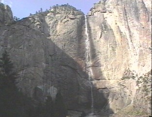
![]() Yosemite Falls, upper part.
Yosemite Falls, upper part.
![]() On the top of the falls
On the top of the falls
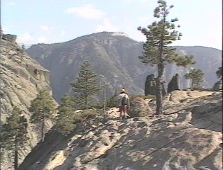
![]() Half Dome from the top of the falls, one must hike here - 2 miles and 2500 ft. up.
Half Dome from the top of the falls, one must hike here - 2 miles and 2500 ft. up.
View from the ![]() Glacier Point, where can everyone easily drive with a car.
Glacier Point, where can everyone easily drive with a car.
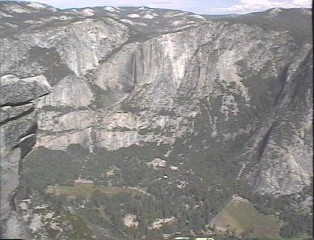
![]() Southern part of the Yosemite Valley.
Southern part of the Yosemite Valley.
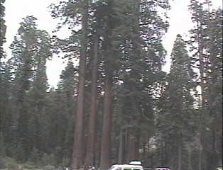
![]() Young sequioas in Sequoia NP.
Young sequioas in Sequoia NP.
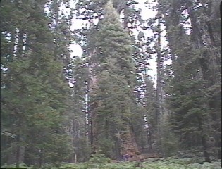
![]() Larger sequoias.
Larger sequoias.
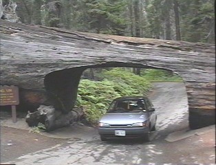
![]() Tunnel log, a tunnel cut in the fallen sequoia tree.
Tunnel log, a tunnel cut in the fallen sequoia tree.
![]() Moro Rock, an easy climb and great view.
Moro Rock, an easy climb and great view.
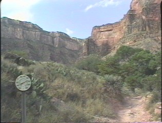
![]() Bright Angel Trail from the South Rim of the Grand Canyon.
Bright Angel Trail from the South Rim of the Grand Canyon.
![]() Indian Garden, oasis in the middle of the trip down.
Indian Garden, oasis in the middle of the trip down.
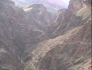
![]() Switchbacks down towards the river.
Switchbacks down towards the river.
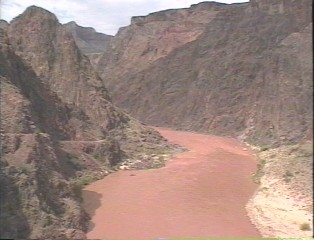
![]() River at the end of the Bright Angel Trail.
River at the end of the Bright Angel Trail.
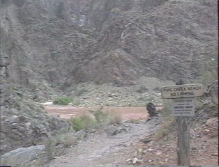
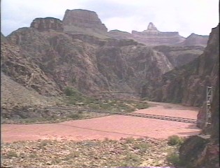
![]() Trail aginst the river flow towards Phantom Ranch.
Trail aginst the river flow towards Phantom Ranch.
![]() Bridge at the Phantom Ranch (phone and flush toilets).
Bridge at the Phantom Ranch (phone and flush toilets).
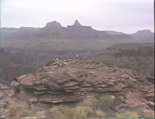
![]() Plateau Point, recommended day trip from the top, ca. 1 mile from the Indian Garden.
Plateau Point, recommended day trip from the top, ca. 1 mile from the Indian Garden.
![]() Wupatki, ruins of old indian pueblo.
Wupatki, ruins of old indian pueblo.
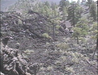
![]() Lava field at the Sunset Crater NM.
Lava field at the Sunset Crater NM.
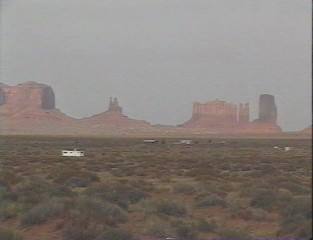
![]() Monument Valley.
Monument Valley.
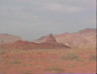
![]() Mexican Hat, rock close to the city with the same name.
Mexican Hat, rock close to the city with the same name.
U of U / Chemistry / HEC / Voth Group / Cuma / Travel / English / Ne., Ca. and Az.
URL: http://voth.chem.utah.edu/~mcuma/ca_az98e.html
Last updated: 03-Nov-98 / mc