
Last weekend of September was a time of first winter storm in Utah, but this did not deter us from going south. The plan was to hike in the La Sal Mountains on Sat. and bike some trails around Moab on Sun.
We traditionally drove down on Fri. night, leaving SLC in a heavy thunderstorm (also becomes a tradition). However, the skies were clear above the La Sals, and we set a camp at the end of the road in Gold Basin, below the three highest peaks in the range. The plan was to hike them next day.
We woke up into a cold cloudy morning, but the sun was peeking out once in a while. We set out quite late, at about 9.30, and did not manage to climb up more than 300 vertical meters before the low clouds came. By noon it was snowing lightly. In about another 30 min, the skies got black, the snow got thicker and wind blew the hard snow right to our faces. We turned around at ca. 3500 m., probably 1/2 under the Mt. Tukuhnikivatz summit, right after we heard the first thunder. We were in the trees in about 10 min, and there already was about an inch of snow on the ground. In about an hour we got down to the car and drove down to Moab. The snow stopped at about 8000 ft. (the cars were parked at ca. 10000 ft.). We went directly to the campground in the Sand Flats, which was pretty empty. Unfortunately, it started to rain right when we got to the campsite, so I just quickly built tent and we drove to the Arches NP visitor's center to warm up and wash. We got back to the campsite at. ca. 5.30pm, right when it stopped raining. I was still kind of excited, so I went for a ride on the Slickrock Trail. Although I did not plan on it initially, I rode the whole main loop (11 miles) in about 1.5 hr., and got out right before it got dark. I should have brought with me my new lamp and I did not have to hurry so much. The rest of the evening went the standard way, dinner, fire, and boiled wine.
For Sun. I planned to ride the Gemini Bridges trail, about 10 miles air distance east of Moab. It is a point to point ride, ca. 13.5 miles. I first planned to close it up to a loop with about 11 mi. road ride. However, due to my Sat. evening riding adventure, I did not feel like riding much on the road. Fortunately, our friends Mari and Rob planned to hike in the Arches so they were happy to drive my car from one trailhead to the other. We started the ride at ca. 10.30am, it was still chilly. I have sent Dina directly to the Gemini Bridges, about 6 mi. away, and myself headed north towards the rim above Sevenmile and Moab Canyons. The terrain was a decent jeep road all the way to the rim, where I got around noon. Then came the hard part. On the map, there was a jeep road that directly leads down to Archs Pasture and the Bridges. However, it took me a while to find it. Another problem was to keep on the road, as it was crossing several slickrock plateaus and the cairns were quite far away from each other. It took me about an hour to get through these several miles and then I zoomed on the gravel roads toward the Gemini Bridges, where I was greeted by upset Dina, who was waiting for me there for good 2 hours. Then the trail continues on a 4wd road down towards Little Canyon and turns east to the Moab Canyon and trailhead. We were at the trailhead at about 3.30 pm. The trail itself is pretty easy, mostly downhill. Even the side trip I have done was not too difficult, there were several short steep hills, but nothing serious for someone used to the Wasatch climbs. The length of my ride was about 45 kms (my computer is in cms ;-) ). Since it was still relatively early, and I did not feel like sharing the road with the RVs, we went up Hwy. 191 for several more miles and did the Monitor and Merrimac Trail. The wussy one is a loop about 8 miles, which is nicely marked. First few miles go on a dirt road which slowly deteriorates. Then follows about 4 miles of slicrock, circling around two buttes. The last stretch is again a jeep road on a sandy bottom of Mill Canyon. I did not have enough after the slickrock stretch so I decided to go up Mill Cyn. towards Merrimac and Monitor Buttes, about 3 more miles away. The road there was quite sandy at spots. The map I have suggests that it's possible to make a loop around the Merrimac, which I did. It was quite nice for about 2/3 way around the butte, mostly slickrock. However, then I got misoriented and descended into a wrong valley. I should have stayed on the slicrock a bit longer and continue circumnavigating the butte. Needless to say, there are no cairns or any other orientation points, so it's pretty easy to get off a decent trail. I ended up pushing the bike for about a 2/3 miles in the sand, until I got back to the road north of Merrimac. Then it was a quick 0.5 hr. ride back to the car. The rest of the day was uneventful, drive home.
Gold Basin trailhead on Sat. morning. View towards Mt. Tukuhnikivatz from the trailhead.
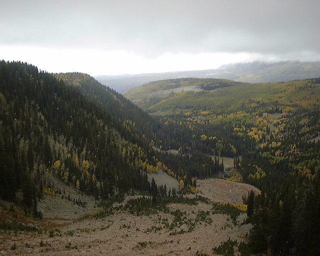 View towards the trailhead from a gully NW of Mt. Tukuhnikivatz.
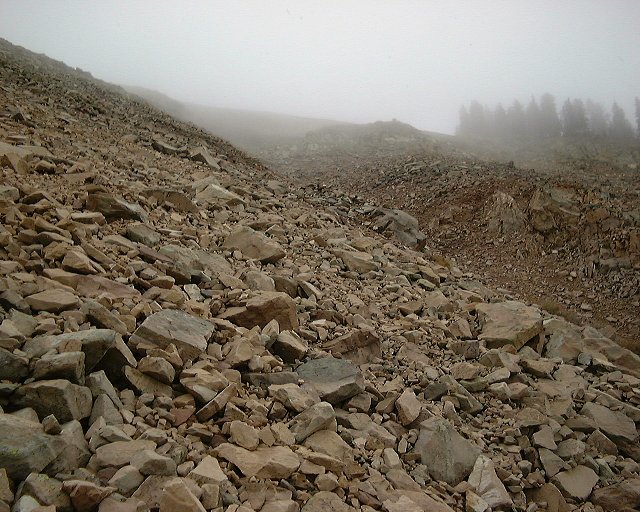 View up from the same spot.
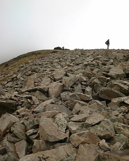 View towards the smaller peak NW of Mt. Tukuhnikivatz from about the treeline.
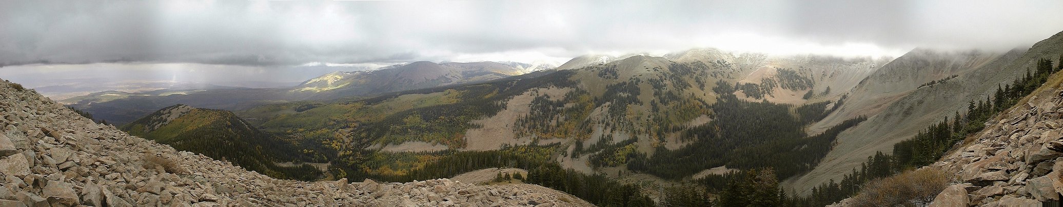 Panorama from about the highest point we got to.
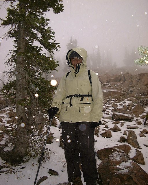
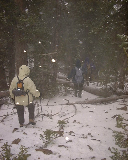 Back in the forest during the snow thunderstorm.
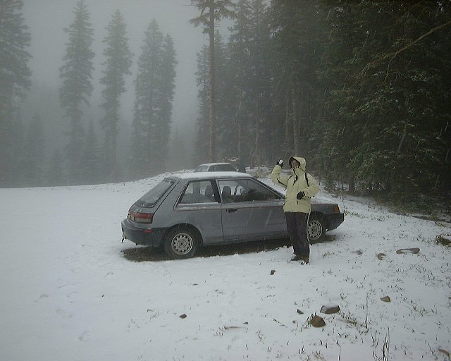
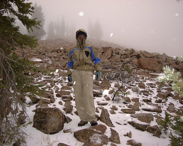
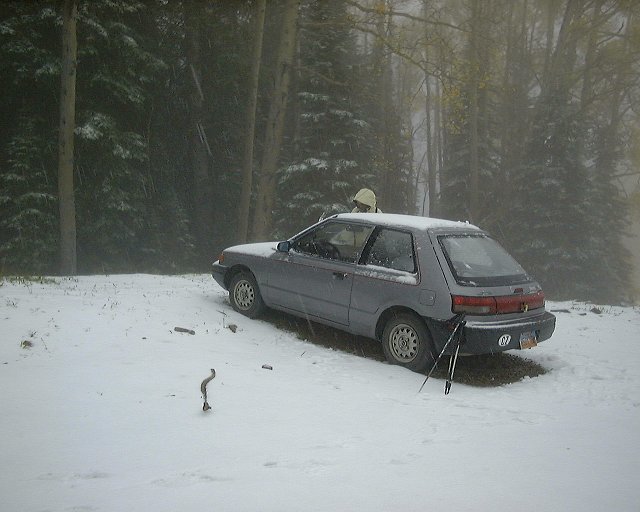 The trailhead when we got back.
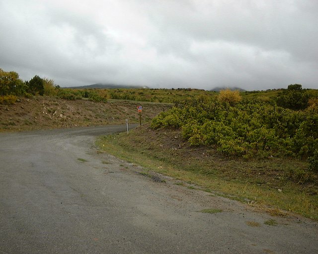 The mountains from the junction of the La Sal loop road and Gyeser Pass road.
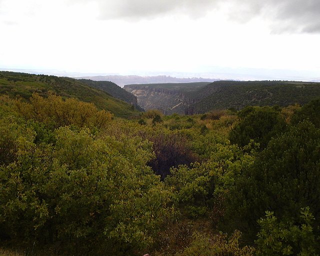 View down Mill Creek Canyon from the loop road.
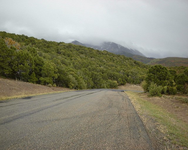 View towards Mt. Tukuhnikivatz from the loop road.
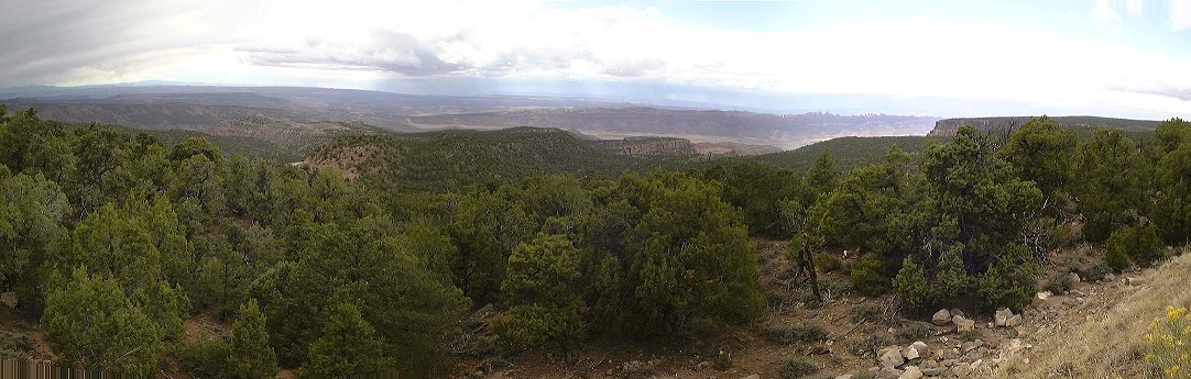 Panorama down towards Moab from the loop road.
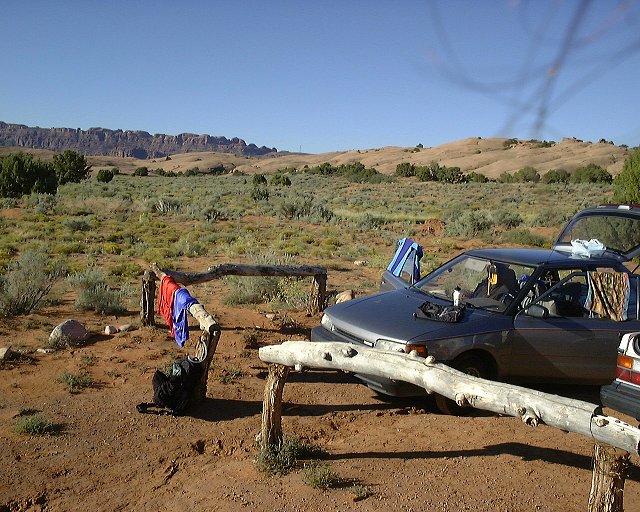 Sun. morning at the Sand Flats Cg., view towards Moab Rim.
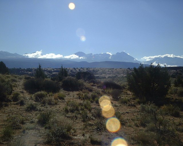 View towards the La Sals from Sand Flats.
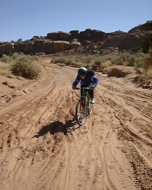
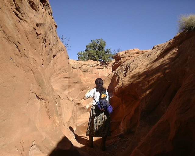
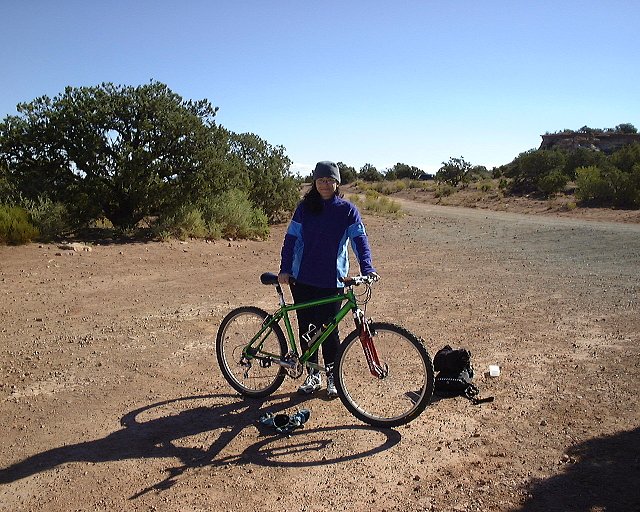 Starting the Gemini Bridges trail.
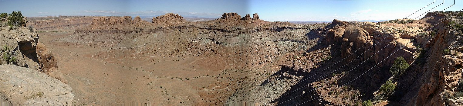 Panorama towards the Sevenmile Canyon, a small tributary in the front.
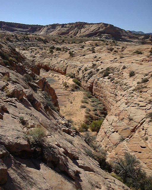
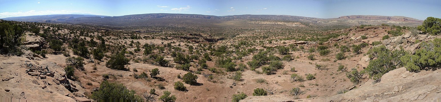 Panorama from the rim west of Moab Cyn. to the south, Archs Pasture is the flat area all around.
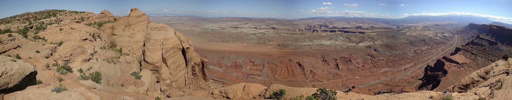 Panorama to the Moab Canyon from the rim west of it.
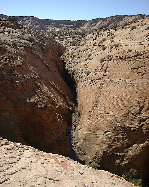
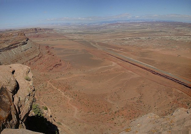 View from the rim west of Moab Canyon north.
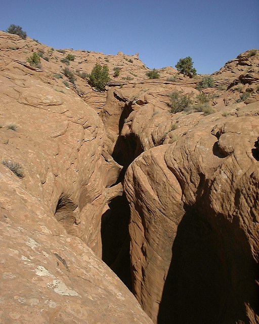
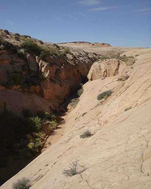
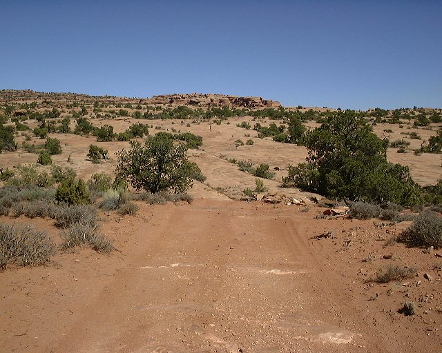 View up the rim south of Moab Canyon, one of the slickrock benches on which it was hard to find the trail.
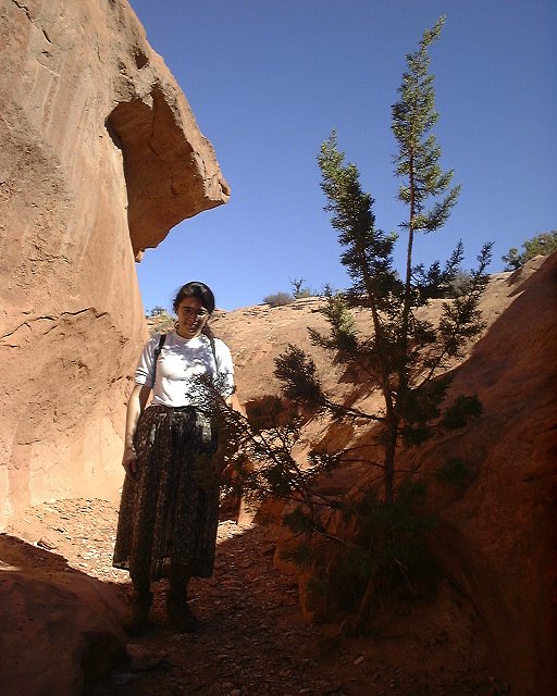
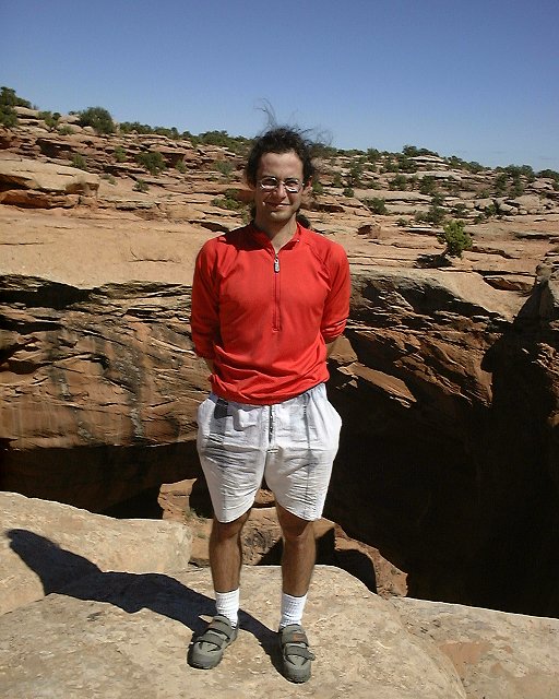 The two of us at the Gemini Bridges.
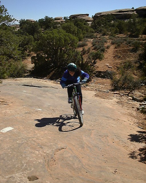
 Dina battling with the trail below Gemini Bridges.
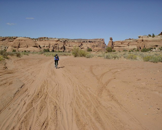 Trail in the Little Canyon.
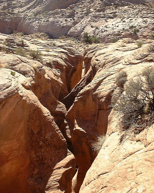
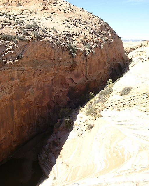
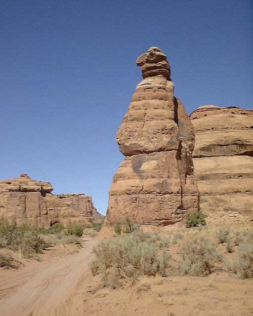 A bird-like rock guarding the entrance to the narrower part of Little Canyon.
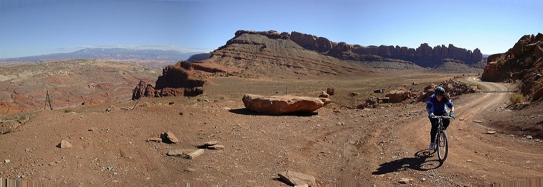 Climbing out of Little Cyn. towards Moab Cyn..
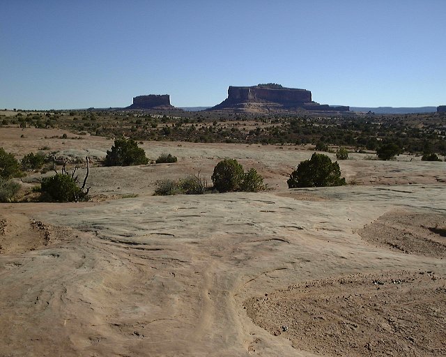 Monitor and Merrimac from the south part of the M&M loop (view south).
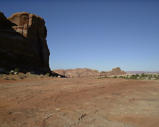 On the slicrock plateau on the M&M trail, looking NE.
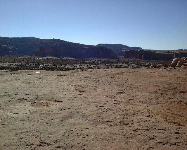 From the same spot looking SW towards Mill Cyn.
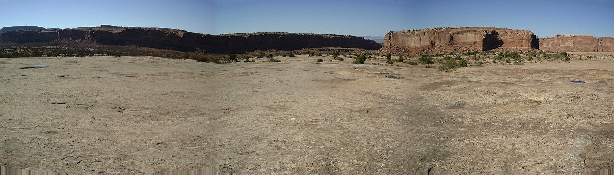 Panorama from the slicrock plateau west of Courthouse Rock towards N.
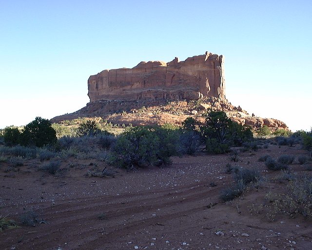 Monitor Butte from the slickrock plateau in between of Monitor and Merrimac.
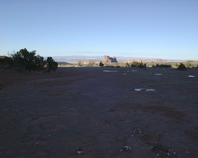 View towards Mill Cyn. from the same spot.
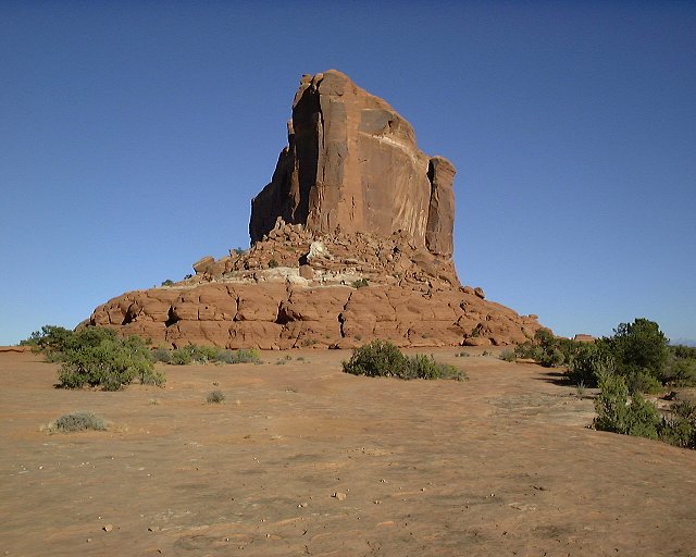 Monitor again, view of its narrow part.
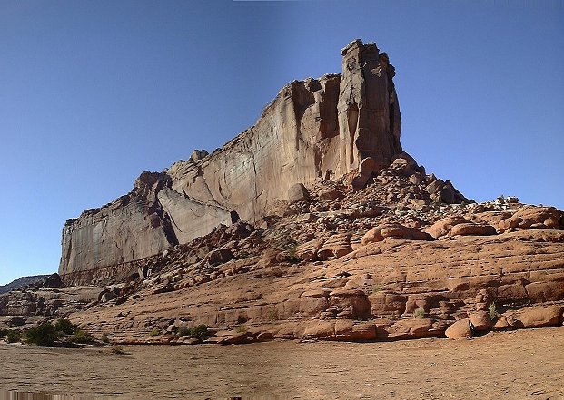 Merrimac Butte from the same spot.
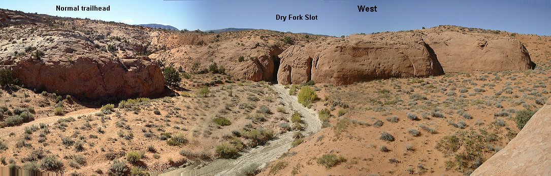
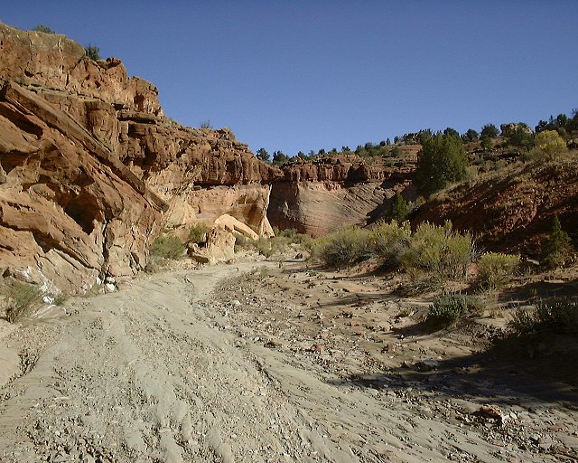
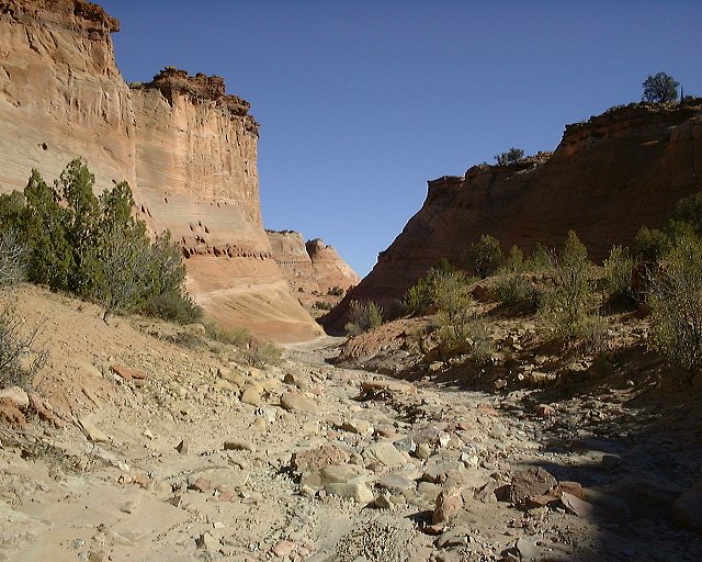
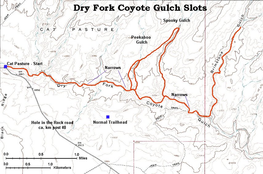
We can call this a fall slot canyon trip. I decided to go to Escalante, since this is one of the few areas in the state which I haven't mapped well yet. The trip from SLC to the town of Escalante took about 4.5 hours, trafic was light as we left about 7pm on a rainy Friday evening. The only excitement on the whole drive was an elk standing in the middle of the road on the Boulder Mountain road. We drove around it, it did not move. It took another 45 min. to cover the ca. 35 km on the Hole in the Rock road to the Dry Fork Coyote Gulch crossing, where we set out a camp.Weekend in the Escalante area
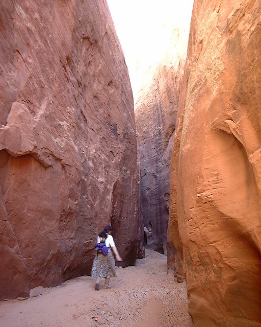
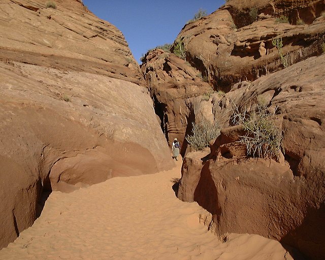
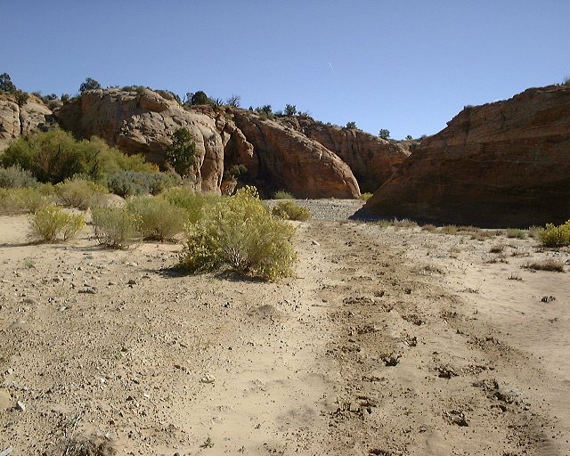
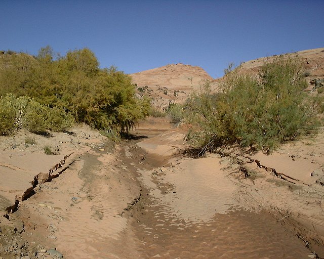
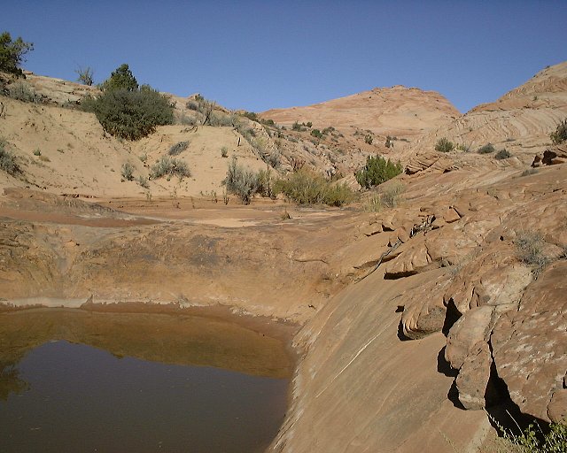
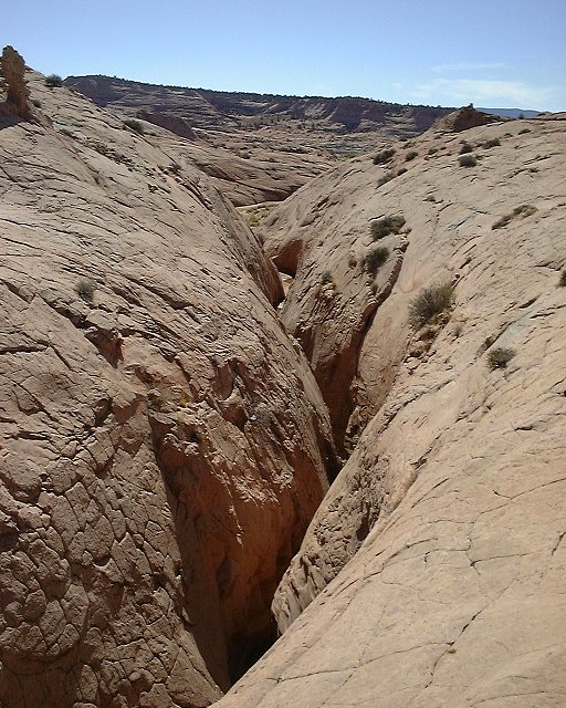
For Saturday, the plan was to walk Dry Fork down about 3 kms (part of which are narrows), and then explore three slots below this, Peekaboo, Spooky and Brimstone. The first km or so was just a walk in a wash, however, occasional muddy spots after the mid-week rain were not a good sign. Indeed, in the central narrows part od the Dry Fork were several water pools up to mid calf deep. We managed to scramble or jump around most of them, but the boots got very dirty. The last section of Dry Fork before Peekaboo was muddy, but no water. About 50 m after Dry Fork exits the narrows, on the left side, is the Peekaboo slot. Right at the entrance was about 4x4 m pool up to knee deep. From here, one has to climb about 2 m to the actual slot entrance, but there are steps in the stone. We threw several boulders into the pool and used an available branch as a ladder to get through the pool and up with dry feet. There are several more tricky dropoffs in Peekaboo, each about 1 m high. Climbing over them was difficult with boot soles full of mud and sand. Only later I learned, that they are considered to be class 4+ climbs. Actually, I ended up using rope to pull Dina and two more by-hikers up the most difficult part. Since both Dry Fork and Peekaboo proved to be more difficult than I though initally, we got out of Peekaboo at about 12.30, 3.5 hrs. after the hike start, and were already getting tired. We walked back to Dry Fork above the slot (there are many ways to get in and out of Dry Fork in this area), and continued down. We walked by Spooky and through a small set of another narrows in the Dry Fork towards Brimstone. There is a chokestone in these narrows, but climbing on the side of it was easy. It was about a 1 km walk up sandy Brimstone wash to reach the slot. It gets really narrow in about 100 m, it was so dark that I had to take off my sunglases, otherwise I would not see. There was about 8 m long section of water about 300 m from the entrance, up to knee deep. Then the slot continues God knows where. I walked up another ca. 500 m, until the slot got really tight and I could not push through anymore. At about 3.30pm, we got out of Brimstone and started walking back towards Spooky. Also this canyon is pretty narrow and fun, although not as long and dark as Brimstone. I would guess it's about 1 km long. There were some dropoffs, but nothing difficult. Then we walked back accross the plateau towards Peekaboo and above the Dry Fork rim back to the campsite, which took us almost until sunset.
Here I must note, that our trip was longer that most of the people do. The official Peekaboo,... trailhead is on the plateau south of Dry Fork very close to the Peekaboo (see map). Starting the trip there shortens it by about 6 km, but you miss the upper Dry Fork narrows. Also, one can walk up Peekaboo and down Spooky, thus making a little loop. I did not think about it until after.
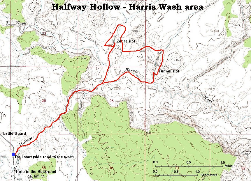
On Sunday, Dina was getting cold, so I ended up hiking in the morning alone. We drove back on the Hole in the Rock road towards the Harris Wash, where I wanted to check out two slots, Zebra and Tunnel. Both of these are tributaries of Harris Wash, which intersects the road at about km post. 8 (Hole in the Rock road posts are in kilometers, a welcomed feature). However, since these slots are some way east of the road, the shortest way to get to them is via Halfway Hollow, which intersects the road at ca. km post 14. The problem is, there are 3 washes like this crossing the road between km posts 10 and 14. Both the Kelsey's guide book and the topo map did not help in locating the right one. So, according to my findings, Halfway Hollow is the first wash after km post 15 if coming from Hole in the Rock, and the one right after a cattle guard at ca. km post 13. It took me slightly under 1 hr to walk down Halfway Hollow to Harris Wash. First, it's just a wash walk, but later it cuts through some sandstone. A prominent feature is a hanging fence about 1.5 km up from the junction with Harris, this way I finally got sure I am in the right wash. Another 15 min down Harris is the Tunnel Slot wash. There is a large pool with large bushes at the wash confluence with Harris. After about 300 m walk, one comes to the Tunnel Slot, with indeed looks like tunnel, about 2 m in diameter and very narrow higher up. There was a lot of water there, I tried to wade, but got only about 3 m. into the slot and the water was to my waist (I did that naked, as I did not meet anybody the whole hike). Since this way of getting through proved to be unsuccessful, I walked back down the canyon about 100 m, and then climbed on the sandstone plateau above the slot. The slot is about 50 m. long, and then the canyon continues up for about another 300 m. until it joins the sandstone plateau. So, apart from the tunnel, this slot is nothing special. I then walked on the plateau west towards Zebra, hoping to walk it down. This proved not to be possible, there are some huge potholes full of water in the upper part, with deep dropoffs. I then walked down the rim into the Zebra wash and back to the slot, which was also full of water, so I skipped the walk in. From the view above, it seems to be also quite short in length, about 100m. Its name comes from strippes of differently colored sandstone that forms its walls, however, I was unimpressed, the stripes, at least in what I could see without getting in the water, were very faint. After this, I walked back to the car, concluding the hike in about 3.5 hrs (supposedly 15 km long).
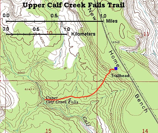
Because it was only about 2pm when I got back, and Dina felt better, we drove to Escalante to get some info at the local BLM office. We decided to stop on the way back for a short hike towards the upper Calf Creek falls, located off Hwy. 12 between Escalante and Boulder. I was surprised to see the vast sea slicrock that lies between these two cities, Calf Creek canyon is one of several that cut through it in the north-south direction. The upper Calf Creek falls trail starts about half in between mile posts 81 and 82, and goes down about 1.5 km to the falls. Since the descent is steep, it took us there and back about 1 hr. It's mostly a walk on the slickrock, the falls form a nice pool and above them, the creek runs on the sandstone with several small cascades and pools. We got back to the car at about 5pm and drove back to SLC, stopping for a dinner at, supposedly renown, Mom's Café in Salina. The food was good and moderately priced, althoug I would not mind more mashed potatoes next time.
Pictures
Map (160 kB) of the Dry Fork area.
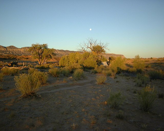 Sat. morning at the Dry Fork campsite, view west, Straight Cliffs and moon in the back.
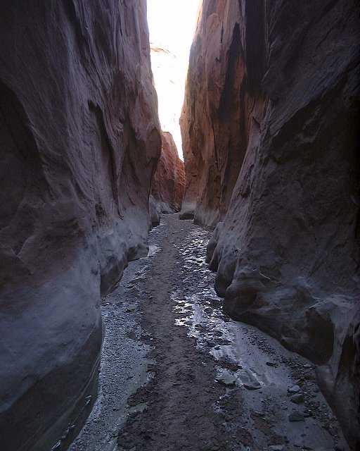
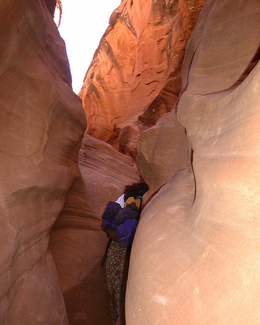
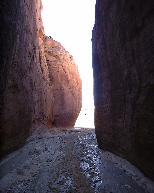
 Shots from Dry Fork (not so dry) narrows.
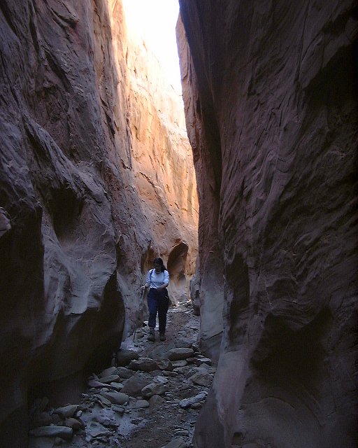
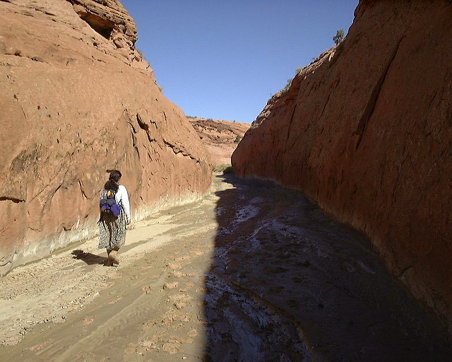
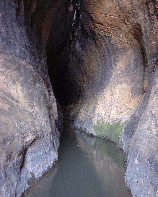
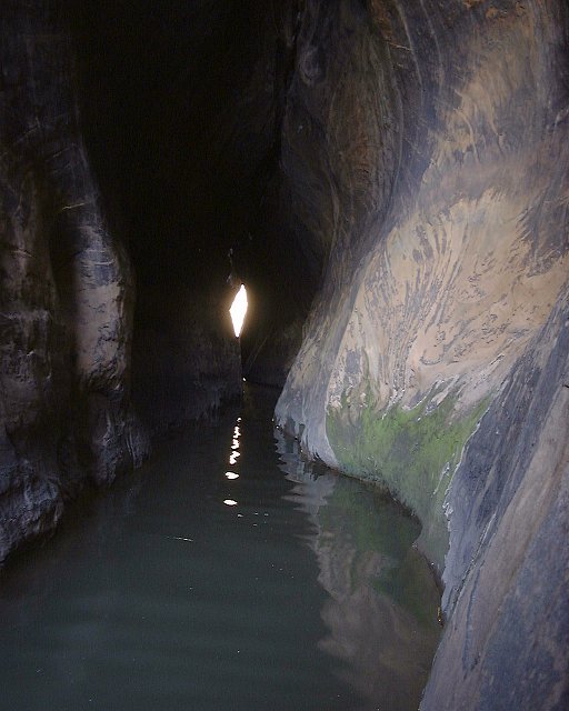
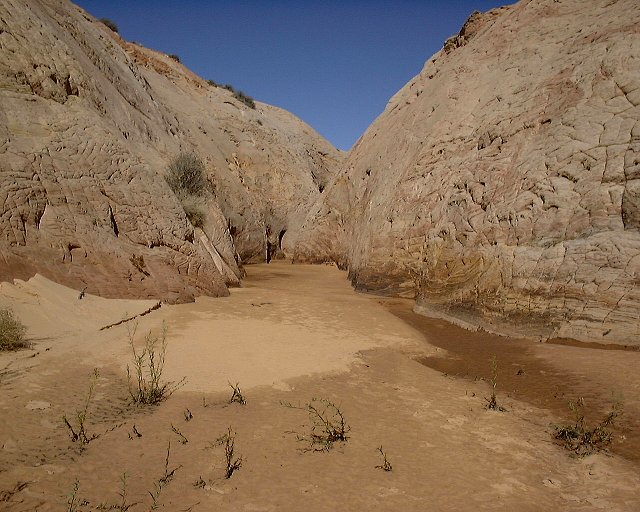
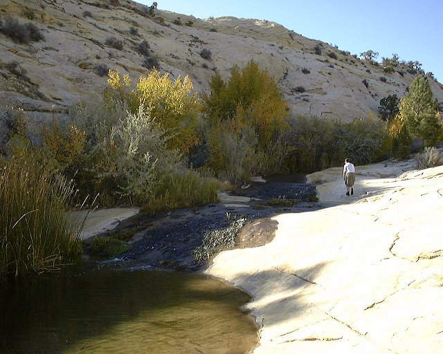
 The lower Dry Fork narrows with just a muddy trail.
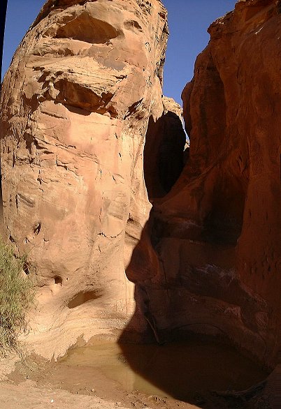
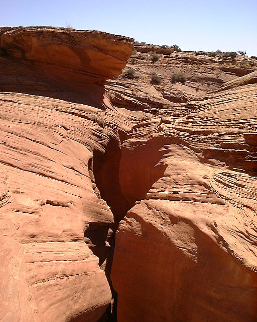
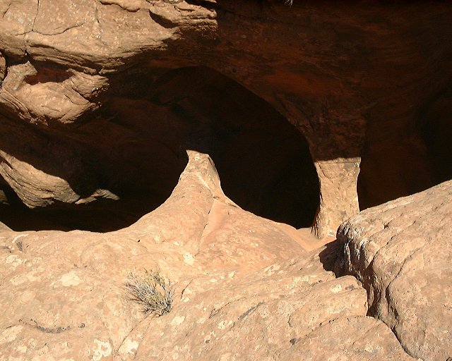
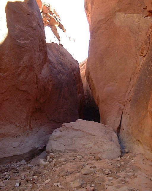
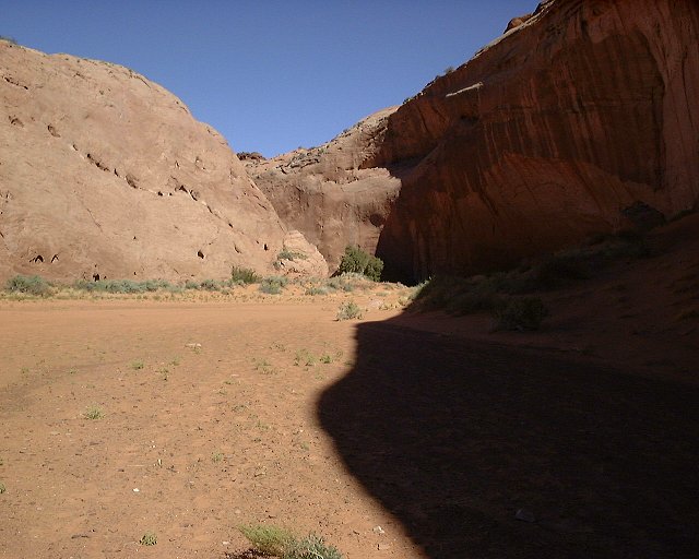
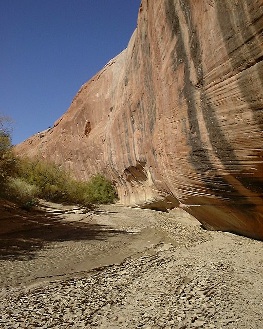
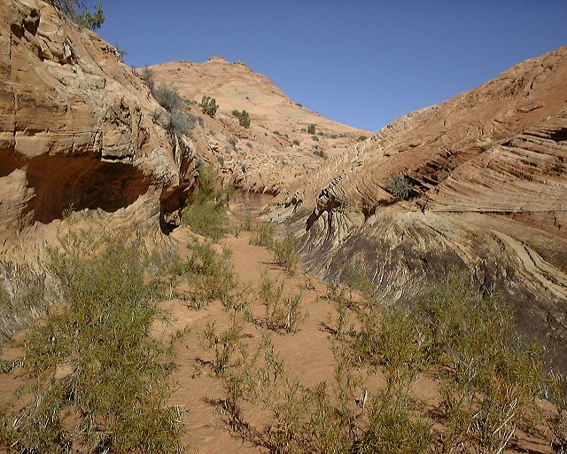
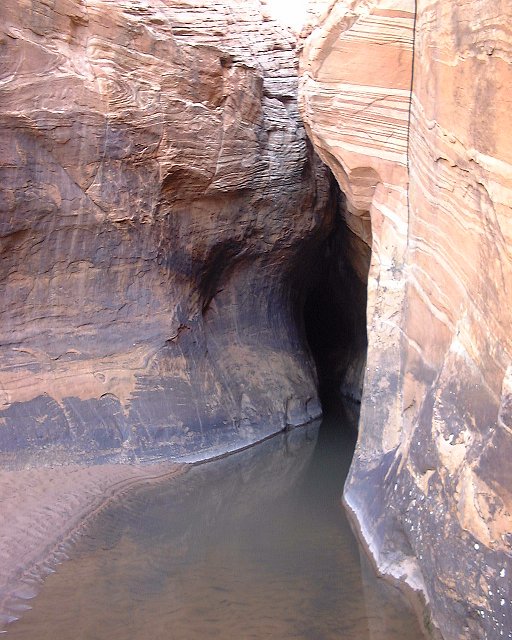
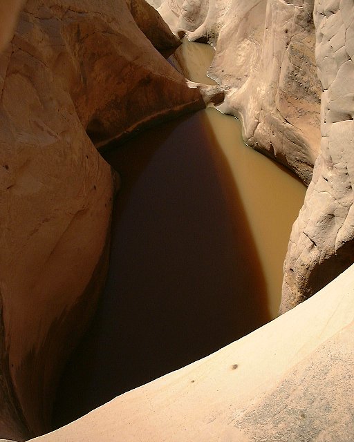
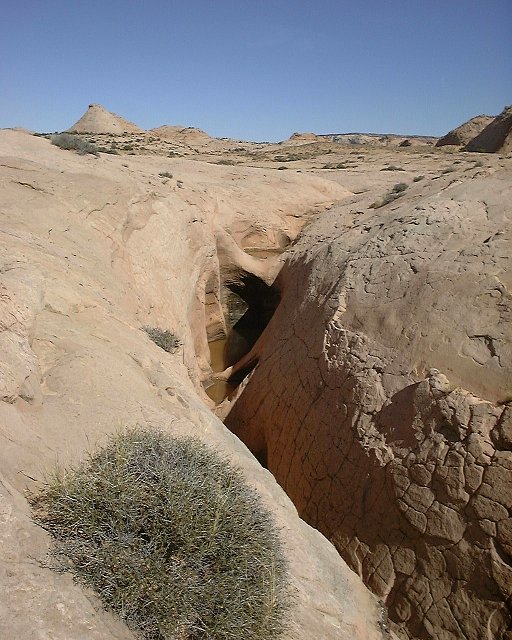
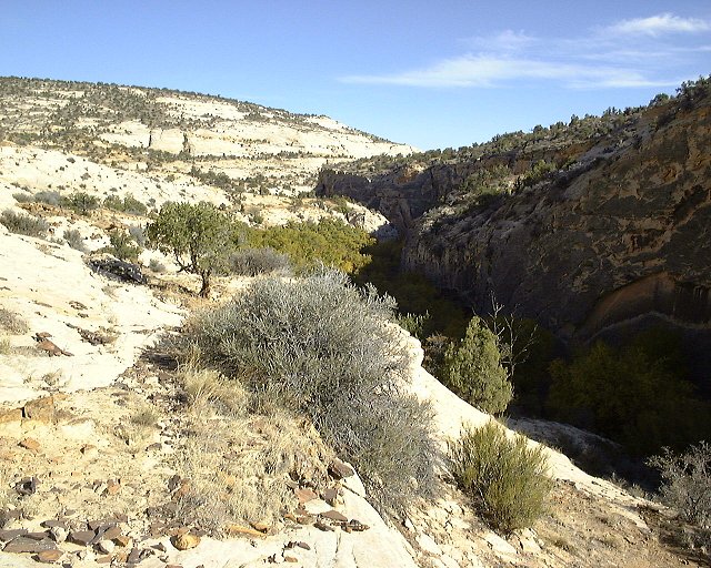
 The end of Dry Fork narrows (the black hole on the right side) from about where Peekaboo is. The official trail comes down from the valley on the left.
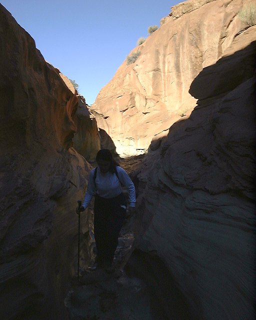
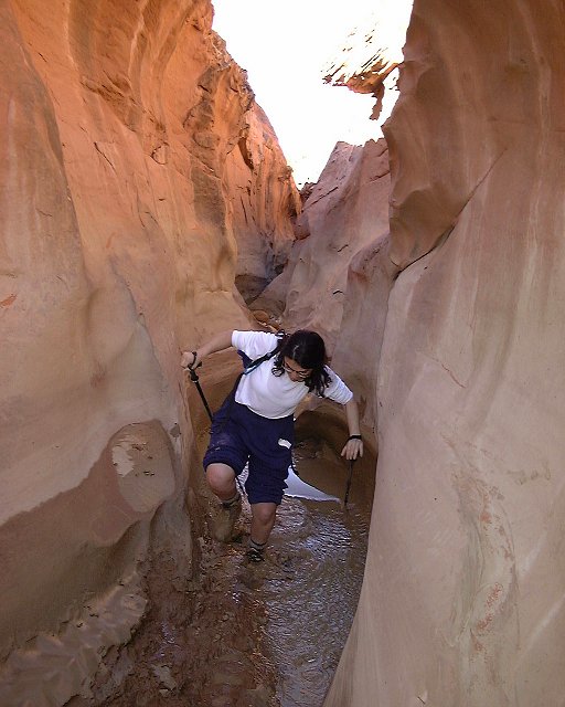
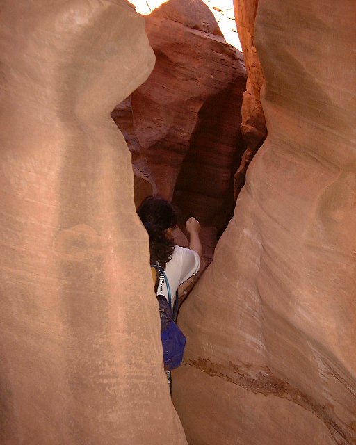
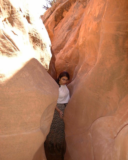
 Entrance to the Peekaboo slot.
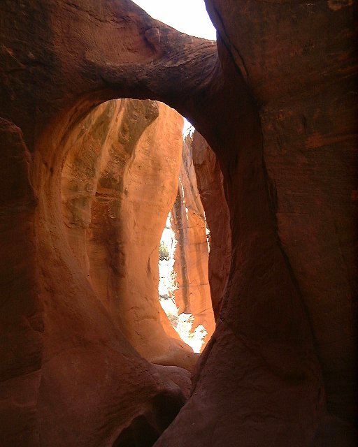
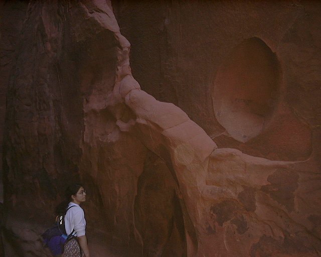
 Lower part of Peekaboo with the natural arch.
 View down from the same spot.
 The arch again.
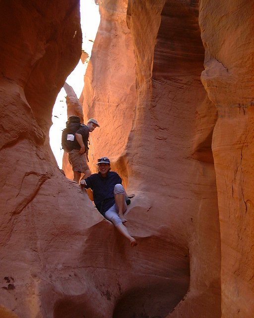 The two we met in Peekaboo at one of the more difficult dropoffs.
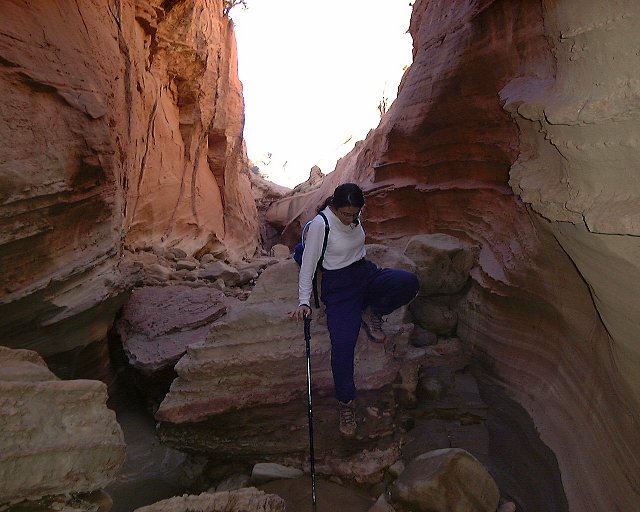
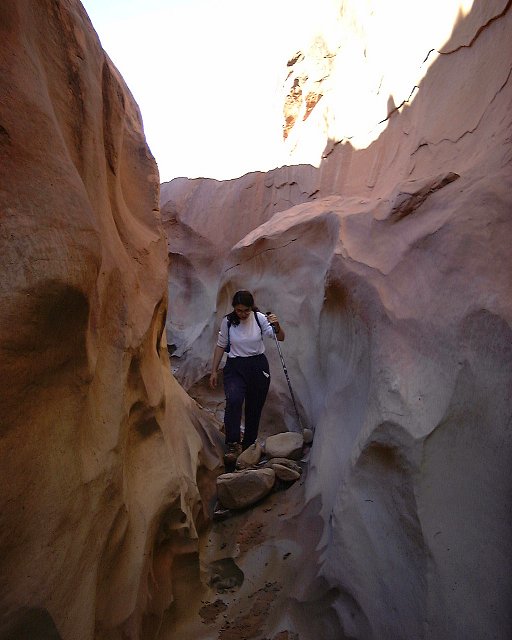
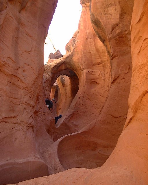
 Shots from the central part of Peekaboo.
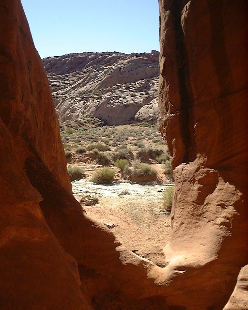
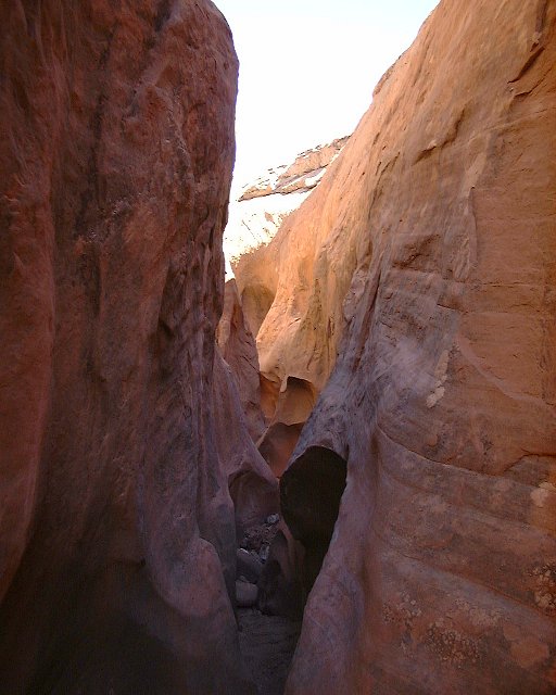
 Then it widens a bit, one can get out of the slot here.
 A lone juniper growing in the slot (accompanied by a Mormon settler).
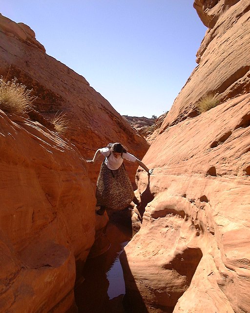
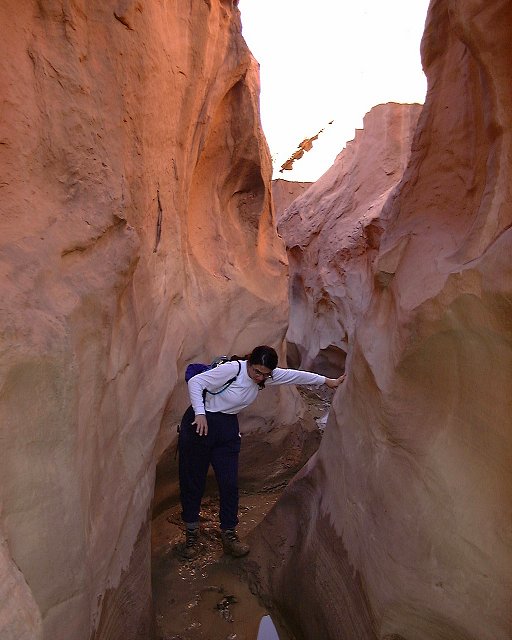
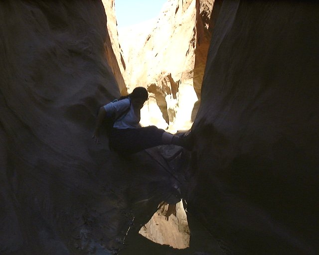
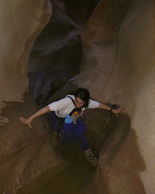
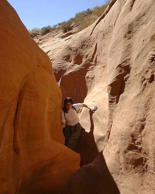
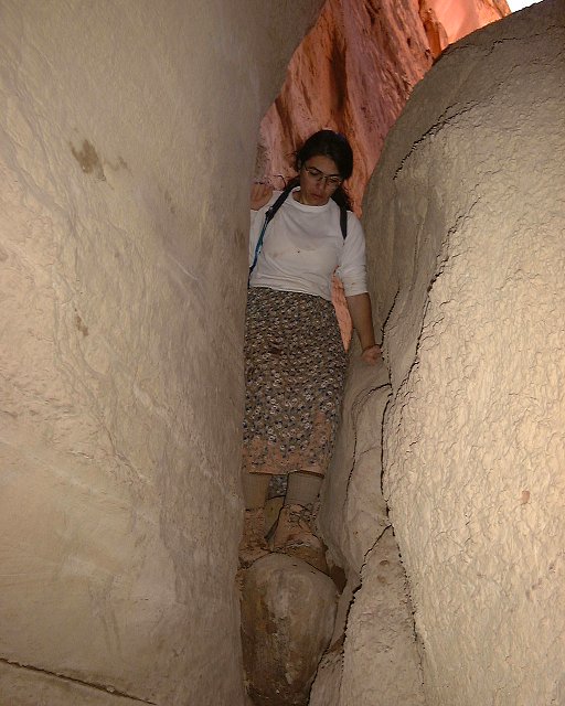
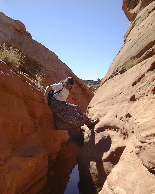 Dina shows two techniques how to get accross the water in the middle Peekaboo.
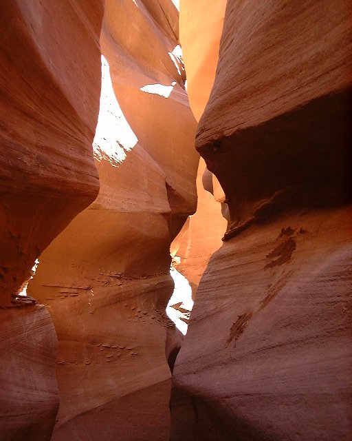 A nice play of shades and sun in the middle Peekaboo.
 Middle Peekaboo from above.
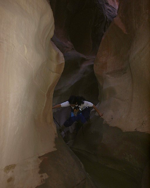
 Upper Peekaboo shots.
 The end (beginnig ??) of the Peekaboo slot.
 Shots of Peekaboo from above.
 The arch in Peekaboo from above.
 Panorama from the plateau above Peekaboo.
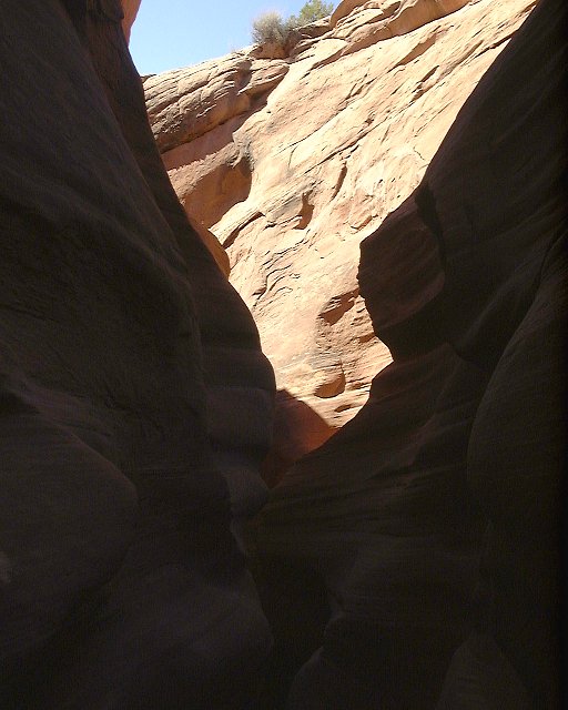
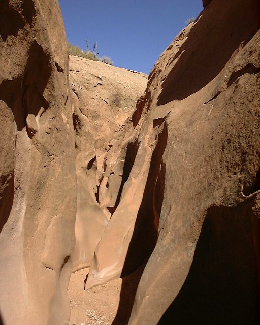
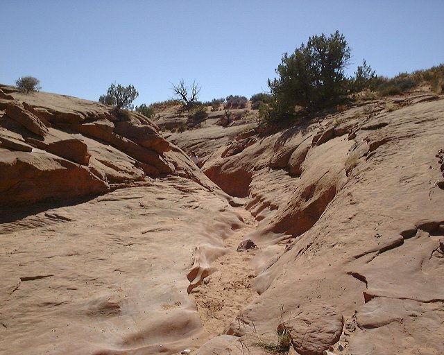
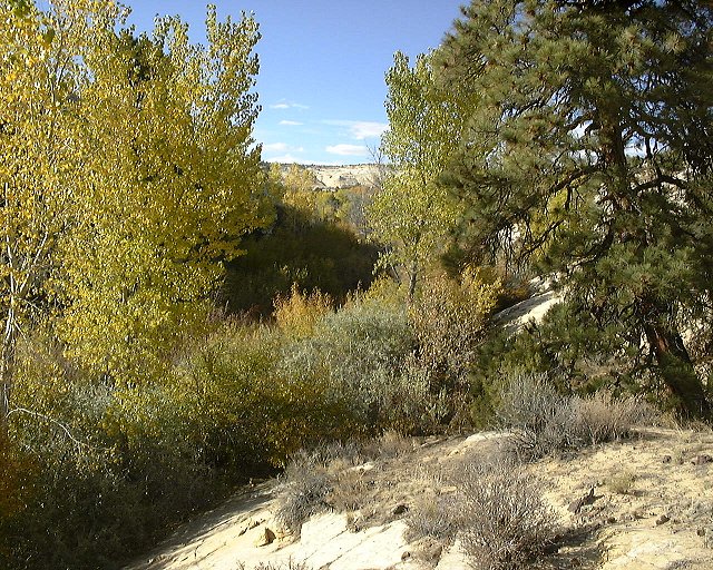
 A small narrow section of Dry Fork right below Spooky.
 The chokestone in the lower Dry Fork narrows.
 Dina getting down around it.
 Cool wedged stones a bit below.
 Sand dune in the lower Brimstone wash.
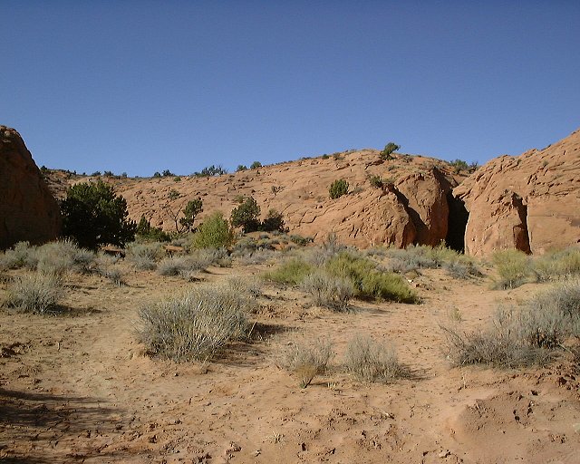
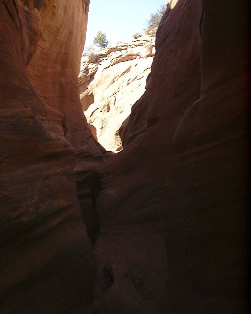
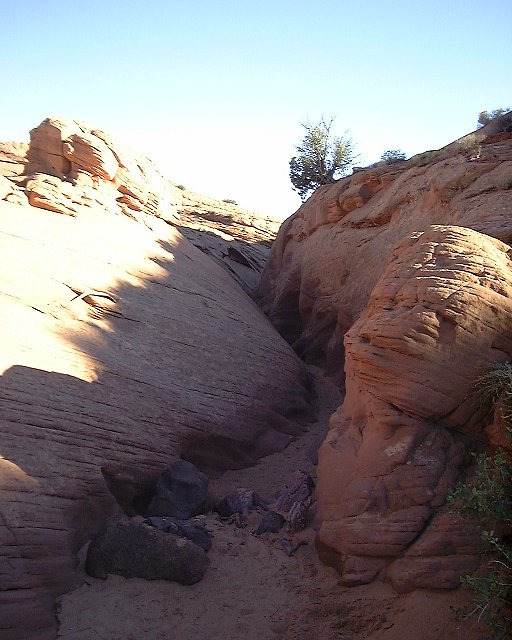
 Entrance to the Brimstone slot.
 Beginning narrows at Brimstone.
 Interesting rock formation at lower Brimstone.
 Shots from Brimstone as we went up (multiple photo page). Most of the picts are pretty dark, because it was pretty dark there.
 Entrance to Spooky slot.
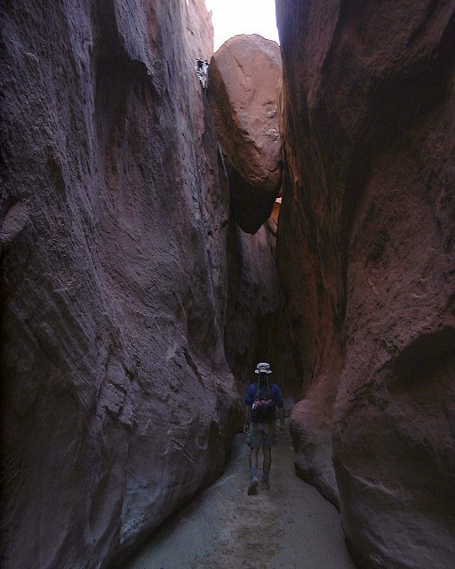
Shots from Spooky as we went up (multiple photo page).
 Top of Spooky when the slot turns back into wash.
Map (220 kB) of the Halfway Hollow - Harris Wash area.
 Two shots from the central part of Halfway Hollow.
 Hanging fence across Halfway Hollow a bit more down.
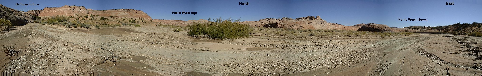 Panorama from confluence of Halfway Hollow and Harris Wash.
 Harris Wash undercutting the sandstone wall about 300 m below the confluence with Halfway Hollow.
 Harris Wash below confluence with Tunnel Wash.
 Tunnel Wash from Harris Wash, note the pool under the bushes.
 Closeup of the pool with Tunnel wash up.
 Tunnel Wash another 100 m up from the pool. It was pretty wet here
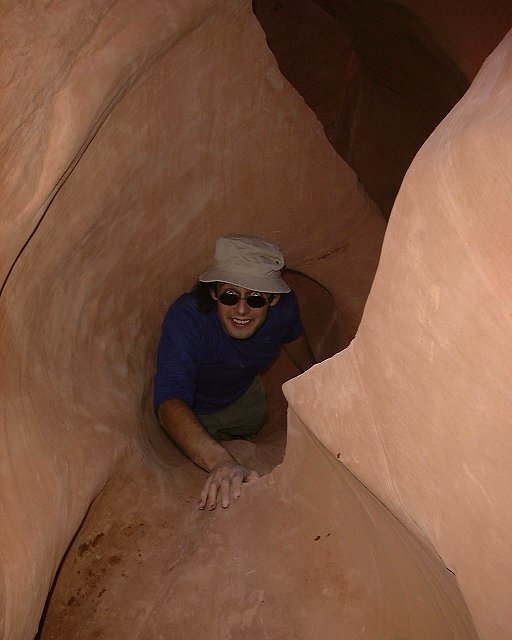
 Tunnel slot from the water.
 Tunnel slot from the above.
 Uppper part of the Tunnel canyon.
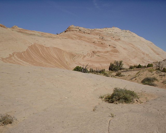
 Tunnel wash on the sandstone plateau above the narrows.
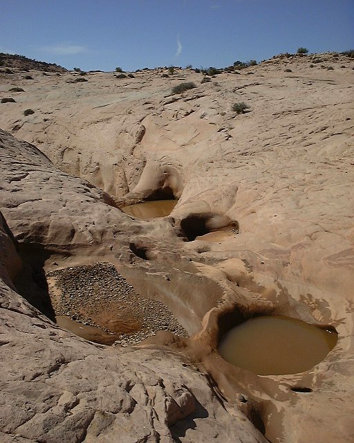
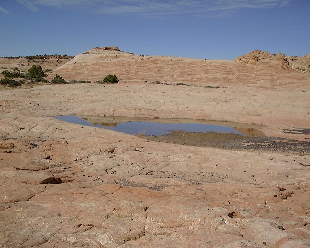 Water pool on the plateau.
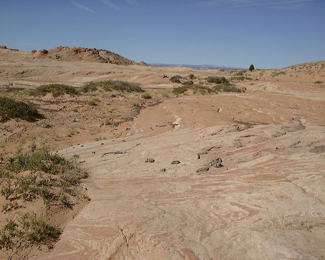
 Panorama of Harris Wash from the plateau north of it.
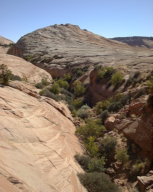
 Wave-like formation on a nearby hill.
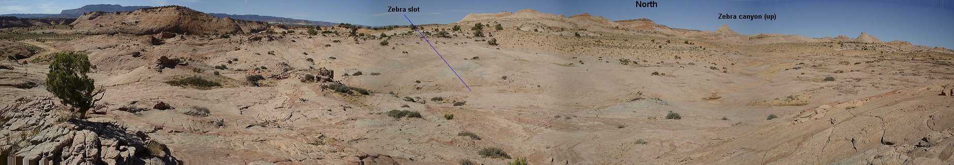 Panorama from above Zebra slot.
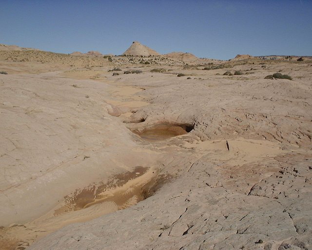
 Potholes above Zebra slot.
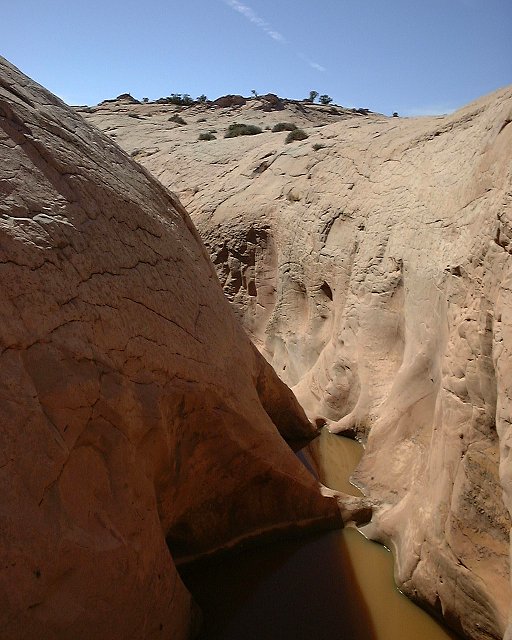
 Zebra slot from above.
 Entry to the Zebra slot.
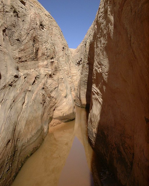 Shot of Zebra slot from as far as where I got (not too far).
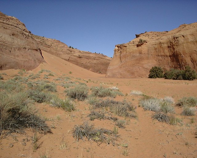
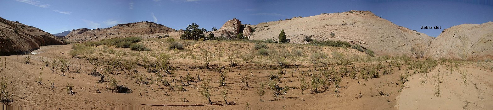 Panorama from Zebra wash a bit below the slot.
Map (120 kB) of the upper Calf Creek falls trail.
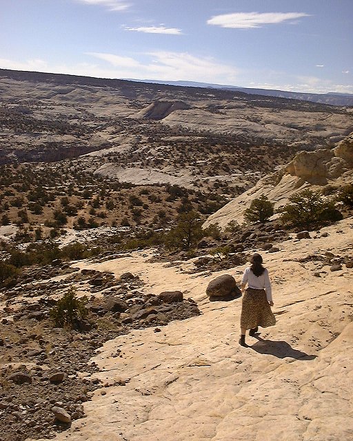 Going down the slickrock bench towards the falls.
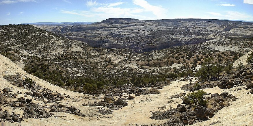 Calf Creek canyon panorama from the bench.
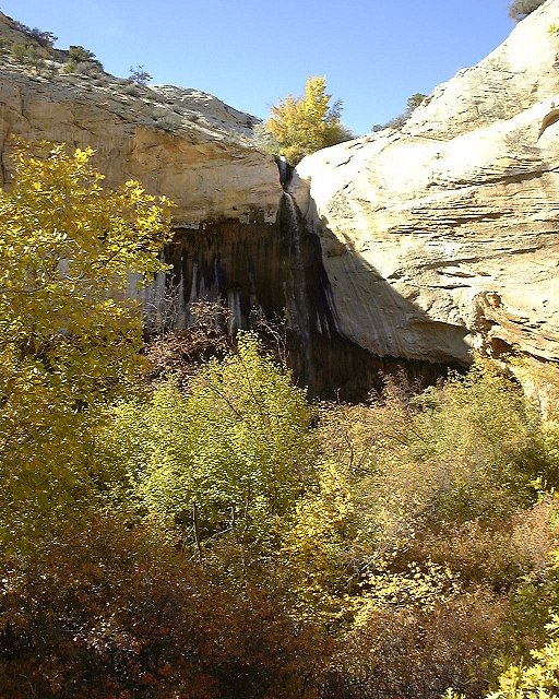 The falls hidden behind the vegetation.
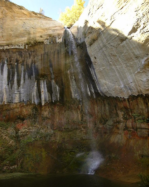 Closer look at the falls.
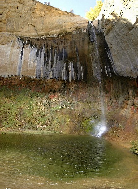 Combined shot of the falls.
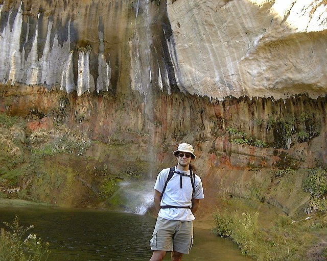 Me under the falls.
 Calf Creek canyon below the falls.
 Area above the falls.
U of U / Chemistry / HEC / Voth Group / Cuma / Travel / English / Fall 00
URL: http://voth.chem.utah.edu/~mcuma/fall00e.html