Skip map to see list of images
Or:
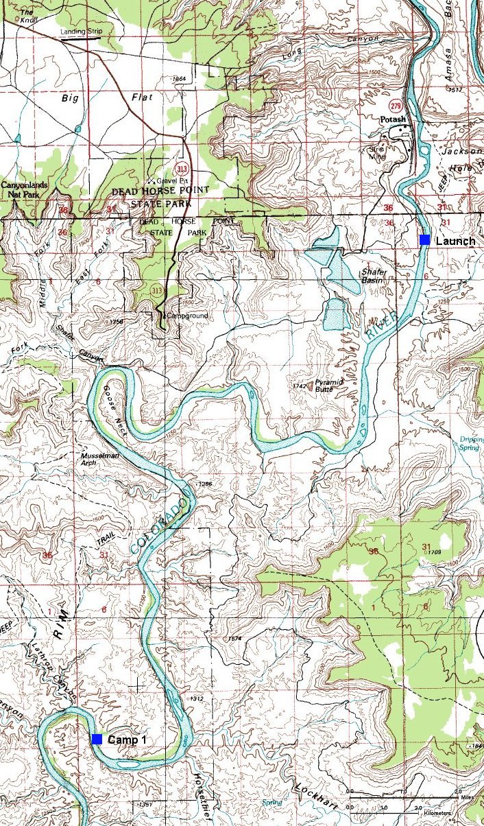
Follow the river with the mouse.
Hold mouse over the map where the cursor changes to hand to see the description.
Click to view the image.

 1. My sleep spot in the tamarisks on the river bank
 2. Panorama of the launch ramp shortly before the launch
 3. View upstream several miles from the launch
 4. View downstream several miles from the launch
 5. A look upstream another mile or so later
 6. View at the right river bank with Pyramid Butte
 7. View downstream from the same spot
 8. Lunch foto 1
 9. Lunch foto 2
 10. Lunch foto 3
 11. Look at Dead Horse Point from the east
 12. View downstream from the same spot
 13. View past the river bend
 14. Dead Horse Point panorama from the Goose Neck
 15. A look upstream towards Dead Horse Point past Goose Neck
 16. View downstream from the same spot
 17. View to the river left from the same spot
 18. Canyonlands NP border sign
 19. A look downstream towards a large mesa on which is the Canyonlands overlook
 20. A look at the river left with a few herons in the middle of the foto
 21. View at the Canyonlands overlook mesa near the river bend
 22. A look at river right near Lockhart Canyon
 23. Mouth of Lockhart Canyon
 24. Look upstream nearby the campspot in the late afternoon
 25. View downstream from the same spot

 1. My sleep spot in the tamarisks on the river bank
 2. Panorama of the launch ramp shortly before the launch
 3. View upstream several miles from the launch
 4. View downstream several miles from the launch
 5. A look upstream another mile or so later
 6. View at the right river bank with Pyramid Butte
 7. View downstream from the same spot
 8. Lunch foto 1
 9. Lunch foto 2
 10. Lunch foto 3
 11. Look at Dead Horse Point from the east
 12. View downstream from the same spot
 13. View past the river bend
 14. Dead Horse Point panorama from the Goose Neck
 15. A look upstream towards Dead Horse Point past Goose Neck
 16. View downstream from the same spot
 17. View to the river left from the same spot
 18. Canyonlands NP border sign
 19. A look downstream towards a large mesa on which is the Canyonlands overlook
 20. A look at the river left with a few herons in the middle of the foto
 21. View at the Canyonlands overlook mesa near the river bend
 22. A look at river right near Lockhart Canyon
 23. Mouth of Lockhart Canyon
 24. Look upstream nearby the campspot in the late afternoon
 25. View downstream from the same spot