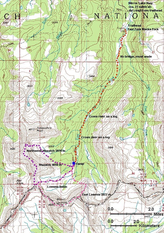
Skip map to see list of images
Or:
Follow the trail with the mouse.
Hold mouse over the map where the cursor changes to hand to see the description.
Click to view the image.
1. Campsite at the trailhead
2. Crossing the Little East Fork creek
3. Look north across the Little East Fork creek
4. Junction of East and Little East Fork Trails, view south
5. Crossing the river, water is very cold
6. Campsite panorama to the east
7. Saturday evening at the campsite
8. Walking up the Lovenia Basin towards the Red Knob Pass
9. On the top of Wasatch Peak, view west
10. On the top of Wasatch Peak, view north-east
11. 360 deg. panorama from the Northwest Wasatch
12. Ridge Wasatch-NW Wasatch from the NW Wasatch
13. View towards Wasatch, Lovenia
14. West Fork Blacks Fork from the saddle
15. Going down from the saddle
16. "Skiing" down a snow field
17. Upper East Fork from below the saddle
18. Wasatch-NW Wasatch ridge from the valley
19. Meadow with a lake on the way back
20. Trail right above the camp
21. Trail almost at the Lovenia Basin
22. North side of the Lovenia Basin
23. South side of the Lovenia Basin
24. View from the Red Knob Pass east, into Lovenia Basin
25. View from the Red Knob saddle east
26. On Lovenia, view east
27. View from Lovenia to the west, Wasatch Mountains in the background
28. Lovenia ridge to the east
29. Step we had to climb down in the Lovenia-East Lovenia pass
30. East Lovenia 360 deg. panorama
31. View from E. Lovenia east
32. Upper E. Lovenia north-east ridge with some tricky sections
33. Upper East Fork from the E. Lovenia slopes
34. End of the trip at the trailhead parking lot