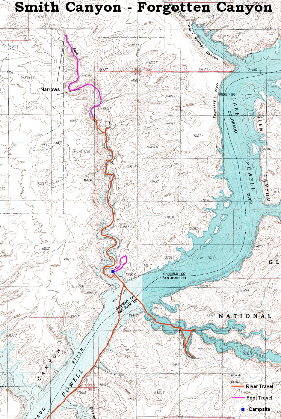
Skip map to see list of images
Or:
Follow the trail with the mouse.
Hold mouse over the map where the cursor changes to hand to see the description.
Click to view the image.

1. Starting to cross the river towards Smiths Canyon
2. Heading into Smiths Canyon
3. Doing the first turn in Smiths Canyon
4. Another turn in the canyon
5. Somewhat straighter section
6. Another turn coming
7. Getting closer to the narrower end
8. A small side canyon, with some cottonwood tree trunks
9. End of the small canyon
10. Last, narrow stretch
11. End of lake
12. Walking under the high water mark, note the desolate canyon floor
13. First side canyon
14. Greenery on the canyon floor above the high water mark
15. Another green canyon floor shot
16. View into the beginning of the real narrows
17. Huge desert-varnished wall at the narrows entrance
18. A wavy narrow little further up
19. Somewhat rocky bottom
20. The slot looks like this for a while
21. Bypassing a small chokestone on a ledge
22. Going down from the ledge
23. The canyon about as far as we got
24. After dinner at the camp
25. Morning panorama of the upper Smiths Canyon
26. Closeup of one of the first meanders
27. Circles in the water after I threw some stones from the rim
28. View north towards Henry Mountains
29. View south-west with Navajo Mountain
30. A look at our de-luxe campground
31. Mouth of Forgotten Canyon
32. Sign at the mouth of Forgotten Canyon
33. Floating toilet in the second bay of Forgotten Canyon
34. Panorama in the third bay in the canyon
35. Alcovy end of the right fork
36. View up the wall of the alcove
37. View towards the outlet from the alcove
38. View out of the right fork
