Skip map to see list of images
Or:
Follow the trail with the mouse.
Hold mouse over the map where the cursor changes to hand to see the description.
Click to view the image.
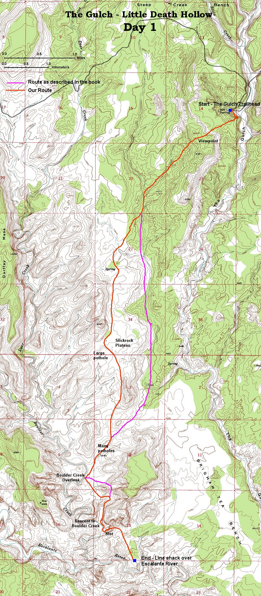
1. View from the trailhead east
2. The trailhead and small canyon to the west
3. Climbing up the bench above the Gulch
4. Panorama from the bench north, Burr Trail road below
5. 360 deg. panorama from the viewpoint hill
6. View north to the viewpoint hill from the wash below
7. View south down the wash
8. Large pothole in the wash
9. Panorama south and east from the first snack spot
10. Panorama of the slicrock plateau north towards peak 6167
11. Panorama south with the first drainage towards Boulder Creek
12. Upper part of the potholes drainage
13. Detail of one of the potholes
14. Potholes at our lunch spot
15. North part of Boulder Creek narrows
16. South part of Boulder Creek narrows
17. On the Bouder Creek overlook, about 20 m. dropoff below
18. Sandstone domes east of Boulder Creek overlook
19. Small slots which can be used to descend into the valley leading back to Boulder Creek
20. Dropoff at the end of the canyon above Boulder Creek, must continue down the stream on a bench above the creek
21. Boulder Creek bend in the area where one descends to the creek
22. The short canyon used to descend to Boulder Creek
23. Last few steps to the Boulder Creek
24. Entrance to the Boulder Creek exit slot
25. Climbing over the first obstacles
26. Upper part of the slot
27. View down the slot from the upper part
28. Sandstone amphitheater right after getting out of the slot
29. Walking towards the plateau over Escalante River
30. View south towards the plateau where is the line shack
31. View down to the Escalante River canyon
32. The trail down to the Escalante River