Skip map to see list of images
Or:
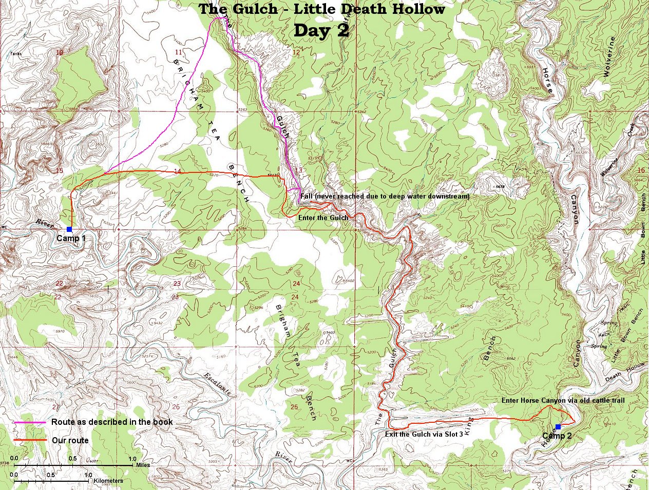
Follow the trail with the mouse.
Hold mouse over the map where the cursor changes to hand to see the description.
Click to view the image.

1. Camp at the line shack in the morning
2. 360 deg. panorama from hill 5412 above The Gulch
3. Upper part of the Gulch narrows
4. View south towards the bend in the Gulch
5. Walking on the slickrock towards the bend
6. The bend from a bench south of it
7. Walking down from the first bench
8. Walking down from the first bench contd.
9. Trail on the second bench before it descends to the creek
10. Start of the real narrows (wading required)
11. Wading upstream in the narrows
12. Wading near where the waist-deep water stopped our advancement
13. View from the bench above the narrows upstream where we turned around
14. Estuary of Halfway Hollow
15. Narrower part with a log jam
16. View downstream in a slightly wider area
17. Beaver's work and some snow
18. View upstream in another wider area
19. View downstream, note the bushes around, a typical feature
20. One of the bends in the lower Gulch
21. Wading near the exit
22. View west towards the Gulch from a first bench leading to the third slot
23. View up Slot 3 from the first bench
24. Climbing up the largest obstacle in Slot 3, part. 1
25. Climbing up the largest obstacle in Slot 3, part. 2
26. Climbing up the bench north of Slot 3
27. View into Slot 3 from the bench above
28. Panorama from the bench between slots 2 and 3
29. Panorama east towards Horse Canyon
30. Steep old cattle trail down to Horse Canyon
