Millcreek Canyon
We mostly hike in the surrounding Wasatch Mountains. Around SLC are several canyons which serve as hubs for the trails. My trips are divided according to them.
Millcreek Canyon
Big Cottonwood Canyon
Little Cottonwood Canyon
Others:
Wasatch Front
Around Provo
West of SLC
North of SLC
Millcreek Canyon
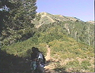
Mount Aire trail
Hike to the top of the mountain, 2-3 hrs. round trip.
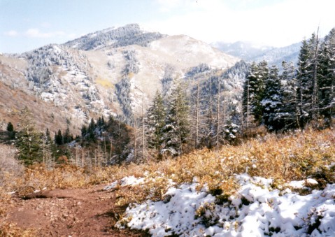
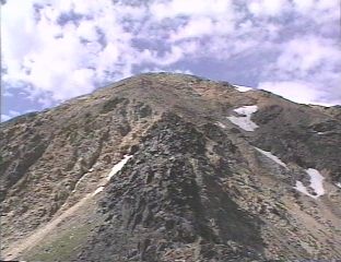
![]() View to the south, into the Millcreek Canyon.
View to the south, into the Millcreek Canyon.
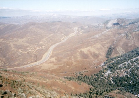
![]() View at the Parley's Canyon with Interstate 80.
View at the Parley's Canyon with Interstate 80.
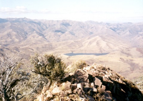
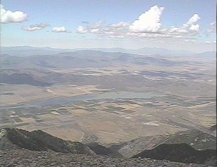
![]() View to the north, to the Little Dell reservoir.
View to the north, to the Little Dell reservoir.
Clickable map of Big Cottonwood (150 kB)
Clickable map of Little Cottonwood (120 kB).
Another trail to the Timp goes from the north, it's called Timpooneke trail, also about 6 miles one way (well, my guide says 9 miles, but I don't think it's that long), less steep than the Aspen grove (starts at 2230 m), but also less scenic (in my opinion). We did this one in fall 1999, 6 hours with a loop going down the "glacier" and back north, the fall colors were, unfortunately, fading out already.
U of U / Chemistry / HEC / Voth Group / Cuma / Travel / English / Hikes Big Cottonwood Canyon
Mount Raymond and Gobblers Knob
Two highest mountains between Big Cottonwood and Millcreek. First is 3122 m., second 3124 m. Both are pretty flat, no scrambling,... We started at 8. in the morning in Buttler Fork at 2200 m., were back at 1.30. Typical power hike.
Clayton Pk. - Sunset Pk. ridge
Ridge east to south around the Brighton bowl on the top of Big Cottonwood. Ca. 2 miles to the ridge, then 2.5 miles on it and 2 miles back to the parking lot. Here is map of the area and here pictures from the hike.
Mt. Millicent
This mountain (3187 m.) is right above the Brighton area. I hiked it up in early November 1999, relatively short hike, probably 2.5 miles one way, but we mostly went off the trail so that made it longer. The ridge and summit access are basically a boulder hopping.
![]() Gayathri hopping up the boulders near the summit.
Gayathri hopping up the boulders near the summit.
![]() View from the summit east towards Lake Mary.
View from the summit east towards Lake Mary.
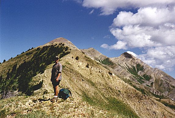
Ridge Sundial Peak - Dromedary Peak
Whole day trip, from ca. 1900 m. at the Broads Fork trailhead to Lake Blanche (2716 m.) and up to the Sundial Peak (10320 ft.), then 2-3 km on the ridge to Dromedary Peak (3386 m.) and back down to the Lake Blanche.
![]() Mill B Fork with Lake Lillian from Sundial Peak.
Mill B Fork with Lake Lillian from Sundial Peak.
![]() Mt. Raymond and Gobblers Knob from Sundial Peak.
Mt. Raymond and Gobblers Knob from Sundial Peak.
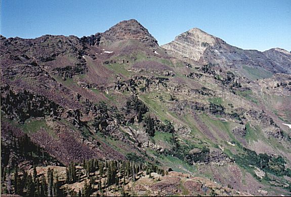
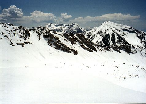
![]() Whole ridge between Little Cottonwood and American Fork Canyons from unnamed peak (3363 m.) on the ridge (combined foto 350 kB, with names of the peaks).
Whole ridge between Little Cottonwood and American Fork Canyons from unnamed peak (3363 m.) on the ridge (combined foto 350 kB, with names of the peaks).
![]() The ridge I went on from that unnamed peak towards Sunrise Pk. and Broads Fork Twin Pks. (view westwards).
The ridge I went on from that unnamed peak towards Sunrise Pk. and Broads Fork Twin Pks. (view westwards).
![]() Mt. Superior from the same spot, view eastwards with me in the front.
Mt. Superior from the same spot, view eastwards with me in the front.
![]() Sunrise Pk. from Dromedary Pk.
Sunrise Pk. from Dromedary Pk.
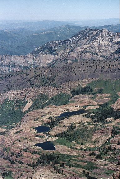
![]() Three lakes, Blanche, Florence and Lillian from Dromedary Pk.
Three lakes, Blanche, Florence and Lillian from Dromedary Pk.
![]() Ridge between Broads and Mill B Fork from Dromedary Pk., I went down that way.
Ridge between Broads and Mill B Fork from Dromedary Pk., I went down that way.
Ridge Dromedary Peak - Broads Fork Twins
Whole day trip (8 hrs.), from ca. 1900 m. at the Broads Fork trailhead up the Mill B fork to Lake Blanche (2716 m.) and up Dromedary Peak (3386 m.), then on the ridge to Sunrise Peak (3437 m.) and then to Broads Fork Twin Peaks (3454 m.). The ridge from Dromedary to the saddle between Sunrise and Twins was pretty tough scramble, but managable. From the twins back via Broads fork, upper part of the trail here is pretty bad, I lost the trail several times and once eneded up in a swamp.
Little Cottonwood Canyon
Little Cottonwood Ridge as I saw it in the beginning of August 1999 (350 kB).
Red Pine Canyon Trail
Trail thru a side canyon of L.C. We got to the Lower Red Pine Lake, higher was too much snow. Some other time.
In Fall 1999 I went up this trail again with my friend Gabi, we made it to the Upper Red Pine Lake in 1.5 hours, and in one hour back down.
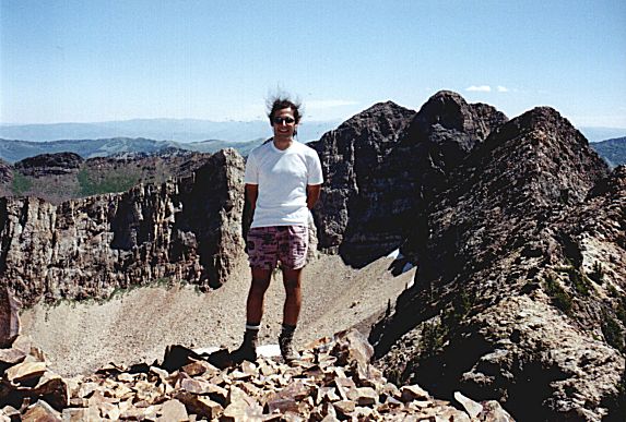
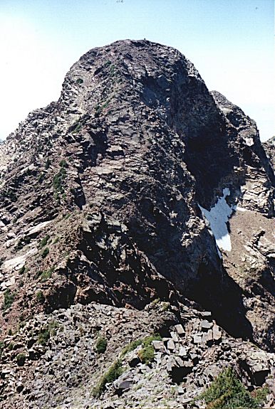
Pfeifferhorn
First real mountain hike. I did it in mid May with two Czech friends, the snow was everywhere from bottom to the top. The mountain itself is the third highest in Salt Lake County (11 326 ft., 34xx m.). One needs to go up the above mentioned Red Pine Cyn. Trail, then continue to the ridge above and on it all the way to the summit. We went light, only with camelbacks, we were up in 4.5 hrs, down in 3.5 hrs (and we slid down on our butts a few times when the slope was right).
![]() View from the lake somewhere up.
View from the lake somewhere up.
![]() View from the ridge towards the Red Pine Canyon.
View from the ridge towards the Red Pine Canyon.
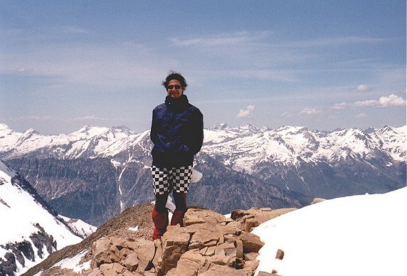
![]() Me on the summit, Mount Timpanogos in the background.
Me on the summit, Mount Timpanogos in the background.
![]() The trip on the ridge on the way back.
The trip on the ridge on the way back.
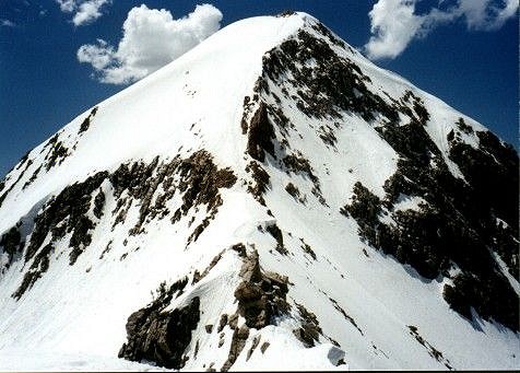
![]() Pfeifferhorn from that ridge.
Pfeifferhorn from that ridge.
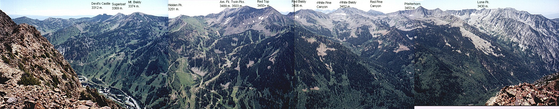
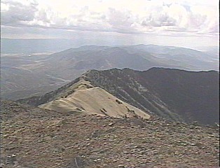
Ridge Hidden Peak - Red Baldy
Whole day trip. From bottom of Snowbird to the Hidden Peak (10980 ft., 3251 m., ca. 2900 ft. elevation) and then about 5 miles on the ridge, via the highest peak in the Wasatch Front, American Fork Twin Peaks (11489 ft., 3503 m.), to the saddle between Red Baldy (11171 ft., 3406 m.) and White Baldy, down to the White Pine Lake and back to the car. The ridge was narrow and steep at some points, but nothing undoable.
![]() Ridge between Hidden Peak and Am. Fk. Twins, the house in the back is the top of the tram to the Hidden Pk. ($14 roundtrip, rip-off).
Ridge between Hidden Peak and Am. Fk. Twins, the house in the back is the top of the tram to the Hidden Pk. ($14 roundtrip, rip-off).
![]() Top of Am. Fork Twins from the ridge.
Top of Am. Fork Twins from the ridge.
![]() On the first peak Am. Fk. Twins.
On the first peak Am. Fk. Twins.
![]() View from Am. Fk. Twins to the ridge towards Hidden Peak where we came from.
View from Am. Fk. Twins to the ridge towards Hidden Peak where we came from.
![]() View from Am. Fk. Twins to the Little Cottonwood Canyonu, resp. Gad Valley of the sji resort Snowbird.
View from Am. Fk. Twins to the Little Cottonwood Canyonu, resp. Gad Valley of the sji resort Snowbird.
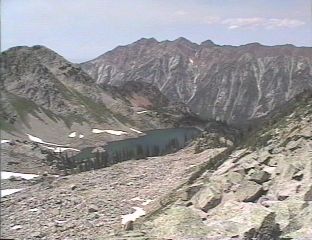
![]() White Pine Lake from the last saddle, ridge between Little and Big Cottonwood Cyns. in the background, the highest is Broads Fork Twin Peaks (most left).
White Pine Lake from the last saddle, ridge between Little and Big Cottonwood Cyns. in the background, the highest is Broads Fork Twin Peaks (most left).
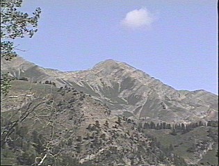
Devil's Castle
Is a rocky mountain (10920 ft., 3312 m.) above the Alta ski resort at the end of Little Cottonwood Cyn. Good afternoon hike, length about 8 mil, 4 hours. The very last part is very rocky and cautious scrambling is required, since there is few hundred feet drop-off.
Sugarloaf
A rounded hill right next to the Devil's Castle, 3369 m. I hiked it up first time in late November 1999 after the first snow storm. There was about 20 cm. of snow on the ground and it was snowing all the time, a nice introduction to the winter. It took us about 5 hours roundtrip from Alta, length about 6 miles. We were slow, but the snow was deeper at times, and we got off the trail several times.
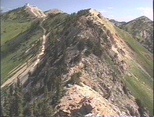
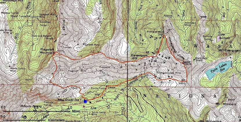
From Alta (2650 m.) it is relatively easy to climb to the Flagstaff Mountain (3210 m.). First part goes on an old mining road, and then bushwack up to the saddle west of the mountain and up on the ridge. From here goes a faint track on the ridge to the east, after about 5 kms comes the Twin Lakes Pass, and from there it's only about 1/2 hour down to Alta. Still on the ridge, I have made a small (ca. 500 m.) detour before it reaches Honeycomb Cliffs north to the Prince of Wales Shaft. 8/6/2000 Ridge Flagstaff Mtn. - Twin Lakes Pass
Here is a map (350 kB).
Fotos:
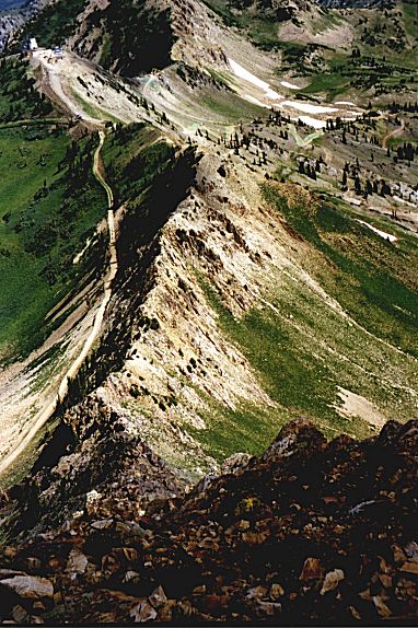
![]() Abandoned mine, in the back saddle west of Flagstaff Mtn.
Abandoned mine, in the back saddle west of Flagstaff Mtn.
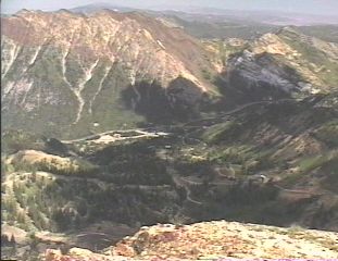
![]() View from the same spot down, SW. Am. Fork Twin Peaks in the back.
View from the same spot down, SW. Am. Fork Twin Peaks in the back.
![]() Panorama from Flagstaff Pk. (460 kB).
Panorama from Flagstaff Pk. (460 kB).
![]() View from the Prince of Wales shaft west (180 kB). In the front Silver Fork.
View from the Prince of Wales shaft west (180 kB). In the front Silver Fork.
![]() Boiler engine at the Prince of Wales shaft.
Boiler engine at the Prince of Wales shaft.
![]() Mountain goat at the Honeycomb Cliffs. Here is a detail
Mountain goat at the Honeycomb Cliffs. Here is a detail
![]() Panorama from the eastern summit of the Honeycomb Cliffs (480 kB).
Panorama from the eastern summit of the Honeycomb Cliffs (480 kB).
Wasatch Front
Mount Olympus
This mountain is located right above the Salt Lake Valley, between Millcreek and Big Cottonwood canyons. It's 2751 m (9026 ft.) high. Since the trail starts basically at tle level of the valley, the elevation change is about 1230 m (4050 ft.) on 3 miles(4.8 km).
![]() View to the north towards the SLC center.
View to the north towards the SLC center.
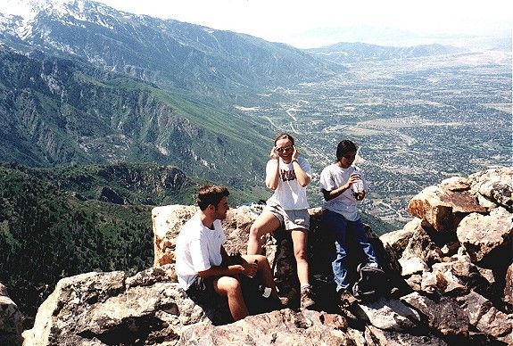
![]() Friends on the top, view towards southwest.
Friends on the top, view towards southwest.
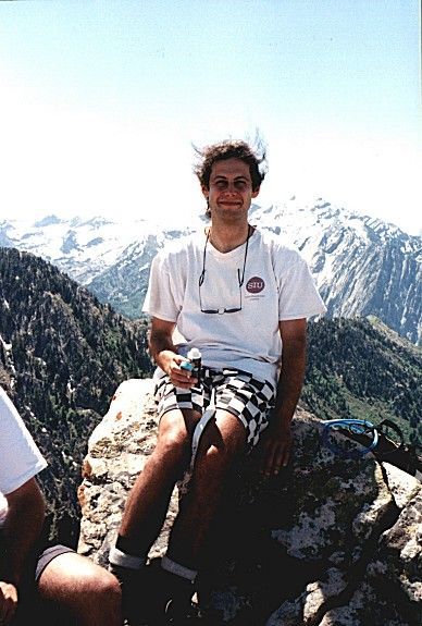
![]() Me on the top, view towards southeast, to Twin Peaks.
Me on the top, view towards southeast, to Twin Peaks.
Pictures from late March 2000
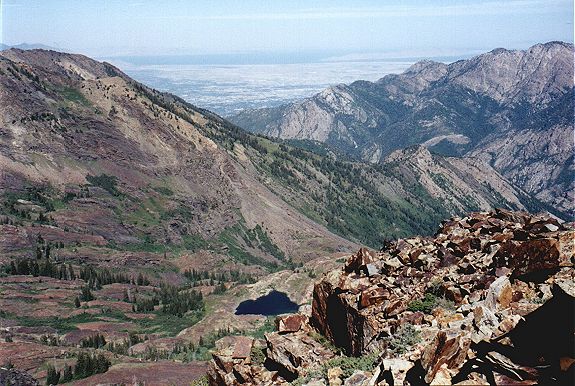
![]() Mt. Olympus from the saddle below the summit. Part of Salt Lake Valley on the right side of the picture.
Mt. Olympus from the saddle below the summit. Part of Salt Lake Valley on the right side of the picture.
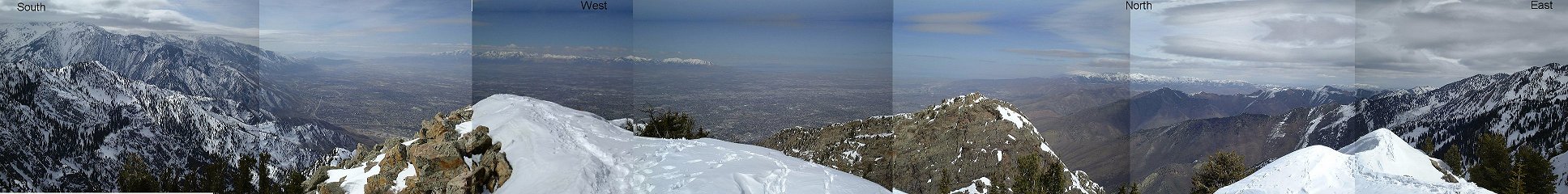
![]() View from the summit all around.
View from the summit all around.
![]() View from the summit southwest, to the southern SLC suburbs.
View from the summit southwest, to the southern SLC suburbs.
Storm Mountain
The westernmost mountain on the Big-Little Cottonwood ridge. It's 2904 m high, and one starts basically from the SL valley floor (1500 m), so it's a good elevation gain in ca. 3.5 miles. I did this one in early November 1999 after a small snow storm which brought in ca. 10 cm of snow. The first couple of miles climb up narrow and beautiful Fergusson Canyon, one can hardly believe that a mile below is a big city. Then the area opens a bit and afterwards there is a final scramble to the summit with a rewarding view. Roundtrip, this took us little less than 5 hours of moderate hiking speed.
![]() Gabi on the summit with view east, the first valley below is the Broads Fork, access to the B.F. Twin Peaks.
Gabi on the summit with view east, the first valley below is the Broads Fork, access to the B.F. Twin Peaks.
![]() Me on the summit with view west, spectacular overlook over the SL valley.
Me on the summit with view west, spectacular overlook over the SL valley.
Lone Peak
A mountain at the southern end of the Salt Lake Valley, the westernmost on the ridge between Little Cottonwood and American Fork Canyons. Like all the mountains in the western part of this ridge, it is made of granite. We started the hike at the western slopes, at about 1700 m. above sea level, off a dirt road going from Draper to Alpine. The road is pretty bad, I was glad we went with friend's Isuzu Trooper and my tiny Mazda did not have to suffer. The first several hours of hiking were unimpressive, steep climb on brushy western slopes of the Wasatch. Then we entered the Lone Peak Cirque, glaciated bowl open to the west, at ca. 2900 m. It is mostly smooth granite rock with occasional trees. From here, it was up to the nothern saddle and towards the summit (3430 m). The last few tenths of meters required some scrambling, but nothing too difficult. On the way back, I want along the ridge to the south getting to the two smaller summits. The scramble here was more difficult at some parts. The most challenging part, however, was descent from the southernmost summit to the south (it was impossible to go down the north slope, since it is at least 100 m wall down). Also the southern slope has several drop-downs, each about 5 m. down. Fortunately, there was always some crack,..., so I managed to get down. If one would go down south from the saddle before the southernmost summit, I think the way down would be easier. Overall, the 16 miles took us 9 hours, not too bad for the fact that we were sitting around a lot and lost our way several times. This is one of the best hikes the Wasatch can offer, a little piece of Sierra at your backdoor.
The pictures did not come out very well, here's just few selected ones:
![]() Me and Ivan in the lower LP cirque, with the summit in the distance.
Me and Ivan in the lower LP cirque, with the summit in the distance.
![]() 3/4 of our group on the summit, view east.
3/4 of our group on the summit, view east.
![]() Me and Gabi with view west.
Me and Gabi with view west.
![]() The southern ridge of LP, it is hikeable til the small saddle on the right.
The southern ridge of LP, it is hikeable til the small saddle on the right.
Around Provo
Mount Timpanogos
Second highest mountain in the Wasatch Range (after Mt. Nebo), 3581 m. It is one of the most massive ones in the range, the ridge is higher than 11000 ft. for about 7 miles. There are two trails to the top, from the north and from the east. We chose the east one, which is shorter, but has higher elevation gain. The trail starts in the Aspen Grove valley near the Sundance ski resort at 2089 m. First one needs to switchback for about 3 hours to the west to a plain, where is a small lake and stone shelter. From the shelter one goes to the southwest up the glacier (or better frozen snowfield) to the saddle (about 1 hour). From here it is less than hour on the ridge to the top. All this timing is on the snow, in early June.
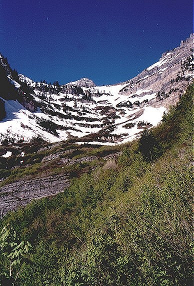
![]() View from Aspen Grove to the top.
View from Aspen Grove to the top.
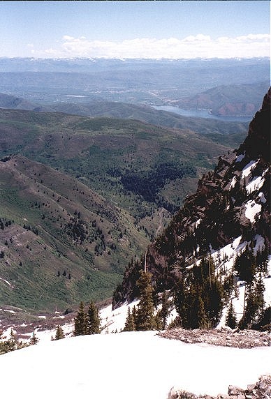
![]() View from the top of Aspen Grove down to the east (Deer Creek Reservoir and Uinta Mountains in the back).
View from the top of Aspen Grove down to the east (Deer Creek Reservoir and Uinta Mountains in the back).
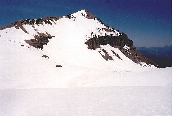
![]() On the plain towards the shelter, the top in the background.
On the plain towards the shelter, the top in the background.
![]() On the way to the saddle.
On the way to the saddle.
![]() View from the glacier down to the saddle.
View from the glacier down to the saddle.
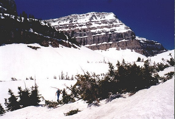
![]() East face of Mt. Timpanogos from the saddle.
East face of Mt. Timpanogos from the saddle.
![]() View from the top to the east, Deer Creek Res, Heber City valley and Uintas.
View from the top to the east, Deer Creek Res, Heber City valley and Uintas.
![]() Me on the top, view to the north.
Me on the top, view to the north.
![]() View from the top to the south.
View from the top to the south.
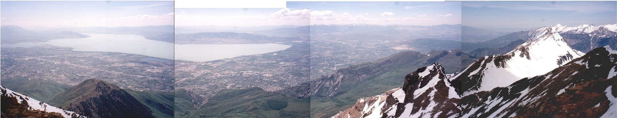
![]() View from the top from the north to the west (combined foto ca. 200 kB), from the right in the distance Salt Lake Valley with Great Salt Lake, American Fork, Provo and Utah Lake.
View from the top from the north to the west (combined foto ca. 200 kB), from the right in the distance Salt Lake Valley with Great Salt Lake, American Fork, Provo and Utah Lake.
![]() View from the summit east, the lake and Aspen Grove below.
View from the summit east, the lake and Aspen Grove below.
![]() View from the summit north, the Timpanogos Basin, and Little Cottonwood ridge in the distance.
View from the summit north, the Timpanogos Basin, and Little Cottonwood ridge in the distance.
Mount Nebo
Highest mountain in the Wasatch Range (11928 ft., 3636 m), south of Prova. We came there on Sat. and camped at the trailhead. We started on the southeastern side and in 8 miles hiked up about 5000 ft. We got only to the two southernmost peaks (the second is 3621 m), because we hit a thunderstorm. A good trail goes all the way to this peak. From here, it is about mile ridge hike to the northern and highest summit. We planned that, but nature prevailed. Some other time.
![]() Nebo from the trailhead.
Nebo from the trailhead.
![]() On the trail, after ca. 1.5 mile.
On the trail, after ca. 1.5 mile.
![]() Northern (5), highest Nebo summit from the same spot.
Northern (5), highest Nebo summit from the same spot.
![]() On the ridge, three highest summits in the background, first the south one, last the north one.
On the ridge, three highest summits in the background, first the south one, last the north one.
![]() Two northern summits from the south summit.
Two northern summits from the south summit.
![]() Ridge to the south from the southern summit.
Ridge to the south from the southern summit.
![]() View from the southern summit to the northwest.
View from the southern summit to the northwest.
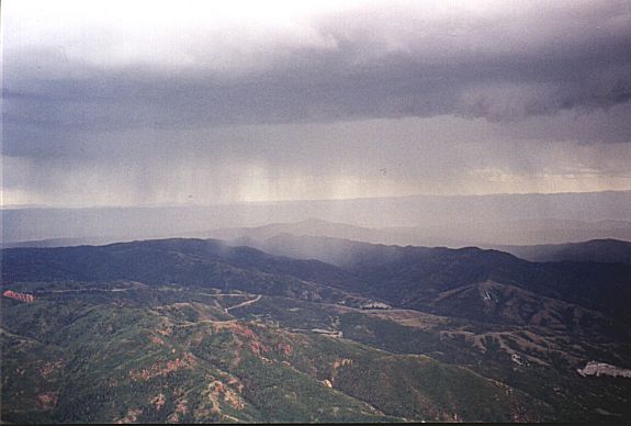
![]() Valley to the east in the thunderstorm.
Valley to the east in the thunderstorm.
![]() Whole Nebo ridge from the road.
Whole Nebo ridge from the road.
West of SLC
DP (3362 m) is the highest in the Stansbury Mountains, the second range west of Salt Lake Valley. It is about 50 mi. drive from SLC to the trailhead, the last 5 miles on dirt road, that is not very well maintained. I hiked the peak on last day of April, after a cold spell, so the snow was pretty firm. The trail goes south-west for about 3 km to a saddle and then up the ridge another 3 km to the peak. Total elevation gain 1000 m. I then continued north on the ridge, there is a trail that goes below the ridge on the western side, for about 2-3 km dropping down few hundred meters, then the trail goes down a valley back to the trailhead. I missed the trail as it was covered by snow, though, and walked down a steep gully to appear right at the trailhead. Total length ca. 13 km time 4:15.Deseret Peak
Fotos:
![]() Look up to the saddle from where the forest cleared, saddle is about 1 km away.
Look up to the saddle from where the forest cleared, saddle is about 1 km away.
![]() View from the saddle NE, to the fork I came from, Deseret Peak on the left.
View from the saddle NE, to the fork I came from, Deseret Peak on the left.
![]() 360 deg. view from the Deseret Peak (370 kB).
360 deg. view from the Deseret Peak (370 kB).
![]() View from the ridge trail north of DP south to NW, DP on the left.
View from the ridge trail north of DP south to NW, DP on the left.
![]() View down Pockets Fork, which I walked down.
View down Pockets Fork, which I walked down.
![]() Marmot's hole in the Pockets Fork snowfield. I saw two of them running in this area. It was slightly after lunch, so they probably enjoyed warm weather.
Marmot's hole in the Pockets Fork snowfield. I saw two of them running in this area. It was slightly after lunch, so they probably enjoyed warm weather.
![]()
![]() View up and down the narrows of the Pockets Fork. Try to find the trail to cross ridge to the righ to avoid this.
View up and down the narrows of the Pockets Fork. Try to find the trail to cross ridge to the righ to avoid this.
![]() Combined view at the Stansburys from ca. 15 kms east of Deseret Peak. DP is the second high mountain from the left.
Combined view at the Stansburys from ca. 15 kms east of Deseret Peak. DP is the second high mountain from the left.
North of SLC
Lies just east of Ogden, ca. 30 miles north of SLC, 2918 m. high. A group of us hiked it in early May 2000, and to our surprise, it was almost snowless. Since we had two cars, we started at the Beus Canyon trailhead southwest of the mountain (end of 46th St. in Ogden) and ended at the mouth of Taylor Canyon at 27th St. This has formed 10-12 miles loop, which took us a whole day to do, mainly because of the relatively large elevation gain, 1350 m.Mount Ogden
Fotos:
![]() Going up the Beus Canyon.
Going up the Beus Canyon.
![]() Somewhat above the trees in the Beus Canyon.
Somewhat above the trees in the Beus Canyon.
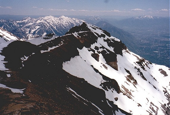
![]() Almost at the top of the main Wasatch ridge, ca. 1 km south of the Mt. Ogden summit.
Almost at the top of the main Wasatch ridge, ca. 1 km south of the Mt. Ogden summit.
![]() View from this ridge to the north (Mt. Ogden) and west.
View from this ridge to the north (Mt. Ogden) and west.
![]() View from a saddle about 500 m. from the previous spot to the north and east.
View from a saddle about 500 m. from the previous spot to the north and east.
![]() 360 deg. view from Mt. Ogden (300 kB).
360 deg. view from Mt. Ogden (300 kB).
![]() Mt. Ogden from Allen Peak, ca. 500 m north.
Mt. Ogden from Allen Peak, ca. 500 m north.
![]()
![]() The couloir north of Allen Peak via which I went down.
The couloir north of Allen Peak via which I went down.
![]() Allen Peak from the bottom of Taylor Fork.
Allen Peak from the bottom of Taylor Fork.
URL:
http://voth.chem.utah.edu/~mcuma/hike_en.html
Last updated: 06-Aug-00 / mc