Research Goals:
The goal of this research project is to move toward the improved modeling of wintertime persistent cold air pools in Utah.
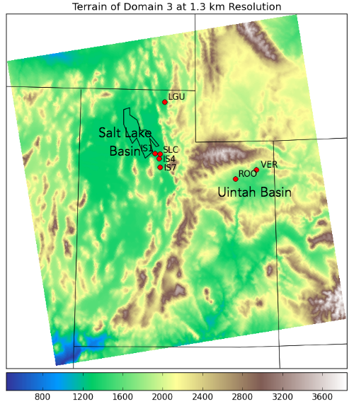
The study currently focuses on three basins within Utah: the Salt Lake Valley, the Uintah Basin, and the Cache Valley.
In order to reach these goals, a number of WRF model runs were carried out and various 'sensitivity tests' were performed in
order to determine which changes we made to the WRF model improved its overall performance.

Terrain of innermost domain 3, overlayed with station locations used for validation in this modeling study.
WRF Base Model Run Configuration
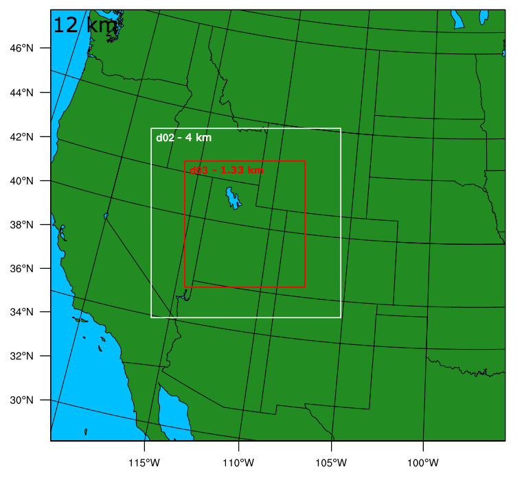
- 3 WRF model domains with 3:1 nesting

Domains 1, 2, and 3 have resolutions of 12 km, 4 km, and 1.33 km respectively.
- Simulation Period: 00 UTC 1 Jan 2011 to 00 UTC 10 Jan 2011
- 40 eta (terrain following) vertical levels
- USGS, MODIS, or NLCD 2006 land use
- Thompson bulk or WRF Single Moment (WSM) microphysics schemes
- YSU PBL Scheme
WRF Model Runs
- USGS Run: Base model state with USGS land use
- MODIS Run: Base model state with MODIS land use
- NLCD Run: Base model state with NLCD 2006 land use
- Early Initialization Run: Initialize WRF model at 00 UTC 31 Dec 2010, otherwise base model state with USGS land use
- WSM Run: Initialize WRF model at 00 UTC 31 Dec 2010, and use WSM3 microphysics scheme, otherwise base model state with USGS land use

