
Thanks to its relatively low elevation and southern location, biking in Dixie is alive even when the nothern Utah folks have their skis on. However, late fall and early spring are probably the best time to come here.
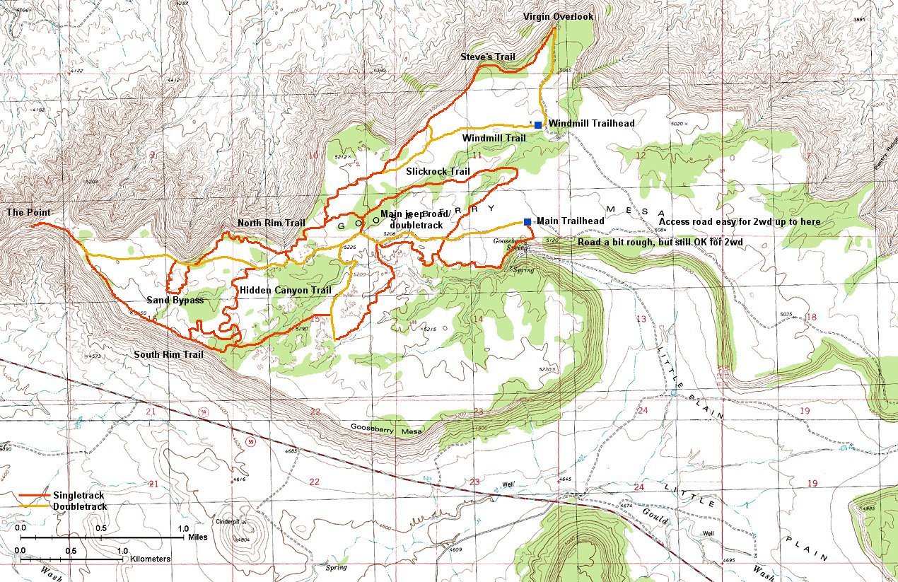
Goosebery Mesa Trails
Gooseberry Mesa Trails
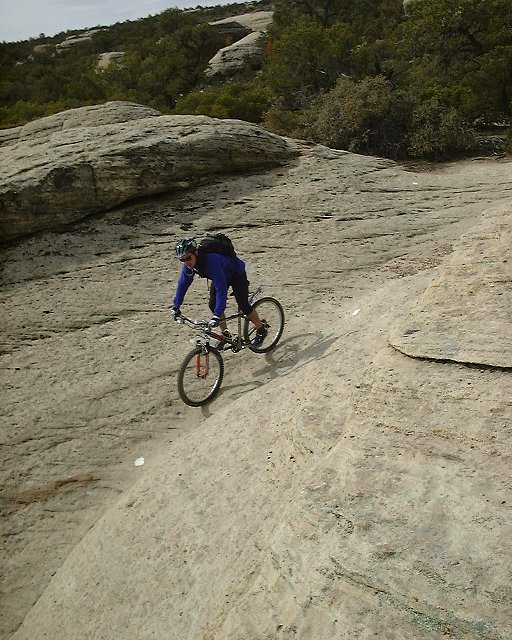
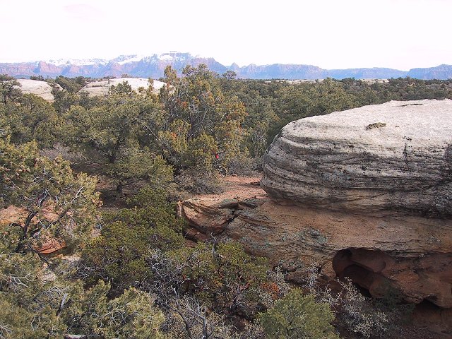
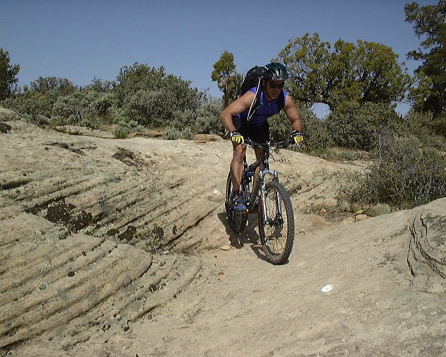
Gooseberry Mesa is one of the plateaus south of Zion. It is located at about 5000 ft., 2000 ft. above Hurricane. It was noticably colder there, and it froze overnight there in early March, but nothing serious. Tthere is a vast network of bike trails that was created here by a cooperation of local bike enthusiasts and BLM. A good example how cooperation can achieve long lasting results. The road there can get muddy after rain, we drove there in the afternoon after a night rain and there were about four muddy spots. The easiest access is turn off the Ut. Hwy. 59 between mile post 8 and 9, north onto Smithsonian Butte Rd., then turn left after about 3 miles, and left again after a small uphill that brings you up to the mesa. Then it is about another mile to the main trailhead. The last piece of road is a bit rough, but still passable by passenger cars. We found a very nice campspot close to the trailhead, with great views to the Zion and other cliffs.
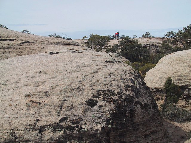
As can be seen on the map (400 kB), there is a maze of trails in a maze of sandstone formations. We started on the south side, then rode Hidden Canyon Trail up and down, and continued on the south rim to the Point, the westernmost part of the mesa. Then we continued on the north rim and via some hard to document trails to the Windmill loop and on the north rim again back to the Slicrock 101 loop (a reasonably good training area similar to Moabs's practice loop). All this took almost 5 hours with ample photo stops, length about 35 kms. We were pretty trashed at the end, the surface is pretty rough, a lot of small ups and downs, the trails are about 70% slicrock, the rest rocky/sandy singletrack.
Clickable map and fotos from the main riding area from spring 2005 are here, from fall 2005 are here.
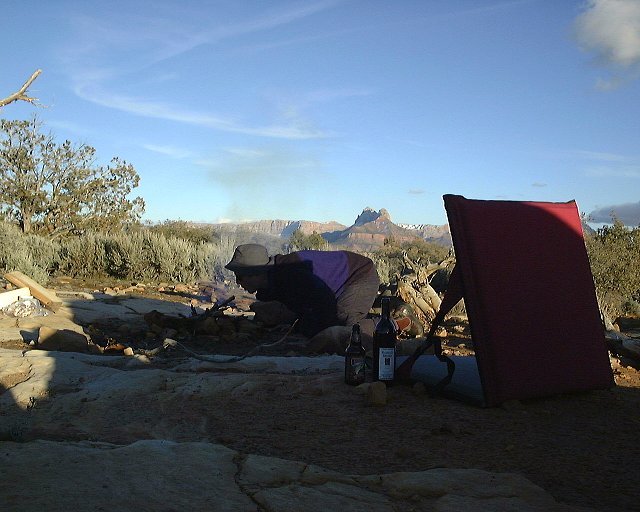
 Few shots from the evening on Gooseberry Mesa. Note some mud on my car. Cars that came in the morning were covered with mud.
 Panorama from our campspot on Gooseberry Mesa.
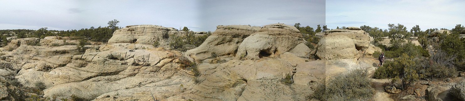 Panorama from the South Rim trail on Gooseberry Mesa about 1 km from the trailhead.
 Gary battles the sandstone at the same spot.
 Panorama south with me a bit futher up the trail.
 Panorama from the South Rim trail about 1 km east from the Hidden Canyon Trail junction.
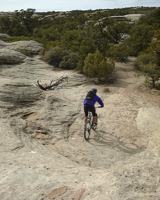
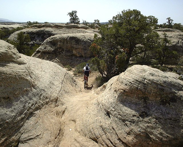
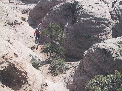
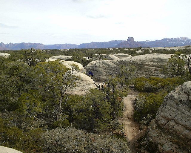 Shots from Hidden Canyon Trail, which goes through and around lots of small sandstone hills.

 More shots from Hidden Canyon Trail, now from Gary's camera, show a progression of my ride through the maze..
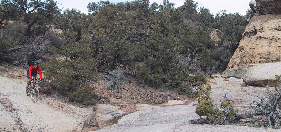 Slightly panoramic shot somewhere on the Hidden Canyon Trail.
 Mike and Morgan Harris, founders of the trails on Gooseberry, who we were honored to meet on Hidden Canyon Trail.
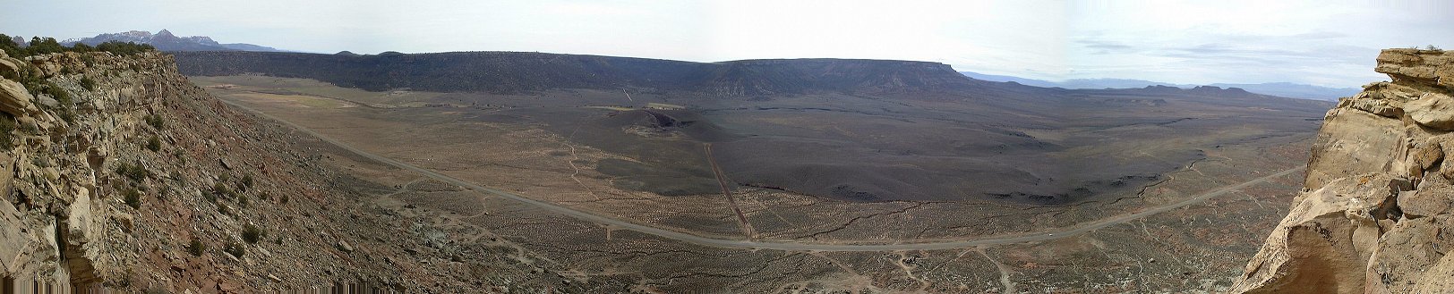 Panorama from the southern end of Gooseberry Mesa to the south.
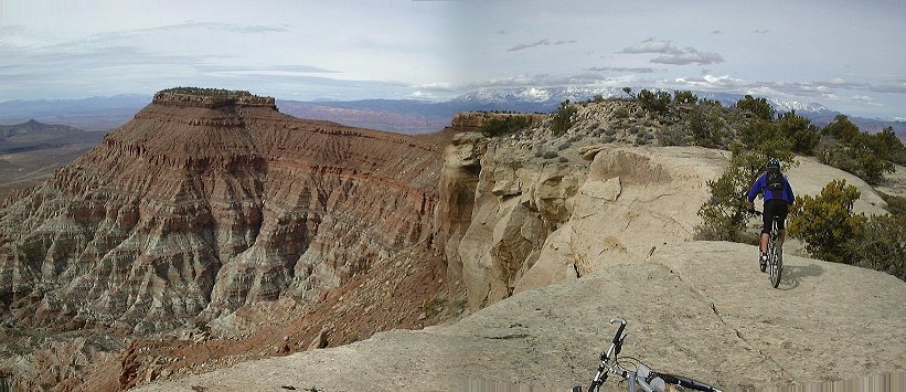 View to the Point from the southern cliffs of Gooseberry Mesa.
 Panorama from the Point north.
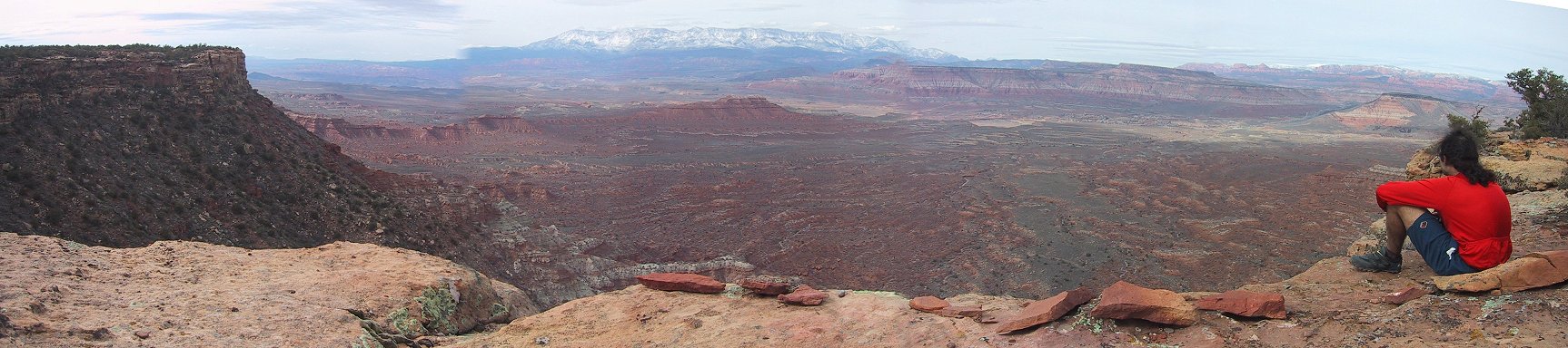 Gary's panorama from the Point north.
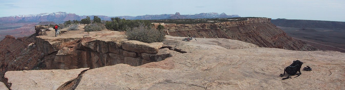 Gary's panorama from the Point east.
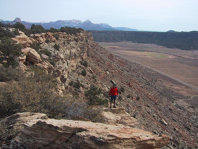
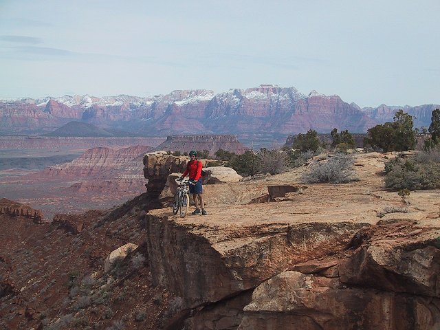 Me on the and near the Point.
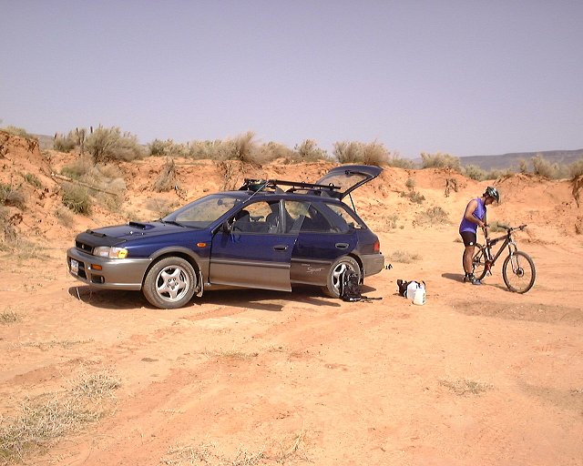
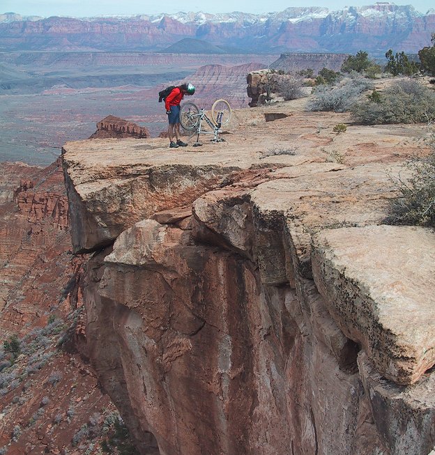 Bike checkup on the Point.
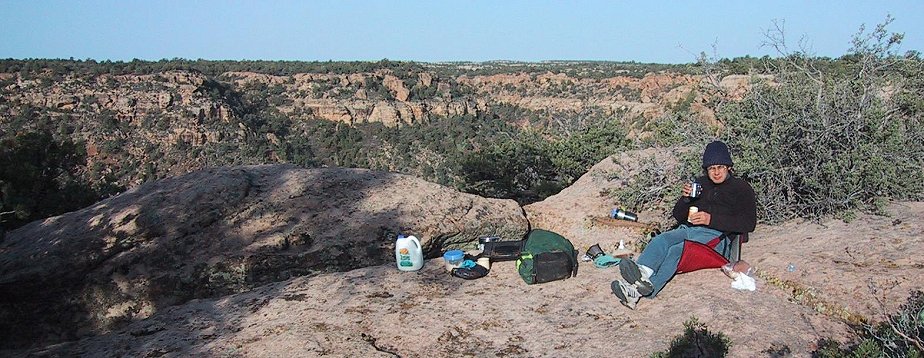 Breakfast on the edge of Gooseberry Mesa.
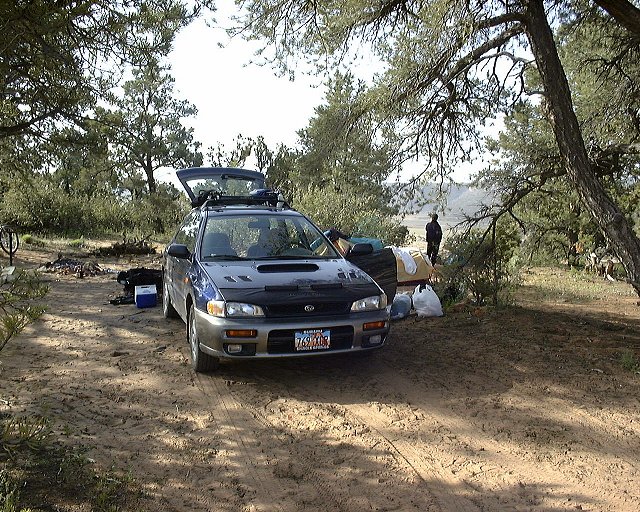
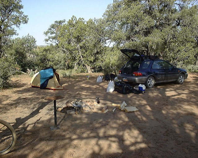 Two shots from our campspot at Gooseberry.
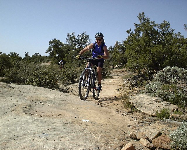
 Twice Gary on the North Rim Trail.
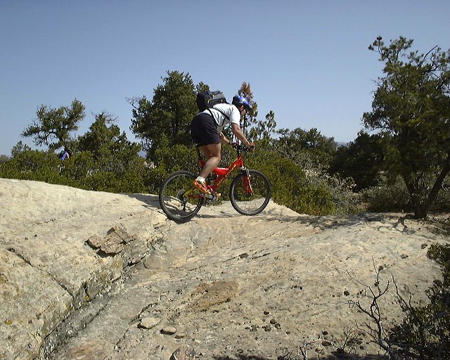 Greg a bit farther on the trail.
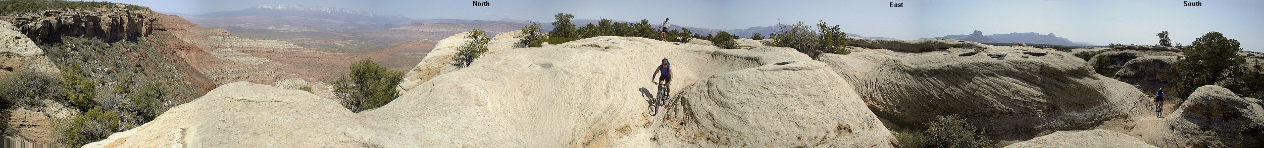 Panorama from the north side of Gooseberry.
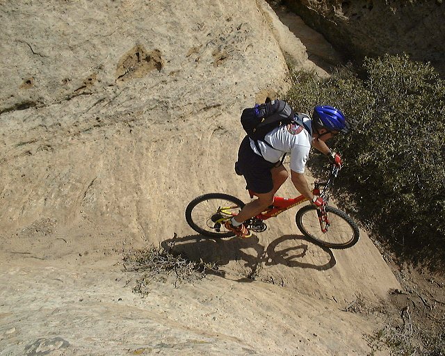
 Greg pases the same gully as on the previous panorama.
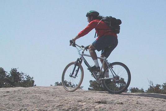 Me biking on one of the sandstone hills nearby.
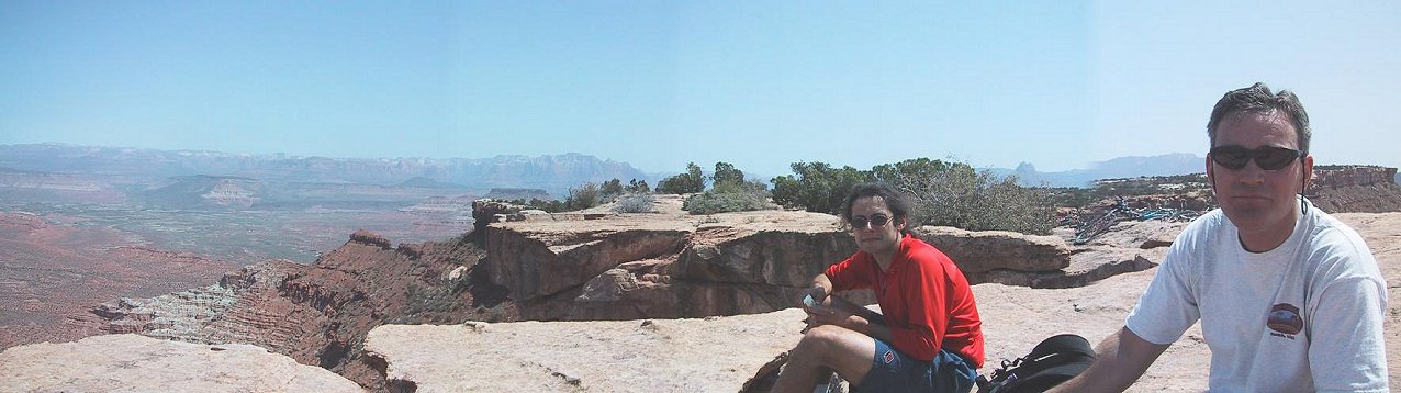 Me and Greg during the lunch on the western end Gooseberry, panorama north-west, Zion NP in the background.
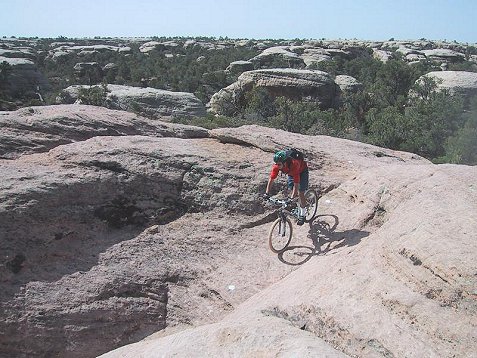
 Me on the sandstone hills of the Hidden Canyon Trail.
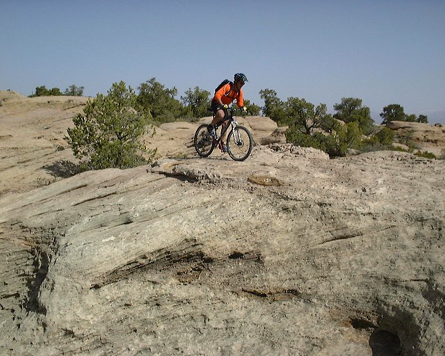
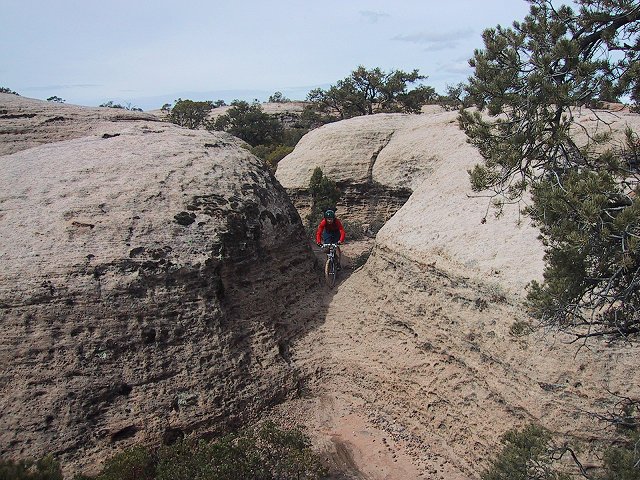
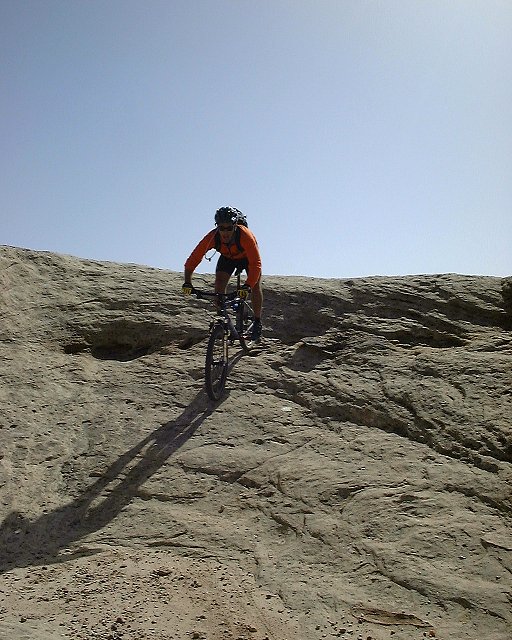 Gary on the Hidden Canyon Trail.
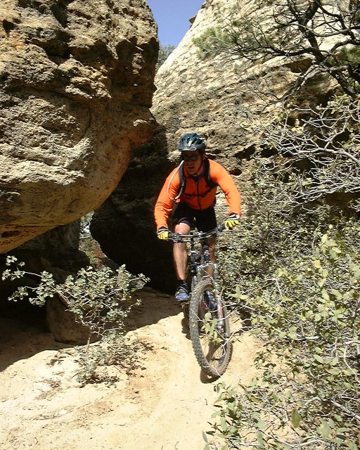 Gary exits a small tunnel on the Hidden Canyon Trail.
Clickable map and fotos from spring 2004 visit are here.
Little Creek Mountain
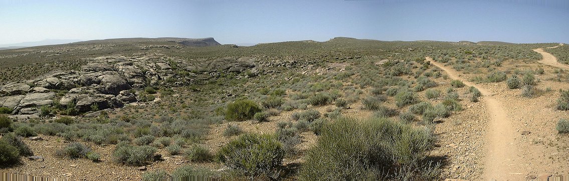
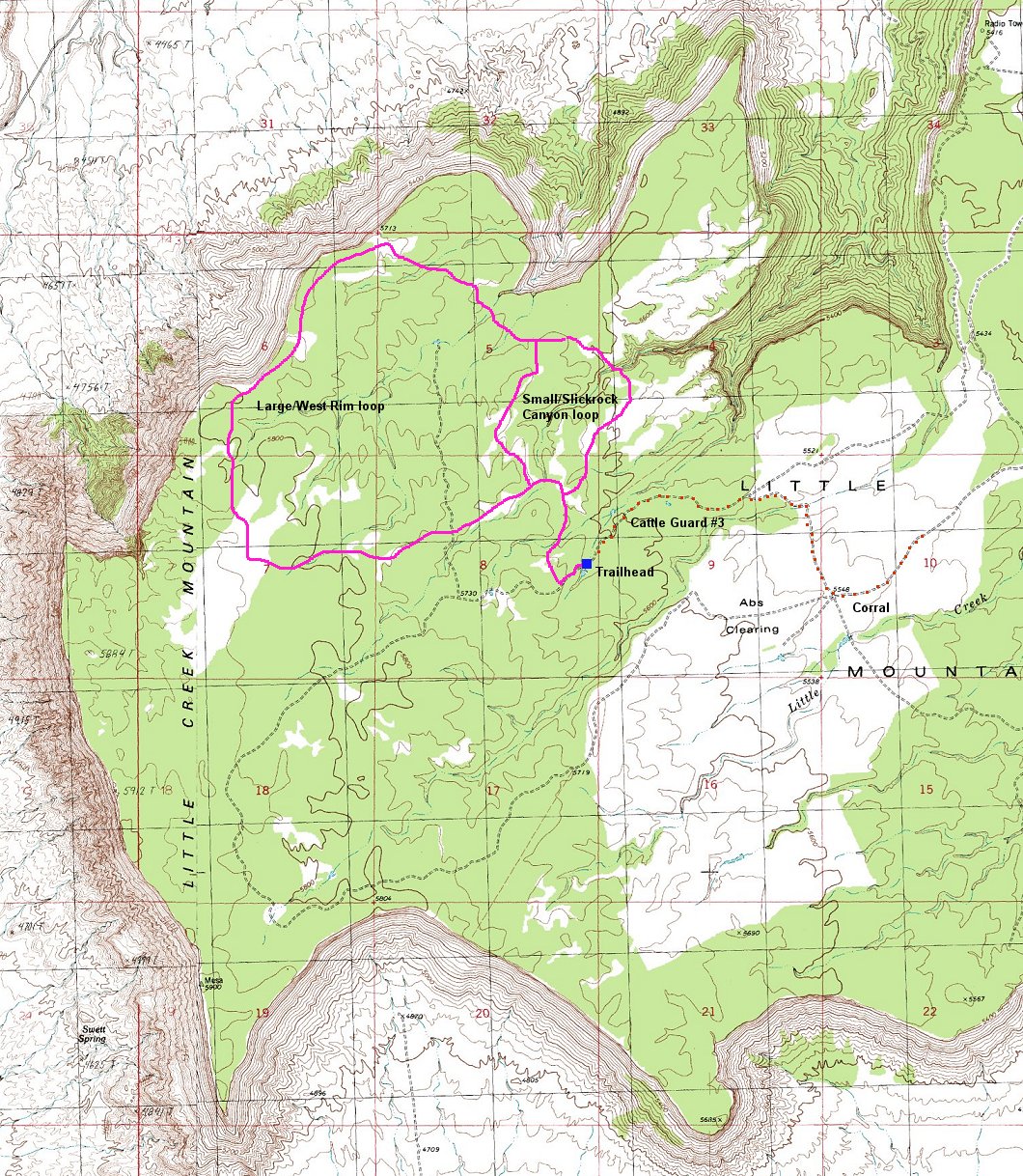
Little Creek Mountain is a mesa south of Gooseberry with a similar topology, albeit several hundred ft. higher and more spread out. A group of local bikers have set up there two basic loops that travel through the north-western part of the mesa, which contains numerous slickrock patches. The rest of the mesa is more-less juniper/pinyon pine forest. The trail is a bit less technical then Gooseberry, but not that fast mainly due to twisty narrow singletrack and a more difficult orientation on the slicrock.
The trail access can be tricky, there is numerous dirt roads that mingle on the mesa, I have oriented myself by a map, shown here (400 kB). Few notable points on the access road include a gravel mine about 3 miles from Hwy 59, then an old corral south of the road on a critical intersection where one must turn right, and finally the third cattle guard about a mile later and a trailhead at the point where the road crosses a slickrock patch right before a small pond.
The trail follows the road west for about 100 m. and then turns right onto a well visible sinletrack. Trail is easy to follow in the forest, harder on the slicrock patches, where one must look for cairns that are sometimes quite far apart. As a start, I rode the big loop clockwise to the west rim, then back and through well visible intersection with the small loop (marked by a big cairn). I got lost on a large slickrock area about 500 m from this intersection. I think that there starts a point-to-point trail to "The Point", which is marked even worse than the main loop. I ended up riding up and down on the slickrock for 1/2 hr, and then turned around and came back to the trailhead on the small loop connector.
The next day I rode the big loop counter-clockwise. The trail was easier to follow, leading first through several smaller slickrock patches, dropping into a small canyon and climbing up a small slot canyon onto the large slickrock area where I could not find my way the day before. Coming from the slot things were much clearer and I immediately saw a big cairn at the top of the slicrock patch. From then on, following the trail was not that hard (although occasional missed turns happened). Access to "The Point" still remains to be explored.
So, I believe it is easier to do the big loop counter-clockwise. Here is the map (400 kB), with at least approximate location of the trail. It sure just gives an idea where you are going, but, coming for the first time, you'll get lost even with the map.
Clickable map and fotos from the main riding area from spring 2005are here.
J.E.M. Trail
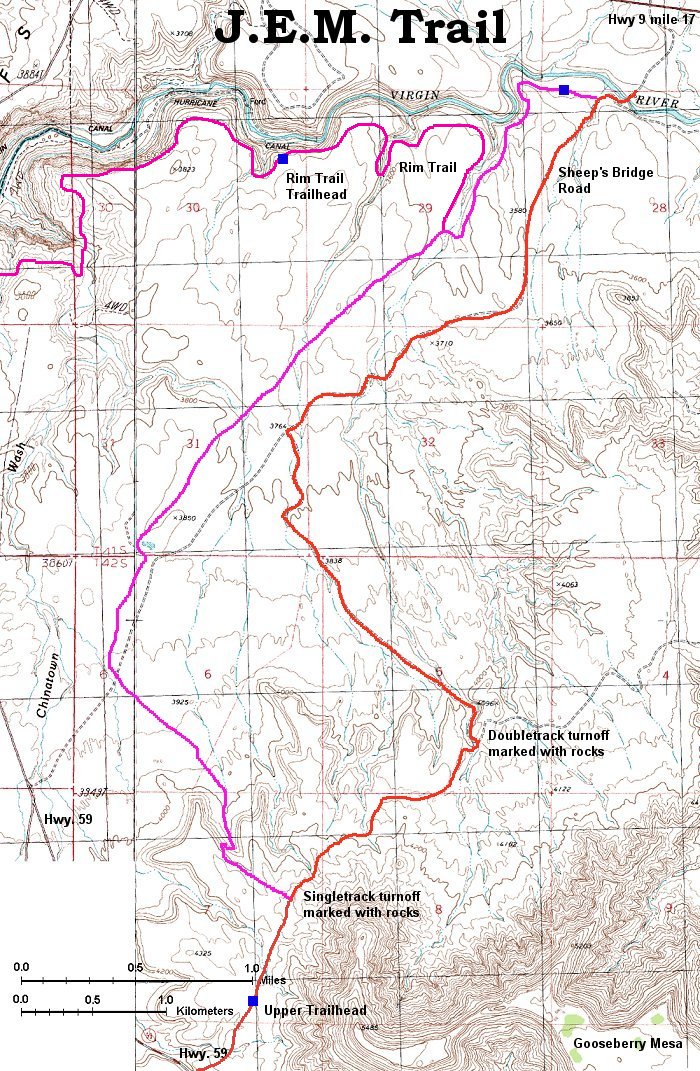
This trail is located on a lower plateau north of Gooseberry Mesa. Access is easy, driving on Hwy. 9 from Hurricane towards Zion NP, exactly at mile post 17 turn south on a dirt Sheeps Bridge Road, park somewhere (as of April 2001 the bridge was being reconstructed so one had to park on the north side of Virgin River). Then pedal up the dirt road for ca. 2.5 miles, after crossing a wash turn left onto another double track. Keep on this one for another 2 miles, crossing a wire fence in the middle. After climbing out of ca. 100 ft. deep canyon turn right onto another doubletrack (marked with stone arrow and cairn) and keep on this on until you are under the western flanks of Gooseberry Mesa. The singletrack going north is again marked. It's mostly downhill and not very technical, except for a short section where the trail drops steeply into a canyon, about 0.5 mi. from the singletrack start. Total length ca. 12 miles, ride time 2 hrs. Here is the trail map (540 kB).
 Start of J.E.M. Trail.
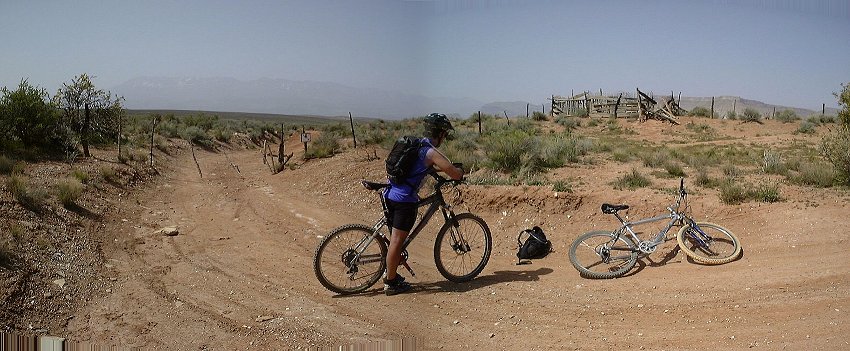 A small panorama with the wire fence on the second doubletrack.
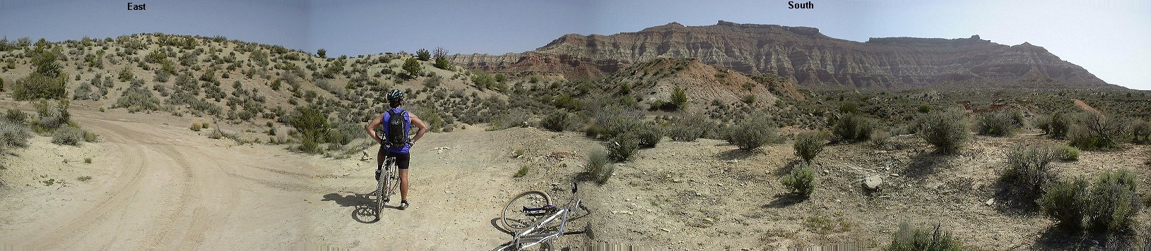 Panorama east-north from an intersection of the second and third doubletrack.
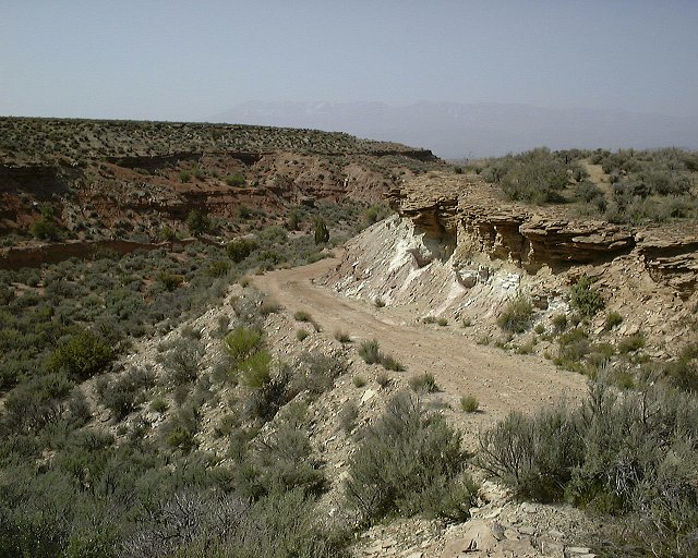 View down from the same intersection to where we came from.
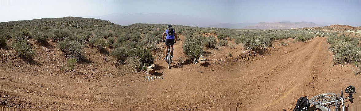 Panorama south from the start of the singletrack.
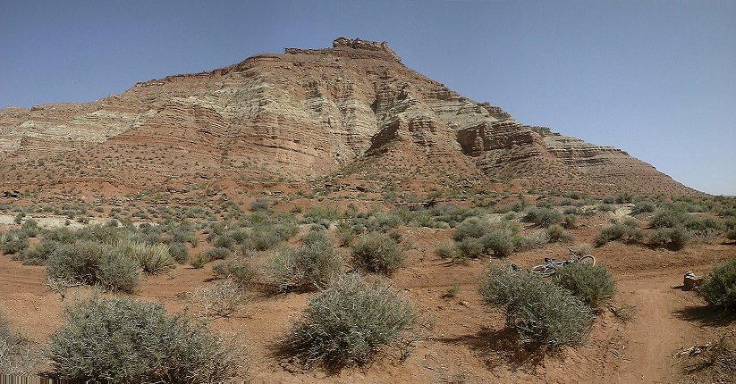 Panorama from the same spot north, towards Gooseberry Mesa.
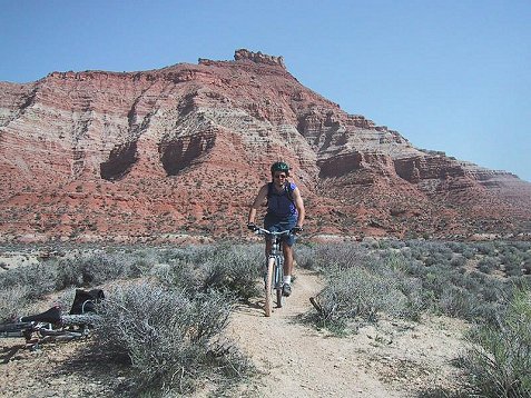 Me a bit down on the singletrack, Gooseberry Mesa in the background.
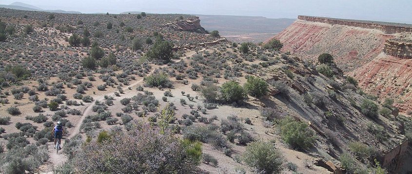 Going down from a small hill, on the right is the canyon into which the trail soon descends, and then continues south.
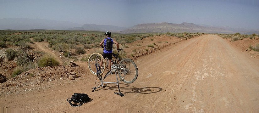 Panorama north from where the singletrack crosses Sheeps Bridge Road.
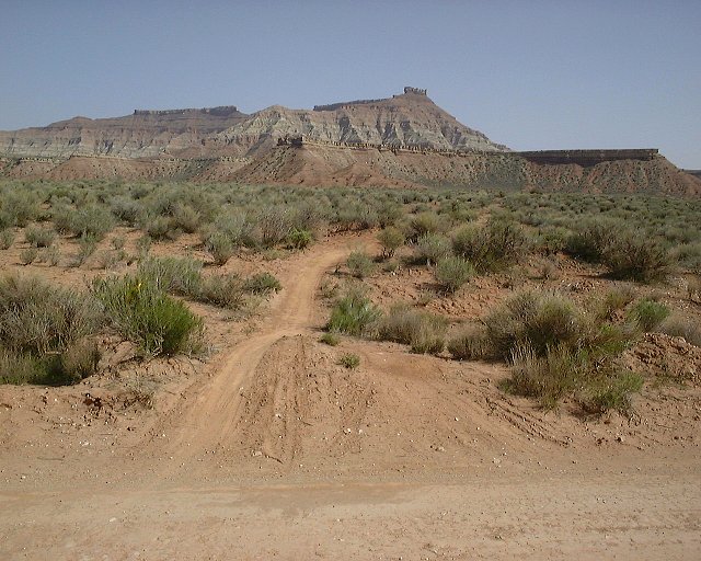 View from the same spot north.
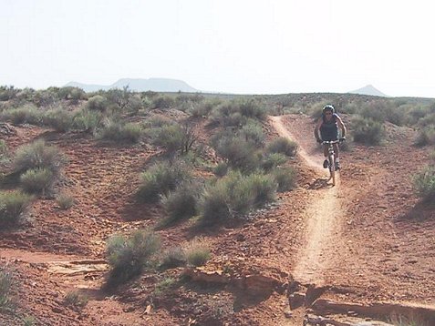 Crossing a small wash somewhat in the middle of the singletrack.
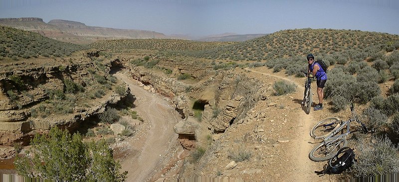 The trail above a small canyon, which it copies to its estuary to Virgin River.
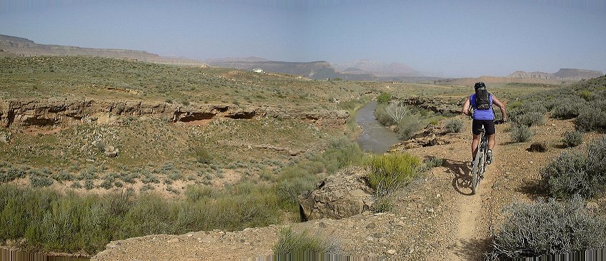 Trail on the Virgin River rim, view east.
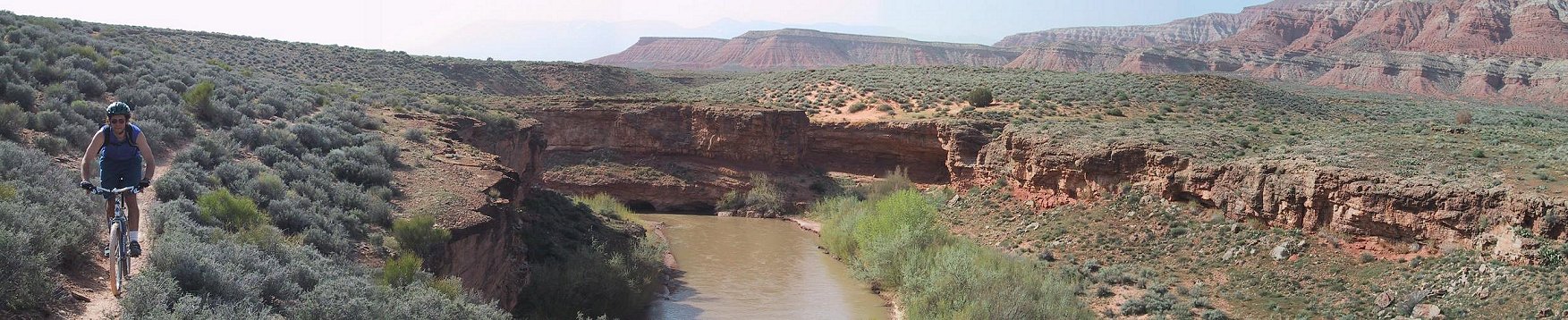 Me on the Virgin River rim, view west.
J.E.M. - Hurricane Rim Trail loop
Since summer 2002, one has some more options to do between Gooseberry Mesa and Hurricane. Two new trail paralleling the Virgin River have been built here. One descends into the river gorge and is more for hikers, the other contours the river south rim from an intersection with JEM trail west towards Hurricane and eventually leads to a trailead on Hwy 59 about 1 mile from Hurricane. The Rim trail is about 7 miles long. My recommended loop connects the new upper JEM trailhead with the Hwy 59 Rim trailhead via about 5 mile climb up Hwy 59. The road part sucks since cars (mosty pickup trucks driven by the local elite) zoom past at 70 mph. But all that singletrack it connects is worth it. I parked on the upper JEM traihead, rode the JEM downhill in ca. 20 min, and then the rim part in ca. 1.5 hr (it's up and down all the time), then a bit under 0.5 hr on the road. Maybe it would be better to start with the road climb. Here is the trail map (540 kB).
Gould Rim - J.E.M. - Hurricane Rim Trail loop
An ultimate almost all singletrack loop functional since fall 2003, avoids road ride from end of Hurricane Rim to start of JEM. The common start is at the lower Hurricane Rim Trailhead off the highway near Hurricane, ride down the road about 200 m, take dirt road climbing up and in about 2 miles look for a singletrack on the right. That's the Gould Rim trail, which follows rim of Gould Canyon for several miles and ends up on a trashed parking area. From here, take dirt road north and look for another singletrack near corral. That one climbs up one mesa level and ends up at the highway across the road from JEM trailhead. Hop on the JEM, ride down, turn off left to Hurricane Rim and follow that 7 miles back to the trailhead. Clickable map and fotos are here, from spring 2005 are here, from fall 2005 are here and here.
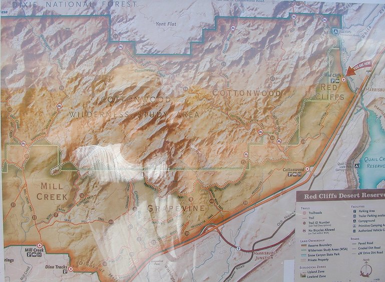
Red Cliffs Desert Reserve trails
The area is located west of I-15 between Leeds and Washington. On the north side, along Quail Creek, is a nice BLM campground. From there, it's good to take Prospector Trail south to Church Rocks area. The trail is a fast rolling desert singletrack with a couple of climbs in both directions. Church Rocks is a slickrock area that includes a loop circling around the main slickrock area, having about 50% slickrock and 50% desert singletrack. Not that great, IMHO. The return on the Prospector was the best.
Here is the trail map, as photographed on a fairly new looking information board at the trailhead. Looks like there is a lot more trails to explore there.
Another option is to ride from Prospector through Church Rocks south-west all the way to Broken Rim Mesa. However, there are some caveats with sandy trails in the connector between the two areas, so, ride as documented on clickable map with fotos is not recommended.
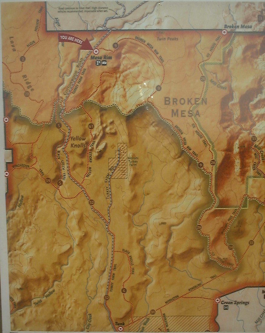
Broken Mesa Rim
I rode this trail as a loop, taking a reference from Utahmountainbiking.com. It's located just north of St. George in the southern part of the Red Rock Desert Reserve. Start at water tanks and climb to ca. 5000 ft. on a dirt road. Then follows singletrack that leans through a lava boulder strewn mesa. Fun ends in ca. 3 miles when you hit a rocky single and then double track that descends to Powerline Road, which heads west returning to the trailhead. This one sucks too, rocky and sandy churned by ATVs. Overall, I was unimpressed, the only good part was the lava singletrack.
Here is photographed trail map from a board at the trailhead.
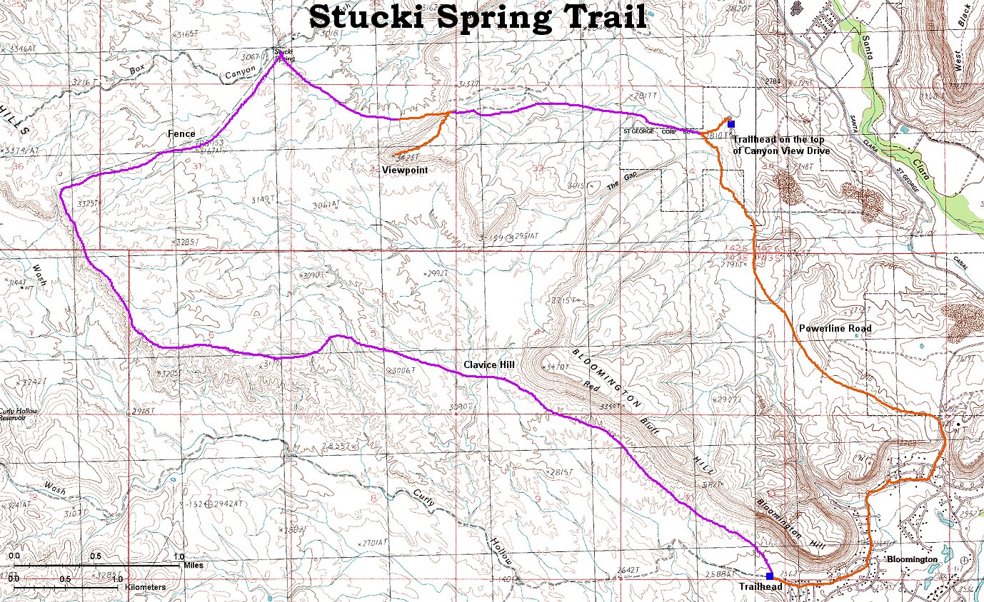
Stucki Spring Loop
About 20 mi. loop in the desert west of St. George. We followed Gregg Bromka's directions and started on a hill above Santa Clara valley, which is covered with luxurious houses and condos. The other side of the hill, where we rode, in pretty bare, though. The trail drops into the valley and then climbs a singletrack which is supposedly a downhill race course (although only moderately steep) all the way to a viewpoint above Stucki Spring. Then follows a wild descent from the rim and rolling ride to Stucki Spring. Here we hit a marked trail, called Bear-Claw Poppy Trail, the rest of the singletrack is in a nature reserve set to protect this plant endemic to St. George area. This means no ATV and similar smelly and noisy beasts. Cool, it's time to hit some sweet rolling singletrack. First several miles of slight uphill along a fence to the Cottonwood Wash Rim and then mostly downhill all the way down to the trailhead near Bloomington. The loop closes by several miles of pavement through green suburb (actually a nice play for the eyes after gray desert) and then slight uphill on Powerline Road doubletrack back to the car. Here is the trail map (300 kB).
I think I finally nailed down a good loop combining most of good trails in the area into a single loop during my spring 2004 visit. Clickable map and fotos are here.
 Panorama west from the singletrack climb to the viewpoint above Stucki Spring.
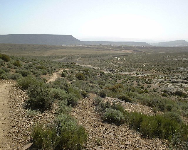 View from the same spot towards the area where we came from.
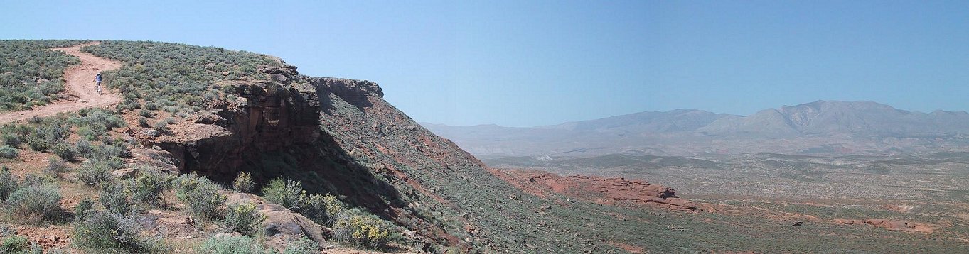 Panorama from under the last climb to the viewpoint above Stucki Spring towards west.
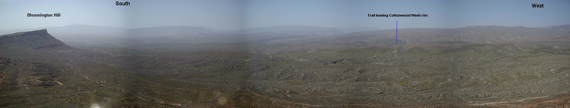
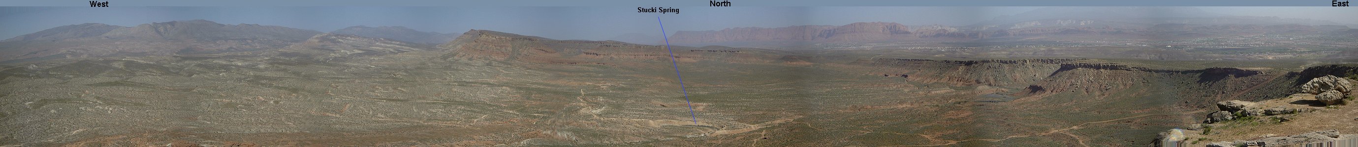 Panorama from the viewpoint above Stucki Spring.
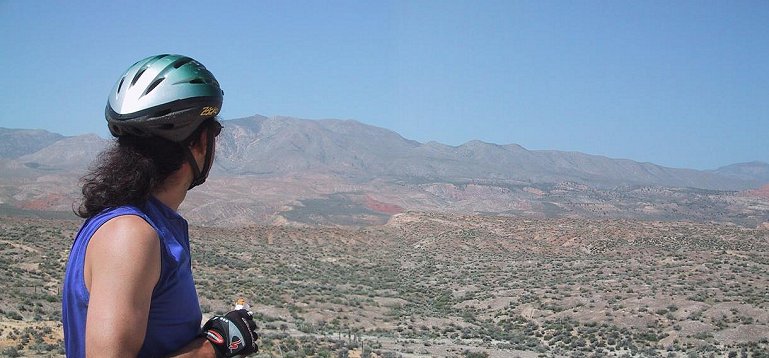 Panorama from the rim above Cottonwood Wash north-west.
 Panorama from the same spot, we came from the trail on left and then continued down on the trail in the middle of the picture.
 Panorama from under Clavice Hill, we came from the left.
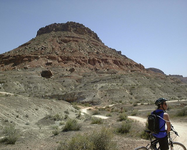 Hill east of Clavice Hill.
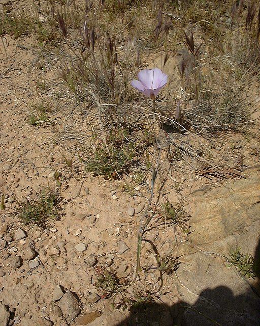 Spring flower beside the Powerline Road.