Hiking in the Uinta Mountains
The Uintas are the highest mountain range in Utah and the distance from Salt Lake City makes them a good summer destination.
Day Hikes
Multi-day Backpacking
Day Hikes
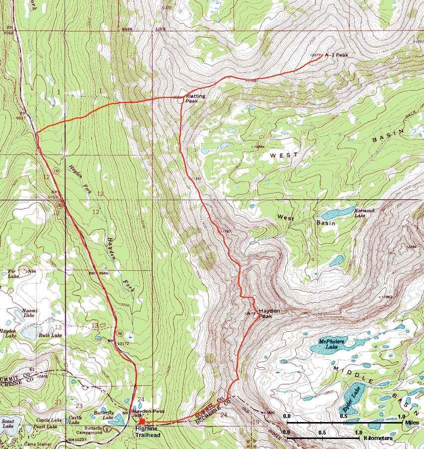
Hayden - Kletting - A-1 Peak ridge
 7/24/00
These peaks are located along the Mirror Lake Highway, so they are easily accessible. All the route was off-trail and required route finding through dense forest and rock hopping. The whole loop with return on the highway took me about 9 hours.
Hike map (360 kB).
 Hayden Pk. summit from the ridge south of it. I climbed up on the right (east) side.
Panoramic view from the Hayden Peak. It took me about 2.5 hours from the parking lot at the Highline Trailhead.
Ridge from Hayden Pk. north to Kletting (took me about 2 hours).
Upper Hayden Ridge from the Hayden-Kletting saddle. The best way down seems to be down the chute in the middle of the picture and then parallel under the rock wall.
Kletting - A-1 ridge from the same saddle.
Panoramic view from the A-1 Peak. It took about 1 hr from Kletting to A-1.
View down the Kletting chute I went down, at about half way. Pretty steep with lots of loose rocks.
Kletting with depiction of my way, from the highway.
Hayden - Kletting ridge from the highway.
Hayden - Kletting ridge with Ruth Lake in the foreground.
Multi-day Backpacking
7/9/00
East Fork Black Fork, Uinta Mtns. (July 2000)
9/1/99 Hike to the Kings Peak (August 1999)
U of U / Chemistry / HEC / Voth Group / Cuma / Travel / English / Uinta Hikes
URL:
http://voth.chem.utah.edu/~mcuma/hike_uinta_en.html
Last updated: 08-May-00 / mc